
- Brief description
-
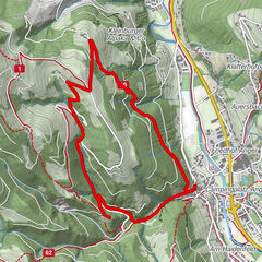
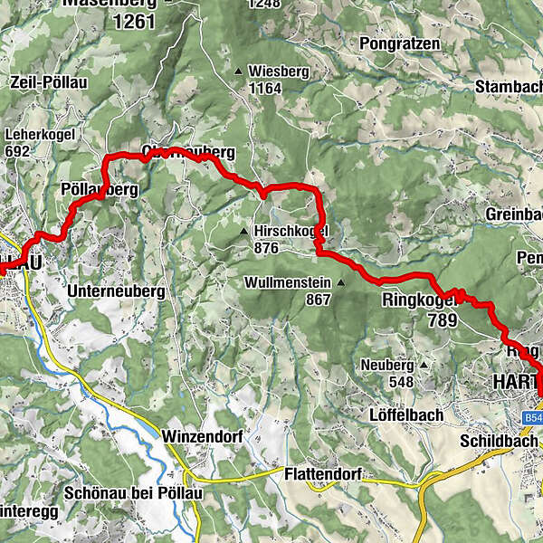
The three sections of this hiking tour in the Pöllauer Tal Nature Park are as varied as the landscape: First, the ascent to the Pöllauberg pilgrimage church, then there is a leisurely up and down between 700 and 1,000 m above sea level, and finally the descent from the Ringkogel, Hartberg's local mountain.
- Difficulty
-
medium
- Rating
-
- Starting point
-
Pöllau
- Route
-
Pöllau0.2 kmKalvarienbergkirche1.3 kmGoldsberghof1.9 kmGoldsberg2.0 kmFilialkirche St. Anna3.1 kmWallfahrtskirche Maria Pöllauberg3.1 kmPöllauberg3.1 kmGasthof Goger "Zum Jagawirt"3.1 kmBerggasthof König3.3 kmBergstubm3.7 kmDreihöf4.1 kmTrinkbrunnen5.1 kmOberneuberg5.8 kmSchwaig8.8 kmSt. Hubertus Kapelle13.0 kmRingkogel (789 m)14.1 kmRingwarte Rast14.1 kmSchreiner's Berghof15.2 kmRing16.0 kmHartberg17.0 km
- Best season
-
JanFebMarAprMayJunJulAugSepOctNovDec
- Description
-
From the "Styrian St. Peter's Cathedral" in Pöllau, we take the Hirschbirn hiking trail up to the flower village of Pöllauberg. Will we see any stags along the way? Probably not, because this is an old Styrian pear variety whose name is derived from the word "autumn" (dialect name "Hiascht"), as it can only be harvested from mid-October. In the course of time, the late-ripening "Herbstbirne" became the Hirschbirne (stag pear). The deer pear brandy distilled from it is of the highest quality. But not only schnapps is made from the stag pear, but with a lot of skill the farms of the Pöllauer Tal Nature Park produce other real delicacies from the stag pears, such as stag pear juice, vinegar, jelly and kletzen (dried pears).
- Directions
-
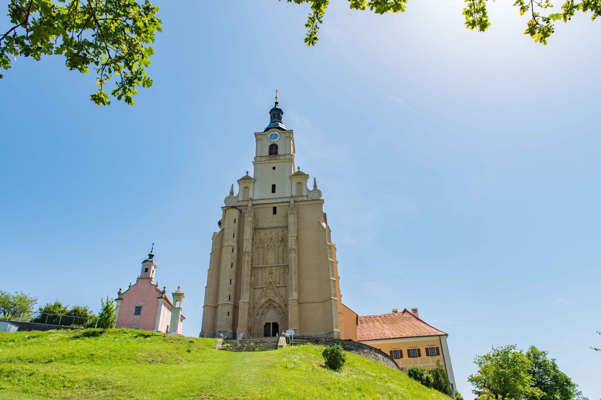
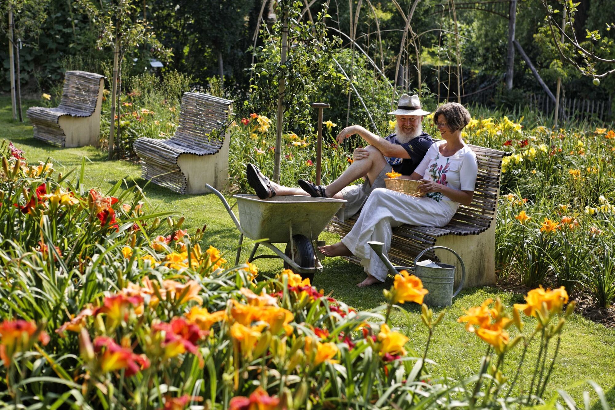
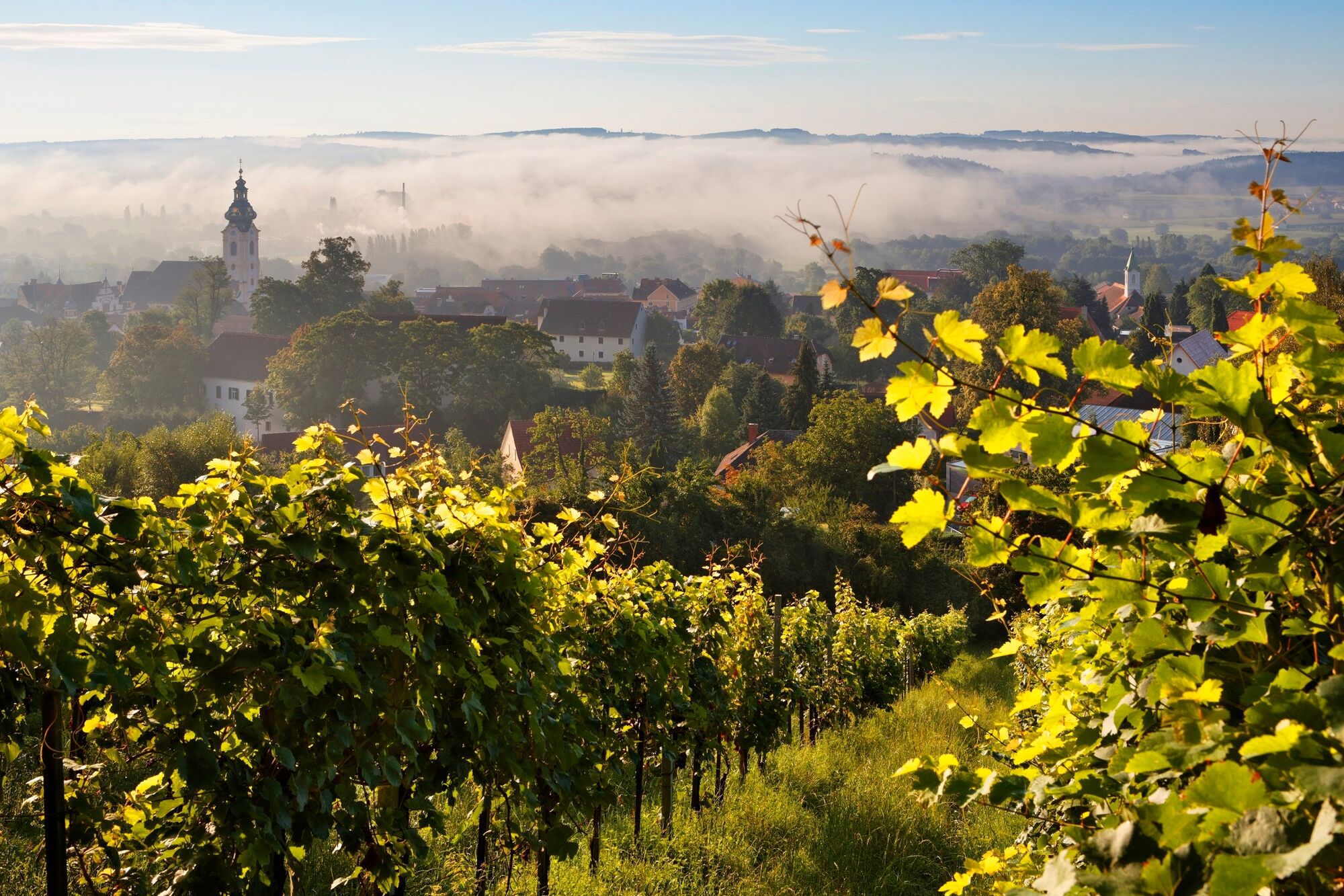
From Markt Pöllau with its imposing castle and the collegiate church in the middle of the town center, we first head to the traffic circle on the L 406, the entrance to Pöllau-Mitte. A short distance to the north and then branching off to the right, we reach the Hirschbirnweg, which is also marked with trail no. 942. On this path we go uphill to the Way of the Cross with its brick stations, which accompanies us to the Sacred Heart Church near Calvary, where we turn right shortly after to cross a stream and hike uphill through a forest towards Pöllauberg. The village of Pöllauberg, with its pilgrimage church visible from afar, has for decades also devoted itself with much love and flair to flower decorations and has been a multiple state winner and was even awarded the title of European Flower Village.
After a tour of the church and the 10 theme and adventure gardens around the church, we head north slightly downhill to the state road. At one of the theme gardens, the "flower island", we keep to the right and straight ahead we see already in about 300 m distance the turnoff of the high road. This road is also marked as the Pankratiusweg, which leads to Vorau with its famous monastery. But we follow this elevated road only about 600 m, then turn sharply to the right and soon again parallel to the road across a meadow to a prominent power pole. From here we go downhill into a shady forest and over a bridge, then uphill again and, after crossing a pasture, downhill again to a beautifully situated farm. The further path leads us to the Krollerkreuz, a beautiful place to stay in the Pöllauer Tal Nature Park. From here we continue straight uphill to the farm vlg. Scherf, where we now follow the Schachenweg to reach the highest point of the day, the Schwaig at 970 m above sea level.
On the Schwaig we now leave the Pankratiusweg and continue on the Weitwanderweg 07 across meadows and through forests down to a short section of an asphalt road. We leave this after about 1.5 km to the left into the forest, and after another turn to the left we reach a stream that puzzles us. A small brook does not follow the laws of gravity to the valley, but flows with little gradient through the forest. No doubt, it must have been artificially created. But by whom? It is very probable that this artificial stream was laboriously created in the primeval forest of that time about 900 years ago in connection with the founding of Hartberg and served to supply Hartberg with water. Of the more than 5 km of this artificial watercourse, we walk only about one fifth and come to a single point with the name Spielstätte. Where does this name come from? Legends tell of knights' games and all kinds of sacrilegious events.
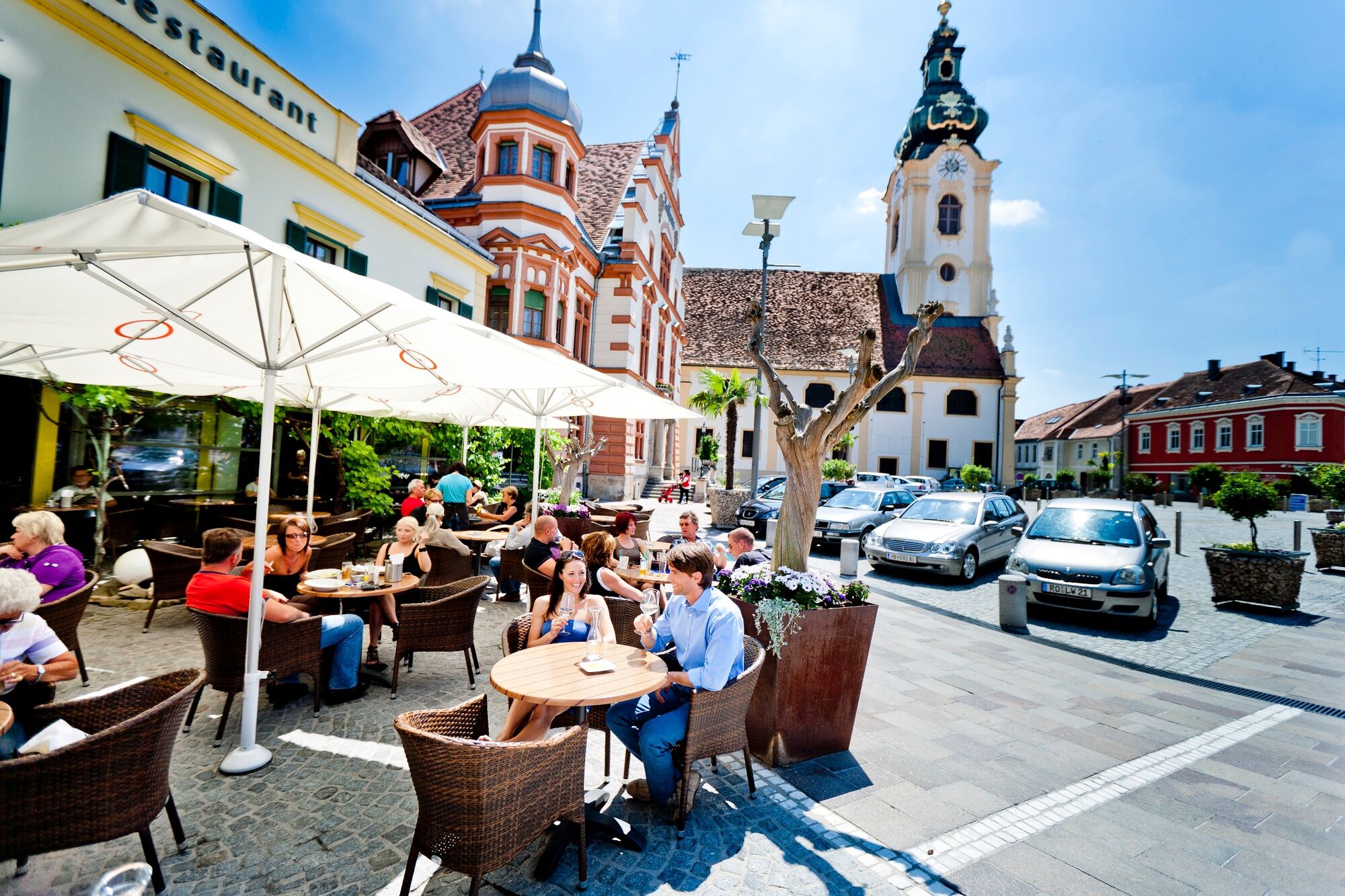
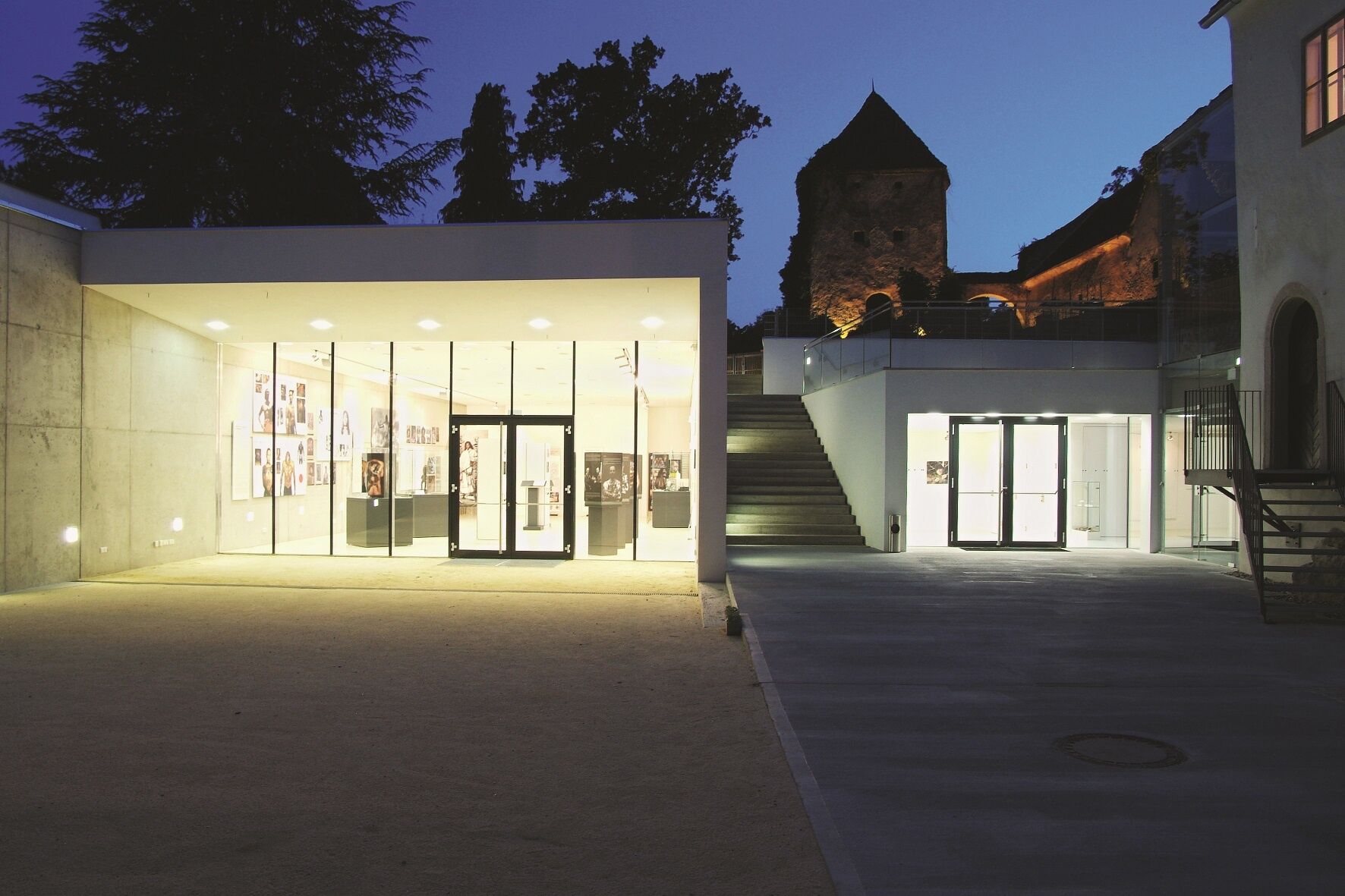
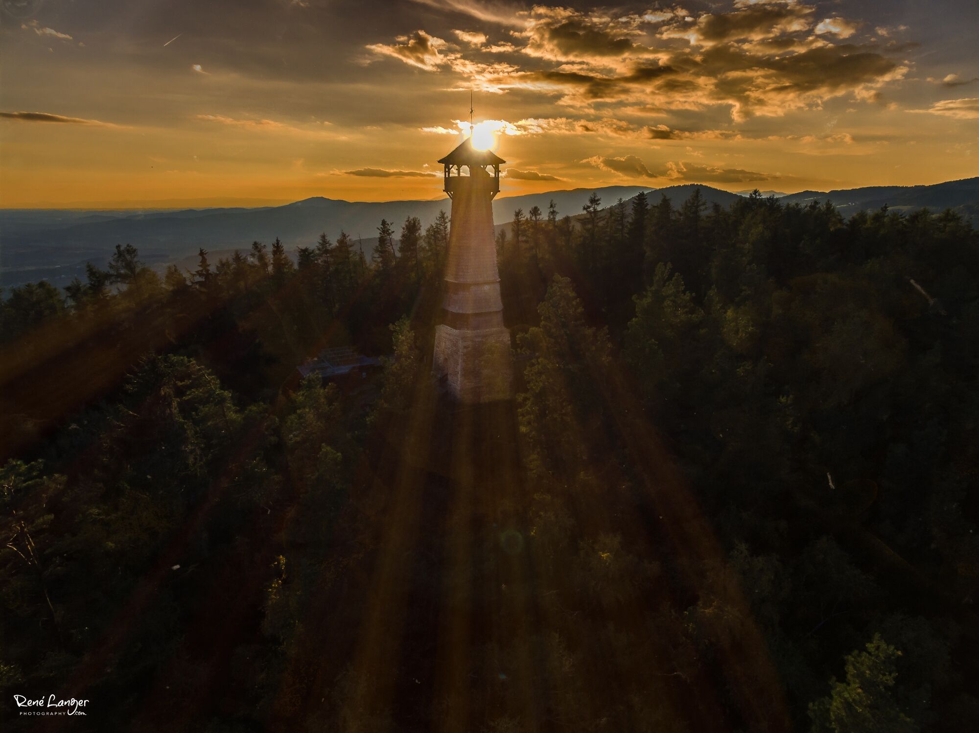
From the playground we walk past the Hubertus Chapel up to the Ringwarte, which is situated at 789 m above sea level. Alternatively, we can descend directly to Hartberg at the junction and parking lot, but in this case we would miss the beautiful panoramic view from the Ringkogelwarte. Already in pre-Christian times the Ringkogel was inhabited by people. Remains of the fortification can still be seen, but nothing remains of the buildings. The present Ringwarte with 30 meters height and 99 steps was built in 1906 and renovated in 2007/08. We have already done a nice stretch, but we must not miss the ascent to the Ringwarte, because this panorama not only allows us to look back on today's stage, but also to already see our destination, the historic town of Hartberg with its surrounding vineyards. From the Ringwarte it is now only downhill. Before we reach Hartberg, the remarkable Steinerne Stiege with 92 steps helps us to descend. Finally, we reach the center of the historically rich town of Hartberg, which has also made a name for itself with numerous cultural events as part of the "Kulturgenuss im Grünen" ("Cultural Enjoyment in the Green"). A cultural walk allows us a glimpse into the eventful past of this beautiful small town. From the simple architecture of the Capuchin monastery to an architecturally excellent castle in the middle of town to the lively city center. Sophisticated and precious are the well-preserved houses and buildings, such as the impressive late baroque city parish church with the Romanesque Karner. Culture is on the agenda in Hartberg before we enter the thermal and volcanic land of Styria on our stage to Bad Waltersdorf the next day.
- Highest point
- 967 m
- Endpoint
-
Hartberg
- Height profile
-

- Equipment
-
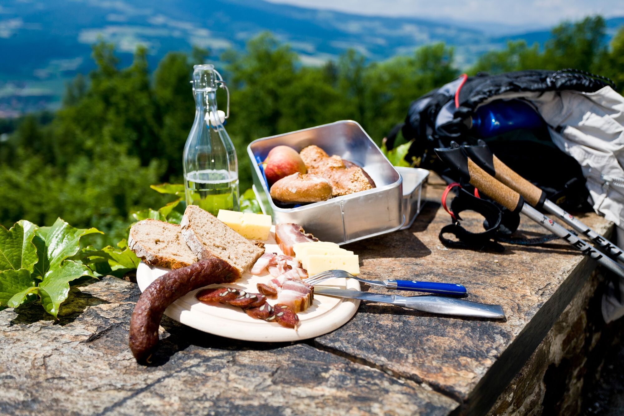
Proper backpack packing makes many things easier: Pack heavy things first. The water bottle should always be within reach in a side pocket. All the things that are often needed, such as sunglasses, camera or hiking map, belong on top. An emergency kit, including blister plasters, belongs in every rucksack and it is always advisable to dress in layers.
- Safety instructions
-
Emergency call mountain rescue: 140
Tips when reporting an emergency – Answer these six WH questions: What happened? How many people are injured? Where did the accident happen (are there GPS coordinates)? Who is reporting the incident (callback number)? When did the accident happen? What is the weather like at the site of the incident?
- Tips
-
In the Thermen- & Vulkanland region of Styria, Eastern Styria and Southern and Western Styria, the GenussCard opens the door to over 200 excursion destinations when you stay overnight in one of the approximately 100 GenussCard partner establishments. Countless of these GenussCard excursion destinations, ranging from culinary manufactories to bathing lakes and museums, are located directly on the hiking route "From Glacier to Wine".
- Additional information
-
Steiermark Tourismus
Tel. +43 316 4003
If you would like to hire a tour operator, simply book with Steiermark Touristik, the official travel agency of Steiermark Tourismus:
Tel. +43 316 4003 450,
The Steiermark Touren app, available free of charge on Google Play and the App Store (Android, iOS), offers detailed first-hand information: brief facts (length, duration, difficulty, ascent and descent/elevation gain, ratings), map, route descriptions, altimeter, compass, peak finder, navigation along the tour. You can also create your own personal lists of favourite tours and sites, store tours and destinations offline, use social media channels, and much more.
- Public transportation
-
Accessible by train and bus.
Detailed information about arriving by ÖBB (Austrian Federal Railways) can be found at www.oebb.at or on the Verbundlinie Steiermark website www.busbahnbim.at
With Verbundlinie’s BusBahnBim route planner app, planning your journey has never been easier: simply enter towns and/or addresses, stop names or points of interest to check all bus, train and tram connections in Austria. The app is available free of charge for smartphones – on Google Play and in the App Store
- Parking
-
In Pöllau there are several parking spaces available for hikers at the castle park and at the Park & Ride parking lot at the bypass.


-

-
AuthorThe tour Stage 27 From Glacier to Wine North Route Pöllau - Hartberg is used by outdooractive.com provided.


General info
-
Thermen- & Vulkanland
1323
-
Naturpark Pöllauer Tal
1089
-
Pöllauberg
353