


- Brief description
-
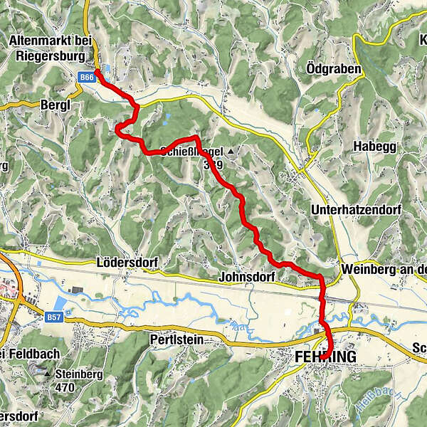
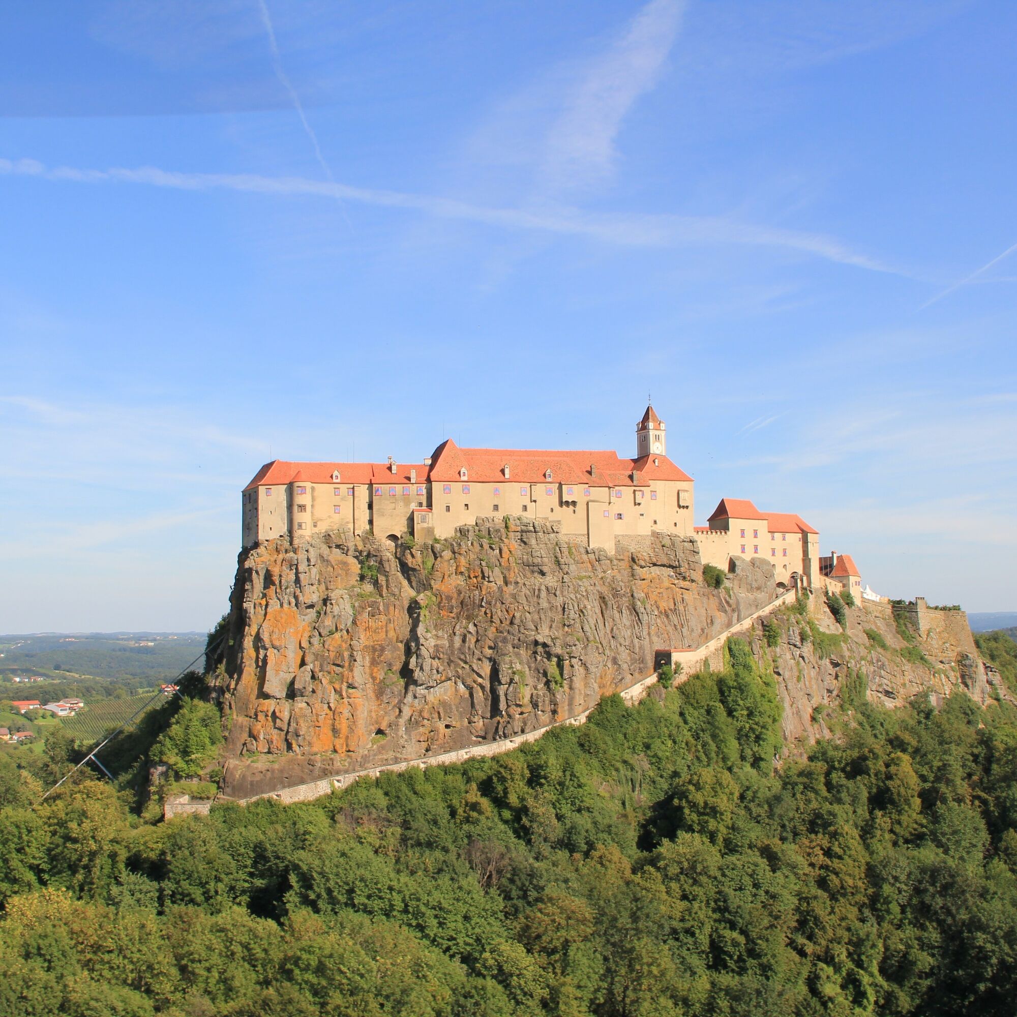
This stage of the hiking route "From Glacier to Wine" leads through forests, across meadows and past orchards from Riegersburg on the East Austrian Borderland Trail 07 southward into the Raab Valley, where the small town of Fehring awaits us. The meters in altitude as well as the kilometers to be covered are low, the landscape is lovely and in midsummer we are happy about the shady forests, which are always our companions on the way. Due to the shortness of the stage, we can take it easy and start with a visit to Riegersburg. Myths, adventures and eerie stories of times long past entwine around the castle, the impressive landmark of southeastern Styria. In all the centuries of its existence, the castle, situated on a mighty basalt cone with its now surrounding vineyards, could never be conquered.
- Difficulty
-
easy
- Rating
-
- Starting point
-
Riegersburg
- Route
-
Riegersburg0.0 kmBuschenschank Christiner Hannes6.1 kmStückelberg6.7 kmRattenberg8.7 kmBrunn10.1 kmFehring12.1 km
- Best season
-
JanFebMarAprMayJunJulAugSepOctNovDec
- Description
-
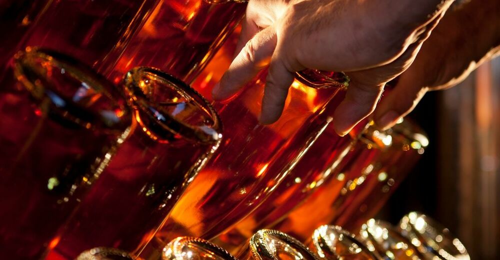
Many small wine islands characterize the wine-growing region of Vulkanland Steiermark, with unique sites on the slopes of extinct volcanoes that give the landscape its unique character. 1,400 hectares of vineyards are cultivated, concentrated around Klöch, St. Anna am Aigen and Straden. One grape variety has particular flair: the highly aromatic Traminer. This part of Styria was hotly contested borderland for centuries, as evidenced by fortified castles and palaces perched on towering basalt cliffs. Today, the borders are open, and Riegersburg Castle, Kapfenstein Castle and other stately residences have become venues for peaceful cultural or, in many cases, wine and culinary events. Numerous events such as the "Kellerstöckl hoamsuachn", the open cellar door days or the Südoststeirischen Thermenlandweintage make the wine around Fehring also in other facets tangible.
- Directions
-
After traveling from east to west on the stage from Unterlamm to Riegersburg, we remember that the northern route of the hiking trail "From Glacier to Wine" also has its destination in the south and therefore change the hiking direction to the south. We follow the Styrian variant of the long-distance hiking trail 07, the East Austrian Borderland Trail, which leads from Nebelstein in the north to Bad Radkersburg in the south.
From Riegersburg we hike on this stage of the hiking route "From Glacier to Wine" first past the bathing lake for a short distance along the road to the southeast. Soon, however, we branch off to the right to head slightly uphill past beautifully situated family homes and farmsteads surrounded by vineyards to reach the Buchberg. As hikers we would prefer field and forest paths, but on this day we have to accept that nowadays even rural access roads are covered with an asphalt surface. Fortunately, there are nevertheless some sections that make our eyes and our feet happy. From time to time, by the way, sections of path through beautiful forests also give us a little shade, which we learn to appreciate especially in high summer. Although the rest of the way is mostly pleasantly flat, the names of the landscapes lead us from mountain to mountain. At the Forchauberg we change the hiking direction to southeast and walk over the Stückelberg and the Faschingberg to Rattenberg. At a crossroads we change direction and go downhill to the right. Soon after, we are surprised at how many asphalt roads crisscross in all directions in this agricultural area. But the Kapper winery, situated on a hill, serves as an orientation aid. We have to go up there to enjoy a beautiful view of the Raab valley, the last part of today's route to Fehring and half of the next stage to Kapfenstein shortly after the start of the descent at a viewing point.
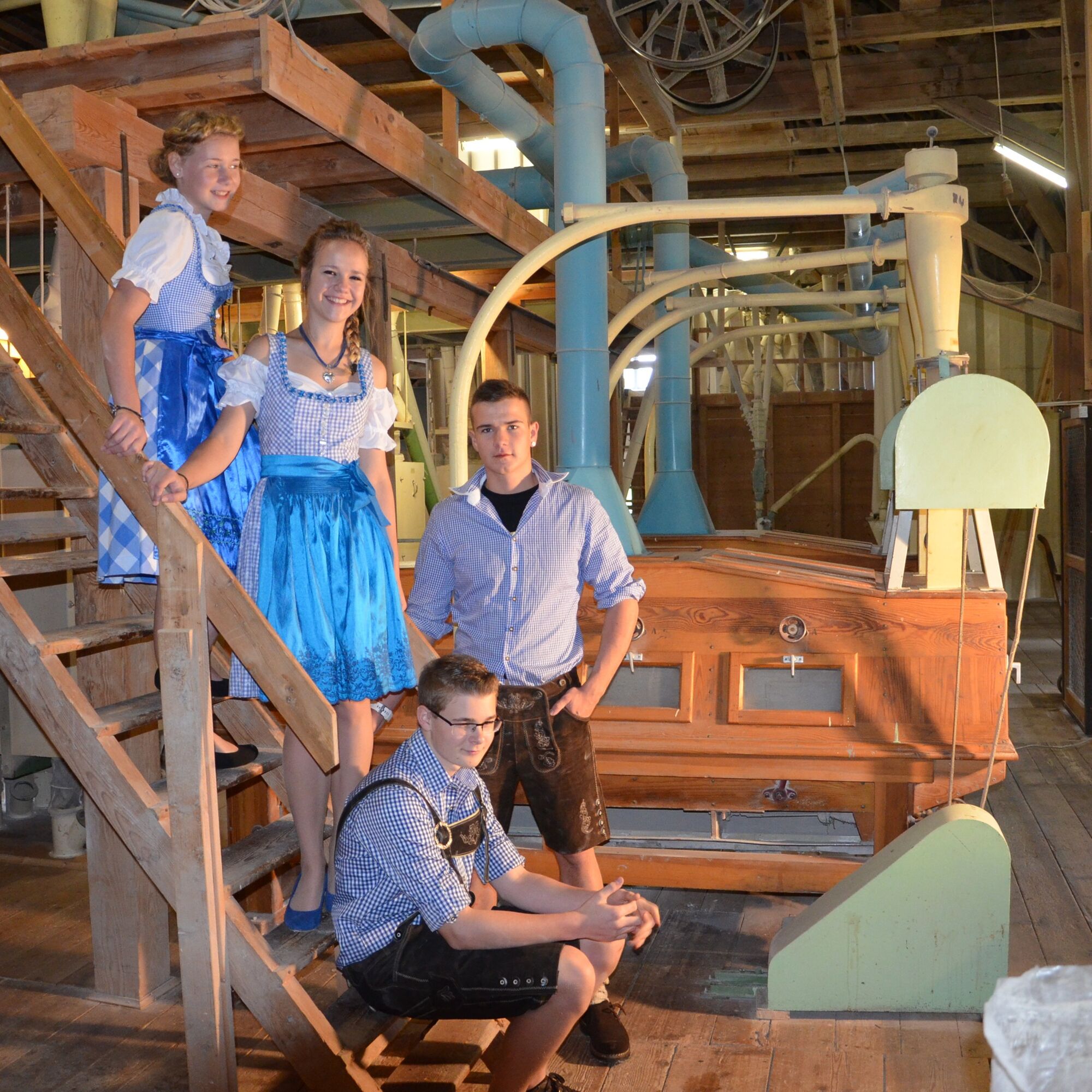
Incidentally, the 250 km long Raab rises in Styria south of the Teichalm in the Almenland Nature Park in eastern Styria and flows into a tributary of the Danube near Györ. Arrived in the Raab valley, the further way brings us past the train station, whose railroad line connects Graz with Hungary. A few hundred meters later we arrive at the Berghofer Mill, which today is one of the most popular foam mills in the region and was already mentioned in documents in the 12th century. Today the mill is run by the three Berghofer sisters in the 6th generation. There are no places to visit today, so we enjoy getting to know the municipality of Fehring, which has now grown to about 7,500 inhabitants, with 17 villages in the geographical center of the Thermenland with its 6 thermal spas - one of which is in Bad Gleichenberg where the next stage takes us. The town has an interesting history, which we will learn about on various panels around the church and in the town center. Here in Fehring we have time and opportunity to enjoy the typical products of the Thermen- & Vulkanland and Eastern Styria from the alpine pastures, from the fruit, vegetable and herb gardens, lovingly prepared by creative chefs or processed into unique products by expert producers. First-class wines, high-quality schnapps, refreshing fruit juices and must specialties, but also some types of beer perfectly round off the culinary offer.
- Highest point
- 384 m
- Endpoint
-
Fehring
- Height profile
-

- Equipment
-
Proper backpack packing makes many things easier: Pack heavy things first. The water bottle should always be within reach in a side pocket. All the things that are often needed, such as sunglasses, camera or hiking map, belong on top. An emergency kit, including blister plasters, belongs in every rucksack and it is always advisable to dress in layers.
- Safety instructions
-
Emergency call mountain rescue: 140
Tips when reporting an emergency – Answer these six WH questions: What happened? How many people are injured? Where did the accident happen (are there GPS coordinates)? Who is reporting the incident (callback number)? When did the accident happen? What is the weather like at the site of the incident?
- Tips
-
In the Thermen- & Vulkanland region of Styria, Eastern Styria and Southern and Western Styria, the GenussCard opens the door to over 200 excursion destinations when you stay overnight in one of the approximately 100 GenussCard partner establishments. Countless of these GenussCard excursion destinations, ranging from culinary manufactories to bathing lakes and museums, are located directly on the hiking route "From Glacier to Wine".
- Additional information
-
Steiermark Tourismus
Tel. +43 316 4003
If you would like to hire a tour operator, simply book with Steiermark Touristik, the official travel agency of Steiermark Tourismus:
Tel. +43 316 4003 450,
The Steiermark Touren app, available free of charge on Google Play and the App Store (Android, iOS), offers detailed first-hand information: brief facts (length, duration, difficulty, ascent and descent/elevation gain, ratings), map, route descriptions, altimeter, compass, peak finder, navigation along the tour. You can also create your own personal lists of favourite tours and sites, store tours and destinations offline, use social media channels, and much more.
- Public transportation
-
Accessible by train and bus.
Detailed information about arriving by ÖBB (Austrian Federal Railways) can be found at www.oebb.at or on the Verbundlinie Steiermark website www.busbahnbim.at
With Verbundlinie’s BusBahnBim route planner app, planning your journey has never been easier: simply enter towns and/or addresses, stop names or points of interest to check all bus, train and tram connections in Austria. The app is available free of charge for smartphones – on Google Play and in the App Store
- Parking
-
Around the center of Riegersburg there are several parking facilities available, such as at the lakeside resort.


-

-
AuthorThe tour Stage 32 From Glacier to Wine North Route Riegersburg - Fehring is used by outdooractive.com provided.


General info
-
Thermen- & Vulkanland
1324
-
Feldbach
408
-
Pertlstein
181