

© Tourismusverband Region Murau - Tom Lamm

© Tourismusverband Region Murau - Tom Lamm

- Brief description
-
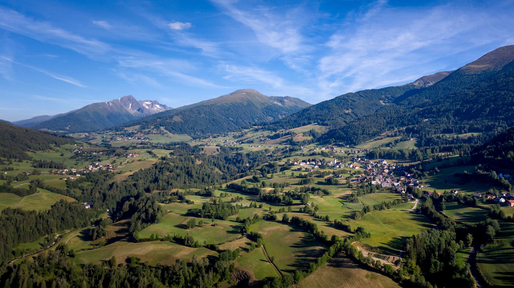
Moderately difficult hike with wonderful landscape scenery.
- Difficulty
-
medium
- Rating
-
- Starting point
-
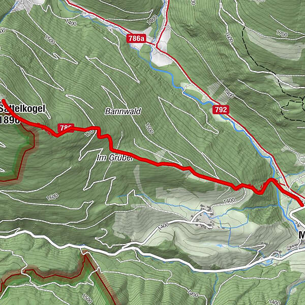
Klausnerberg-Säge
- Route
-
MoosGrazer Hütte3.1 kmMoos6.3 km
- Best season
-
JanFebMarAprMayJunJulAugSepOctNovDec
- Description
-
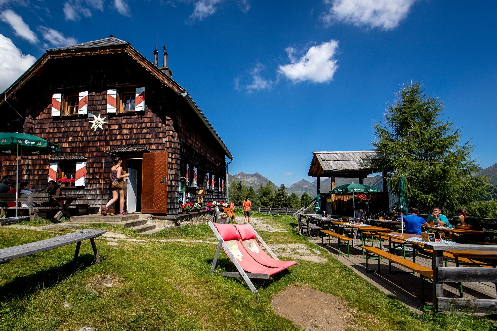
This tour offers a perfect opportunity to get to know the area around Krakow. The climb to the Grazerhütte offers great views and one or two places to rest.
- Directions
-
From the Klausnerberg sawmill (parking possible) after about 200m on the forest road left into the forest, through a densely overgrown, slightly rising forest area in the direction W. On hiking trail 786 to the Grazerhütte.
Return the same way.
- Highest point
- 1,874 m
- Endpoint
-
Klausnerberg-Säge
- Height profile
-

- Equipment
-
Good shoes
Sun protection
Sufficient food - Additional information
-
The ideal time for this tour is from May to October.
- Directions
-
East: From Vienna on the A 2 and S 6 to Leoben and St. Michael i. d. E., continue on the S 36 to Judenburg and on the B 96 to Murau. From Murau via Ranten to Krakau.
West, North: From Bregenz/Innsbruck via the A 12, A 93 and A 8 to Salzburg. From Salzburg on the A 10 to St. Michael im Lungau. From here on the B 96 to Tamsweg and further towards Murau via Sauerfeld to Krakau.
South: From Klagenfurt on the B 83 to Scheifling. Then take the B 96 to Murau and on to Krakau.
- Public transportation
-
With the BusBahnBim app from the interconnected line, timetable information is easier than ever before: all bus, train and tram connections in Austria can be queried by entering locations and/or addresses, stops or important points. The app is available as a free app for smartphones (Android, iOS) - on Google Play and in the App Store.
- Parking
-
Public parking spaces are available directly at the Klausnerberg sawmill.
- Author
-
The tour Grazerhütte is used by outdooractive.com provided.
GPS Downloads


General info
Refreshment stop
A lot of view
Other tours in the regions


