Stage 20 From Glacier to Wine North Route Karl Ludwig Haus - Mürzzuschlag


- Brief description
-
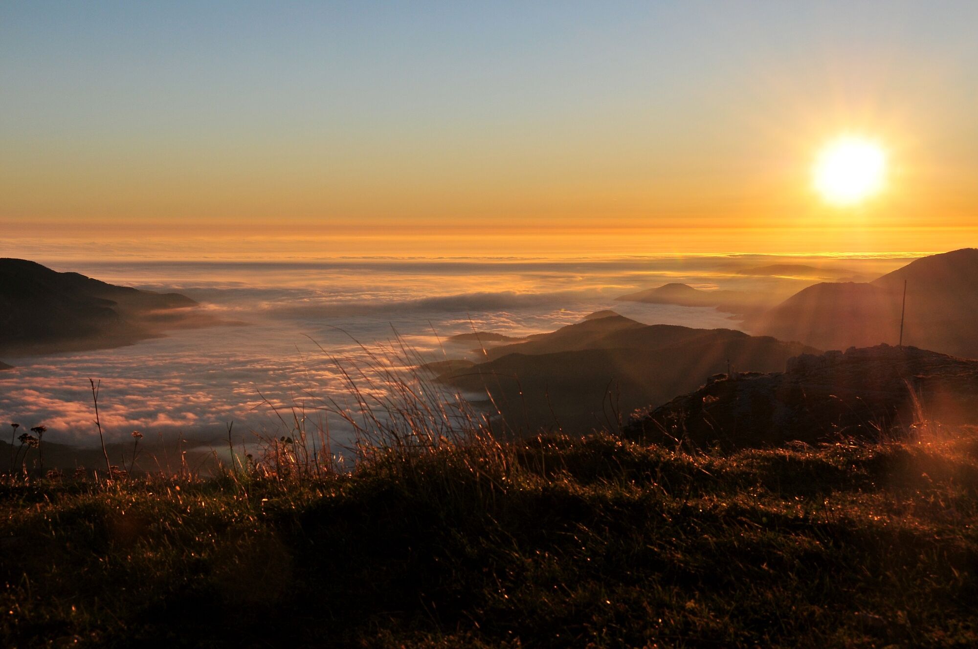
This stage of the hiking route "From Glacier to Wine" takes us from the alpine limestone massif of the Rax to the green mountains in the direction of the Fischbach Alps with their dense forests and gentle alpine pastures. The small town of Mürzzuschlag at the foot of the Semmering welcomes us as a stage stop. It is also the starting and end point of the UNESCO World Cultural and Natural Heritage Semmering Railway and surrounding landscape, and also boasts a surprisingly high number of museums.
- Difficulty
-
medium
- Rating
-
- Starting point
-
Karl Ludwig Haus
- Route
-
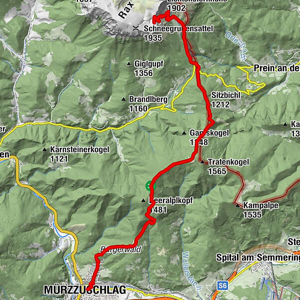
Törl (1,768 m)0.2 kmSiebenbrunnenkessel1.1 kmWaxriegelhaus2.4 kmHelenenquelle2.8 kmEdelweisshütte3.9 kmSitzbichl (1,212 m)5.2 kmPernreit18.8 kmMürzzuschlag19.7 km
- Best season
-
JanFebMarAprMayJunJulAugSepOctNovDec
- Description
-
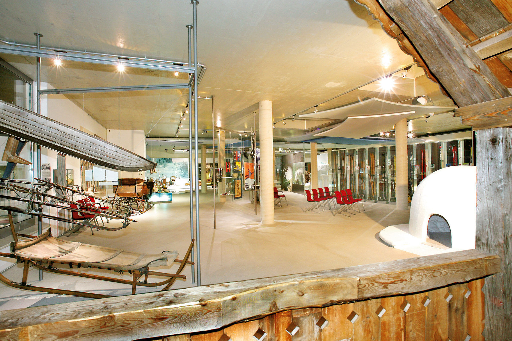
This tour takes us from a beautiful natural area, the Rax Massif in the Mürzer Oberland Nature Park, to the cozy little town of Mürzzuschlag, whose development has also been influenced by the Semmering Railway. The Semmering Railway is now over 150 years old. But what distinguishes the 41-kilometer-long railroad line from Gloggnitz to Mürzzuschlag is not only its proud age: in 1854, it was the first mountain railroad in the world and was declared a UNESCO World Heritage Site in 1998. In the Südbahnmuseum (Southern Railway Museum) directly on the station grounds in Mürzzuschlag, you will find a cultural-historical railroad experience that will delight young and old alike. The range of other cultural sites in Mürzzuschlag that should be visited extends from the FIS Winter Sports Museum with the largest collection of winter sports equipment in the world to the Kunsthaus and the Brahms Museum, which is housed in the former home of the world-famous composer, musician and conductor Johannes Brahms. He spent summer holidays in Mürzzuschlag in 1884 and 1885 and composed his IV. Symphony as well as more than 30 songs and choral works.
We also move here on a stage of the circular tour BergZeitReise, which leads through the wildly romantic mountain landscape of Hochsteiermark.
- Directions
-
From the Karl Ludwig Haus (Tel. +43 699 11888972) on our today's stage of the hiking route "From glacier to wine", we immediately go downhill over the snake path to the Waxriegelhaus (Tel. +43 2665 237) and further on the Preiner Gscheid with the (Tel. +43 676 7554881), a pass crossing between Styria and Lower Austria.The Preiner Gscheid is also a popular starting point for hikes and tours in the mountain world of the Rax and the Kampalp train towards Spital am Semmering and Mürzzuschlag.
Crossing the pass, we continue on the 01 path along the border between Styria and Lower Austria, passing the Tattermannkreuz to a crossroads west of the Tratenkogel. Here we keep to the right in order to continue hiking slightly downhill in the direction of Große Scheibe / Beeralplkopf. At the crossroads near the Große Scheibe with the Scheibenhütte (Tel. +43 664 3640940), open from Easter to the end of October on Sundays and public holidays, we have to decide whether to take the short climb to the hut or descend directly to Mürzzuschlag.
Passing the Franzlbauerwand and through the Bürgerwald, we now head downhill to the beautiful small town of Mürzzuschlag with its numerous museums (Tourist Information Tel. +43 3852 3399) at the foot of the Semmering and the Fischbacher Alps, which we visit on our next stage up the Pretul, which takes us along the Semmeringbahn and over the summit of the Stuhleck.
- Highest point
- 1,799 m
- Endpoint
-
Mürzzuschlag
- Height profile
-

- Equipment
-
Proper backpack packing makes many things easier: Pack heavy things first. The water bottle should always be within reach in a side pocket. All the things that are often needed, such as sunglasses, camera or hiking map, belong on top. An emergency kit, including blister plasters, belongs in every rucksack and it is always advisable to dress in layers.
- Safety instructions
-
Emergency call mountain rescue: 140
Tips when reporting an emergency – Answer these six WH questions: What happened? How many people are injured? Where did the accident happen (are there GPS coordinates)? Who is reporting the incident (callback number)? When did the accident happen? What is the weather like at the site of the incident?
- Additional information
-
Steiermark Tourismus
Tel. +43 316 4003
If you would like to hire a tour operator, simply book with Steiermark Touristik, the official travel agency of Steiermark Tourismus:
Tel. +43 316 4003 450,
The Steiermark Touren app, available free of charge on Google Play and the App Store (Android, iOS), offers detailed first-hand information: brief facts (length, duration, difficulty, ascent and descent/elevation gain, ratings), map, route descriptions, altimeter, compass, peak finder, navigation along the tour. You can also create your own personal lists of favourite tours and sites, store tours and destinations offline, use social media channels, and much more.
- Public transportation
-
Detailed information about arriving by ÖBB (Austrian Federal Railways) can be found at www.oebb.at or on the Verbundlinie Steiermark website www.busbahnbim.at
With Verbundlinie’s BusBahnBim route planner app, planning your journey has never been easier: simply enter towns and/or addresses, stop names or points of interest to check all bus, train and tram connections in Austria. The app is available free of charge for smartphones – on Google Play and in the App Store
- Parking
-
At the foot of the Karl Ludwig Haus there is the possibility to start the stage at the Preiner Gscheid, a popular hiking starting point. There is also a large parking lot here.


-

-
AuthorThe tour Stage 20 From Glacier to Wine North Route Karl Ludwig Haus - Mürzzuschlag is used by outdooractive.com provided.


General info
-
Hochsteiermark
4084
-
Waldheimat
2198
-
Mürzzuschlag
591


