
- Brief description
-
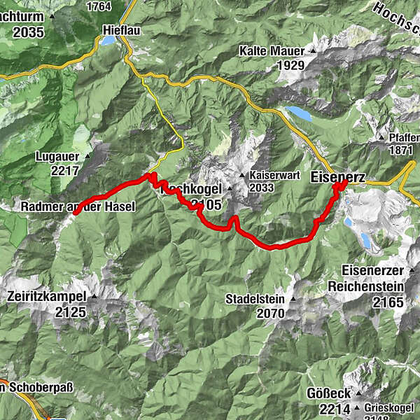
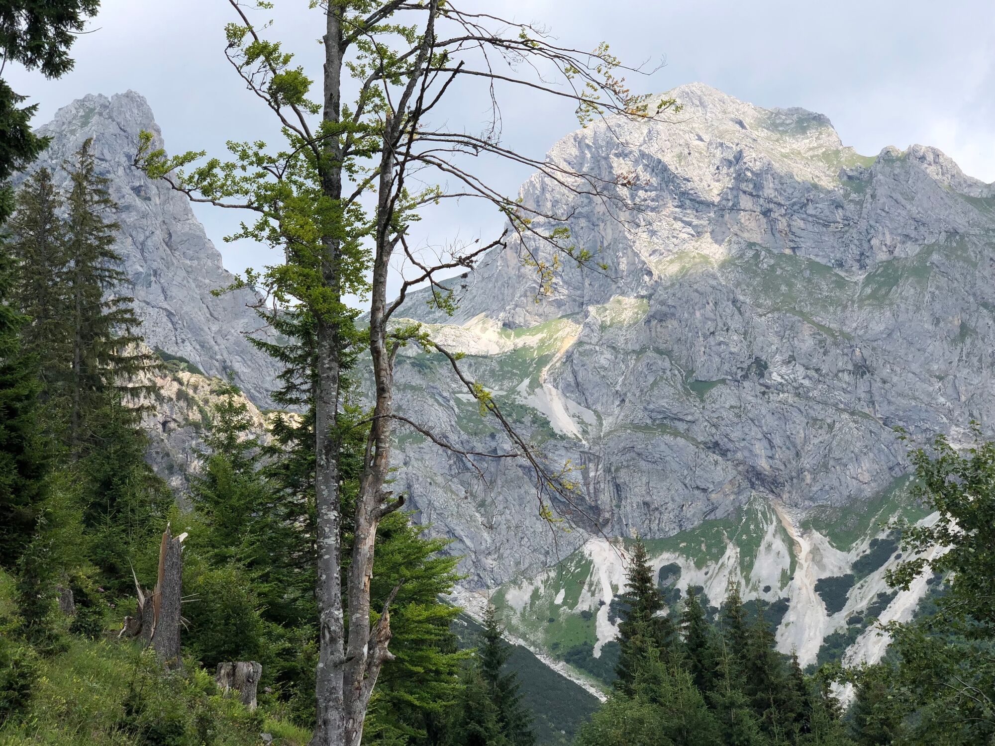
From the idyllically situated Radmertal, the tour leads to the historic mining town of Eisenerz, whose landmark is the Erzberg. If you are interested in mining, you will find what you are looking for in the starting point Radmer as well as in Eisenerz, of course, because at the end of the valley in Radmer the copper mine with Austria's smallest gallery railroad awaits a visit and in Eisenerz the majestic stepped pyramid of the Erzberg with a wide range of experiences. The tour itself is one of the longer stages of the hiking route "From Glacier to Wine" and leads over the 1,305 meter high Radmerhals and the Eisenerzer Ramsau with the Nordic Training Center to the historic miner's town in the southwest of the Hochschwab massif.
- Difficulty
-
easy
- Rating
-
- Starting point
-
Radmer
- Route
-
Radmer an der Hasel (820 m)0.2 kmGasthof zum Erzberg3.3 kmRadmer an der Stube4.1 kmRamsau14.5 kmLärch Alm14.6 kmPichlerhof15.5 kmHohenegg19.0 kmEisenerz21.0 kmLiebfrauenkirche21.3 kmOswaldikirche21.7 km
- Best season
-
JanFebMarAprMayJunJulAugSepOctNovDec
- Description
-
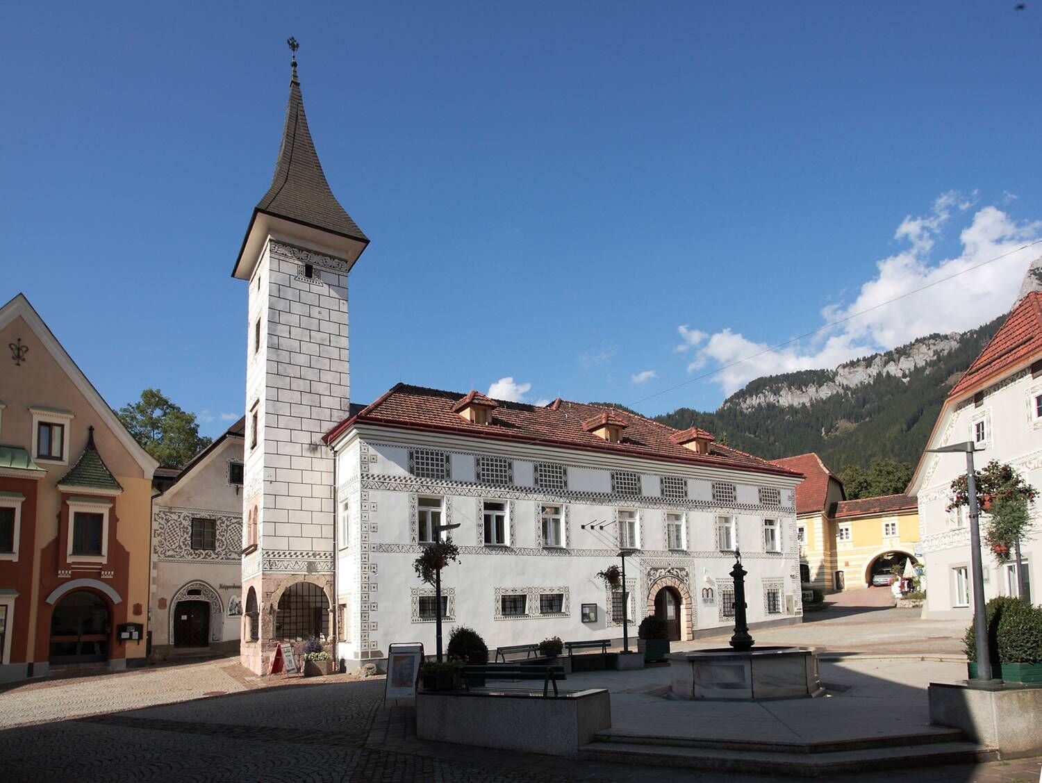
The Erzberg is truly unique, because as an active mining operation with 1,300 years of history and currently the most modern day mining operation in Europe, and at the same time tourist attraction is unique in Europe. The incredible silhouette above ground, the exciting adventure tour during the day and a ride in the largest 860 horsepower cab in the world are astonishing. But Eisenerz also offers other sights. One can call the art and culture offer Land-Art in golden tones, because besides the Erzberg, tradition and modernity are also given a lot of space here. Another unique event in this context is certainly the annual Rost Fest in August. There is something for everyone here, whether for action fans, art enthusiasts or music lovers: the Rostfest Eisenerz offers varied cultural highlights on different themes. In addition, the extraordinary art, culture and music festival invites you to various workshops and talks about culture in rural areas.
- Directions
-
From the inn "Zum Erzberg" (Tel. +43 3635 2145) in the area between the villages Radmer an der Hasel and Radmer an der Stube (tourist information Tel. +43 3635 2110) we first head out of the valley. In Radmer an der Stube we branch off to the right in a southeasterly direction in order to march in the direction of Lahngraben. Walking slightly uphill parallel to the Lahngraben we reach the Radmerhals, the highest point of our stage on the hiking route "From glacier to wine", via the Paargraben, the Heindlgraben and the Hienharthütte (private hut). From here, we now head leisurely downhill to the Eisenerzer Ramsau, where we reach the Nordic Training Center of the Austrian Ski Association. Since training is carried out here diligently even in summer, we can also - if chance has it - watch the mat jumping.
With the Erzberg always in sight, the trail leads us out of the valley via the Alpengasthaus Ramsau (Tel. +43 3848 60226), the Gasthof Pichlerhof (Tel. +43 3848 3414) and the JUFA Eisenerzer Ramsau (Tel. +43 3848 60560) in the direction of Eisenerz, keeping to the left after just under 12 kilometers of trail in order to reach the historic mining town via the Hohenegg with a view of the Erzberg and the Erzbergbahn and via the Krumpental (Tourist Information Tel. +43 3635 2110 or +43 676 6164847). The next day, one of the highlights of the northern route awaits us: the ascent to the Hochschwab massif with the stage to the Sonnschienalm.
- Highest point
- 1,301 m
- Endpoint
-
Eisenerz
- Height profile
-

- Equipment
-
Proper backpack packing makes many things easier: Pack heavy things first. The water bottle should always be within reach in a side pocket. All the things that are often needed, such as sunglasses, camera or hiking map, belong on top. An emergency kit, including blister plasters, belongs in every rucksack and it is always advisable to dress in layers.
- Safety instructions
-
Emergency call mountain rescue: 140
Tips when reporting an emergency – Answer these six WH questions: What happened? How many people are injured? Where did the accident happen (are there GPS coordinates)? Who is reporting the incident (callback number)? When did the accident happen? What is the weather like at the site of the incident?
- Additional information
-
Steiermark Tourismus
Tel. +43 316 4003
If you would like to hire a tour operator, simply book with Steiermark Touristik, the official travel agency of Steiermark Tourismus:
Tel. +43 316 4003 450,
The Steiermark Touren app, available free of charge on Google Play and the App Store (Android, iOS), offers detailed first-hand information: brief facts (length, duration, difficulty, ascent and descent/elevation gain, ratings), map, route descriptions, altimeter, compass, peak finder, navigation along the tour. You can also create your own personal lists of favourite tours and sites, store tours and destinations offline, use social media channels, and much more.
- Public transportation
-
Detailed information about arriving by ÖBB (Austrian Federal Railways) can be found at www.oebb.at or on the Verbundlinie Steiermark website www.busbahnbim.at
With Verbundlinie’s BusBahnBim route planner app, planning your journey has never been easier: simply enter towns and/or addresses, stop names or points of interest to check all bus, train and tram connections in Austria. The app is available free of charge for smartphones – on Google Play and in the App Store
- Parking
-
In Radmer there are enough parking possibilities in the middle of the village.


-

-
AuthorThe tour Stage 12 From Glacier to Wine North Route Radmer - Eisenerz is used by outdooractive.com provided.


General info
-
Erzberg Leoben
2529
-
Hochschwab
1272
-
Radmer
240