Winter
Summer
Weather
Webcams
Accommodations
Tours
Search history
Search suggestions
No results found
Search
Tours
Home
Summer Österreich
Styria
Tours
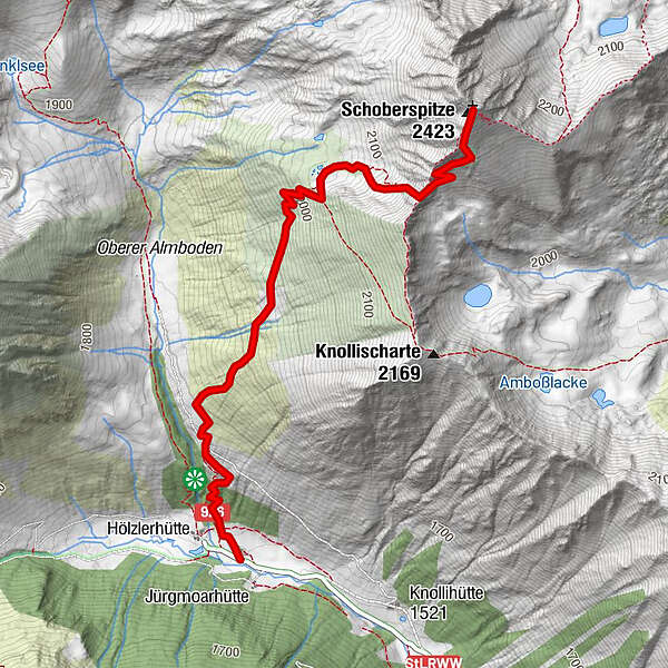
Schoberspitze
Regions
Weather
Webcams
Tours
Highlights
Bathing lakes
Accommodations
Offers
Sports provider
Events
Ski resorts
Cross-country skiing
Snow parks
Schoberspitze
Hiking
Bookmark
Map
show
hide
Print
Tour data
6.4
km
1,530 - 2,423
m
Distance
863
hm
863
hm
Ascent
07:00
h
Duration
nord
created am 12.10.2014
1,462
Views
Difficulty
medium
Rating
Technique
Fitness
Landscape
Experience
Highest point
Schoberspitze (2,423 m)
Write a review
Overall rating
5
0
%
4
0
%
3
0
%
2
0
%
1
0
%
Reviews
(0)
0 Comments
Write a review
Error
An error has occurred. Please try again.
Thank you for your review
Rating has been deleted
Report tour
GPS Downloads
GPX
GPS Exchange Format (XML)
KML
Google Earth, Google Maps
QR Download Codes for Mobile Phones
Schoberspitze
QR Codes - tour download for cell phones
GPX
KML
Other tours in the regions
TourismusRegion Murau
1743
Naturpark Sölktäler
927
Donnersbachwald - Riesneralm
185
Popular tours in the area
Summit Tour to the Knallstein
medium
Hiking
15.51
km |
1430
hm |
08:00
h
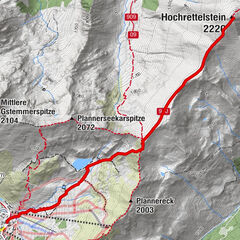
Via Plannersee and Plannerknot to the Hochrettelstein
medium
Hiking
7.42
km |
613
hm |
03:30
h
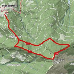
From the Michaelerberghaus up to the Kochofen
medium
Hiking
6.77
km |
688
hm |
03:30
h
Günster waterfall hike
easy
Hiking
4.05
km |
161
hm |
01:19
h
No entries found.
The search is currently not available.
Please refine your search.
Local search results
(<= 25km)
More results
(> 25km)
%count% Search results
%name%
%type%
%elevation%
%population%
%lpButton%