- Brief description
-
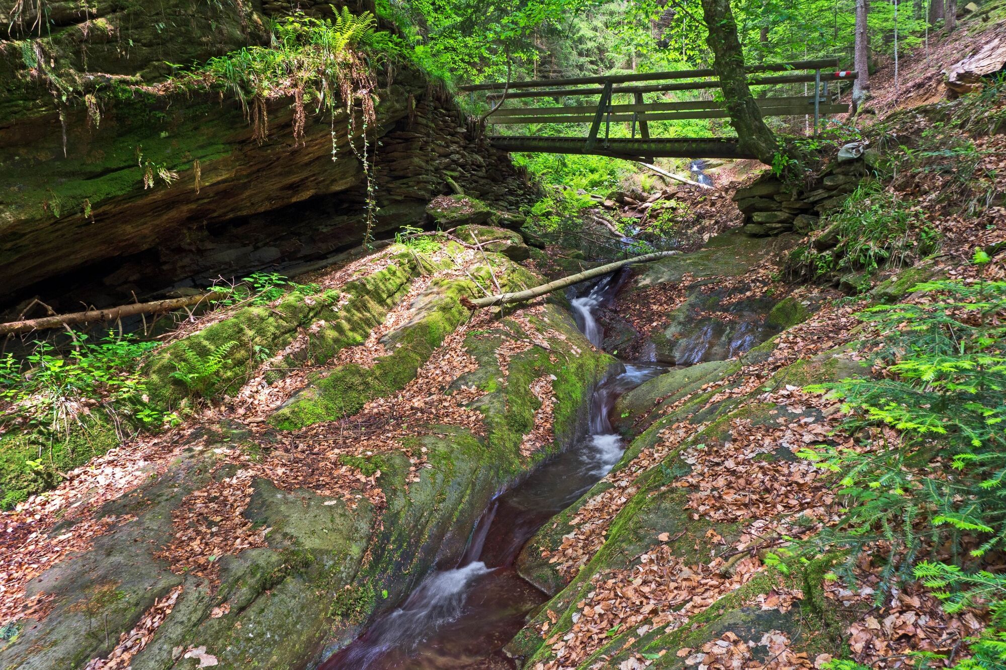
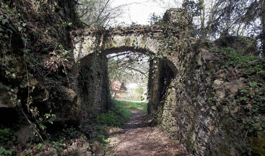
A leisurely walk. Through an archway into the romantic Hinterbrühl gorge, you almost feel like you're in another world.
- Difficulty
-
easy
- Rating
-
- Starting point
-
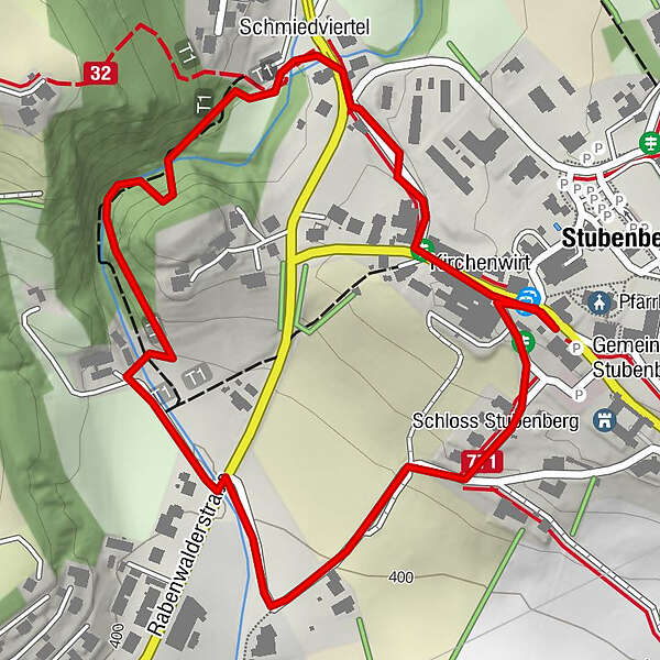
Stubenberg village square
- Route
-
Schmiedviertel0.4 kmStubenberg am See1.8 km
- Best season
-
JanFebMarAprMayJunJulAugSepOctNovDec
- Description
-
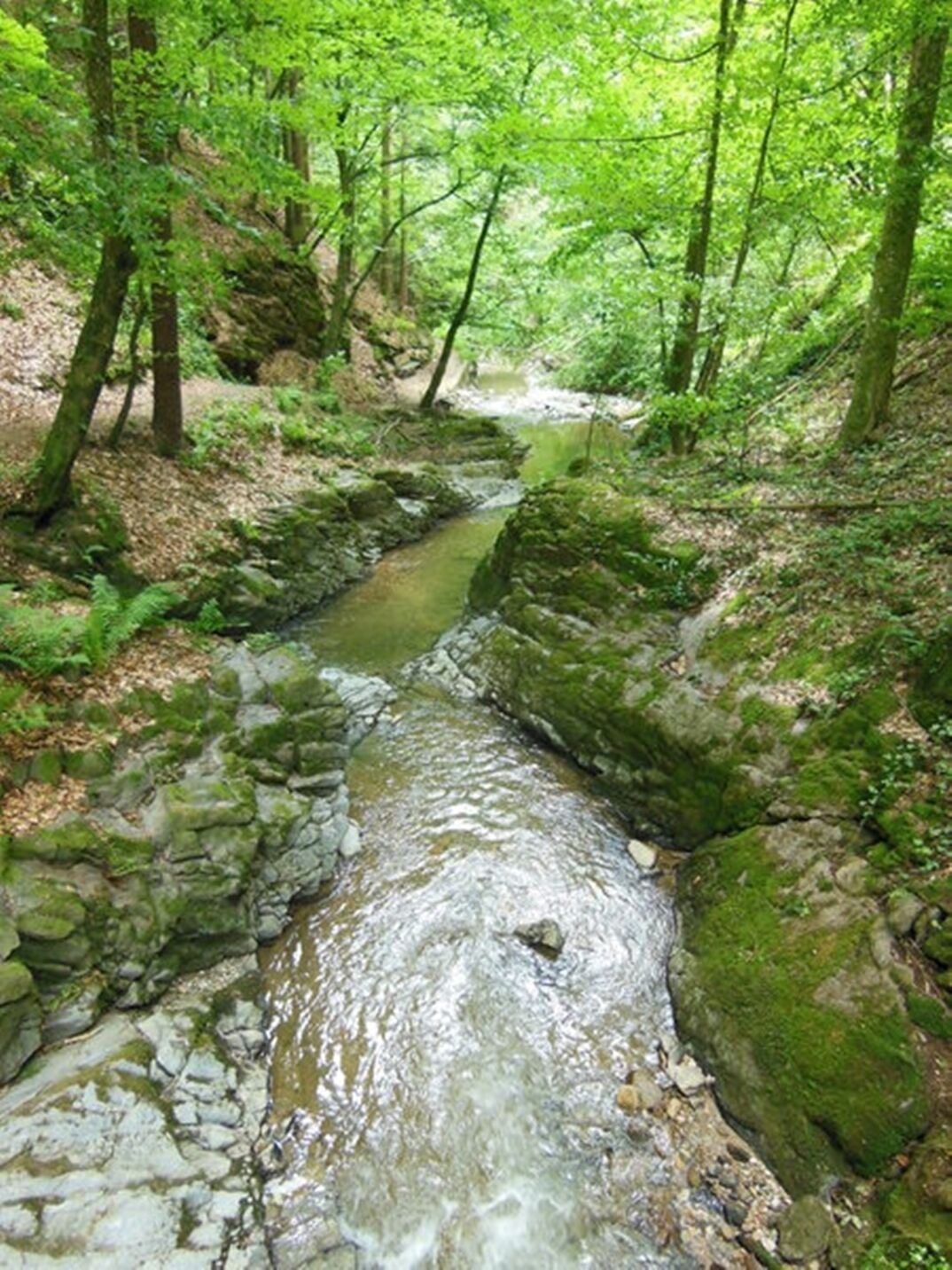
A popular walking trail in Stubenberg am See. Short and yet versatile and varied. Above all, however, it impresses with the enchanting Hinterbrühl gorge. This gorge enchants you into another world. The soothing babbling of the small stream and, above all, the wonderful natural landscape invite you to relax and enjoy.
- Directions
-
This leisurely circular walk takes us from the centre of Stubenberg to the romantic Hinterbrühl gorge and back to Stubenberg.
We start the hike at Stubenberg village square and then head towards Apfelwirt-Flaggl. On the right-hand side of the road we see a large former department stores', we turn right after this house and continue along the path until we come to a crossroads.Here we cross the road and turn left immediately after a car park and a house, passing through an archway into the Hinterbrühl Gorge.Here we can really relax and enjoy - some "benches" invite us to do so.
After the gorge, the path crosses a meadow and continues along a small stream to the road. The path crosses the road again.
This is where the Hinterbrühlweg and Seeweg paths join. We then take this path back to the village square at a leisurely pace.
- Highest point
- 443 m
- Endpoint
-
Stubenberg village square
- Height profile
-

- Equipment
-
Small rucksack with water bottle (+ provisions)
Sturdy shoes
Appropriate clothing - preferably several layers - "onion principle"
Rain and sun protection
Hiking poles as required
Cell phone
Small first aid kitRoute description
Before starting the hike, check where you can stop for refreshments, including opening times, or pack suitable food and drink.
- Safety instructions
-
Important telephone numbers:
European emergency call: 112
Emergency call mountain rescue: 140 (if possible, please provide GPS data)
Rescue: 144
Fire brigade: 122
Police: 133T
ips for even more hiking fun: Rules of behaviour when hiking
A few tips on correct and fair behaviour in the forest: (Source: www.bundesforste.at )
Hikers should avoid visiting the forest approx. 1.5 hours before sunrise and after sunset, as wild animals are particularly active at this time.Plastic bottles, handkerchiefs, cigarette butts etc. have no place in the forest! Please make sure that you do not leave any rubbish in the forest.Camping and making fires is strictly forbidden in the forest!In principle, every person in the forest is allowed to collect 2kg of mushrooms and berries per day for their own use. It is only prohibited if the forest owner expressly forbids it.
- Tips
-
We recommend that you:
Take time to relax and enjoy yourself. There are several benches that invite you to do so.
- Additional information
-
Information about the region, places to stop for refreshments and overnight accommodation, excursion destinations, etc:
Eastern Styria Tourist BoardApfelLand-Stubenbergsee office8223 Stubenberg am See 5
Tel. :+43 3176 8882
- Directions
-
ApfelLand is located in the heart of Eastern Styria, approx. 60 km north-east of Graz and approx. 140 km south of Vienna
By car: Coming from Vienna: Via the south motorway (A2) to the Hartberg exit - via the main road (B54) towards Graz - 2 km after Kaindorf towards Graz, turn off towards ApfelLand-Stubenbergsee- Stubenbergsee- Floing- Anger
Coming from Salzburg/Germany: Motorway via Salzburg - Pyhrnautobahn (A9) to Graz - continue via the Südautobahn in the direction of Vienna (A2) to the Gleisdorf West exit - main road (B54) to Kaibing - ApfelLand-Stubenbergsee- Stubenbergsee- Floing- Anger
To Google Maps for the calculation of the journey.
- Public transportation
- Parking
-
Car park Amtshaus - next to Stubenberg Castle


-

-
AuthorThe tour Hinterbrühlweg, Stubenberg is used by outdooractive.com provided.


-
Oststeiermark
2126
-
ApfelLand - Stubenbergsee
1140
-
Stubenberg am See
321