
- Brief description
-
A beautiful, varied hike with some ascents and descents.
- Difficulty
-
easy
- Rating
-
- Starting point
-
Bad Aussee train station
- Route
-
Sportstüberl, Pizzeria0.3 kmUnterkainisch0.4 kmKalsswirt0.6 kmKohlröserlhütte6.6 km
- Best season
-
JanFebMarAprMayJunJulAugSepOctNovDec
- Description
-
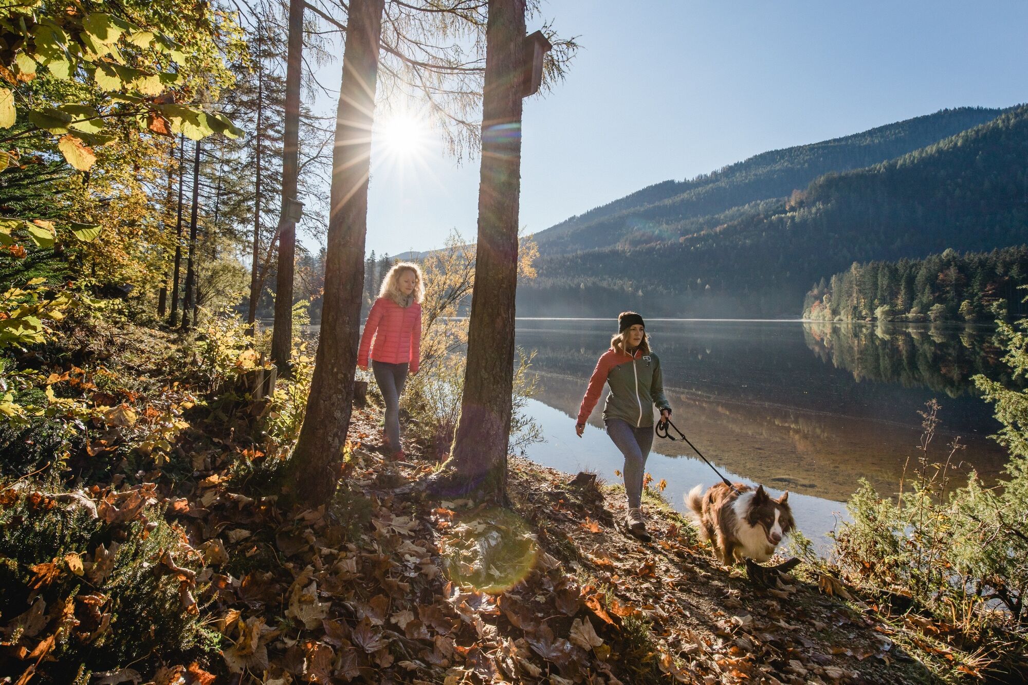
Ödensee nature experience - the heart of the region. Circular trail equipped with information boards and viewing platforms.
- Directions
-
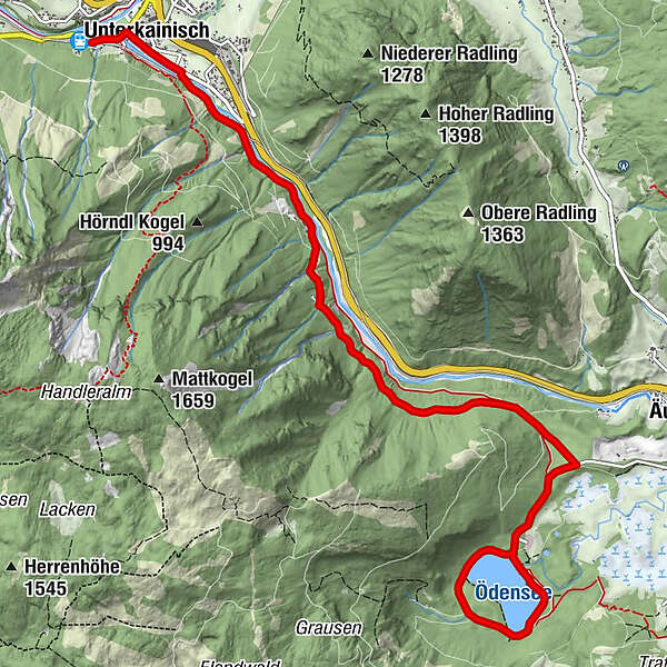
From the forecourt of the train station, follow the signs to Lake Ödensee in the direction of the city center. At the soccer stadium, turn right into Sießreithstraße and follow it for about one kilometer, where you cross the Ödenseetraun over a bridge.
Follow the road to the left for about 700 meters until you reach the bridge on the right that crosses the Kainisch Traun. Cross this bridge and continue straight on, past the shooting range of the Bad Aussee-Unterkainisch shooting club on the right, and immediately turn left onto the hiking trail to Lake Ödensee.
The marked, gravelled path leads along the Kainisch Traun upstream. Pass under the railroad bridge, past the waste disposal center, and continue in a southerly direction below the Brandgraben, Lahngraben and Rabenwand and above the Wasen bridge.
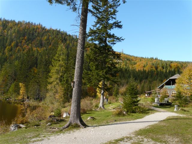
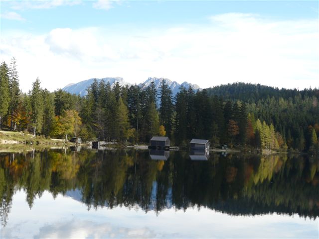
After about 1.5 kilometers you come to a forest road, on which you continue to climb to the right. The road, which soon becomes level, leads to the access road to Lake Ödensee. Follow this road to the right and after about 750 meters you will reach your destination, Lake Ödensee. The spring water lake invites you to take a bath in the crystal clear water in summer.
If you still have the desire and stamina, treat yourself to a walk around the Ödensee after a rest. Length - about two kilometers.
You can return to Bad Aussee either by cab or by train.
- Highest point
- 816 m
- Endpoint
-
Ödensee
- Height profile
-

- Equipment
-
Proper backpacking makes many things easier:
pack heavy things first.
The water bottle should always be within easy reach in a side pocket.
All things that are often needed, such as sunglasses, camera or hiking map, belong on top.
An emergency kit including blister plaster belongs in every backpack and a clothing according to the "onion system" is always recommended! - Safety instructions
-
Emergency call mountain rescue: 140
Emergency reporting tip - provide answers to the six W questions:
What happened? How many injured? Where did the accident happen? (possibly GPS coordinates) Who is reporting? (callback number) When did the accident happen? Weather at the accident site? - Tips
-
The original lake and river landscape is an Eldorado for botanists and biologists.
- Additional information
- Directions
- Public transportation
- Parking

- Author
-
The tour From Bad Aussee to Ödensee is used by outdooractive.com provided.


General info
-
Ausseerland - Salzkammergut
3382
-
Haus - Aich
1364
-
Bad Aussee
292