- Brief description
-
This challenging trail leads to the Rabenwald and to the long mining history of the whole region. At Rabenwald lies one of the largest talc deposits in Europe
- Difficulty
-
medium
- Rating
-
- Starting point
-
Anger swimming pool
- Route
-
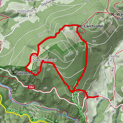
AngerFresen0.9 kmMärchenwald1.1 kmMärchenwald10.6 kmFresen10.8 kmAnger11.8 km
- Best season
-
JanFebMarAprMayJunJulAugSepOctNovDec
- Description
-
In the footsteps of the former "shift workers" who in those days went on foot to the Rabenwald to work in the mine. Talc is the softest mineral in the world and has always been used in furnace construction. It was brought from Rabenwald on the Roman salt roads to Venice as early as the 9th century.
In 1809, farmers began to mine talc on their land at "talc outcrops" (the places where the talc came to the surface), and from 1900 onwards, mining began in tunnels in order to recover this "treasure", the "white gold", the "feather white", as the talc is called by the local population.
Hardly imaginable today, at that time the talc was only mined "underground" and thus countless tunnels were created by the hard work of the miners.
Shift work at Rabenwald was from 6 a.m. to 2 p.m. and from 2 p.m. to 10 p.m., so the "shift workers" had to leave very early on foot from the valley to the mountain to work.
- Directions
-
This described and marked "Schichtweg" starts from Anger, but of course from many sides (from Feistritz bei Anger- Baierdorf and Floing) the workers came to the Rabenwald, where today only the mineral is extracted in surface mining and brought to the mill in Oberfeistritz via the material cableway. The "Schichtweg" runs at the beginning along the "Erlebnisweg Honigbiene" with the starting point at the swimming pool in Anger. The first hiking destination is the "Mill in the Fairytale Forest". A functioning water mill as well as a small Kneipp facility in the "Fresenbach" invite you to linger.Continue along the "Erlebnisweg Honigbiene" (honey bee adventure trail) past a fish pond to a road, keep left and after about 50 m change to the other side and from now on follow the "Schichtweg" markings. After about 10 minutes of walking you will come to the "Schott-Hansl- Kreuz". The cross, which dates back to 1722, was completely renovated last year and offers a magnificent view of "Keppeldorf and Schulhausviertel" in the community of Baierdorf near Anger.Following the markings "Schichtweg" you will come to the material cableway- which still today delivers the talc (Federweiß) from Rabenwald to Feistritz bei Anger. A short rest would certainly be appropriate now and in the trout inn Holzerbauer you can strengthen yourself for the last stage. To do this, you only have to follow the "Genussrundweg" markings for a short while.The cable car now becomes a constant companion until you finally reach your destination at the Rabenwald mine.Unfortunately, for safety reasons, it is not allowed to enter the mine. The hike then goes right back to the starting point in Anger (at the swimming pool), the same way the "Schichtler" went home.
- Highest point
- 990 m
- Endpoint
-
Anger swimming pool
- Height profile
-

- Equipment
-
Backpack with water bottle/thermos flask and provisions
Mountain / hiking boots
Appropriate clothing - preferably several layers - "onion principle" on cool days: long hiking trousers, don't forget gloves: Headgear, sunglassesRain protection, seat padHiking polescell phoneFirst aid kitDirections, detailed plan of the hike/hiking map/GPS deviceBefore starting the hike, check where to stop for refreshments, including opening times, or pack appropriate food and drink
- Safety instructions
-
Important telephone numbers:
European emergency call: 112
Emergency call mountain rescue: 140 (if possible, please provide GPS data)
Rescue: 144
Fire department: 122
Police: 133
Here you will find the rules of conduct for "Safe handling of grazing livestock" and "Safety on the mountain"
A few tips on correct and fair behavior in the forest: (Source: www.bundesforste.at )
Hikers should avoid visiting the forest approx. 1.5 hours before sunrise and after sunset, as wild animals are particularly active at this time.Plastic bottles, handkerchiefs, cigarette butts etc. have no place in the forest! Please make sure that you do not leave any garbage in the forest.Camping and making fires is strictly forbidden in the forest!In principle, every person in the forest is allowed to collect 2 kg of mushrooms and berries per day for their own use. It is only prohibited if the forest owner expressly forbids it.
- Tips
-
We recommend:
Museum Mystical Under- & Overworlds of the Anger Region
- Additional information
- Directions
-
ApfelLand is located in the heart of Eastern Styria, approx. 60 km north-east of Graz and approx. 140 km south of Vienna
By car: Coming from Vienna: Via the Südautobahn (A2) to the Hartberg exit - via the main road (B54) towards Graz - 2 km after Kaindorf towards Graz, turn off towards ApfelLand-Stubenbergsee- Stubenbergsee- Floing- Anger
Coming from Salzburg/Germany: Highway via Salzburg - Pyhrnautobahn (A9) to Graz - continue on the Südautobahn in the direction of Vienna (A2) to the Gleisdorf West exit - main road (B54) to Kaibing - ApfelLand-Stubenbergsee- Stubenbergsee- Floing- Anger
- Public transportation
- Parking


-

-
AuthorThe tour "Shift path" to the Raven Forest is used by outdooractive.com provided.


-
Oststeiermark
2126
-
ApfelLand - Stubenbergsee
1140
-
Floing
371