- Brief description
-
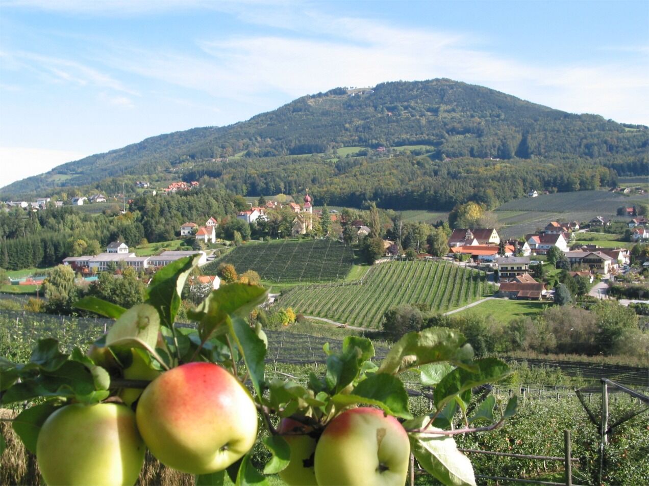
A pleasant and varied circular route around the apple village of Puch, which is located in the center of the Styrian Apple Road in the largest fruit-growing area in Austria.
- Difficulty
-
easy
- Rating
-
- Starting point
-
Municipal office Puch
- Route
-
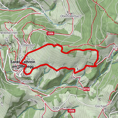
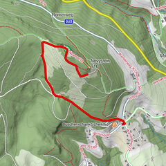
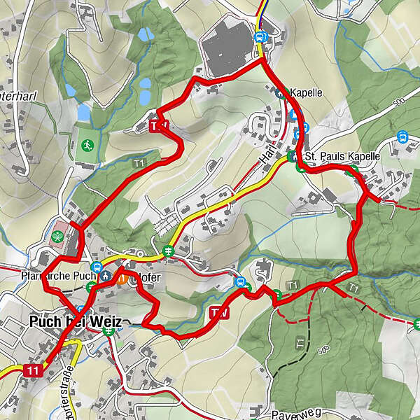
Eiteljörg0.0 kmPfarrkirche Puch0.1 kmHofer0.2 kmSt. Pauls Kapelle2.1 kmKapelle2.3 kmPuch bei Weiz3.9 kmMeißel4.1 km
- Best season
-
JanFebMarAprMayJunJulAugSepOctNovDec
- Description
-
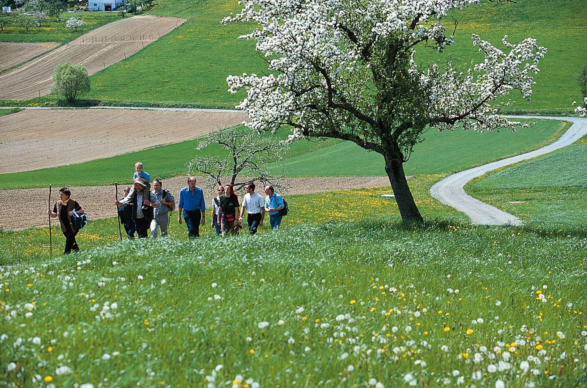
Hiking under the sign of the apple
The term "Tramway" is used in English-French to refer to a tramway.
On the Styrian Apple Road Tramway is a hiking trail that takes you through the beautiful landscape along orchards around Puch. In spring we are impressed with a unique splendor of flowers, in summer the trees give us shade, in autumn we can enjoy the ripe fruit.
The fruit farms around the apple village of Puch cordially invite you to taste their delicacies.
Of course, culture is not neglected either.
Listen to the organ and bell ringing parish church Puch bei Weiz
- Directions
-
Start at the municipal office Puch, past the country inn Eiteljörg-Scholz. Then turn right and walk between the church and Kirchenwirt Hofer. Orchards await you on the following section. Then turn right at the fork, a bend follows, turn right again and you will enter a shady wooded area. After that you will come to a settlement. Turn left here. Keep left at the next fork and you will pass a small idyllic residential area. In front of the company Obst Gössl turn left. At the apple man, family Planner, turn left and cross the farm, the path will you but again through orchards and a small piece of forest. So you pass the new middle school and get back to the center of the village to the starting point.
- Highest point
- 514 m
- Endpoint
-
Municipal office Puch
- Height profile
-

- Equipment
-
- Small rucksack with water bottle (+ provisions)- Sturdy shoes- Appropriate clothing - preferably several layers - "onion principle"- Rain and sun protection- Hiking poles as required- Cell phone- Small first aid kit- Route description- Before starting the hike, check where you can stop for refreshments, including opening times, or pack suitable food and drink.
- Safety instructions
-
Important telephone numbers:
European emergency call: 112
Emergency call mountain rescue: 140 (if possible, please provide GPS data)
Rescue: 144
Fire department: 122
Police: 133
Hikers should avoid visiting the forest approx. 1.5 hours before sunrise and after sunset, as wild animals are particularly active at this time.Plastic bottles, handkerchiefs, cigarette butts etc. have no place in the forest! Please make sure that you do not leave any garbage in the forest.Camping and making fires is strictly forbidden in the forest!In principle, every person in the forest is allowed to collect 2 kg of mushrooms and berries per day for their own use. It is only prohibited if the forest owner expressly forbids it.
- Tips
-
We recommend:
House of the apple Styrian Apple Route
- Additional information
- Directions
-
ApfelLand is located in the heart of Eastern Styria, approx. 60 km north-east of Graz and approx. 140 km south of Vienna
By car: Coming from Vienna: Via the Südautobahn (A2) to the Hartberg exit - via the main road (B54) towards Graz - 2 km after Kaindorf towards Graz, turn off towards ApfelLand-Stubenbergsee- Stubenbergsee- Floing- Puch
Coming from Salzburg/Germany: Highway via Salzburg - Pyhrnautobahn (A9) to Graz - continue on the Südautobahn in the direction of Vienna (A2) to the Gleisdorf West exit - main road (B54) to Kaibing - ApfelLand-Stubenbergsee- Stubenbergsee- Floing- Puch
- Public transportation
- Parking


-

-
AuthorThe tour Tramway, Puch near Weiz is used by outdooractive.com provided.


General info
-
Oststeiermark
2125
-
ApfelLand - Stubenbergsee
1139
-
Puch bei Weiz
334