


- Brief description
-
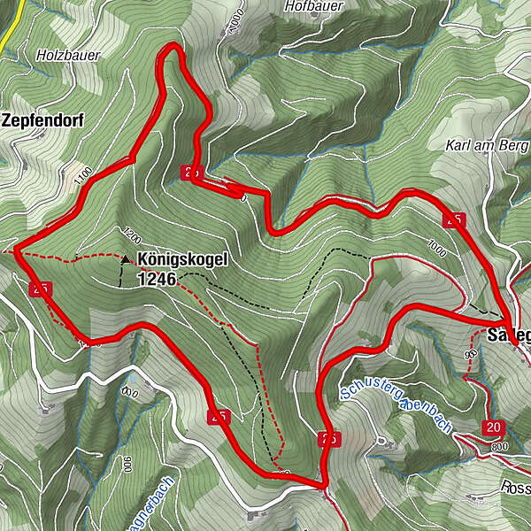
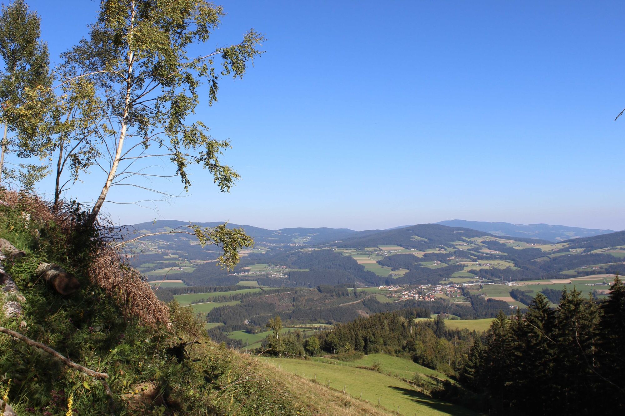
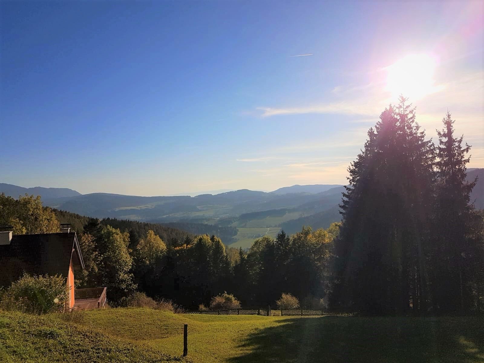
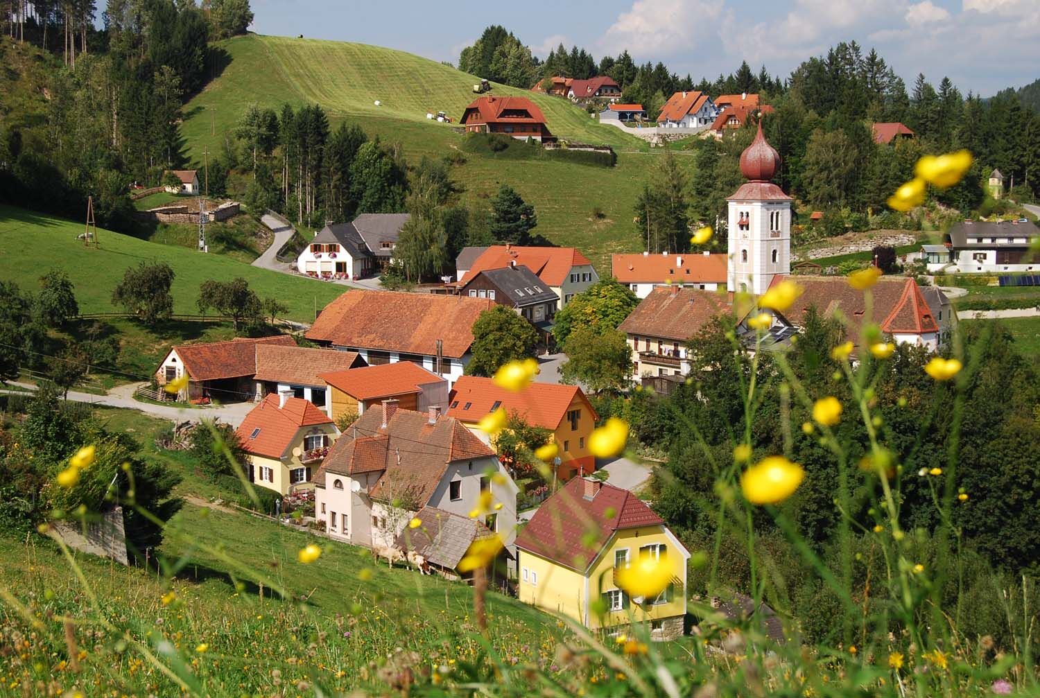
The trail starts in Sallegg, high above Koglhof, and leads around the Königskogel in the Almenland Nature Park in Styria. The tour impresses with its beautiful views.
- Difficulty
-
easy
- Rating
-
- Starting point
-
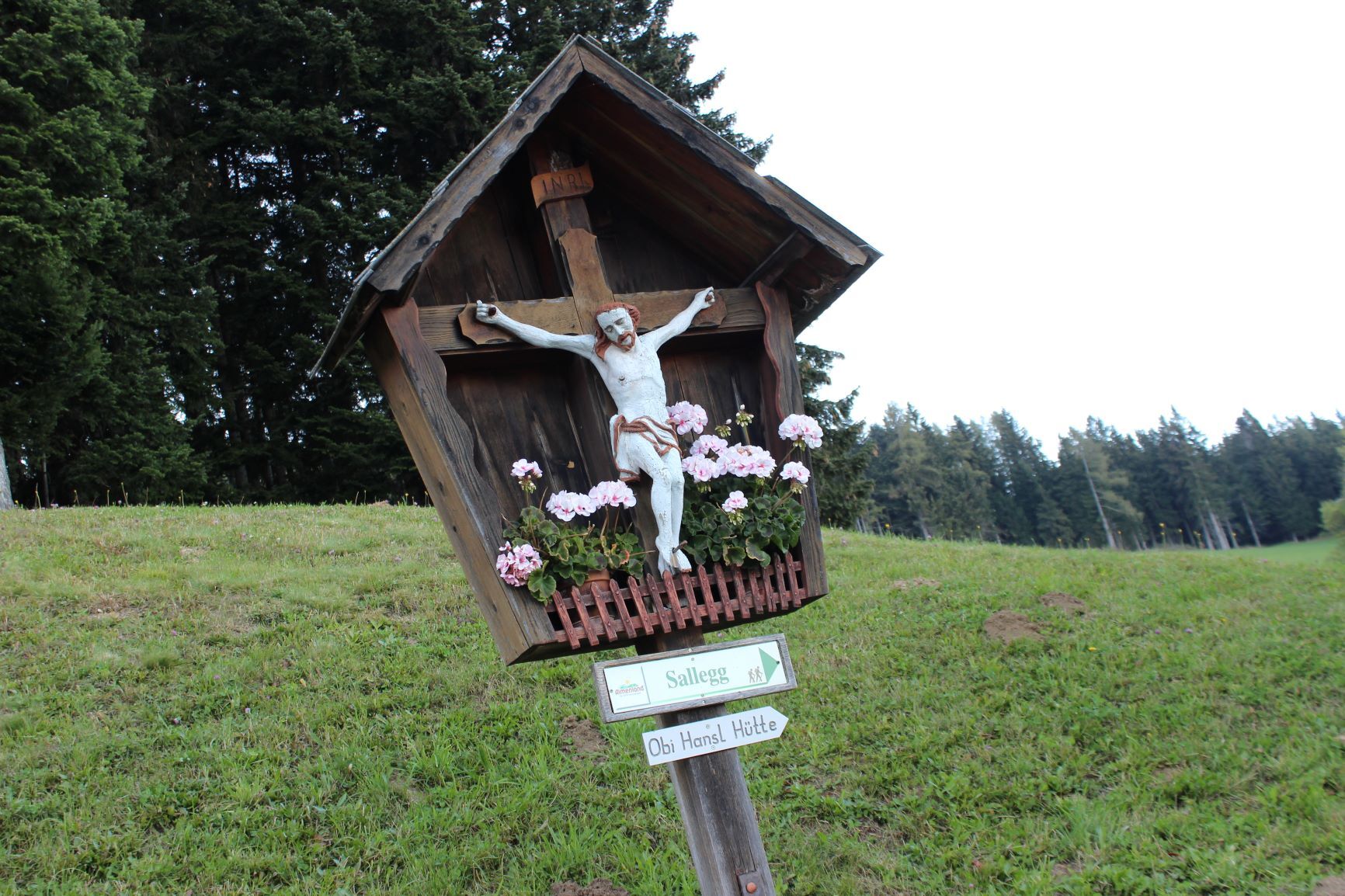
Sallegg Arche Park,
- Route
-
Sallegg0.0 kmZepfendorf3.9 kmSallegg8.4 km
- Best season
-
JanFebMarAprMayJunJulAugSepOctNovDec
- Description
-
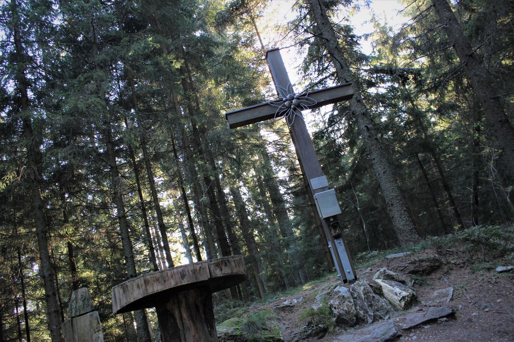
The trail around the Königskogel is easy to walk and offers beautiful views and a few resting places. There is no ascent to the summit cross because the summit lies in the dense forest.
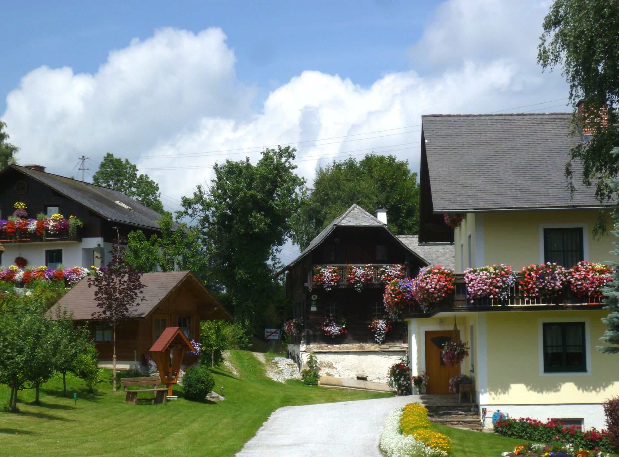
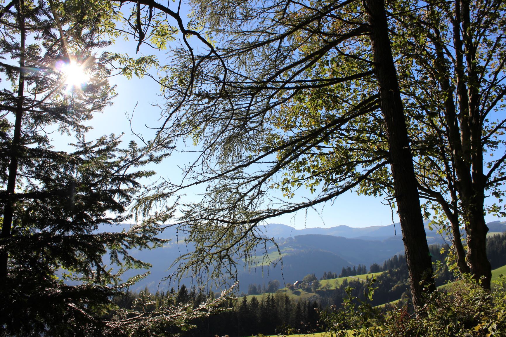
Sallegg with its magnificent floral decorations lies directly on the Almenland-Panoramastrasse, the views here are correspondingly beautiful. To the north, the view goes to the Fischbacher Alps, to the Schneealpe, to the Rax or to the Hohe Veitsch.
Deep down in the valley lies St. Georgenkirche, which was first mentioned in the 13th century and is the oldest parish church in the upper Feistritz valley. In the 18th century, the church was rebuilt and later furnished in the New Baroque style.
A refreshment stop is possible in the village of Koglhof or on the Brandlucken/Heilbrunn.
The tour can be combined well with a trip to the summer toboggan run with the motor skills park in Koglhof - fun for the whole family!
- Directions
-
We start in Sallegg from the car park of the Obi-Hansl-Hütte (closed!) and follow the signs "Um den Königskogel" in the direction of "Wolfersberger".
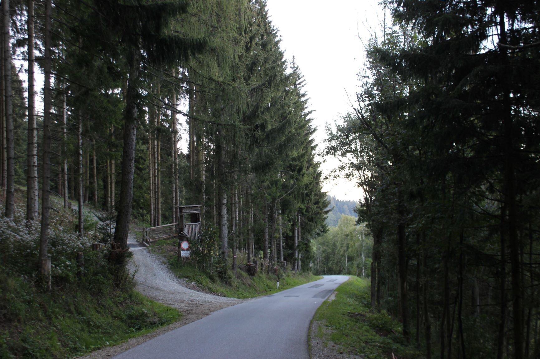
The beautiful hiking trail leads comfortably through pastureland at the beginning and then moves uphill in the forest - we always follow the Almenland signposts.
At the well-signposted crossroads (approx. 800 m before the Wolfersberger farm) we turn left uphill in the direction of "Königskogel".
At the next bend, keep to the right and continue uphill on the wide forest road until you reach the large, also well-signposted forest road junction (located a little above Zepfendorf).
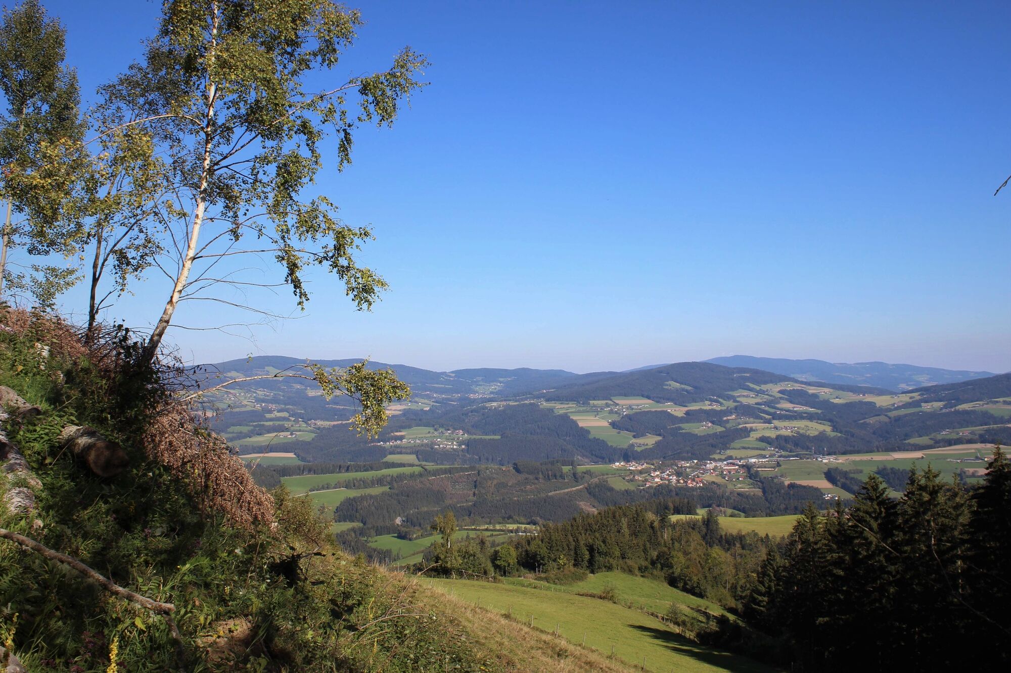
Now we follow the signpost "Um den Königskogel" again, first slightly downhill, then uphill again. In between we have a view of the partly extreme mountain farming area of Obere Haslau.
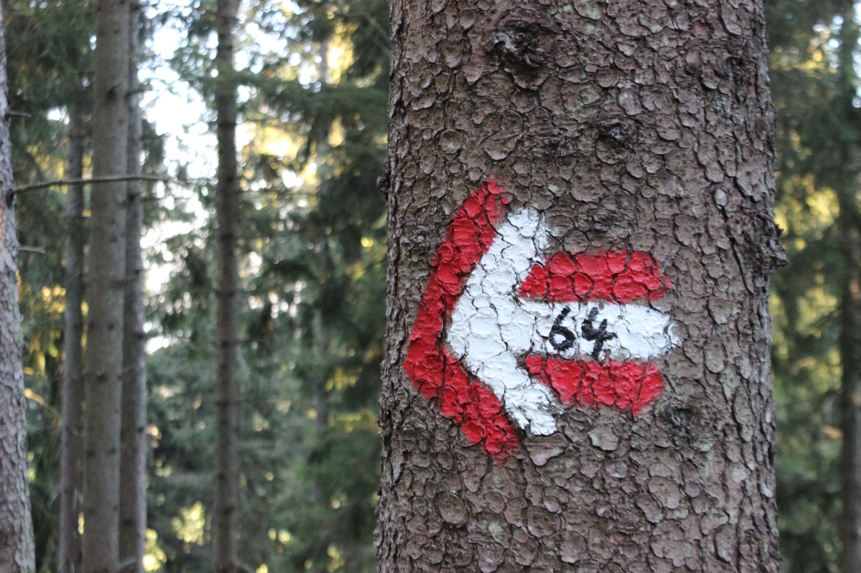
When the forest path ends, we continue along the beautiful forest trail to the crossroads and meet "Königskogelweg Nr. 64", which comes up from the Offener Kreuz and continues to the Königskogel summit cross in the forest.
We continue our leisurely Königskogel circuit and follow the sign towards "Koglhof", initially on a forest road slightly downhill.
At the next right-hand bend, we change to the cart track straight ahead (marked red-white-red and Almenland signs!).
On the gentle, almost romantic forest path we finally reach a picture tree (crucified Christ sculpture).
Attention - watch out! We now go half-right downhill on a forest path and in a few minutes we reach the access road to the Aibler homestead.
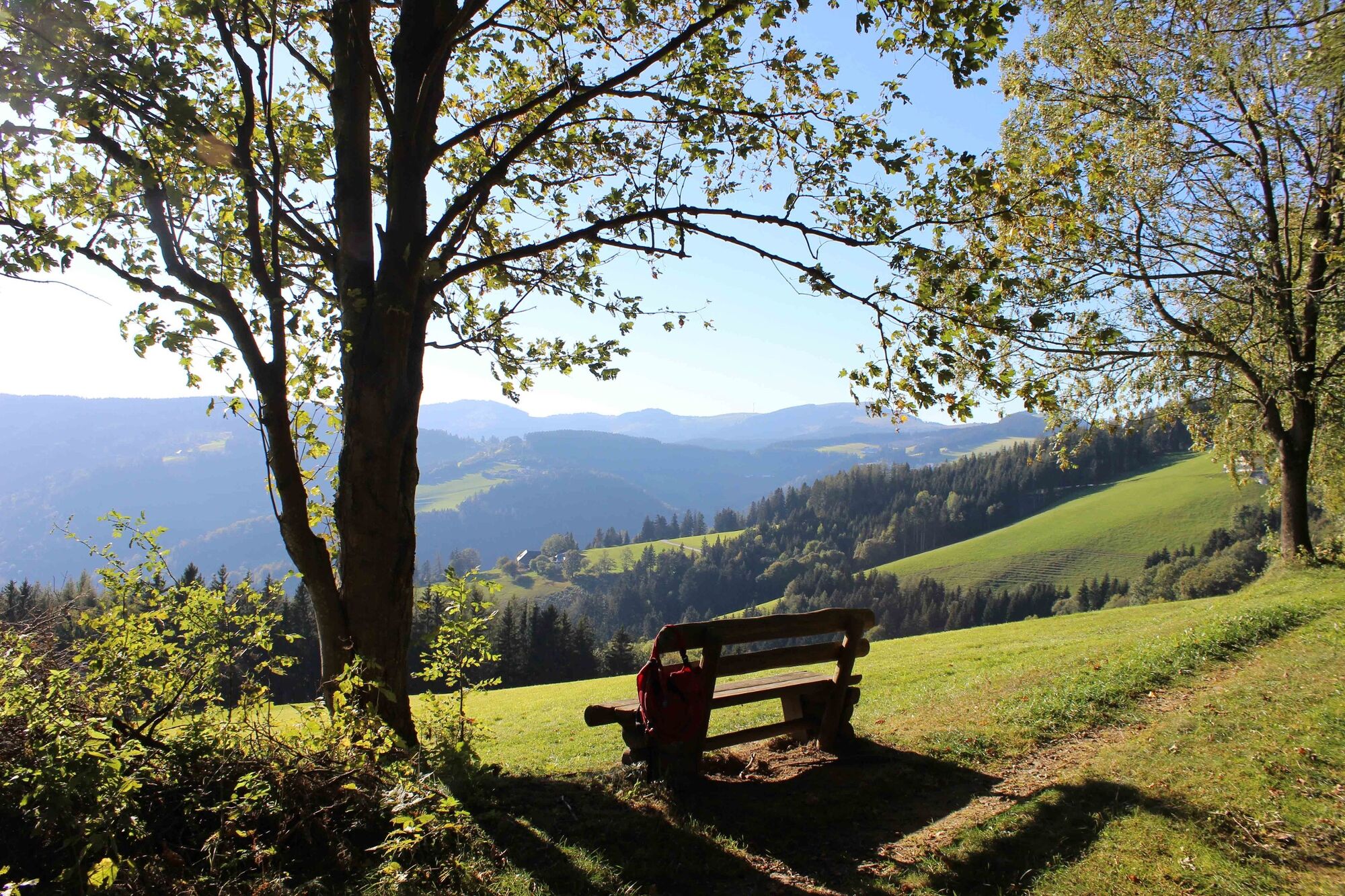
The path now goes slightly uphill to the farmstead and on the following forest path comfortably along to the "Panoramablick-Bankerl" with the view of the Sommeralm.On the level forest path we soon reach the beautiful, recently restored "Zahenhoferkreuz".
Now we continue slightly downhill and reach the farmstead vlg. Egger (Felberbauer family) we reach another great vantage point.
A short stretch on the asphalt road downhill, past a particularly beautifully restored old farmhouse (now a weekend house) to the Obi Hansl hut. - Highest point
- 1,143 m
- Endpoint
-
Sallegg, Arche Park
- Height profile
-

- Equipment
-
Good shoes, a jacket, rain protection and a water bottle are sufficient.
- Safety instructions
- Tips
-
Right next to the car park, the Ark Park with many rare, indigenous animal breeds and plants can be visited free of charge.
- Additional information
-
More info about the region, where to stop for a bite to eat, where to find rooms and descriptions of the excursion destinations and businesses:
Tourismusverband Oststeiermark
Almenland Nature Park Office
Fladnitz 100
8163 Fladnitz/Teichalm
Tel: +43 3179 23000
Mail: almenland@oststeiermark.com
www.almenland.at | www.oststeiermark.com - Directions
- Public transportation
- Parking
-
In Sallegg, at the Obi-Hansl hut.

-

-
AuthorThe tour Königskogel - circular hiking trail is used by outdooractive.com provided.


General info
-
Hochsteiermark
4079
-
Naturpark Almenland
1766
-
Heilbrunn-Brandlucken
381


