

- Brief description
-
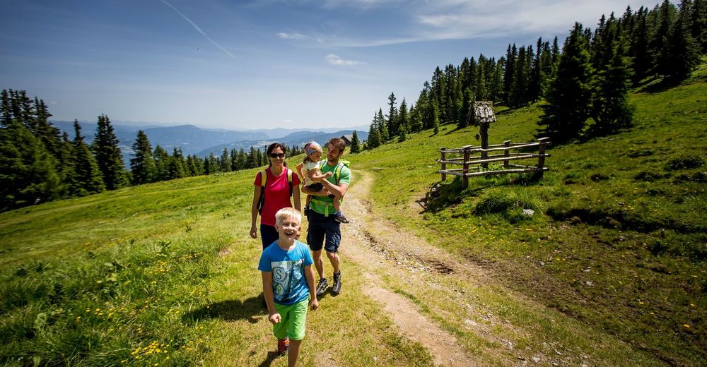
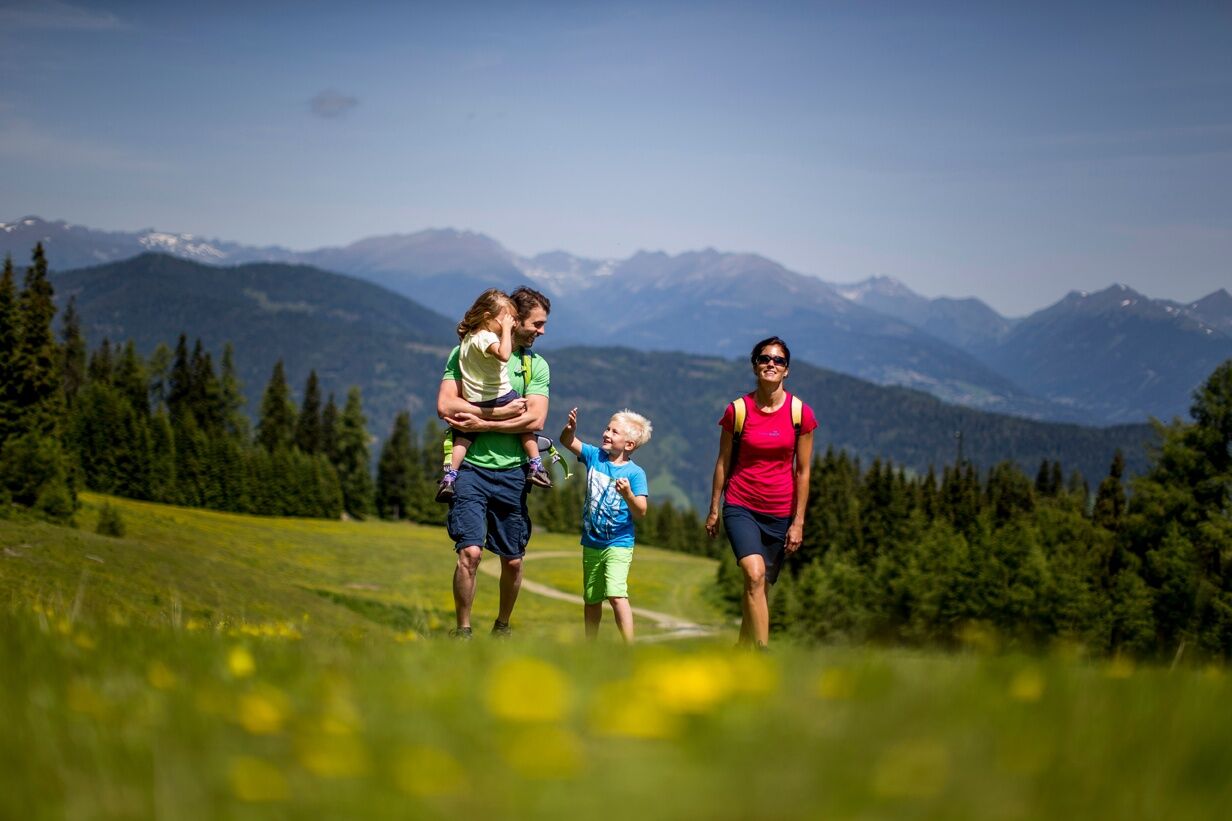
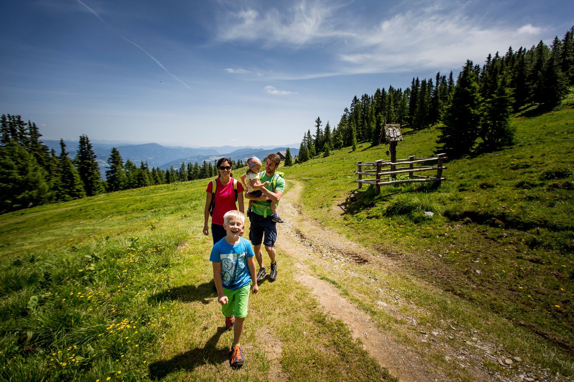
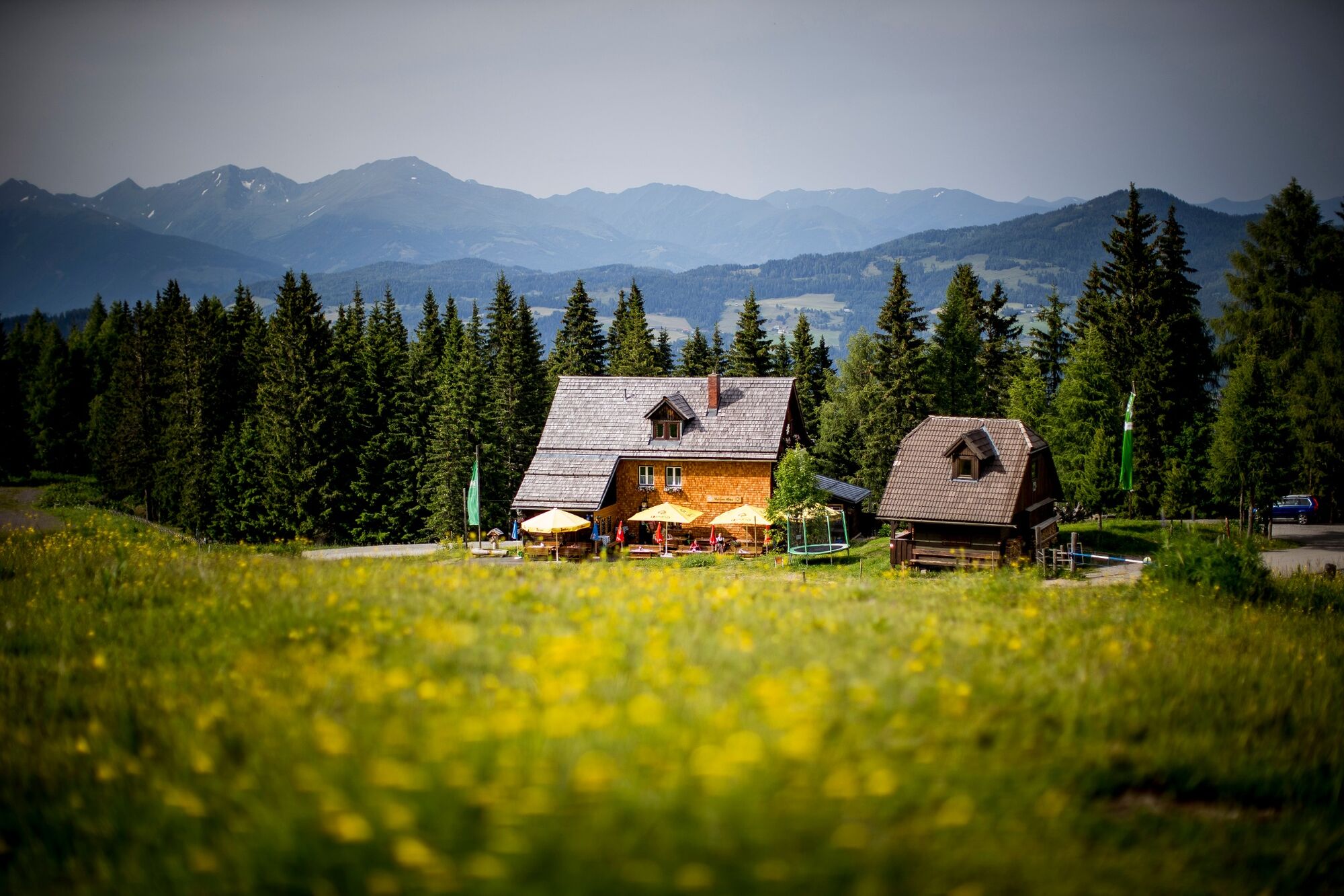
An easy tour starting at 1,583m at the Murauerhütte (mountain hut). It is an ideal hike for families, offering magnificent views over mountain pastures to the summit of the Frauenalpe.
- Difficulty
-
easy
- Rating
-
- Starting point
-
Murauerhütte
- Route
-
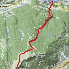
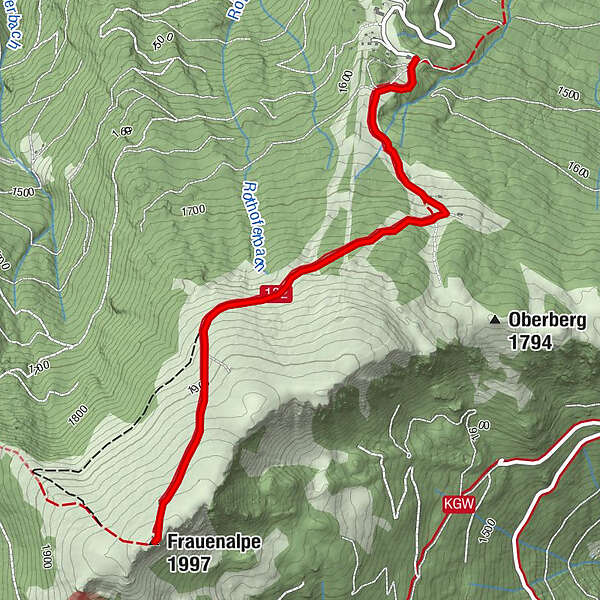
Murauer Hütte0.0 kmFrauenalpe (1,997 m)3.1 kmMurauer Hütte6.3 km
- Best season
-
JanFebMarAprMayJunJulAugSepOctNovDec
- Description
-
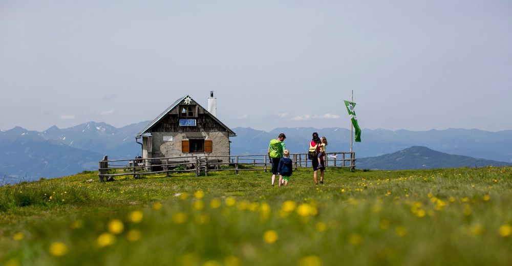
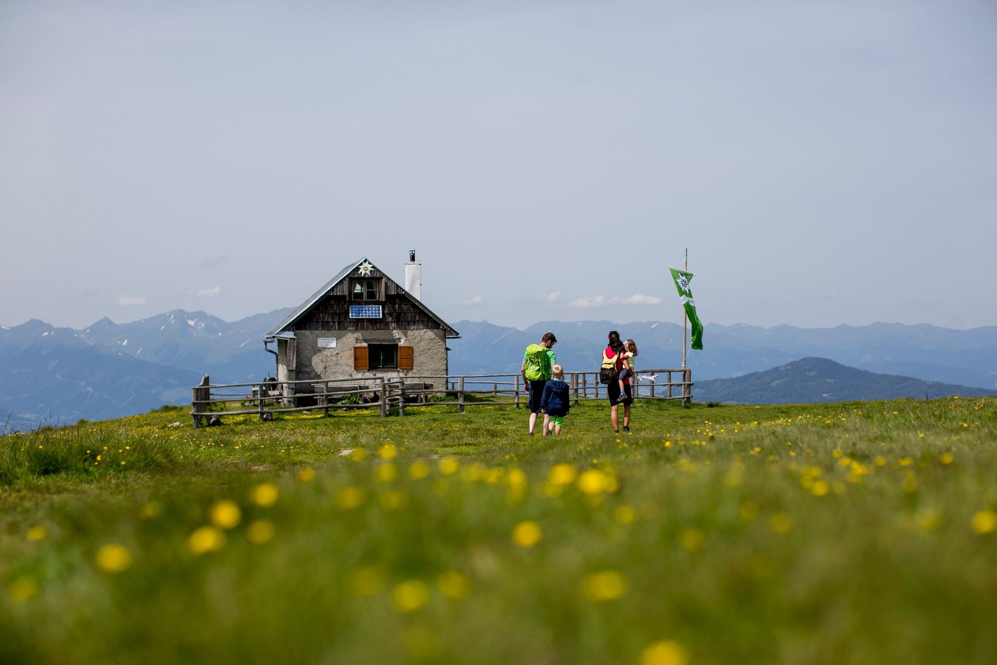
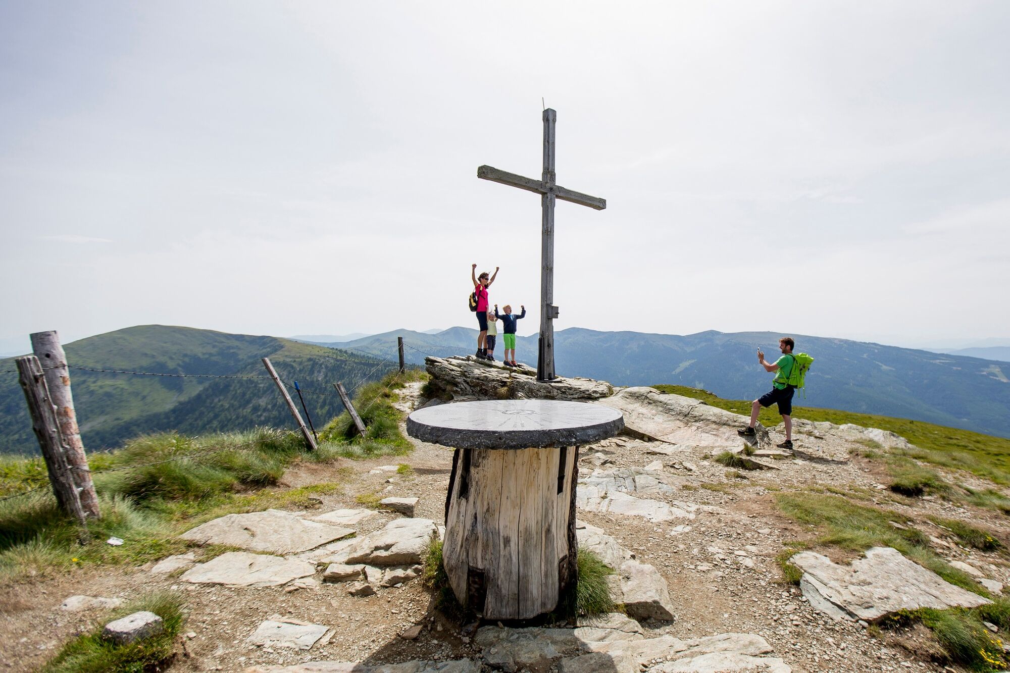
This is a great beginner's tour on which you can drive up the Frauenalpe to the Murauerhütte from Murau, via Schlatting. You will be rewarded by pure alpine pastures and mountain vistas after just a short time walking. Depending on your level of fitness, you can reach the summit of Murau's local mountain in approx. 1.5 hours ‒ where you can enjoy an impressive sweeping view of the Niedere Tauern, the Gurktaler Alpen and, weather permitting, even as far as the Karawanken. The Apollonia Chapel and the panorama information panel at the summit are particularly worth a look. In December 2017, the summit cross on the Frauenalpe was destroyed by a storm. A new cross was erected by the Alpine Association just before Christmas.Every year on the first Sunday in August, the Almsonntag celebration takes place on the summit. It is a chance for locals and guests to embark on a pilgrimage to the Frauenalpe in order to attend mass there, with music provided by the Music Association.
- Directions
-
Starting at the Murauerhütte (1,583m), the markers lead us up to the Kasereihütte at 1,691m. From there, we hike past the Bernhard Fest Hütte (1,982m) to the summit cross of the Frauenalpe (1,997m). At the peak/Trogscharte fork at 1,854m, we can walk approx. 250m towards the Trogscharte peak and refresh ourselves at the spring. Return via the route ascended.
Alternative descent: Head east over rolling mountain pastureland on the ridge towards the ski run, and follow this back to the Murauerhütte (makes the descent approx. 30 minutes longer).
- Highest point
- 1,989 m
- Endpoint
-
Frauenalpe
- Height profile
-

- Equipment
-
Good hiking shoes
Sun protection
Sufficient food - Safety instructions
-
Plan your tours carefully & stay flexible.
Bring the right equipment.
Check current weather information.
Cancel your trip in the event of poor weather.If there is an accident, remain calm.
Emergency mountain rescue number: 140
Take your rubbish with you.
Act calmly when encountering animals on the mountain pastures (alps).
Always keep dogs on a lead. - Tips
-
The panorama panel at the summit describes the surrounding mountains.
- Additional information
- Directions
-
Coming from Judenburg via Unzmarkt to Scheifling. Here turn right in the direction of Murau. In Murau turn left towards Schlatting. Follow the mountain road to the Gasthof Krische oder the Murauerhütte.
Coming from Tamsweg via Ranten or Stadl an der Mur drive straight on to Murau. In Murau keep right in the direction of Schlatting. Follow the mountain road to the Gasthof Krische or to the Murauerhütte.
- Parking
-
Parking is available directly at the Murauerhütte or the Alpengasthof Krische.
- Author
-
The tour From the Murauerhütte to the Frauenalpe is used by outdooractive.com provided.


General info
-
TourismusRegion Murau
1743
-
Frauenalpe - Murau
126