


- Brief description
-
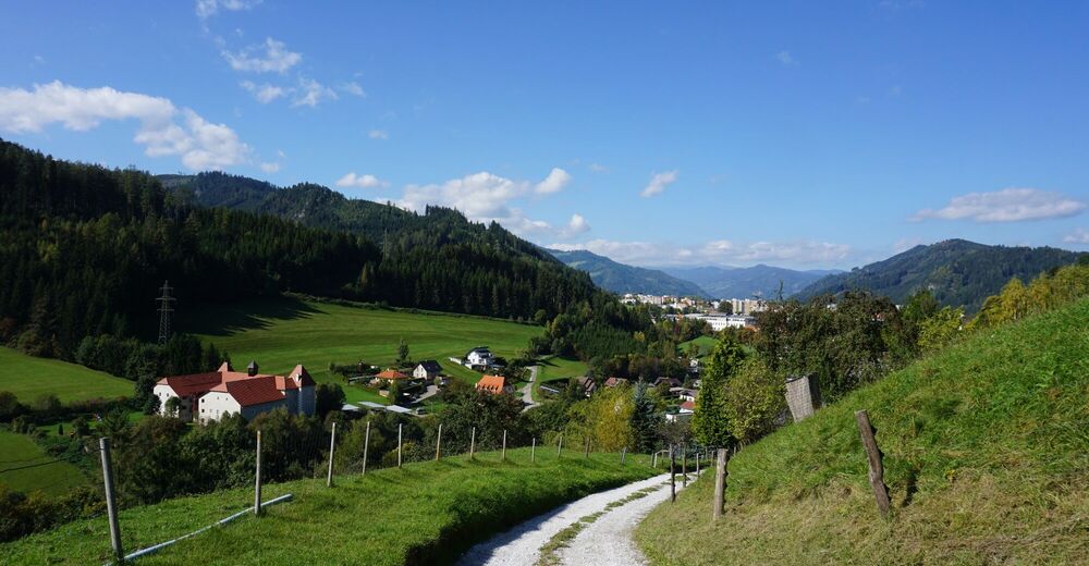
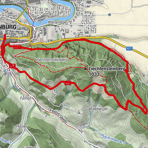
Circular hike around the Liechtensteinberg with great views of Judenburg and the Aichfeld, crossing some cow pastures. Extension to Maria Buch possible.
- Difficulty
-
medium
- Rating
-
- Starting point
-
Main square Judenburg
- Route
-
JudenburgWöllmerdorf4.1 kmKalvarienbergkirche6.6 kmJudenburg7.8 km
- Best season
-
JanFebMarAprMayJunJulAugSepOctNovDec
- Description
-
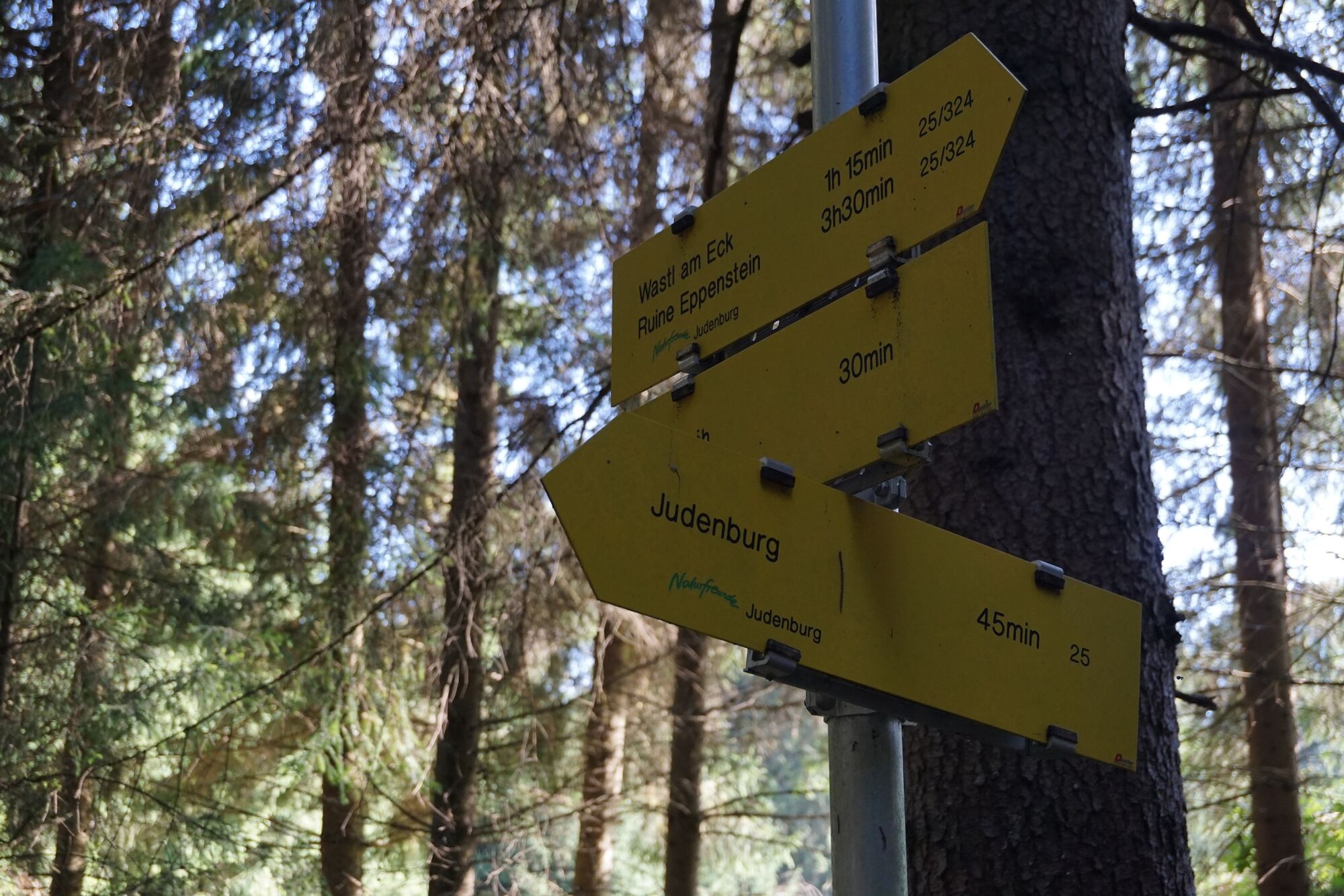
From the main square via Weyergasse - along the Murradweg - to Weyerplatz, onto Feebergstraße. At the crossing "Bergweg" follow the hiking trail 25 to the "Wastl am Eck". The further waymarking along the forest road is good to take from the crossing cow pastures. Several cow pastures have to be crossed.
After about an hour you reach "Wastl am Eck", a former snack station. On the way there are some benches for a rest.
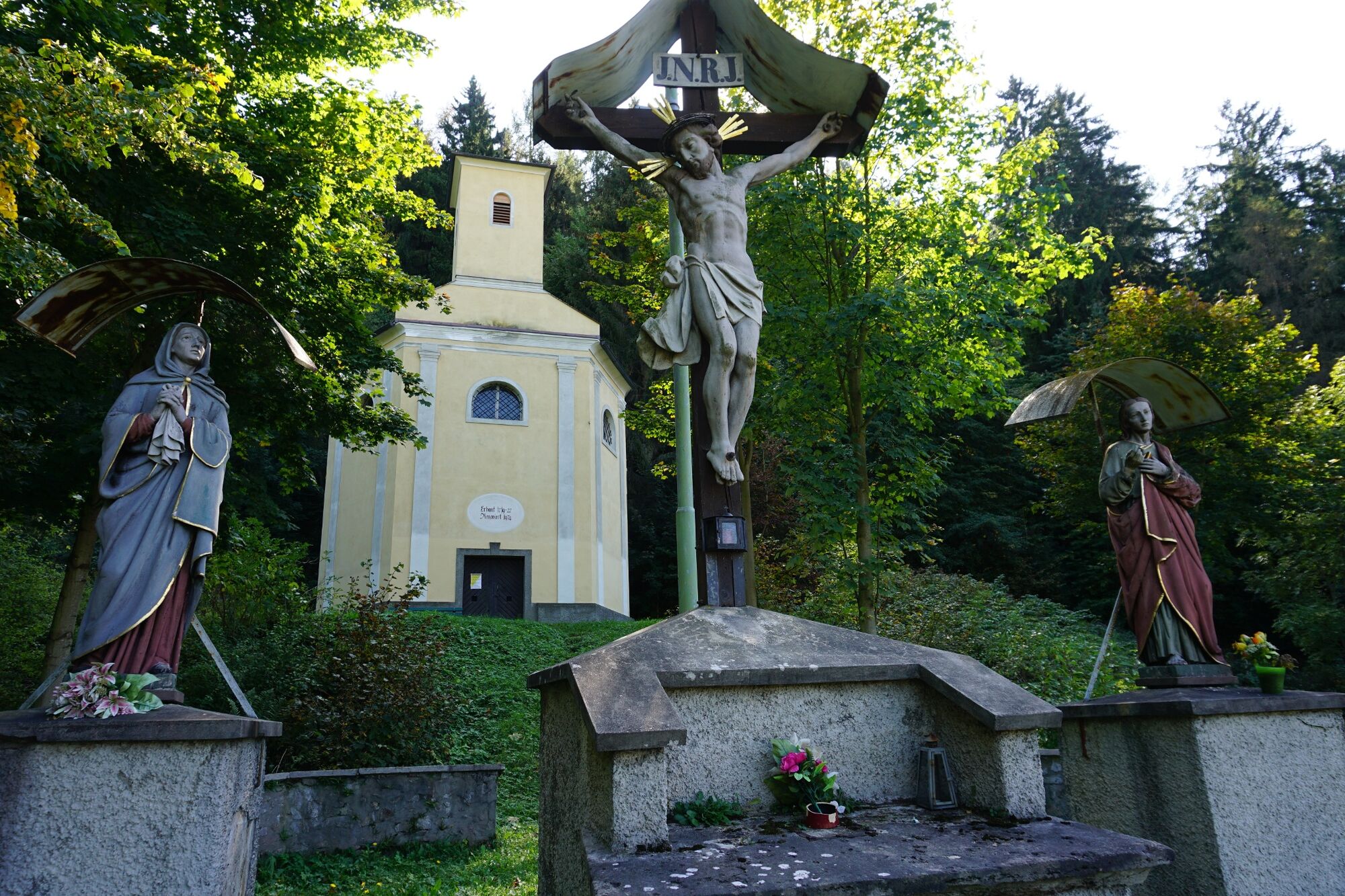
Continue along the wide forest path in the direction of Jahnstein (hiking trail 20). Descent in the direction of "Wöllmerdorf Judenburg" - hiking trail 25, across the forest to the next forest road. Here you turn right on the forest road to the next fork, always follow the hiking trail 25 in the direction of Judenburg. Through the forest and along the fields in the direction of Judenburg, transition to hiking trail 324. Descent via Calvary Church and the stations of the cross along the Purbachweg. Return to the Weyerplatz.
From here another short uphill back to the center of Judenburg.
- Directions
-
The circular walk around the Liechtensteinberg and to the Calvary Church used to be the typical "Sunday round" of the Judenburgers.
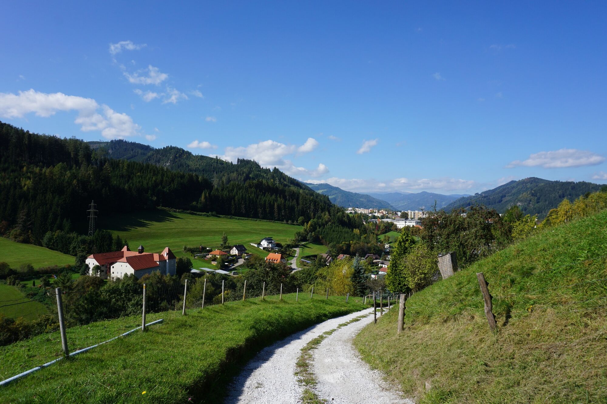
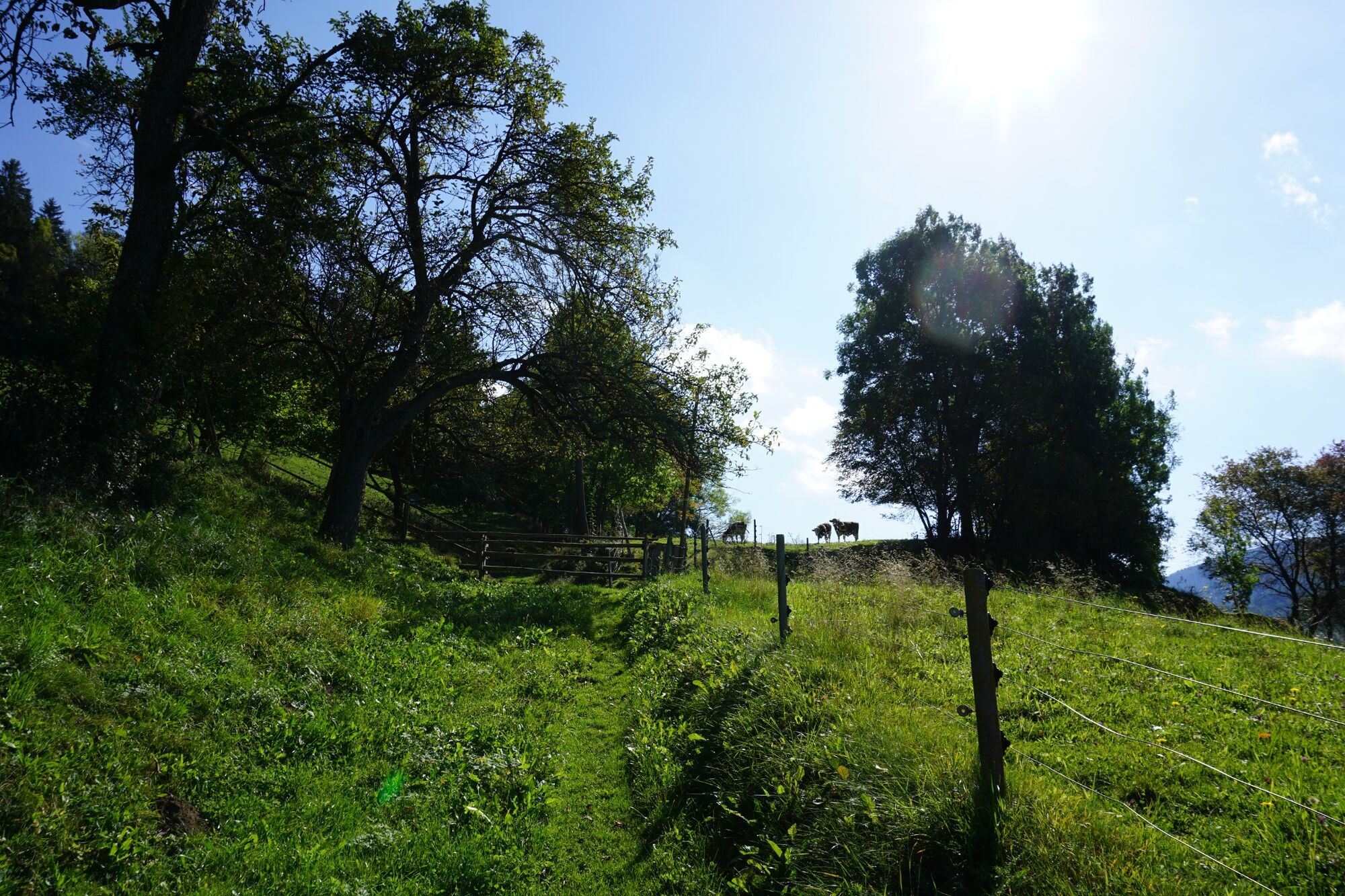
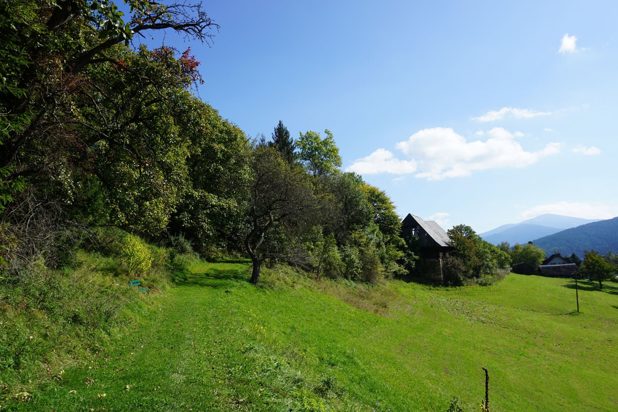
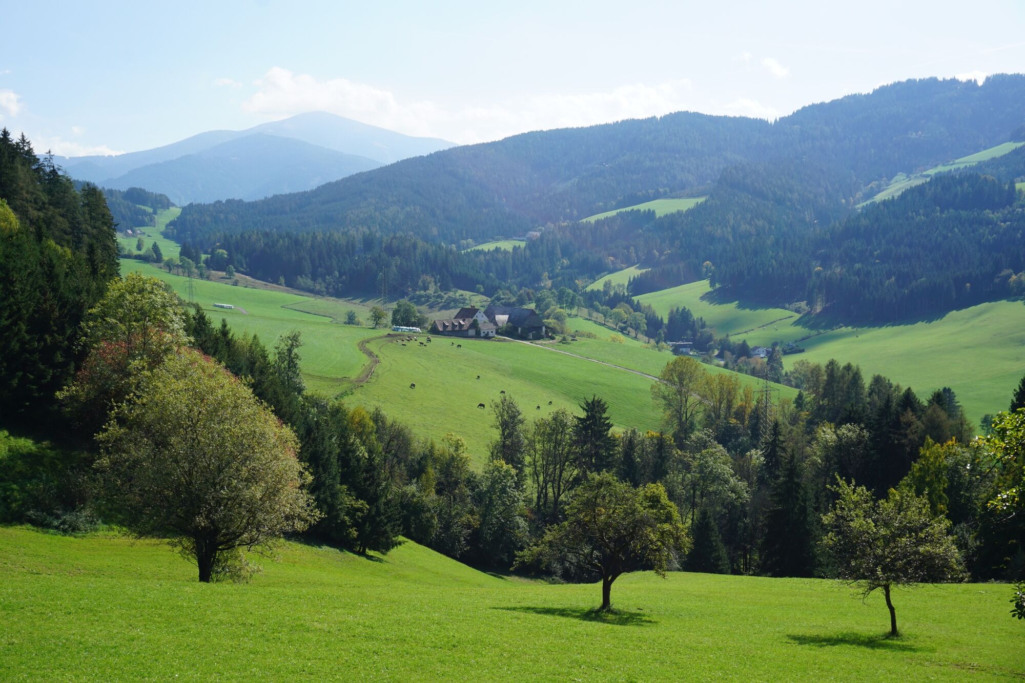
From the main square it goes over the Weyergasse - along the Murradweg - to the Weyerplatz. Cross the small bridge and continue in the direction of Feebergstraße. At the intersection with the Bergweg follow hiking trail 25 to the "Wastl am Eck". Over well paved gravel road you cross few settlement houses, then it goes along a wide forest road. The trail markings can be seen well from the crossing cow pastures. Several cow pastures have to be crossed until you reach Wastl am Eck. In the back you have a wonderful view of the town of Judenburg, on the right hand you look into the Feeberggraben. With good visibility, the view soon extends to the Seetaler Alps (south-west direction) as well as the Größenberg (south-east direction).
After about an hour you reach "Wastl am Eck", a former snack station. Around this stopover you will find several benches where you can rest and enjoy your own snack.
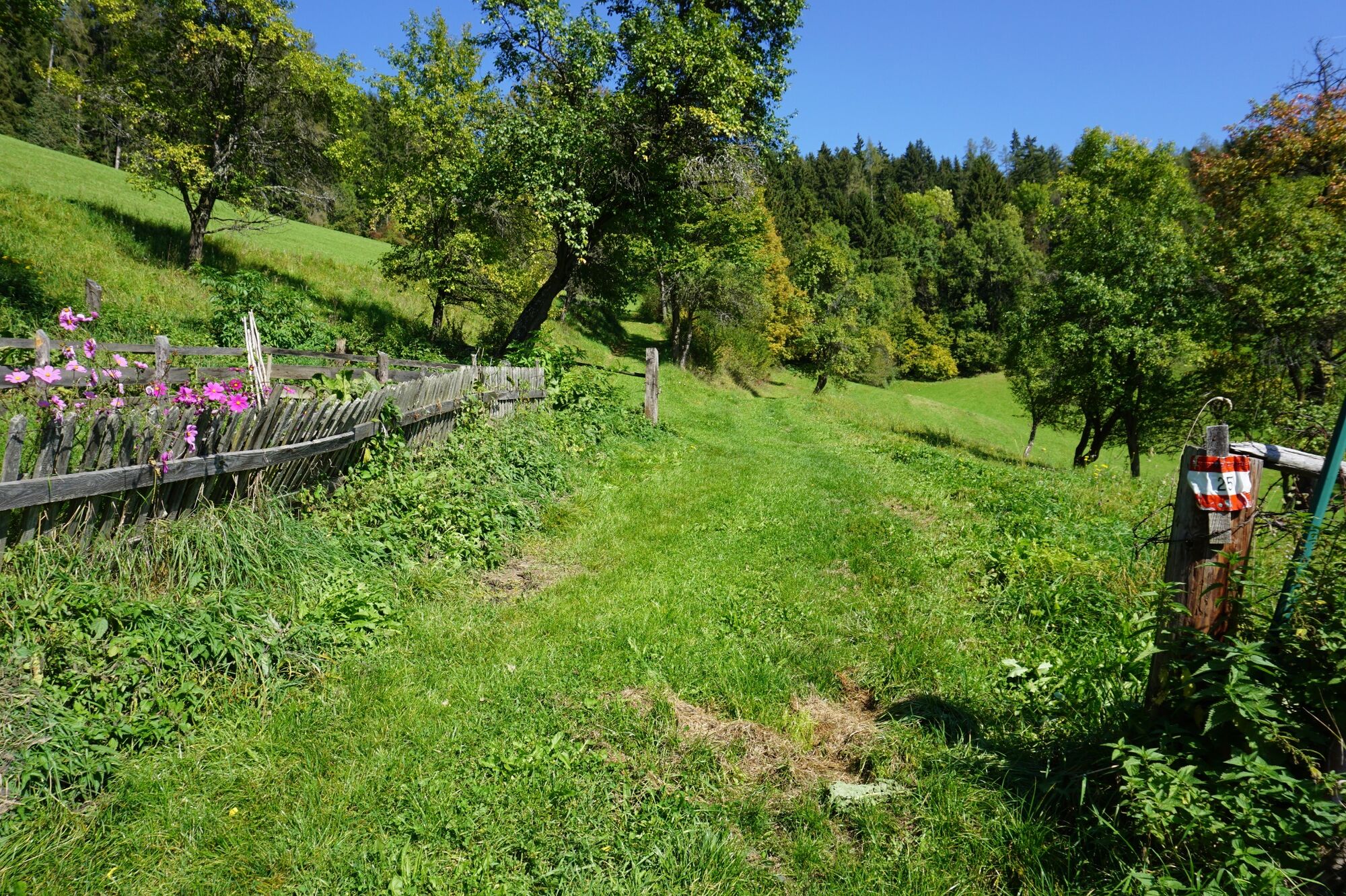
After "Wastl am Eck" you continue along the wide forest path in the direction of Jahnstein (hiking trail 20), which leads between cow pasture and forest. Shortly before you leave the cow pasture, you have the opportunity to climb a little higher to the left and enjoy a wonderful view of the Aichfeld.
You leave this last cow pasture via a cow gate embedded in the ground.
Continuing along the forest path, you can enjoy wonderful views of the Aichfeld, the Seetaler Alps and the Größenberg alternately to the left and right.
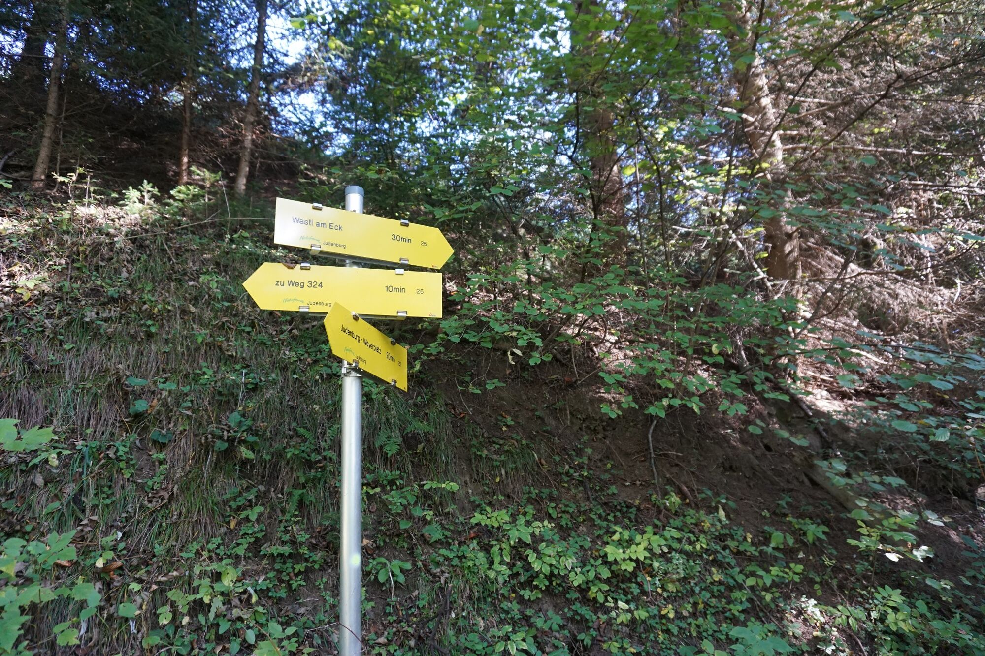
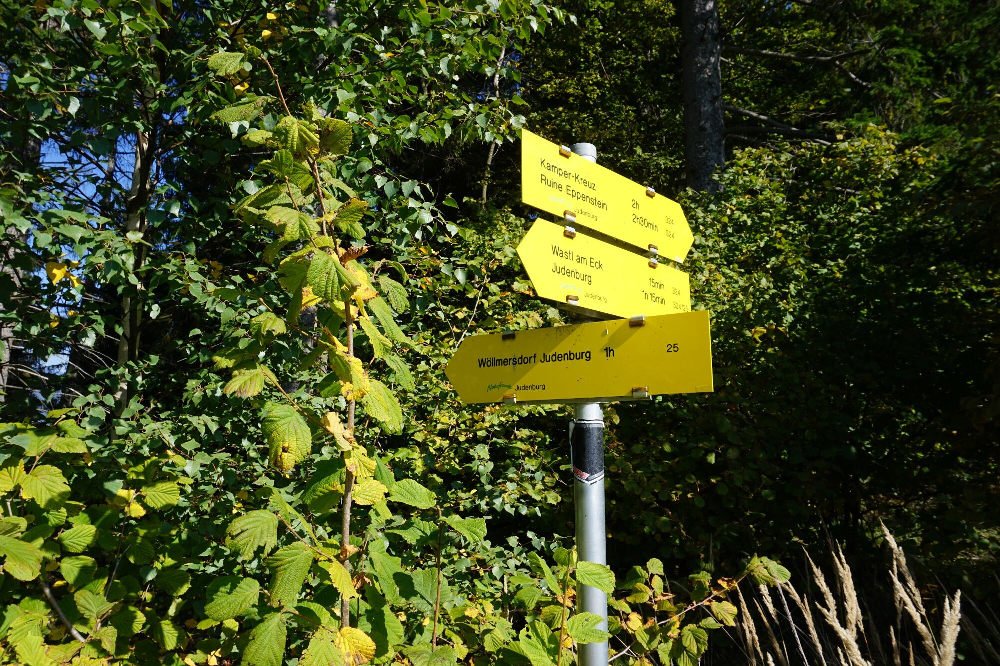
At the next hiking trail junction follow the arrow in the direction of "Wöllmerdorf Judenburg" - hiking trail 25. Follow a well-marked hiking trail downhill through the forest and you will quickly reach the next forest road, which you continue to descend on the right. You are now on the cool shady side of the Liechtensteinberg.
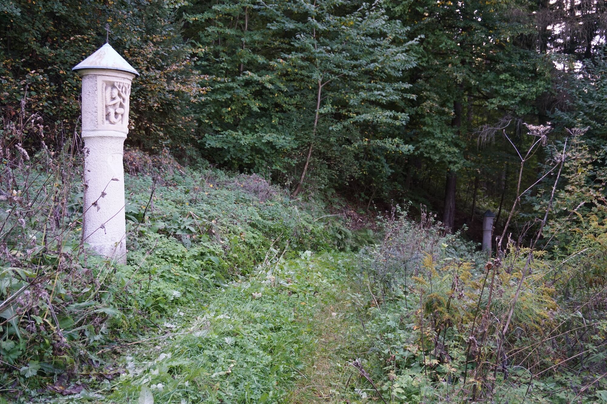
After the forest road follows another short section of a narrow hiking trail through the forest - here we continue to follow hiking trail 25 in the direction of Judenburg. Continue through the forest and along the fields in the direction of Judenburg. Passing small benches, we soon reach a beautiful wayside shrine. From here continue along the marked path in the direction of Ruine Liechtenstein / Wastl am Eck - always follow in the direction of Judenburg. We are always in the direction of Judenburg on the way, keep to the hiking trail 324 and thus quickly reach the Calvary Church. Here you can enjoy an indescribably beautiful view of Judenburg and take another long rest. From the Calvary Church, descend straight on via the stations of the cross along the Purbachweg. This is the quickest way back to Weyerplatz.
From here it's a short climb again and we're already back in the center of Judenburg.
- Highest point
- 965 m
- Endpoint
-
Main square Judenburg
- Height profile
-

- Equipment
-
Dress appropriately for a hike:
Wear weather-appropriate, durable clothing. In any case, the clothing should protect you from possible rain and cold or sun and heat.
Even low mountain ranges often hold meteorological surprises. It is not uncommon, even in June, for a cold snap to occur at higher altitudes.
Sandals, bathing slippers, even sneakers are not the appropriate footwear for a hike.
Use hiking boots with ankle protection. Make sure they have a good tread and grip. After rain showers, it can be very slippery in the forest, even in summer, on roots, leaves and stones - Safety instructions
-
In order to really enjoy a hike in the Murtal and relax, please note the following points: Plan your stages according to your condition and ability. Take your time. Organize your energy very well, take enough breaks. There are very long sections. Not everywhere there are possibilities to stop for refreshments. For a long-distance hiker it goes without saying that he should have enough drinks (and snacks) with him. Adapt your behavior to the respective conditions, both meteorological and ground conditions. Study the weather forecast daily.
Pay attention to yourself and other hikers.
- Tips
-
If you have enough energy, continue along trail 20 - 324 in the direction of Jahnstein until you reach the Benediktweg. From here you can descend to Maria Buch.
- Additional information
- Directions
-
Approach to Judenburg via S36 and B77.
- Public transportation
- Parking
-
Entgeltliches Parken in Judenburg entsprechend der vorgebeben Parkgebühren.
Längeres Abstellen des Autos in der Parkgarage Judenburg Zentrum möglich. Hier entstehen nur sehr geringe Parkgebühren für den gesamten Tag. Hinweis: Die Zahlung ist hier nur mit Kredit- bzw. kontaktloser Zahlung mittels Bankomat-Karte möglich. (Parkgarage Judenburg, Schulgasse 7, 8750 Judenburg)


-

-
AuthorThe tour Hike around the Liechtensteinberg is used by outdooractive.com provided.


General info
-
Erlebnisregion Murtal
1783
-
Steirisches Zirbenland
710
-
Judenburg
206