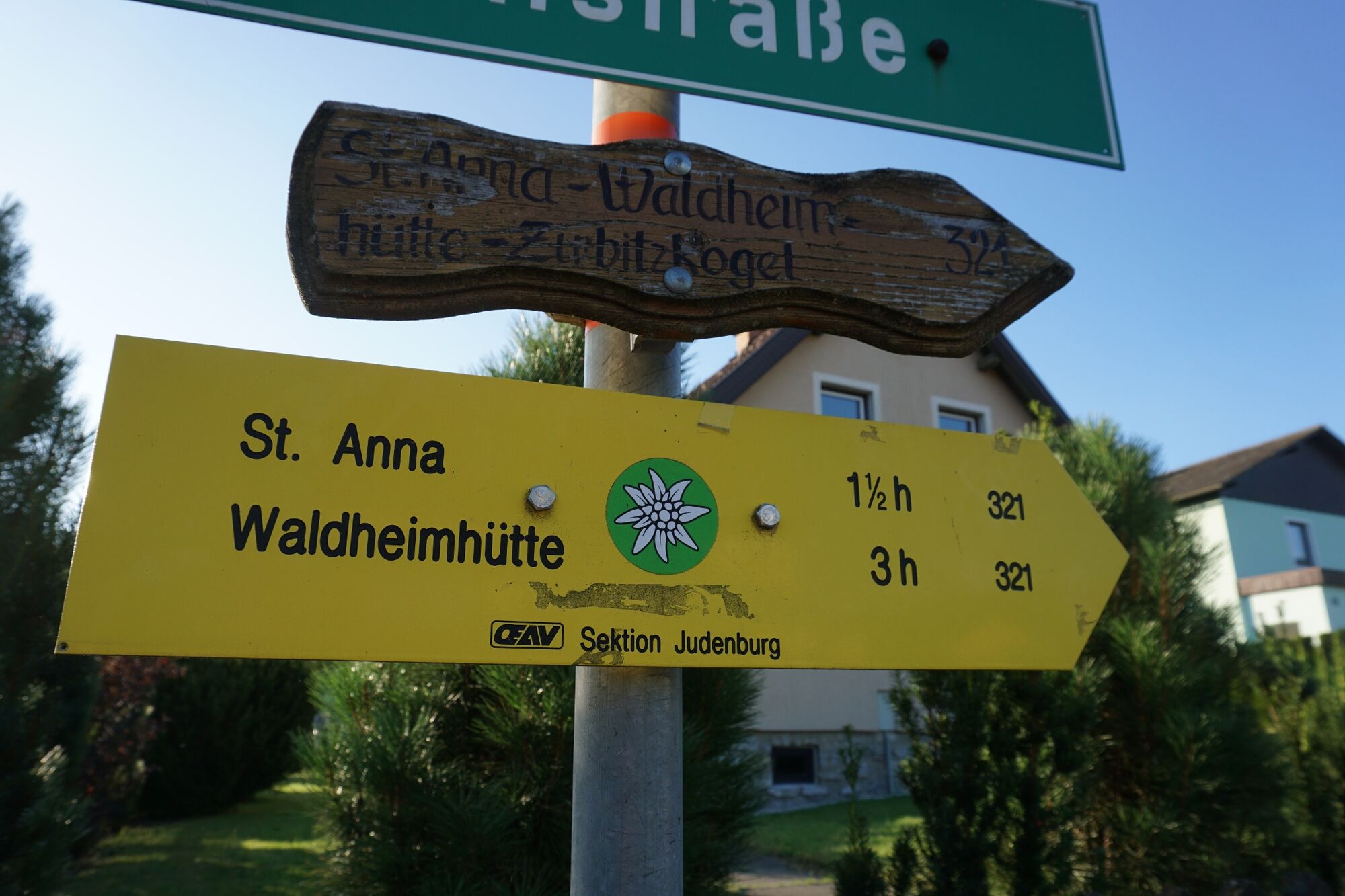
Starting from Obdach via the adventure hiking trail to the St. Anna viewing platform


- Brief description
-
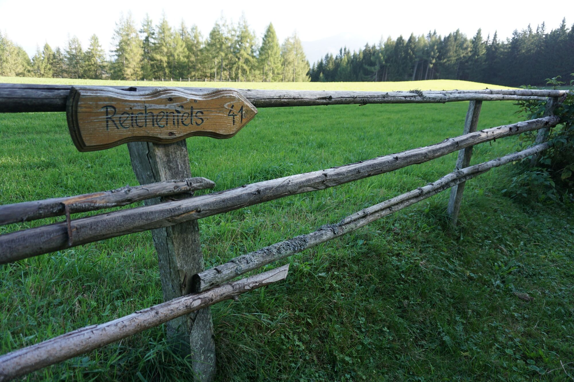
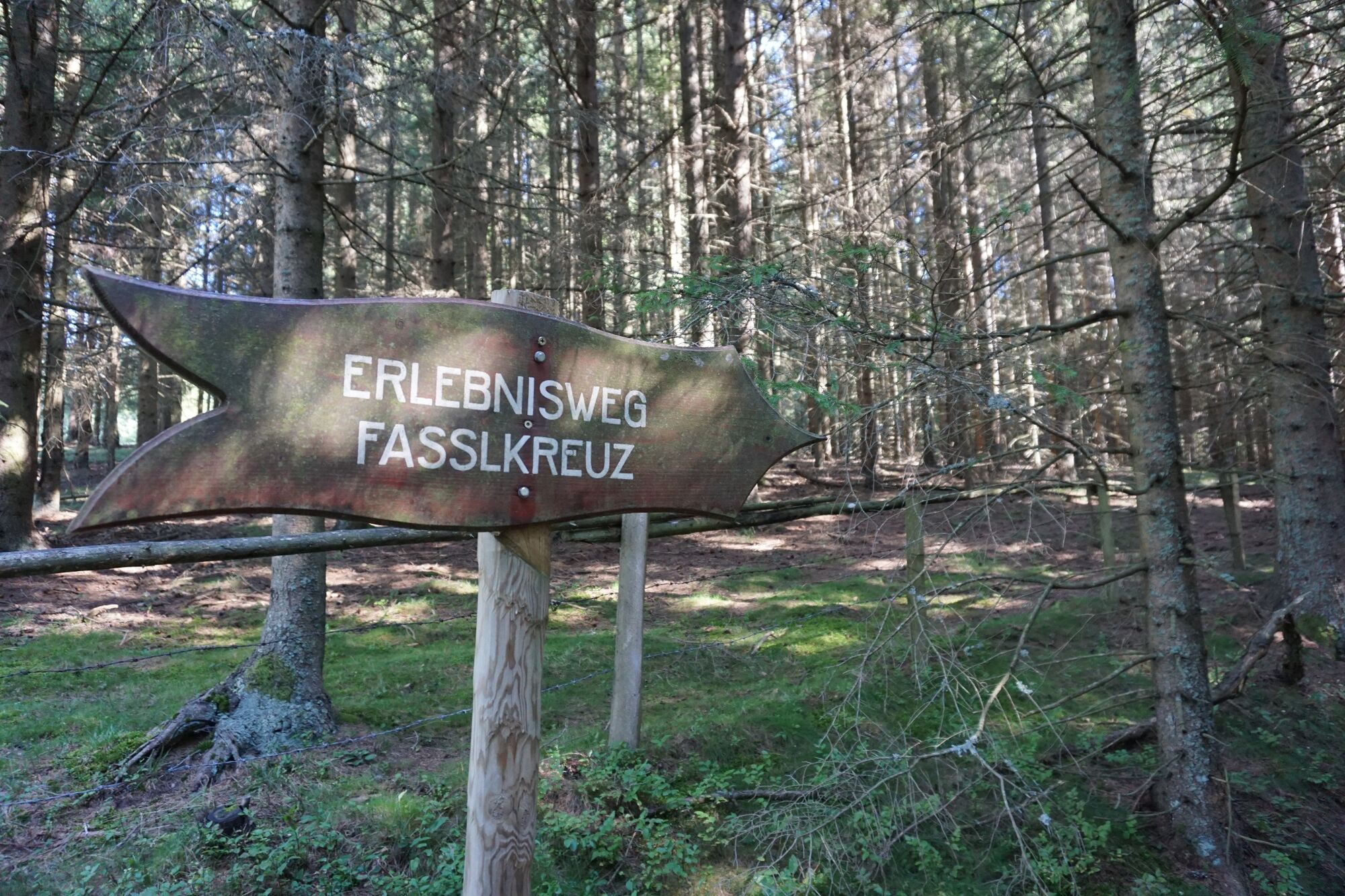
Hiking trail 321 to Fassl Kreuz. Adventure hiking trail to St. Anna. Hiking trail 41 to viewing platform and back. Hohlweg - hiking trail 321 to Fassl Kreuz. Hiking trail 3 to Obdach.
- Difficulty
-
medium
- Rating
-
- Starting point
-
Town center Obdach
- Route
-
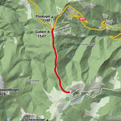
ObdachGH Zeillinger Poco-Loco0.0 kmGasthof Rösselwirt0.0 kmPfarrkirche hll. Joachim und Anna5.0 kmSankt Anna am Lavantegg5.1 kmAussichtswarte St. Anna6.6 kmPfarrkirche hll. Joachim und Anna8.1 kmPfarrkirche St. Ägyd13.3 kmJohanneskapelle13.3 kmGasthof Rösselwirt13.8 kmObdach13.8 kmGH Zeillinger Poco-Loco13.8 km
- Best season
-
JanFebMarAprMayJunJulAugSepOctNovDec
- Description
-
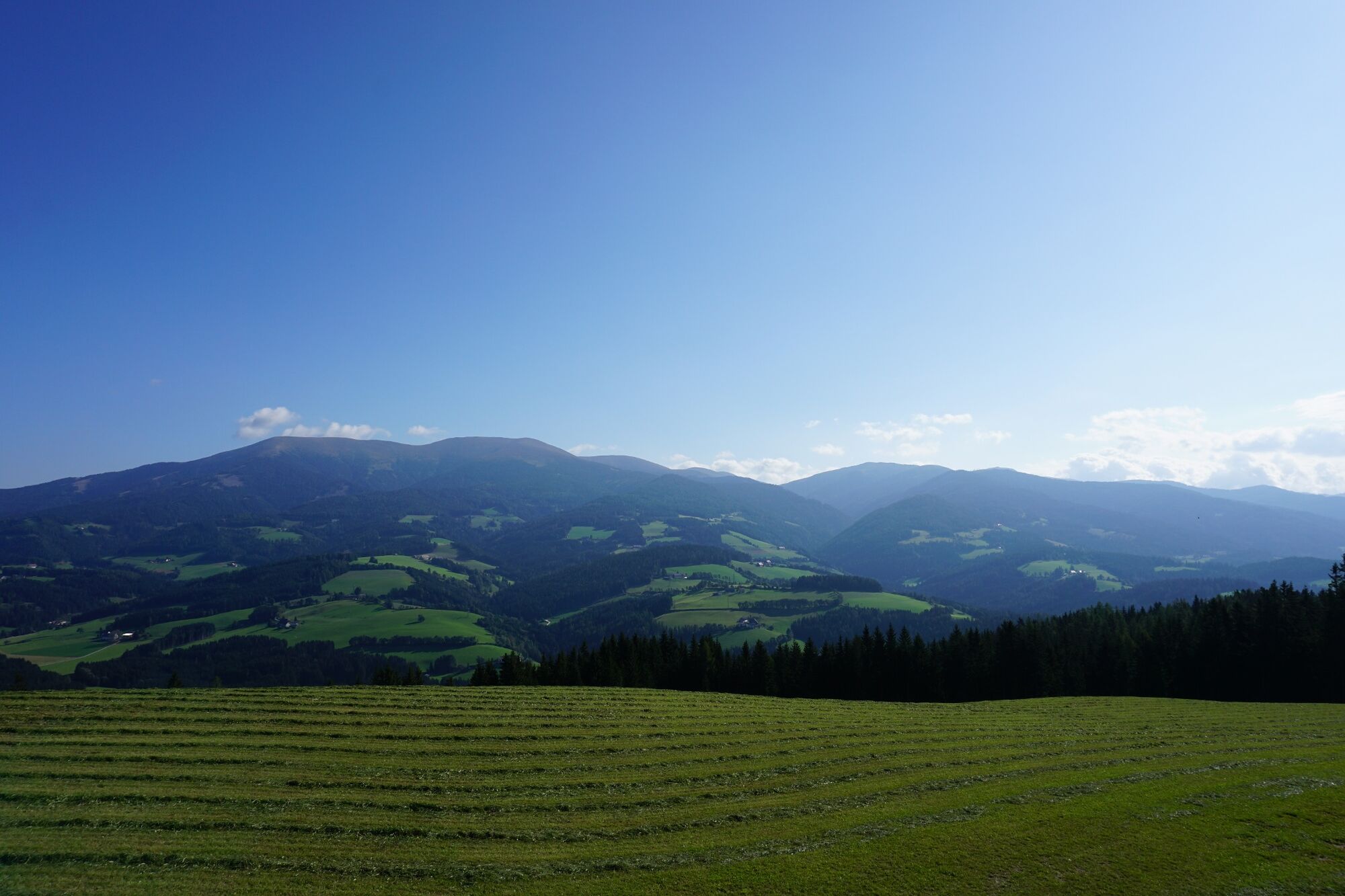
From the village center via St.Anna-Weg-Oberer Siedlungsweg to Liftstraße, along hiking trail 321. On a well-marked road with little traffic to "Kalchbauer". The asphalt road turns into a wide path behind Kalchbauer Haus. Short section over pastureland for cattle. Via forest path and short hollow path to the "Fassl Kreuz".
From here, follow the flat section of the "St. Anna adventure trail". Past the Anna-Wirt-Kreuz. Cross the forest and meadow to reach the Rabensteiner cross in St. Anna.
Keep left. Past the church via hiking trail 41 to the St. Anna viewing platform.
Return along the same route back to St. Anna, but past the Rabensteiner cross and only one road later via a hollow path back to the St. Anna adventure hiking trail. At the crossroads, keep right on hiking trail 321 back to the Fassl cross.
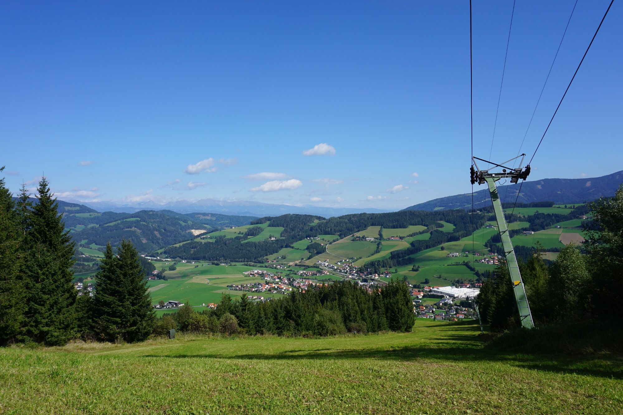
Descend via hiking trail 3 through the forest to the ski lift slope. Short section along the ski slope. Follow the markings on the left to the Donnweg - hiking trail 3 back to Obdach.
- Directions
-
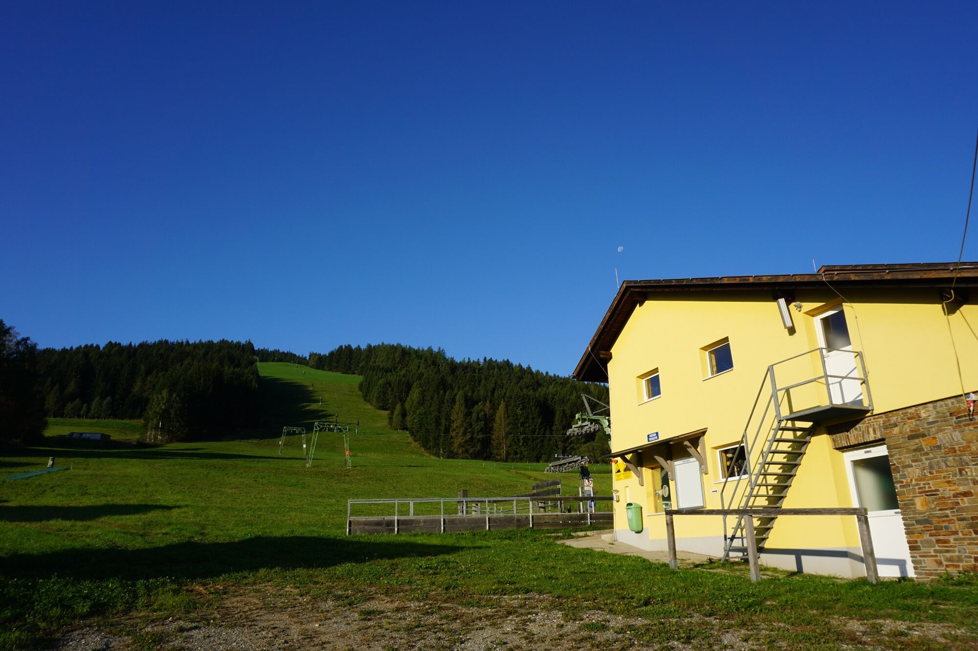
Starting point: Pestsäule in the center of Obdach
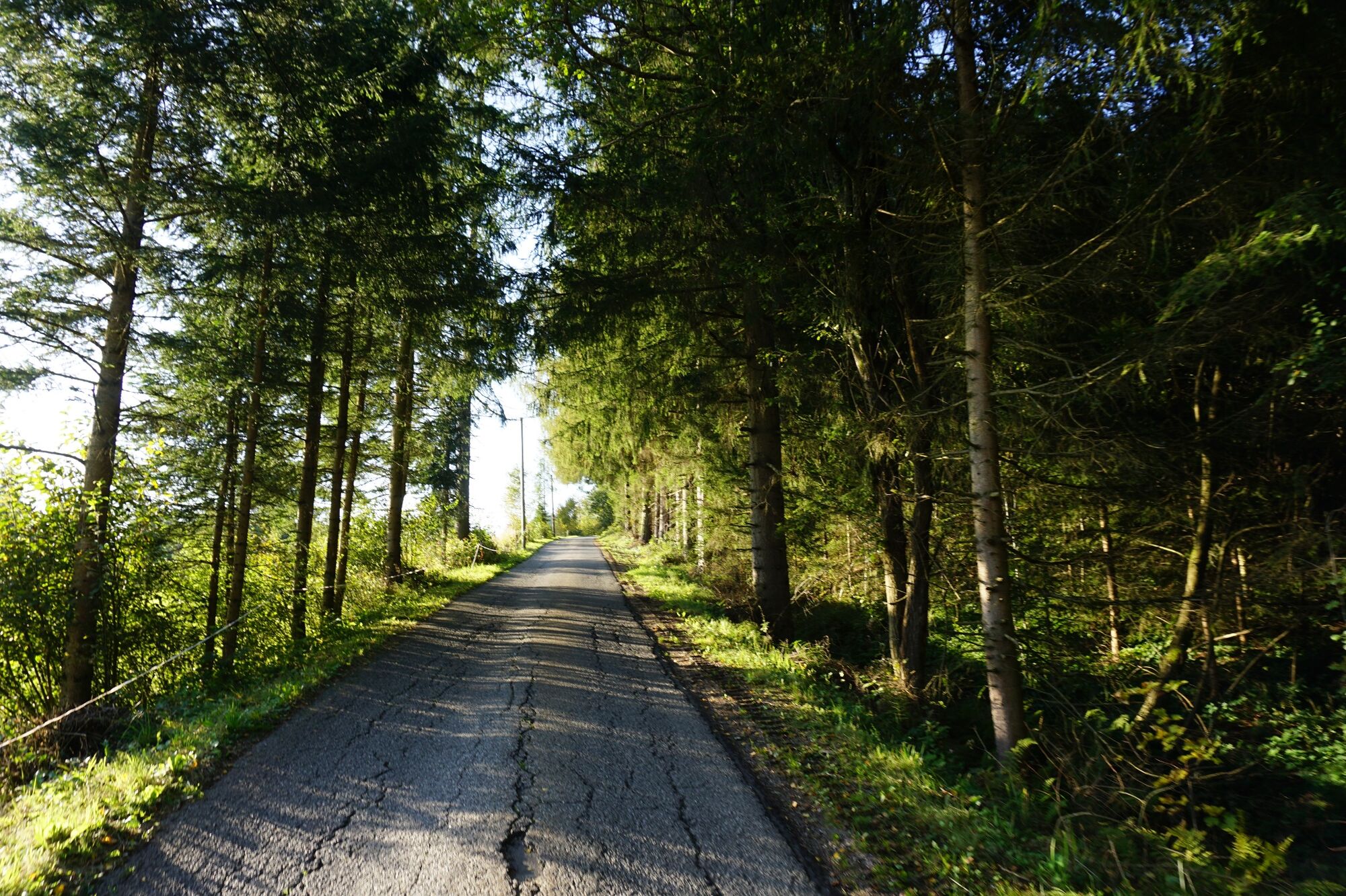
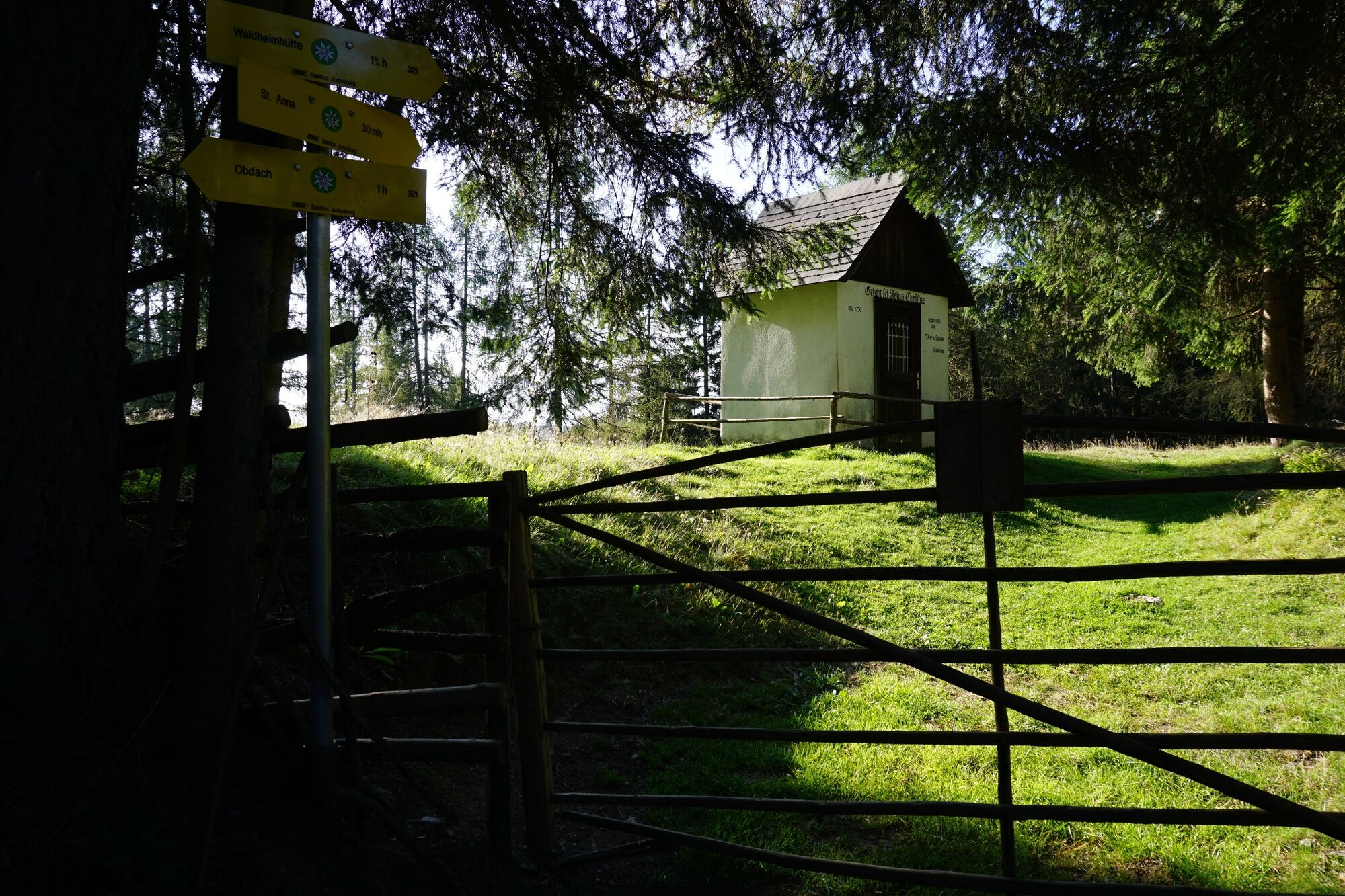
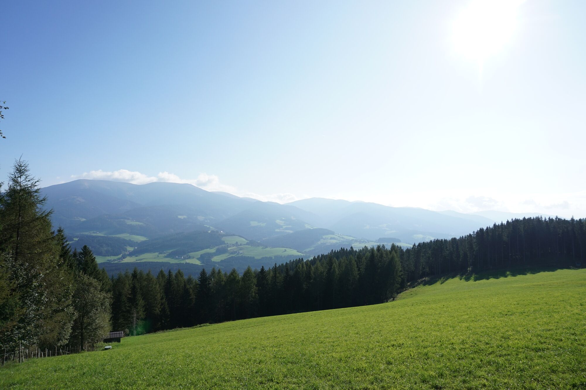
Turn right at Trachtenhaus Neuböck into St. Anna-Weg. Go straight on until the Oberer Siedlungsweg junction, then follow Oberer Siedlungsweg in a left-hand direction until Liftstraße. From here, continue along Liftstraße, always following hiking trail 321. We pass the lower lift station of the Obdach ski lift and follow the little-used asphalt road steadily uphill. The lift road turns into the Kalchbauerweg and the road continues into the forest, where benches invite you to take your first rest. We follow the well-marked path to the "Kalchbauer". Here we keep left, the asphalt road ends here and turns into a wide path. Behind the Kalchbauer house, we continue along the path. We pass a beautifully manicured Matterl and cross a short stretch of cattle pasture. From here you have a fantastic view of the valley. A huge, single Swiss stone pine adorns the meadow of the Kalchbauer pasture. After passing the Kuhgatter again, we continue along the forest path, pass a high seat and reach the "Fassl Kreuz" via a short, narrower hollow path. Benches and a small chapel invite you to rest.
From here, we follow the "St. Anna adventure hiking trail" with its adventure stations in the direction of St. Anna. From Fassl Kreuz, continue along the flatter section of the trail. A fountain trough provides wonderful refreshment and the adventure stations break up the hike. We soon reach the Anna-Wirt-Kreuz. We leave the forest and reach the Stoana meadow. We arrive in St. Anna at the Rabensteiner cross.
Past the church and the former parish, hiking trail 41 continues to the St. Anna viewing platform. Here you only have a few meters of altitude to conquer.
The return route follows the same path back to St. Anna. However, we pass the Rabensteiner cross and only rejoin the St. Anna adventure hiking trail one street later. After a short walk along a hollow path, you reach a crossroads where you keep to the right on hiking trail 321. You return to the Fassl cross via further adventure stations.
The descent is via hiking trail 3, through the forest to the Obdach ski lift slope. We descend a short distance across the meadow of the ski slope. We follow the Donnweg - hiking trail 3 to the left, following the markings.
We reach the wine tavern "Der kleine Rosengarten". The rest of the descent follows the gravel path down to Obdach, along the Donnweg back to Obdach. Passing a large cross, we soon return to the asphalt road and pass the Obdach school and a large playground. From here there are several paths back to the starting point.
The small lane past the church is particularly beautiful. This takes you from the other side back to the St. Anna path and thus to the plague column in the town center.
- Highest point
- 1,357 m
- Endpoint
-
Town center Obdach
- Height profile
-

- Equipment
-
Dress appropriately for a hike: Wear weather-appropriate, durable clothing. In any case, the clothing should protect you from possible rain and cold or sun and heat. Even low mountain ranges often hold meteorological surprises. It is not uncommon, even in June, for a cold snap to occur at higher altitudes. Sandals, bathing slippers, even sneakers are not the appropriate footwear for a hike. Use hiking boots with ankle protection. Make sure they have a good tread and grip. After rain showers, it can be very slippery in the forest, even in summer, on roots, leaves and stones
- Safety instructions
-
In order to really enjoy a hike in the Murtal and relax, please note the following points:
Plan your stages according to your condition and ability. Take your time. Organize your energy very well, take enough breaks. There are very long sections. Not everywhere there are possibilities to stop for refreshments. For a long-distance hiker it goes without saying that he should have enough drinks (and snacks) with him. Adapt your behavior to the respective conditions, both meteorological and ground conditions. Study the weather forecast daily.Pay attention to yourself and other hikers.
- Tips
-
Make sure you take a snack with you for the viewing platform in St. Anna!
- Additional information
- Directions
-
Approach to Obdach via federal road B78
- Public transportation
- Parking
-
Large parking lot to the right of St. Anna-Weg and at the Obdach bus station.


-

-
AuthorThe tour Starting from Obdach via the adventure hiking trail to the St. Anna viewing platform is used by outdooractive.com provided.


General info
-
Erlebnisregion Murtal
1782
-
Steirisches Zirbenland
711
-
Obdach
185