
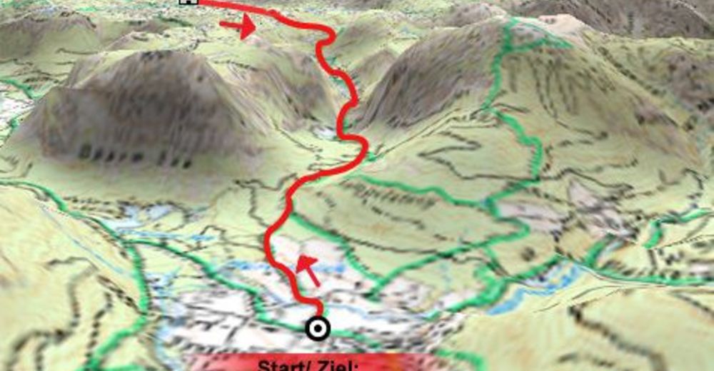
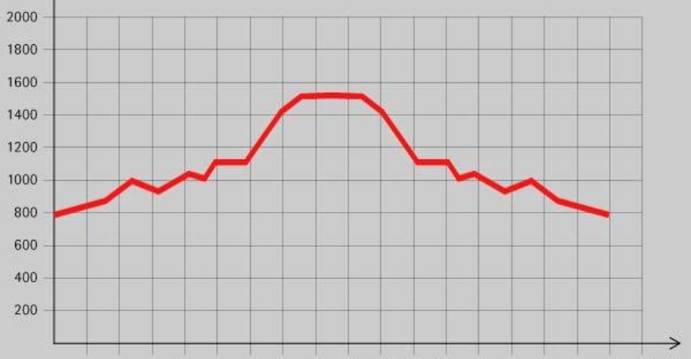
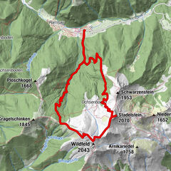
Tour data
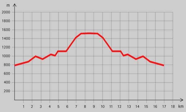
17km
788
- 1,525m
921hm
05:00h

- Rating
-
- Route
-
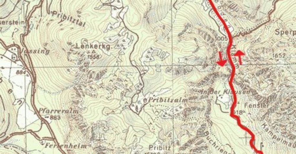
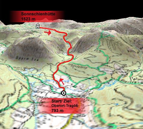
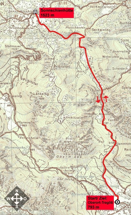
Pfarrkirche hl. MagdalenaTragöß - OberortAntoniuskapelleKlamm3.8 kmKlammbründl4.1 kmSonnschienalm8.0 kmSonnschienhütte8.3 km
- Highest point
- 1,525 m
- Rest/Retreat
-
Gh. in Oberort, GH Seehof, Jassingalmhütte, Sonnschien Schutzhaus
- Ticket material
-
www.tragoess-gruenersee.at

GPS Downloads


Trail conditions
Asphalt
Gravel
Meadow
Forest
Rock
Exposed
Other tours in the regions
-
Erzberg Leoben
2529
-
Hochschwab
1273
-
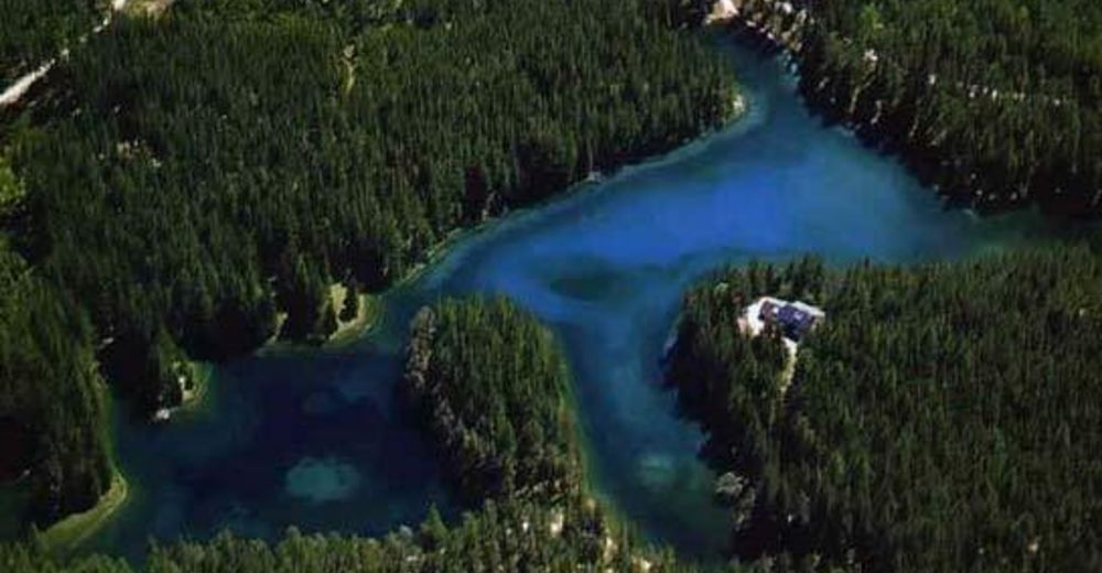
Tragöß - Grüner See
471


 & Kaiserschild (rechts)")
