
- Brief description
-
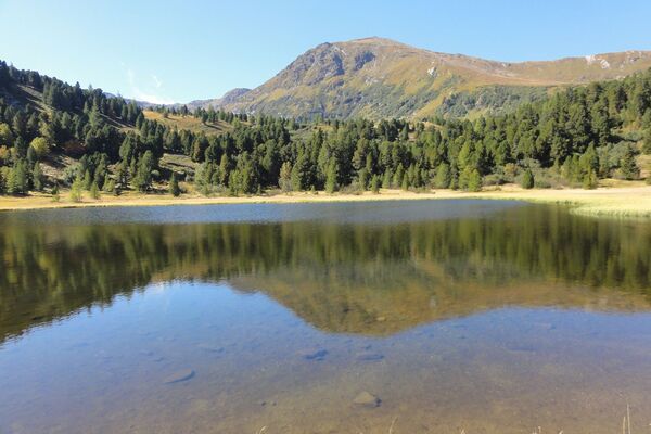
Impressive viewing angles: From the silhouette of the small mountain village of St. Blasen with the Kalkberg over long forest passages to the unobstructed view from the church hill on Mühlsteinboden.
- Difficulty
-
medium
- Rating
-
- Starting point
-
Gasthof Kirchmoar, St. Blasen
- Route
-
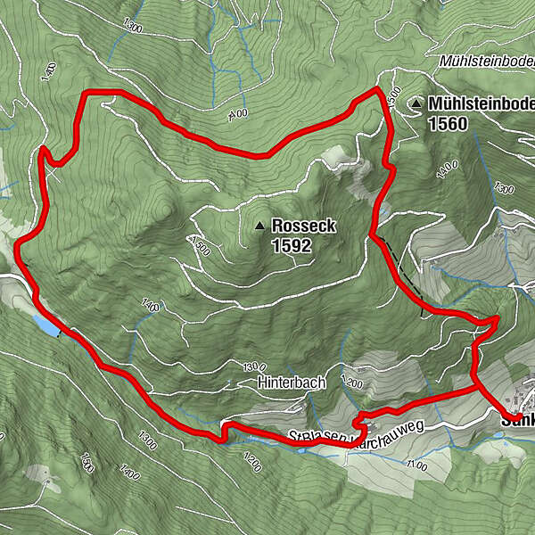
Sankt BlasenKirchmoarKirchmoar8.2 kmSankt Blasen8.3 km
- Best season
-
JanFebMarAprMayJunJulAugSepOctNovDec
- Description
-
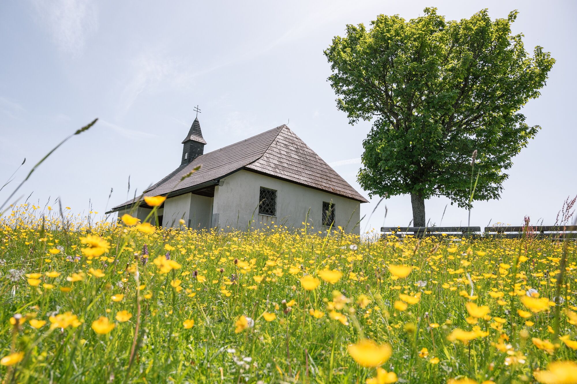
According to legend, Mühlsteinboden was a witch mountain. Bad weather is said to have showered hail here every year until a pious farmer erected a cross there. Today there is a small pilgrimage church there at 1,544 m above sea level. Locals and guests alike confirm that this is still a special place of power today, where you can find peace and recharge your batteries for everyday life.
- Directions
-
The path leads over pastures and forest paths past a hunting lodge to the Seebauer homestead. Passing the arsenic tunnel you reach the small church on the Mühlsteinboden. A forest road leads to a biotope with a fountain and forest roads lead down the valley back to the Gasthof Kirchmoar in St. Blase.
- Highest point
- 1,491 m
- Endpoint
-
Gasthof Kirchmoar, St. Blasen
- Height profile
-

- Equipment
-
Good shoes
Sun protection
Sufficient food - Additional information
-
The ideal time for this tour is from April to October.
- Arrival
-
By car from Germany
From Munich via the A8 towards Salzburg. From Salzburg on the A10 Tauernautobahn to St. Michael im Lungau. On the B 96 to Tamsweg, then on the B 95 to Predlitz. The B 97 leads via Stadl/Mur to Murau. There at the roundabout towards St. Lambrecht to Murauer train station and further towards St. Lambrecht. Via Laßnitz near Murau you reach St. Lambrecht, which is already in the nature park. On the federal road from St. Lambrecht to Mariahof turn left towards the church.Arrival from Eastern Austria/Hungary
At the motorway junction in St. Michael near Leoben, take the S 36 towards Klagenfurt. Past Knittelfeld and Judenburg to Scheifling. In Scheifling continue towards Klagenfurt to Neumarkt, via Unzmarkt and Perchau am Sattel you reach Neumarkt. There turn right towards Murau, in Mariahof after the railway crossing turn left towards St. Lambrecht. On the main road to St. Lambrecht, turn right into St. Blase, towards the church.Arrival from southern Austria/Italy
Via Klagenfurt on the S 37 past St. Veit/Glan, Treibach and Friesach. In Friesach continue towards Vienna, via Dürnstein and Wildbad to Neumarkt. After the town center turn left towards Murau, in Mariahof after the railway crossing turn left towards St. Lambrecht. On the main road to St. Lambrecht, turn right into St. Blase, towards the church. - Public transportation
-
Parking spaces are available at the Gasthof Kirchmoar. With the BusBahnBim app for the interconnected line, timetable information is easier than ever: All bus, train and tram connections in Austria can be queried by entering locations and/or addresses, stops or important points . The app is available as a free app for smartphones (Android, iOS) - on Google Play and in the App Store.
- Parking
-
Parking spaces are available at the Gasthof Kirchmoar.

- Author
-
The tour Around the Roßeck is used by outdooractive.com provided.