
- Brief description
-
This is a somewhat longer but ver inviting, scenic hike.
- Difficulty
-
difficult
- Rating
-
- Starting point
-
Tonnerhütte, Mühlen
- Route
-
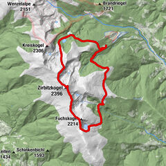
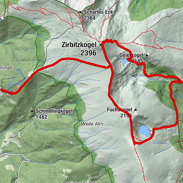
Tonnerhütte0.1 kmZirbitzkogel (2,396 m)4.3 kmZirbitzkogel Schutzhaus4.5 kmTürkenkreuz7.9 kmKatholisches Kreuz (1,814 m)9.0 kmFuchskogel (2,214 m)11.8 kmTonnerhütte17.3 km
- Best season
-
JanFebMarAprMayJunJulAugSepOctNovDec
- Description
-
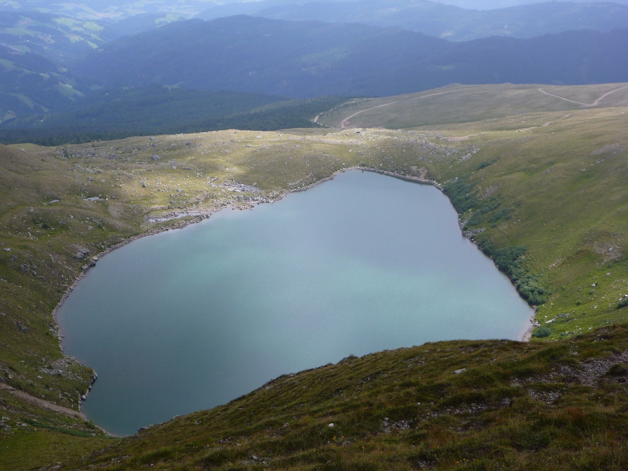
This hike offers a combination of summit experiences, als well as mountain lake bathing pleasure! The picturesque panoramic scnery in the direction of Murau, Murtal and Carinthia lends on top of it, still the conscience flair.
- Directions
-
From the Tonnerhütte parling lot, follow the slightly ascending forest road to the 1st hairpin bend. Immediately from the bend, the footparth branches off the right and turns towards the right edge of the ski slope. Follow the course pf the slope to the Hohe Hald. Out of the increasingly sparse tree line, the path now leads us slightly uphill over treeless terrain in the direction of the Zirbitzkogel, before turing east (half-right) and heading towards the Murtalblick at the Lavantsee, 2.250m. There you have a wonderful view into the Murtal and to the Lavantesee.
Follow the ridgt to the N (left), the mark 312 to the summit of the Zirbitzkogel. Not far form the summit is the Zirbitzkogel-Schutzhaus, which invites you to stop for a break. From the Zirbitzkogel shelter, follow the trail 320 to the east.
Follow the mark 45 to the SE over steep terrain to the Lavantsee lake. Continuing to follow maker 45, the descent leads over steep, treeless terrain to the Köhler Hütte. After a short stretch downhill in the SE direction, you reach the very young Lavant. Through oark-like stone pine forest, The Judenburger-Wallfahrerway now winds its way in a S direction.
Past a wooden cross and a spring, you reach the 1st turnoff to Wildsee. Slightly ascending trrough a small high valley, trail 312 leads to Wildsee, 1.981m. Pass the south side of the Wildsee to the W across the open plateau, climbing moderately to the ridge running from the Zirbitzkogel to the south. Follow the course of the ridge to the N on the Fuchskogel, 2.114m. The summit cross of the Fuchskogel is slightly offset to the NE away ftom the marked path. Take trail 321 on the slightly ascending ridge to the N until you reach the fork at the top of the Lavantesee. Turn left (W) and follow the trail, which is always slightly descending, past the hiker's watering hole, 2.073m to the Hohe Hald. Via the gently descending, marked Zitbitzkogelway you reach the ski slope to the bend of the forest road and further to the starting point, the Tonnerhütte.
- Highest point
- 2,372 m
- Endpoint
-
Wildsee
- Height profile
-

- Equipment
-
Good footwear
Sun protection
Sufficient food - Tips
-
Possibly bring swimmwear to cool off the mountain lake!
- Additional information
-
The ideal time for this tour is from May to October.
- Arrival
-
Coming from Judenburg via Unzmarkt to Scheifling. Follow the road straight ahead until you reach Neumarkt. Keep left and drvie via Mühlen to the Tonnerhütte.
Coming from Tamsweg drive via Ranten (or Stadl an der Mur) to Murau. Keep right here and drive via Laßnitz, St. Lambrecht and Mariahof to Neumarkt. Keep left here and drive via Mühlen to the Tonnerhütte.
- Public transportation
-
With the BusBahnBim app of the Verbundlinie, timetable information has never been easier: all bus, train and streetcar connections in Austria can be queried by entering locations and/or addresses, stops or important points. The app is available as a free app for smartphones (Android, iOS) - on Google Play and in the App Store.
- Parking
-
Parking is available at the Tonnerhütte (Attention: free required!)


- Author
-
The tour To the Lavantsee - Wildsee is used by outdooractive.com provided.