Tour data
16.97km
753
- 1,530m
801hm
05:00h
- Difficulty
-
medium
- Rating
-
- Starting point
-
Schönberg
- Route
-
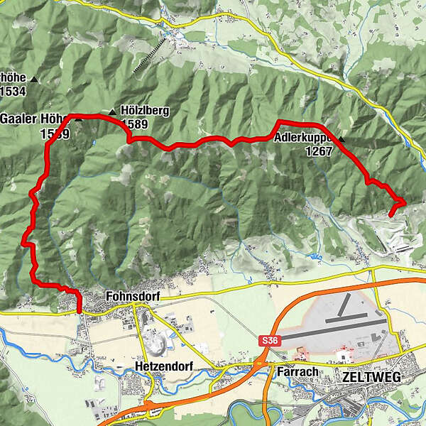
Schönberg0.1 kmFlatschacher Höhe (1,323 m)4.4 kmRattenberger Höhe (1,430 m)6.3 kmZwieselberg (1,534 m)8.1 kmGaaler Höhe (1,539 m)10.0 kmSchutzhaus auf der Gaaler Höhe10.6 kmStoxi's Mostschenke14.3 kmDietersdorf16.7 km
- Best season
-
JanFebMarAprMayJunJulAugSepOctNovDec
- Highest point
- 1,530 m
- Endpoint
-
Dietersdorf/Fohnsdorf
- Rest/Retreat
-
Galler Höhe Schutzhaus, Mostschenke Stoxreiter
GPS Downloads


Trail conditions
Asphalt
Gravel
Meadow
Forest
Rock
Exposed
Other tours in the regions
-
Erlebnisregion Murtal
1782
-
Steirisches Zirbenland
711
-
Fohnsdorf
190