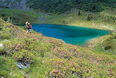
Gumpental - Moaralmsee - Moaralmscharte - Kaiblingalm

Logo Gumpental - Moaralmsee - Moaralmscharte - Kaiblingalm
Tour data
8.72km
1,166 - 2,056m
Distance
937hm
Ascent
03:30h
 
Duration
Rating
Technique
Fitness
Landscape
Experience
Starting point

Gumpental

Route
Schmiedalm
1.6 km
Seeschartl (2,070 m)
5.6 km
Harrys Alm
7.5 km


Highest point
2,056 m

Rest/Retreat

Kaiblingalm Hütte
Krummholzhütte
Berggasthof Scharfetter (Seilbahn-Bergstation)

Ticket material

Wanderkarte Dachstein-Tauern; Maßstab: 1:50.000; Verlag: freytag&berndt


Info phone

0043-3686-2234

Link

Overall rating

5

0

%

4

0

%

3

0

%

2

0

%

1

0

%

Error
An error has occurred. Please try again.
Thank you for your review

Rating has been deleted

GPS Downloads
  • GPX GPS Exchange Format (XML)
  • KML Google Earth, Google Maps
QR Download Codes for Mobile Phones

Trail conditions

Asphalt
Gravel
Meadow
Forest
Rock
Exposed
Other tours in the regions

Popular tours in the area

Filzmoos: Rötelstein (Rettenstein)

Hiking
9.5km | 895hm | 05:00h

Schladming - Hochgolling

difficult Hiking
20.64km | 1731hm | 10:30h

Grimming via Southeast degree

difficult Hiking
13.73km | 1678hm | 09:00h