


- Brief description
-
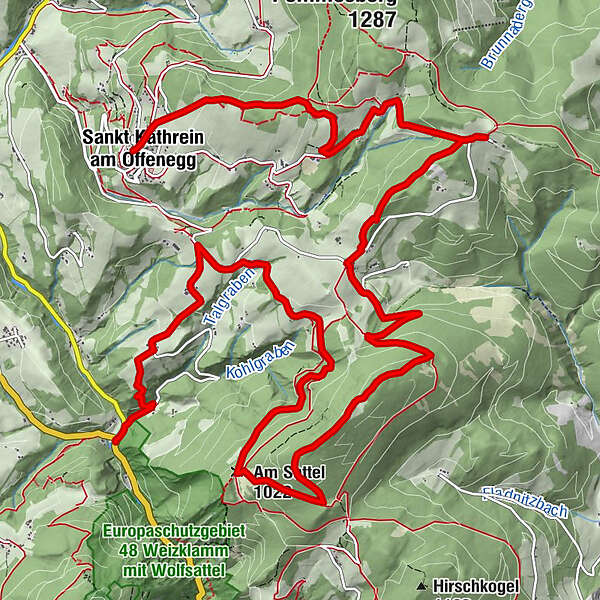
This trail leads in 6 stages around the southern Almenland, the 5th stage starts in St. Kathrein/O. and leads over the Patscha down to the Kreuzwirt in the Weizklamm gorge.
- Difficulty
-
medium
- Rating
-
- Starting point
-
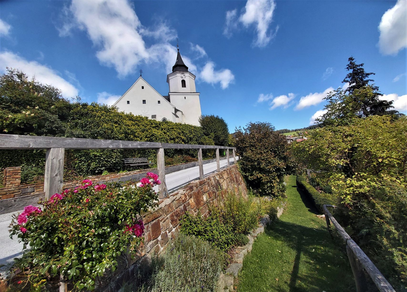
St. Kathrein am Offenegg, Town's Centre
- Route
-
Dorf0.0 kmSankt Kathrein am Offenegg0.0 kmOberdorf0.3 kmGrillkapelle zum heiligen Theodor0.4 kmLärchenwiese0.7 kmEibisberg3.9 kmSchutzhütte Eibisberg4.1 kmGschaid6.1 kmPatschahütte6.4 kmPatscha Gipfel (1,271 m)9.1 kmAm Sattel (1,022 m)11.1 kmGreith13.0 kmKogl14.1 kmRiegl15.3 km
- Best season
-
JanFebMarAprMayJunJulAugSepOctNovDec
- Description
-
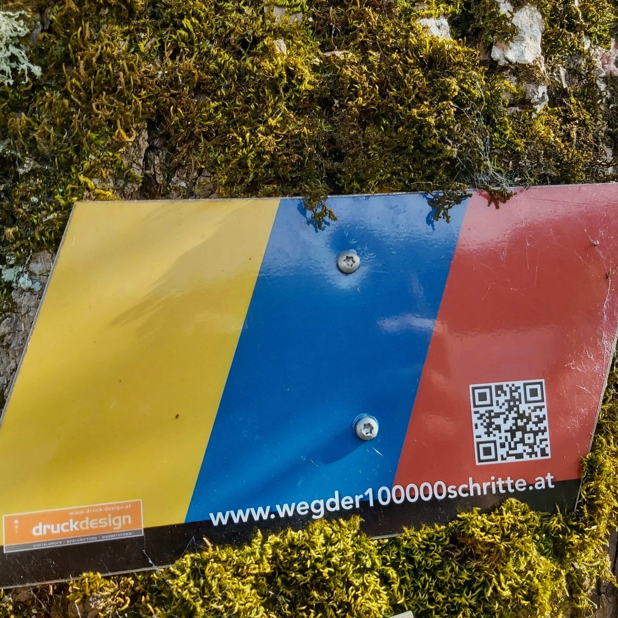
This hike around the "Passailer Kessel" is an idea of the Kath. Männerbewegung Passail and was also planned and implemented by them. The six sections are designed in such a way that after each day's stage there is an opportunity to stop for a break or overnight stay. The stages run mainly along designated Alpine Club paths and were also marked with their own signposts. The small boards represent the colours of the hiked communities Fladnitz an der Teichalm (gold), Passail (blue) and St. Kathrein am Offenegg (red).
The trail starts in Arzberg, leads up to the Schöckl and on to the Rechberg. From there it goes via the Nechnitz up to the Teichalm, via the Osser up to the Sommeralm and via the Brandlucken to St. Kathrein am Offenegg. The last two stages then lead over the Patscha down into the Weizklamm gorge before returning to Arzberg via the Gösser and Große Raabklamm gorges.
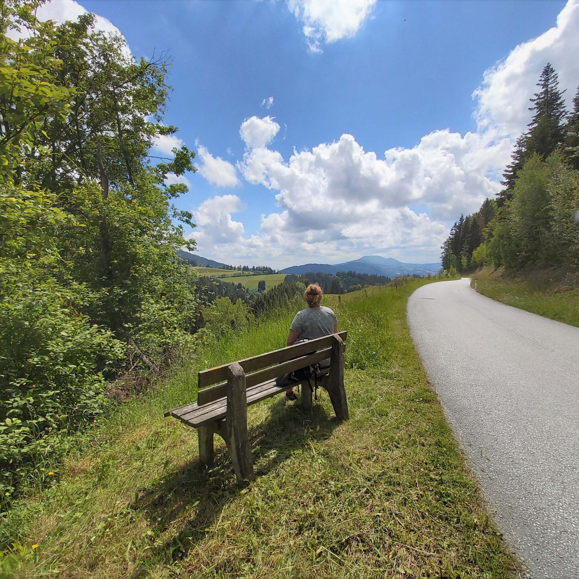
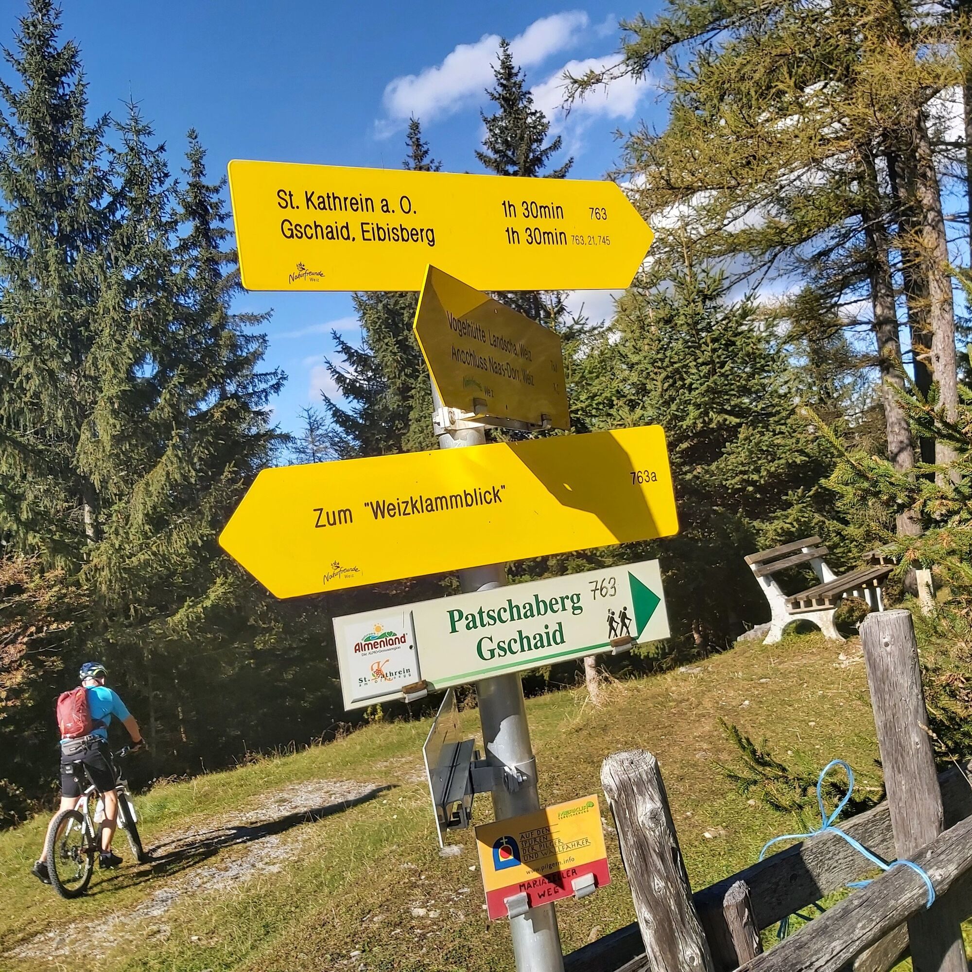
This 5th stage leads through the beautiful flower village of St. Kathrein am Offenegg out to the Patscha saddle, which is especially known for its magnificent "3 churches view" - from the Passailer Kessel over the Sommeralm to St. Kathrein.
- Directions
-
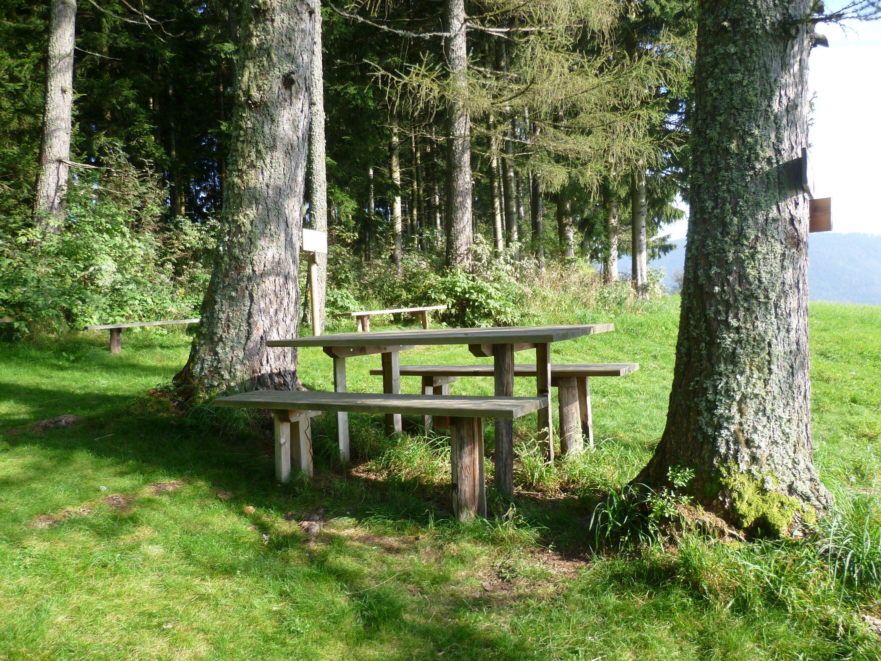
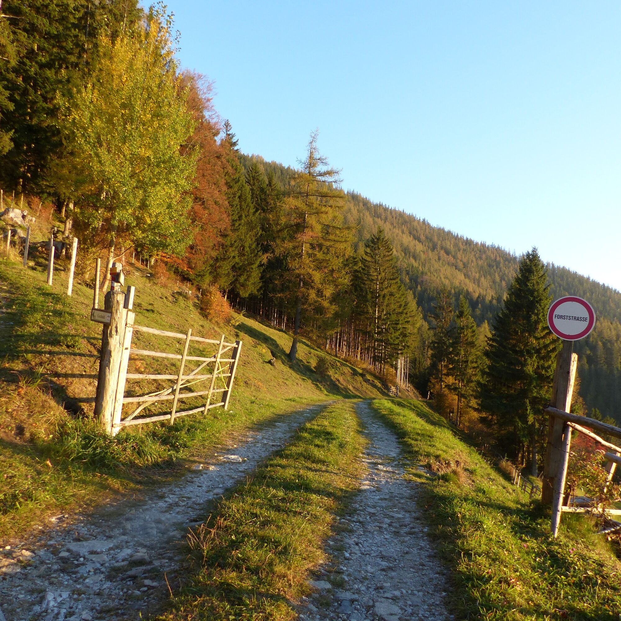
Start: St. Kathrein am Offenegg; Kathreinerhaus From the centre of St. Kathrein, walk a few steps north ("Oberhollerbach") and then follow the "Vogelbeer-Panoramaweg" markings uphill to the right. The well-marked "Vogelbeer-Panoramaweg" with several stations leads past the Schwoaghofer pond and ends at the municipal road; a detour down to the right to the Graf Distillery or the Spreitzhofer Inn is recommended. Turn left up the municipal road and walk through the "Ringbauer"/Family Schwaiger homestead in the direction of Eibisberg (path no. 11), if you wish, walk a little further uphill and you will then reach the Eibisberg shelterjust before you reach the municipal road again, the path to "Gschaid" turns off to the right (path no. 745/21) Descend through the forest to the chapel in the district of Gschaid (here it is possible to take a detour down to the Patscha hikers' hut for a break) At the chapel, trail no. 745a leads up to the Patscha summit, at 1,271 metres the highest point of the tour The further trail (trail nos. 745a & 763a) leads out to Patscha-Sattel (or Patscha-Nase) with a magnificent panoramic view of the Weizklamm gorge over the Passailer Kessel and the Sommeralm as far as St. Kathrein From the Patscha-Sattel walk back towards St. Kathrein along the path (path no. 763) to the junction Kogl/Greith - Gschaid/Eibisberg - St. Kathreinfrom here walk slightly downhill to the left until you reach the "Riegl" junction After about 1 km you reach the farm of the Wumbauer family vlg. Seppl in Riegl Here you leave the municipal road at a right angle, past the Wumbauer farm, and follow the markings (trail no. 21). After an increasingly steep meadow path you reach the forest, then the path descends steeply in serpentines After reaching the municipal road, the trail leads out to the right to the Kreuzwirt inn at the entrance to the Weizklamm gorge.
- Highest point
- 1,271 m
- Endpoint
-
Kreuzwirt, Weizklamm
- Height profile
-

- Equipment
-
Closed shoes, jacket, rain protection and a water bottle are sufficient.
- Safety instructions
-
The trail is walkable without any major difficulties and is therefore suitable for the whole family. Be careful at the Patscha saddle - here it goes steeply down into the Weizklamm gorge!!!
Emergency call mountain rescue: 140 (if possible please provide GPS data).
Please observe the rules for correct behaviour in the mountains.
- Tips
-
The Fine Distillery Graf also has a "Genuss-Laden", where you can choose from a wide range and stock up on the best products from the Almenland Nature Park.
- Additional information
-
You can find all the information about the "100,000 Steps Trail" here.
More info about the region, where to stop for a bite to eat, where to find rooms and descriptions of the excursion destinations and businesses:
Tourismusverband Oststeiermark
Almenland Nature Park Office
Fladnitz 100
8163 Fladnitz/Teichalm
Tel: +43 3179 23000
Mail: almenland@oststeiermark.com
www.almenland.at | www.oststeiermark.com - Directions
- Public transportation
- Parking
-
in the centre of St. Kathrein (Kathreinerhaus)


-

-
AuthorThe tour Stage 5: Path of 100,000 Steps, St. Kathrein - Kreuzwirt Inn is used by outdooractive.com provided.


General info
-
Hochsteiermark
4082
-
Naturpark Almenland
1767
-
St. Kathrein am Offenegg
477


