


- Brief description
-
This traditional hiking trail leads from Ramsau Ort to the alpine pastures at the foot of the Dachstein. You can easily combine the hike with the bus to/from the Türlwandhütte.
- Difficulty
-
medium
- Rating
-
- Starting point
-
Hiking trail head Edelbrunn-Roseggersteig or Ramsau village
- Route
-
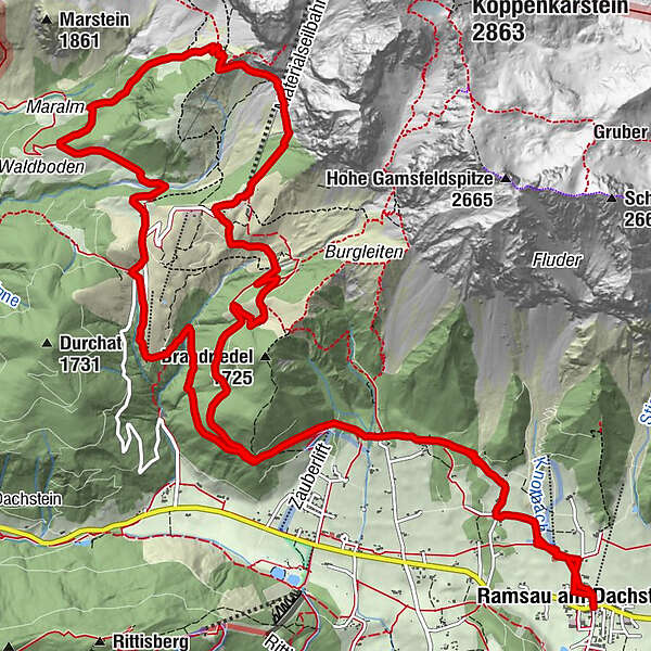
Evang. Pfarrkirche0.1 kmRamsau am Dachstein0.1 kmRamsbergerstube1.4 kmAlpengasthaus Edelbrunn2.7 kmDachsteinhaus3.5 kmBrandalm5.5 kmAustriahütte6.1 kmDachsteinsüdwandhütte9.4 kmJagahofalm12.9 kmNeustattalm12.9 kmGlös-Alm13.5 kmDachsteinhaus16.3 kmAlpengasthaus Edelbrunn17.1 kmRamsbergerstube18.5 kmEvang. Pfarrkirche19.7 kmRamsau am Dachstein19.8 km
- Best season
-
JanFebMarAprMayJunJulAugSepOctNovDec
- Description
-
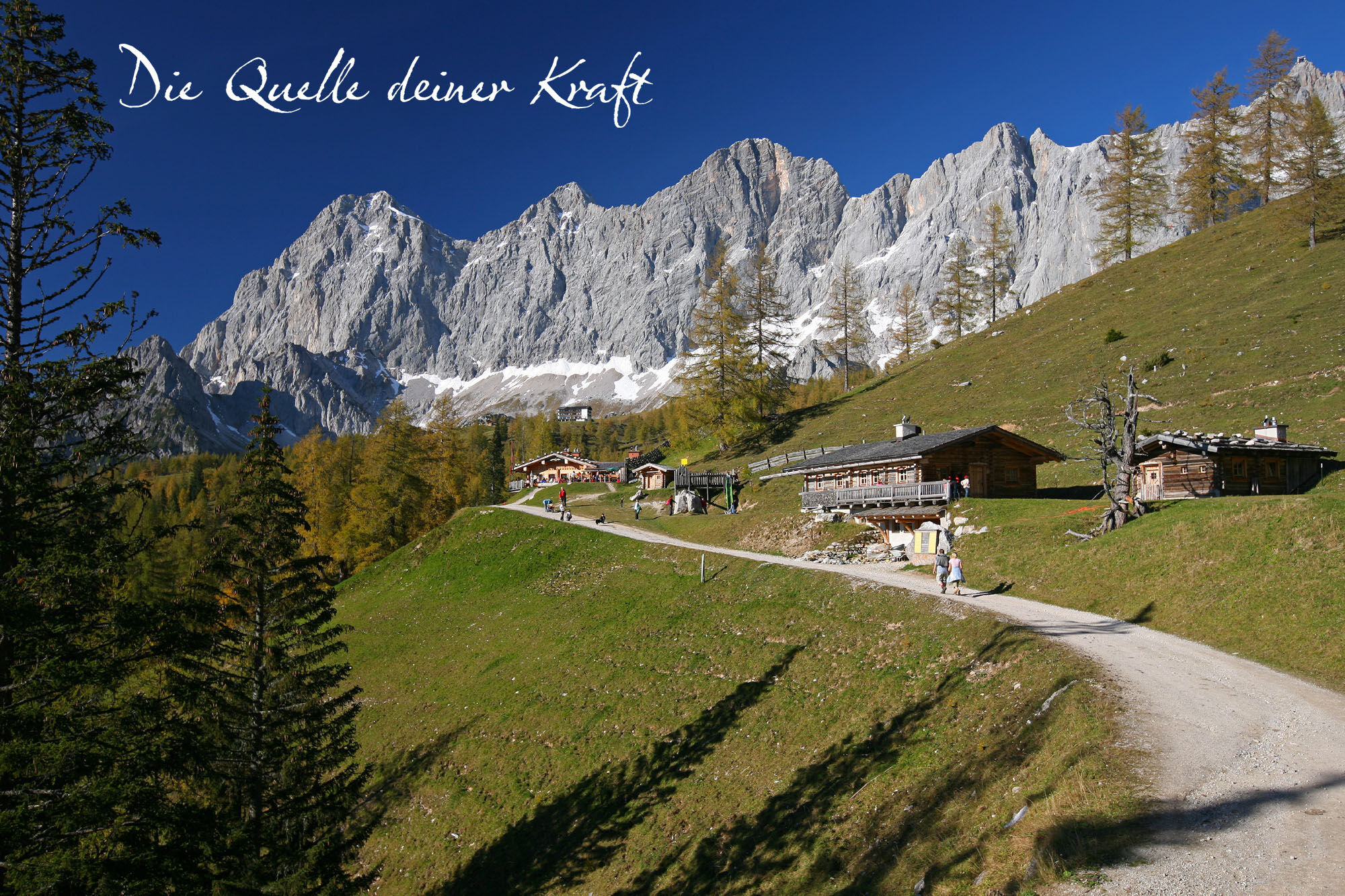
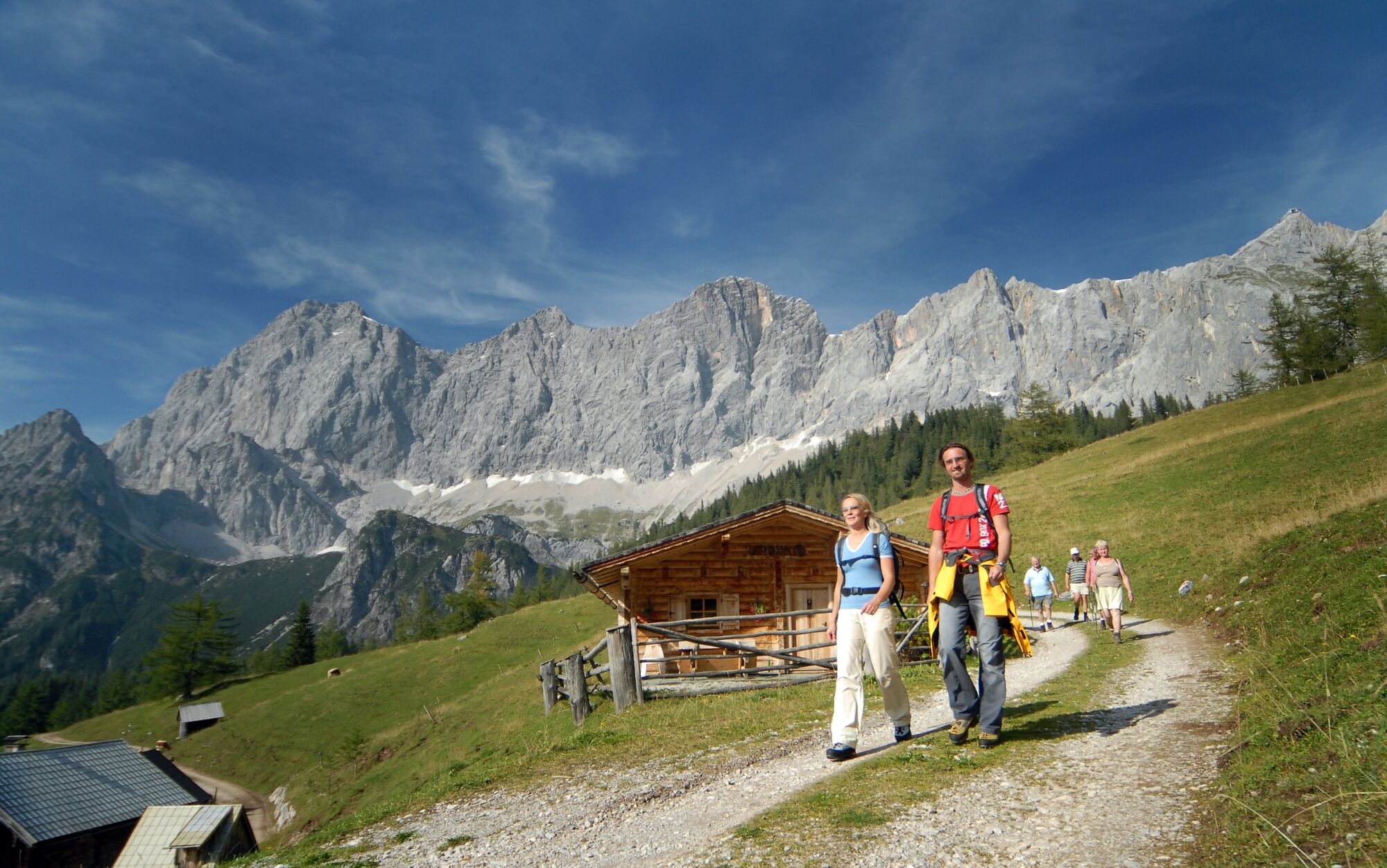
Classic route from the Ramsau Plateau to the alpine pastures. Across meadows, fields and high forest to above the tree line at the foot of the Dachstein south face. A beautiful day hike that can be done as a circular route and offers more than just 5 huts/refreshments :) A return trip with the bus is also possible from Türlwandhütte, Walcheralm and Glösalm.
- Directions
-
From Ramsau-Ort you hike up through the town, past the Protestant church and the cemetery to Knollhof. Here continue on path #6 to Ramsbergerhof and Lindenhof and continue uphill through sparse forests to the Edelbrunn-Roseggersteig hiking portal.
From Gasthof Edelbrunn, a wide forest path (path #615) leads steadily uphill, first past the Dachsteinhaus towards the Türlwandhütte. The Sitzbichl (rest area with bench) is a beautiful vantage point with a clear view over the western Ramsau plateau and the Schladminger Tauern. Our path continues steadily, slightly uphill to the Brandalm with a first beautiful and really impressive view of the Dachstein. There is also the memorial for the mountaineers who died on the Dachstein and the Dachstein Church. Above is the Austriahütte with the Dachstein Museum, accessible via a short hike from Brandalm. The 5 Huts Trail continues through the Ramsauer Almen area and flows into Dachsteinstrasse below the Hunerkogel inn.
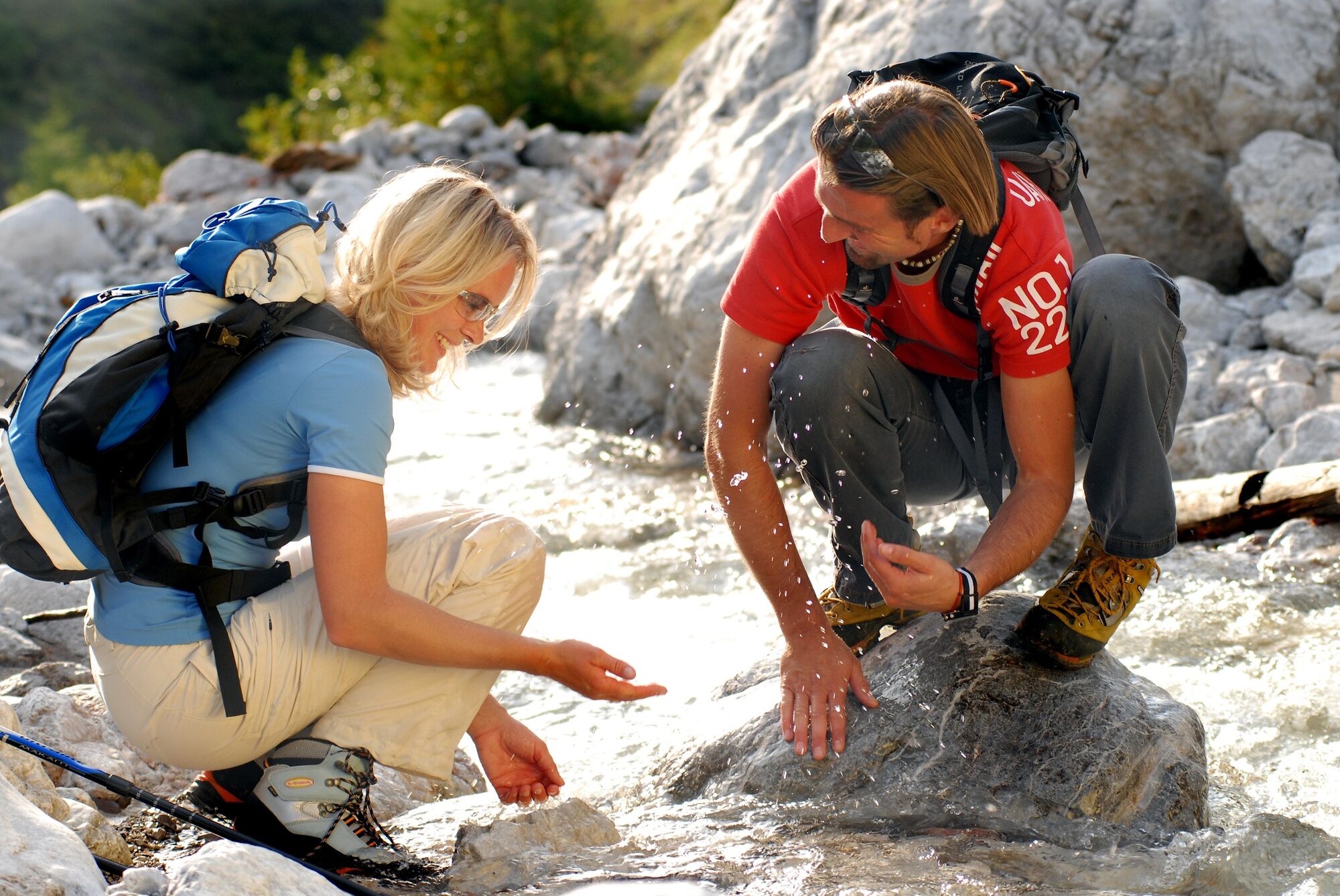
About 400 m to the valley station of the Gletscherbahn or Türlwandhütte. The climb to the Südwandhütte (path # 6 and 615) begins here. This path leads directly below the Dachstein cable car up to the Schwadering cirque, where a waterfall often cascades over the rock face and a snow field still has to be crossed well into the summer. The views on the climb are magnificent. After about 40 minutes of walking from the valley station you will reach the Südwandhütte, which impresses with its great location at the foot of the Dachstein south walls with panoramic views.
From the Südwandhütte the path first leads down the Pernerweg towards the south walls, then turns left and goes steeply downhill. Later in a beautiful larch forest to the Maralmboden. This is a more special place, a natural arena with a small stream and a magnificent view of the southern walls. On path #671 in approx. 30 minutes to the Neustattalm - probably one of the best photo points along the tour! Continue across Dachsteinstrasse to the Walcheralm with its own cheese dairy and down to the Glös-Alm. Via the Schlitzenalm we head towards the Dachsteinhaus, where shortly before the path connects back to the ascent route. From there on the familiar route back to Edelbrunn or Ramsau-Ort.
- Highest point
- 1,866 m
- Endpoint
-
Hiking trail head Edelbrunn-Roseggersteig or Ramsau village
- Height profile
-

- Equipment
-
A well-packed backpack is helpful and especially when touring Alpine terrain a tuque, gloves, a windproof jacket and pants are standard equipment. Good, waterproof shoes, sun glasses, sun cream and sufficient beverages are essential too. Torch light, a map of the area, knie and a small first-aid kit should also be in the backpack.
- Safety instructions
-
Changes in weather patterns, quick falls in temperature, thunderstorms, wind, fog and snow are some of the dangers that can be encountered on a hiking tour. Hosts of alpine huts and mountain refuges have a lot of experience in the mountains and can give good advice about weather and the trails. Poor equipment, overestimation of one's own capabilities, carelessness, poor personal constitution and/or wrong judgement can lead to critical situations. In case of thunderstorms: avoid summits, ridges and steel ropes.
GPS data and orienteering
Available GPS data - just like hiking maps - is only a guidance for orientation and can never depict a trail exactly with all its details. Especially at dangerous spots it is essential to judge on site how to proceed.
In an emergency please call:
140 - for Alpine emergencies (all over Austria) 112 - European GSM emergency number - Tips
-
You can also start and end the hike at the Edlebrunn-Roseggersteig hiking portal. This shortens the tour by around 1.5 hours.
- Directions
-
From the west: Tauern Autobahn (A 10) to Knoten Ennstal - turnoff direction Graz/Schladming - stay on the Ennstal-Bundesstraße (B320) for approx. 20 km until Schladming - take the turnoff for Ramsau.
From the north: Pyhrn Autobahn (A 9) direction Liezen - take the Ennstal-Bundesstraße (B320) to Schladming - turnoff Ramsau.
Drive up to Ramsau and through the village until you reach the turn-off "Edelbrunn" to your right-hand side. Drive up the road to the parking lot.
- Public transportation
- Parking
-
Edelbrunn-Roseggersteig car park or Ramsau-Ort event center (the 5 Hütten Weg is also signposted from there).
-

-
AuthorThe tour 5 Huts Trail - The Classic is used by outdooractive.com provided.


General info
-
Schladming - Dachstein
3001
-
Ramsau am Dachstein
1689
-
Dachstein Gletscher
527


