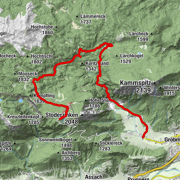
Hike through forest and alpine pastures from the Stoderzinken to the Viehbergalm


- Brief description
-
Long hike, rich in variety, from the Stoderzinken down through the Notgasse to the Viehbergalm, then through the Öfen to Gröbming Winkl.
- Difficulty
-
medium
- Rating
-
- Starting point
-
P on the Stoderzinken – end of the Stoderzinken Alpine Road, elev. 1,890 m
- Route
-
Stoder0.1 kmBerggasthof Steinerhaus0.1 kmBrünner Hütte1.0 kmNotgasse4.5 kmRiesgasse5.1 kmBrandalm6.3 kmViehbergalm10.7 kmSimeterhütte10.7 kmRitzingerhütte11.0 kmEckangerl11.7 kmSeeboden14.1 kmOberwinkl17.9 kmWinkl18.5 km
- Best season
-
JanFebMarAprMayJunJulAugSepOctNovDec
- Description
-
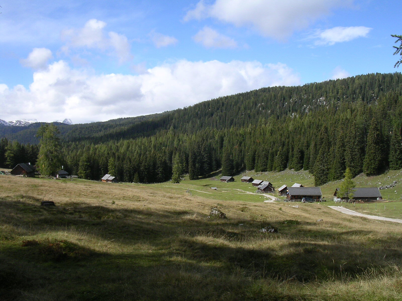
From Gasthof Steiner on the Stoderzinken, we follow the dirt road to the Brünnerhütte. A beautiful larch forest interspersed with pine surrounds narrow path No. 618, which we follow for the better part of an hour through the Brandner Urwald. In the valley bottom below the Kimpflingsattel, we branch off to the Notgasse. We need to pay close attention, since the markings are easy to miss. Big clearings, such as the Wiesmahd, occasionally interrupt the dense forest. It was here, in former times, that charcoal was produced. In the narrow, some 550 m long and up to 30 m wide rocky canyon of the Notgasse, it is not rare for snow to be on the ground until well into summer. Because of the rock drawings discovered there, the Notgasse is protected as an important cultural site – so please take that into consideration! After this ancient trade route, we come to a new forestry lane, which we follow to the Brandalm – from there now along the Bettlersteig trail to a beautiful hut village at the Viehbergalm.
Following trail No. 28, we descend about 300 m as far as the Rahnstube, where we again meet up with that forestry lane from the Brandalm. We continue through flat terrain until a beautiful path through the impressive Öfen brings us to Gröbming Winkl. - Directions
-
From Gasthof Steiner on the Stoderzinken, we follow the dirt road to the Brünnerhütte. A beautiful larch forest interspersed with pine surrounds narrow path No. 618, which we follow for the better part of an hour through the Brandner Urwald. In the valley bottom below the Kimpflingsattel, we branch off to the Notgasse. We need to pay close attention, since the markings are easy to miss. Big clearings, such as the Wiesmahd, occasionally interrupt the dense forest. It was here, in former times, that charcoal was produced. In the narrow, some 550 m long and up to 30 m wide rocky canyon of the Notgasse, it is not rare for snow to be on the ground until well into summer. Because of the rock drawings discovered there, the Notgasse is protected as an important cultural site – so please take that into consideration! After this ancient trade route, we come to a new forestry lane, which we follow to the Brandalm – from there now along the Bettlersteig trail to a beautiful hut village at the Viehbergalm.Following trail No. 28, we descend about 300 m as far as the Rahnstube, where we again meet up with that forestry lane from the Brandalm. We continue through flat terrain until a beautiful path through the impressive Öfen brings us to Gröbming Winkl.
- Highest point
- 1,824 m
- Endpoint
-
Gröbming Winkl
- Height profile
-

- Equipment
-
Sturdy shoes, rain gear
- Tips
-
Interesting guides of experts through the Notgasse! Further information at the tourist office Gröbminger Land, Tel. 03685/22131 22. Hiking tours every Thursday from end of May until mid-October (dependent on weather conditions)
- Additional information
-
Safety information
Safety on the mountainside: changes in the weather, sudden fall in temperature, thunder storms, wind, fog and snow fields are all objective dangers and require the correct behaviour whilst underway. the landlords of the huts are all very knowledgeable about the mountains and can give you good tips about the weather and the routes. Insufficient equipment, exaggerated opinion of ones capabilities, frivolousness, poor health condition and a false evaluation of the situation can lead to a critical situation. In thunder storms: summits, crest-sites and safety rope aids are to be avoided.
If something should happen call following emergency numbers:
No. 140 - the number for all Alpine Emergencies in all of Austria
No. 112 - European emergency call GSM emergency-call-service - Arrival
-
From Gröbming to the end of the Stoderzinken Alpenstraße
- Public transportation
-
Hiking taxi Sport Kornberger, minimum of 4 people.
Register by phone; Tel.: 03685/22172 - Parking
-
Parking area at the end of the Stoderzinken Alpenstraße
- Author
-
The tour Hike through forest and alpine pastures from the Stoderzinken to the Viehbergalm is used by outdooractive.com provided.


General info
-
Schladming - Dachstein
3002
-
Haus - Aich
1368
-
Aich
280


