
- Brief description
-
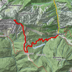
Via the Klettsteig passages of the waterfall path and the Kölblplan you cross the Planspitze. On the descent the path leads to the famous Heßhütt
- Difficulty
-
difficult
- Rating
-
- Route
-
Planspitze (2,114 m)2.7 km
- Best season
-
JanFebMarAprMayJunJulAugSepOctNovDec
- Description
-
connection of the Gesaeuse classic "Waterfall Trail - Heßhütte" with a summit tour
- Directions
-
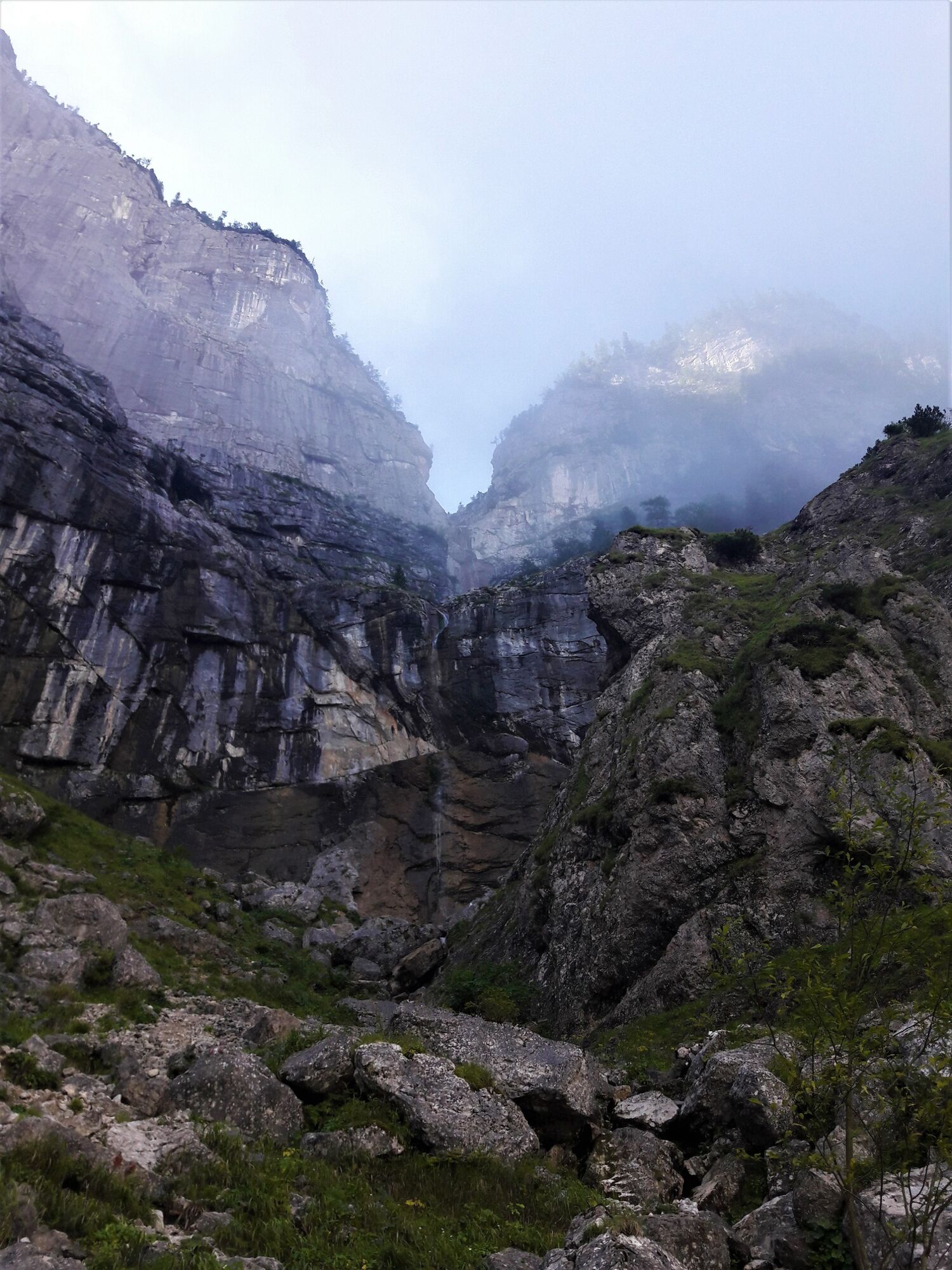
First a comfortable climb through the forest to the waterfall, then we climb up numerous iron ladders to the Ebnes- or Erbersanger.
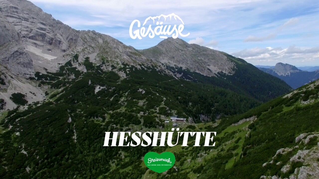
Here we do not take the direct, comfortable hiking trail to the Hess hut, but turn right towards Planspitze to add another summit storm. The path to Planspitze leads first 300 meters of altitude difference through the forest, then mostly in rocky terrain and we have to reach into the rock sometimes to overcome the altitude difference.
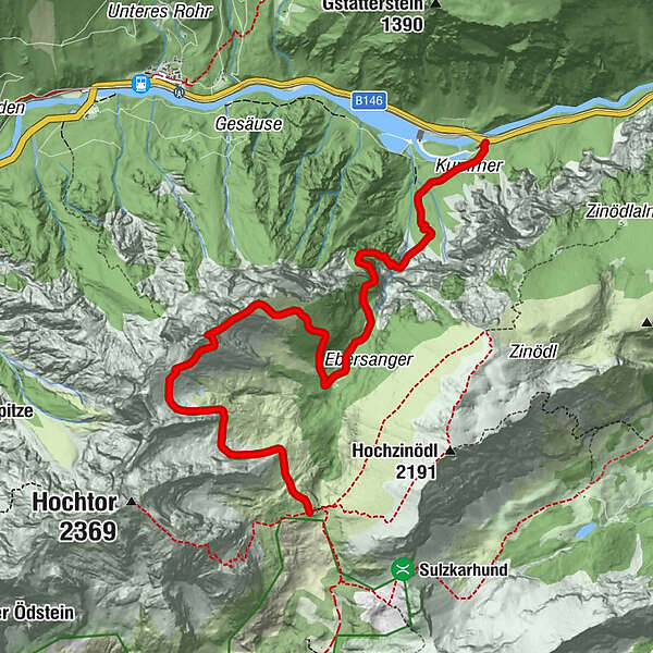
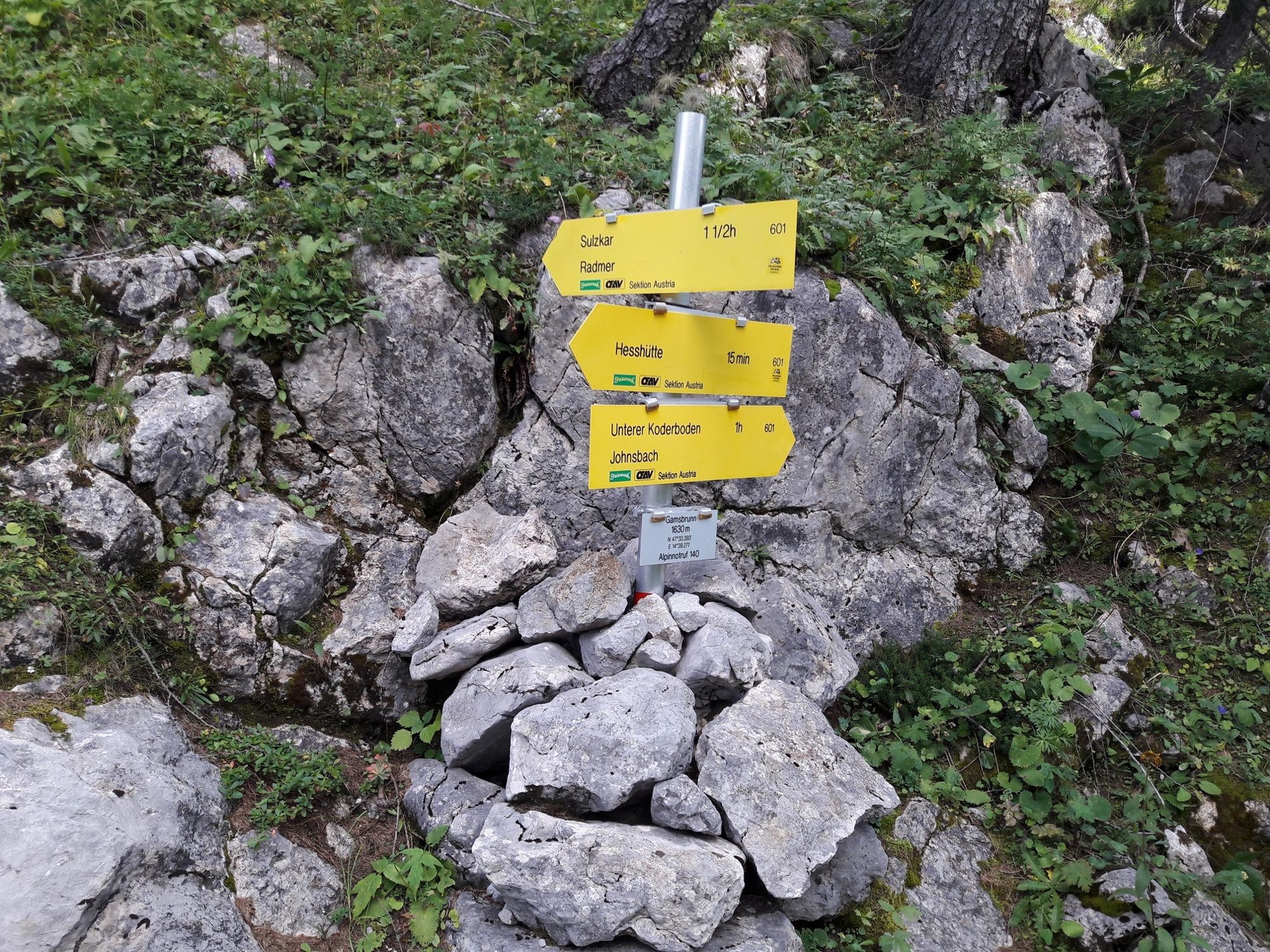
After we have enjoyed the view into the Gesäuse, which lies at our feet, at the summit cross, we descend over likewise very rocky terrain via the Peternscharte to the Heßhütte. There we are hosted by the host of the hut and also the overnight stay in the hut is recommendable after the meters of altitude we already have in our legs today.
- Highest point
- 2,089 m
- Endpoint
-
Heßhütte - 1.699 m
- Height profile
-

- Equipment
-
Sturdy mountain boots or good trekking shoes,
as well as hiking rucksack with appropriate contents (water bottle, first aid, hiking map,)
- Safety instructions
-
The best way to pass the waterfall path is uphill, take special care when wet!
On the way to the Planspitze surefootedness is required, maby book a mountain guide.
- Tips
-
spend the night at the Hess hut and the next day, before descending into the valley, join the Zinödl panorama trail (3 hours).
- Additional information
- Directions
-
A9 Phyrn motorway to exit Ardning/Admont and from there past Frauenberg, approx. 10 km after Admont. Via the B146 (Gesäuse Bundesstraße) coming from the west into the Gesäuse.
Or via Leoben, Vordernberg and Eisenerz to Hieflau and from there via the B146 in a westerly direction into the Gesaeuse.
A1 Westautobahn to exit Ybbs and from there in southern direction through Scheibbs, Lunz am See, Göstling an der Ybbs and Palfau to Hieflau. From there via B146 in western direction into the Gesäuse
- Public transportation
-
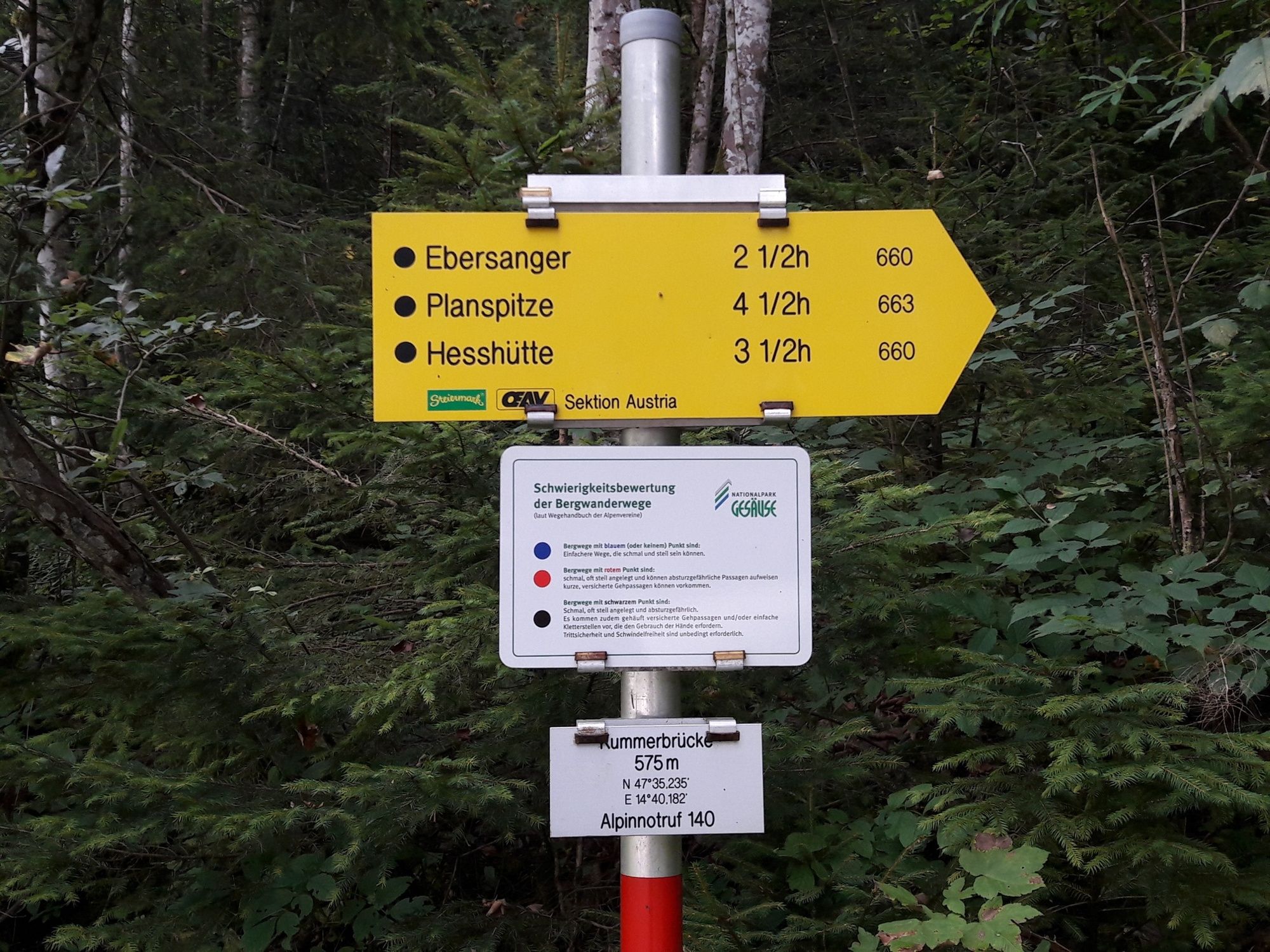
Postbus Line 912, Haltestelle Kummerbrücke (www.busbahnbim.at)
- Parking
-
A free national park parking lot with information boards is located at the Kummerbrücke about 3 km east of Gstatterboden. There is also the bus stop Gesäuse Kummerbrücke, where the bus line 912 stops.


-

-
AuthorThe tour Via the waterfall path and the Planspitze to the Hesshütte is used by outdooractive.com provided.


General info
-
Gesäuse
2225
-
Steyr und die Nationalpark Region
1371
-
Radmer
240


 & Kaiserschild (rechts)")