

- Brief description
-
High alpine mountain tour - firstly high altitude trail - transition to high alpine path - partly as a variant via ferrata or steep rocky path.
- Difficulty
-
difficult
- Rating
-
- Starting point
-
Ramsau Kulm or Hotel Feistererhof
- Route
-
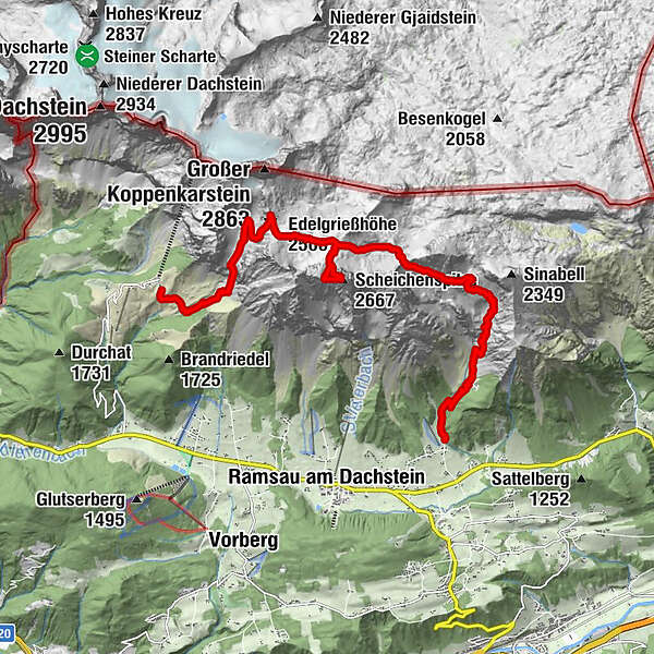
Bio- & Wellnesshotel feistererhofFischermauer (1,668 m)2.4 kmFeisterer Tiefkar3.2 kmFeisterer Hochkar4.0 kmGuttenberghaus4.7 kmGruber Scharte (2,353 m)6.0 kmScheichenspitze (2,667 m)8.1 kmEdelgrießhöhe (2,500 m)10.3 km
- Best season
-
JanFebMarAprMayJunJulAugSepOctNovDec
- Description
-
From the Hotel Feistererhof ascent to the Guttenberghaus. From the hut on trail no. 618 to the Gruberscharte and continue through the imposing Landfriedtal (junction of trail no. 68) to the Scheichenspitz summit (2,667 m). Descent via the Edelgrießkar on trail no. 672 to the Türlwand.
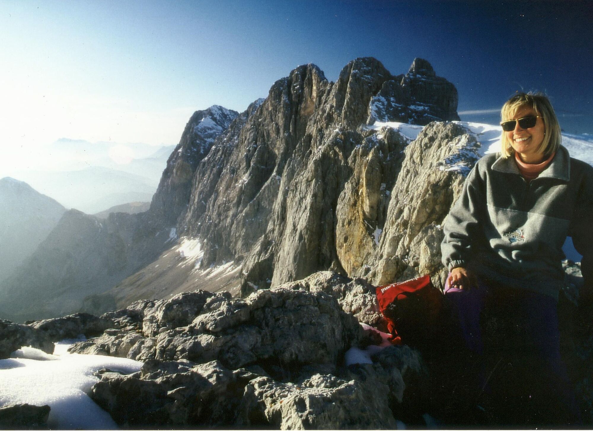
High alpine mountain tour - initially high altitude path - transition to high alpine path - partly as a variant via ferrata or steep rocky path.Summit cross Scheichenspitze - impressive karst landscape, small Edelgrieß glacier, summit hiking trail.
- Directions
-
Starting at Hotel Feistererhof, the winding 616 trail, leads up to the Tiefkar. After around 45 minutes, you reach the charmingly rustic Lärchbodenalm. From there an alpine trail continues along the rocks of the Fischermauer before heading uphill through the green hills of the Tiefkar and to Guttenberghaus. There you can enjoy a splendid view of Ramsau am Dachstein, the Niedere and Hohe Tauern. This is now the high alpine.
Go left on the Guttenberghaus trail 618 to the Gruberscharte, through the Landfriedtal valley and up to the Edelgrießhöhe (2,489 m ). Trail 68 to Schleichenspitze is also a great option, but you need to be surefooted, for an unforgettable view at the summit. From Edelgrießhöhe, trail 618 leads Edelgrießgletscher’s snow field. Trail 672 leads down through Edelgrieß to the Türlwand. Take care: trail 673 is very steep and scree covered.
- Highest point
- 2,636 m
- Endpoint
-
Türlwandhütte
- Height profile
-

- Equipment
-
very good hiking equipment (steep descent on scree fields)
- Safety instructions
-
surefootedness and head for heights are necessary
- Additional information
- Directions
-
Arriving from the west:
From the west you can take the Munich-Salzburg motorway, continuing on the Tauern motorway (A 10) until the Ennstal junction. From here take the Ennstal A-road (the B 320) for around 30 km into the Schladming-Dachstein region, then take the Ramsau am Dachstein turn-off.Arriving from the north:
From the south-east take the Pyhrnautobahn motorway (A 9) to the Liezen junction and then the Ennstal A-road (B 320) into the Schladming-Dachstein region. Then take the Ramsau am Dachstein turn-off. - Public transportation
- Parking
-

-
AuthorThe tour Summit tour to Scheichenspitze is used by outdooractive.com provided.


General info
-
Schladming - Dachstein
3001
-
Ramsau am Dachstein
1689
-
Ramsau am Dachstein
479


