


- Brief description
-
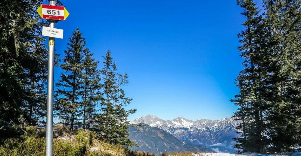
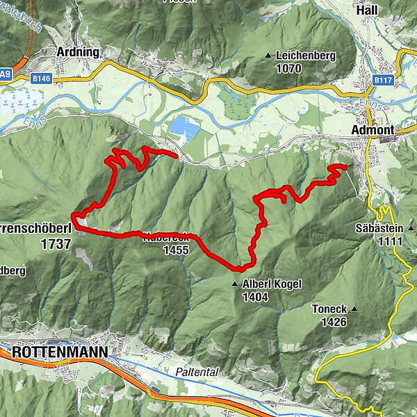
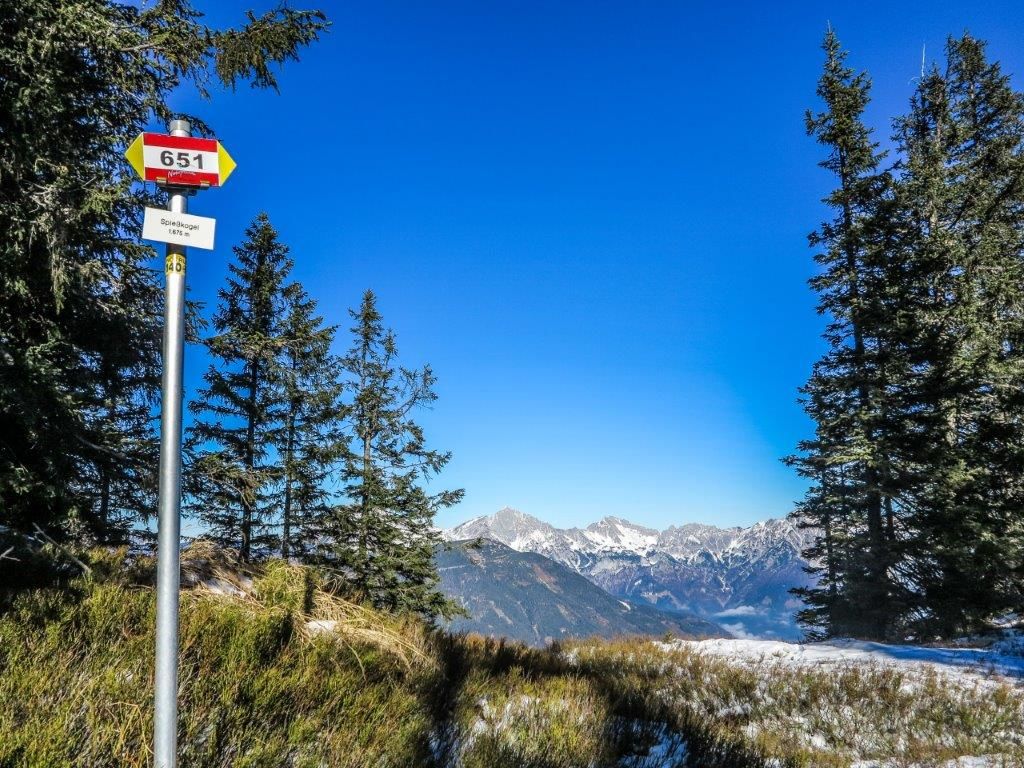
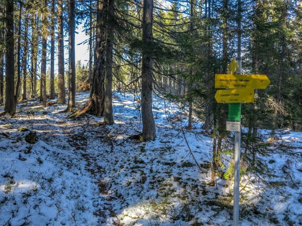
On trail no. 651 we hike on forest roads past Röthelstein Castle to Hubereck. From here the trail leads directly over the ridge. We hike through high moors over the Spießkogel and reach the summit with its magnificent panorama after about 4 1/2 hours.
- Difficulty
-
medium
- Rating
-
- Starting point
-
Admont Schloss Röthelstein
- Route
-
Hubereck (1,455 m)9.4 kmDürrenschöberl (1,737 m)12.6 km
- Best season
-
JanFebMarAprMayJunJulAugSepOctNovDec
- Description
-
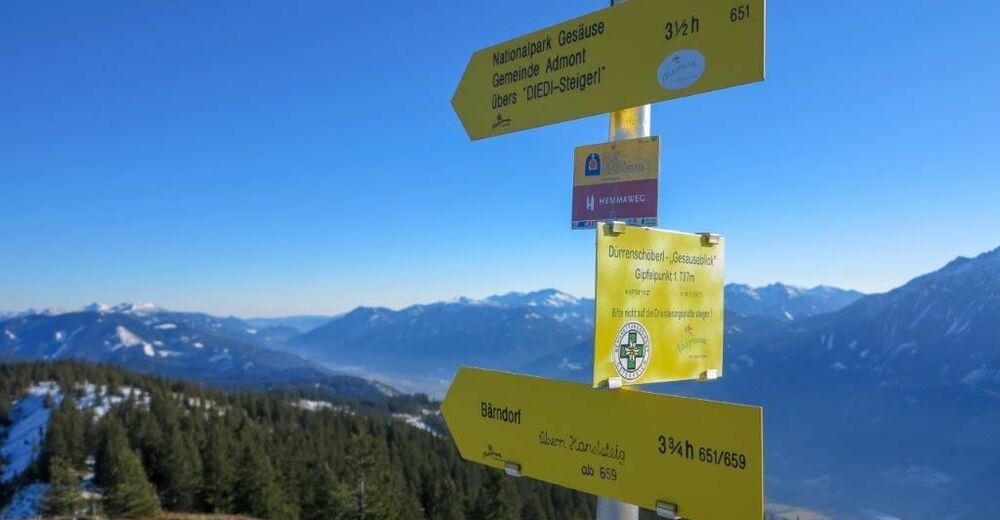
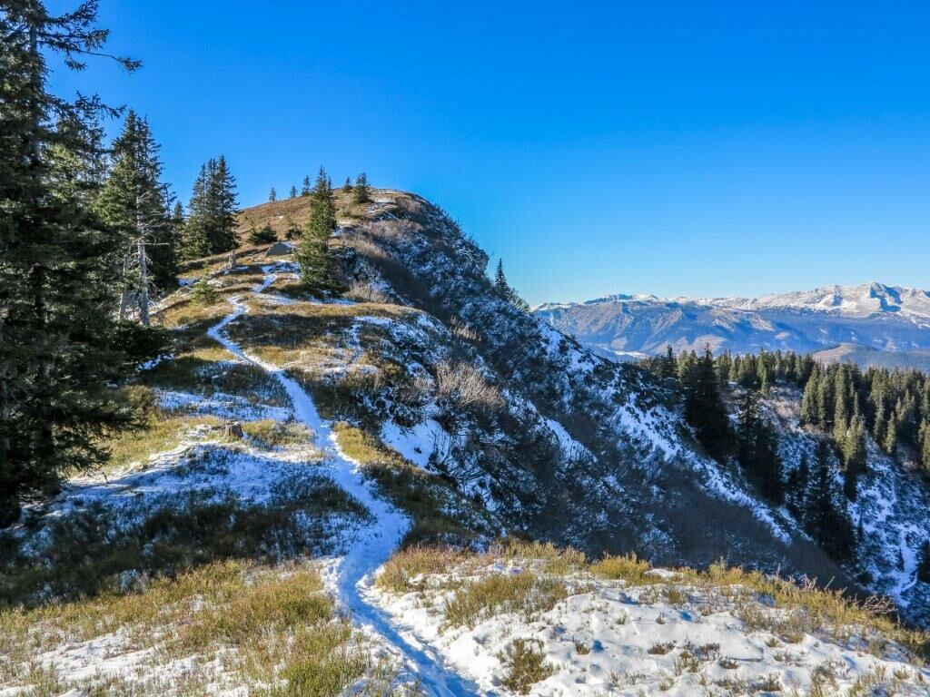
Trail no. 651 leads from Admont via Röthelstein Castle - Hubereck - Spießkogel to the summit in approx. 4 1/2 hours. The last third in particular leads directly along the ridge (high moors) to the Dürrenschöberl.Descent either the same way or as we did on trail no. 652 to Frauenberg/ Ardning (approx. 3 hours).
Trail conditions: gravel, forest, meadow, alpine pastureland
Except for the first part of the descent to Frauenberg, this is an easy but enduring hike with absolutely fantastic views in all directions!
- Directions
-
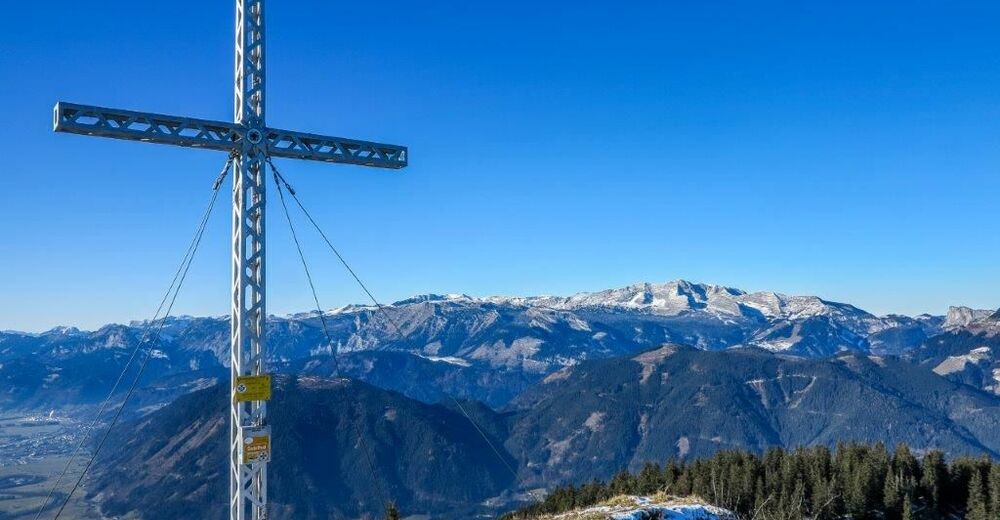
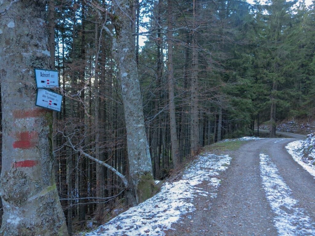
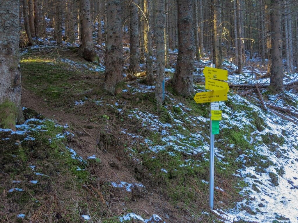
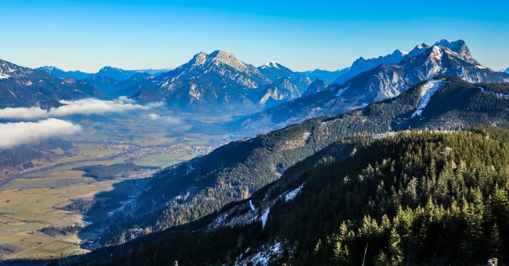
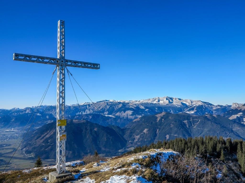
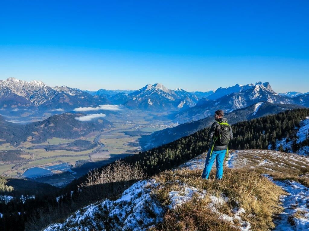
We start at the car park of Röthelstein Castle and follow trail 651, perfectly signposted, initially on forest roads up to Hubereck. From Hubereck we continue along a marked forest path up to Spießkogel and then the last ascent up to Dürrenschöberl. The Dürrenschöberl is an outstanding panoramic mountain and offers a view of the Enns valley, Gesäuse mountains, Haller Mauern, Rottenmanner Tauern etc. A disc at the summit near the cross explains all the surrounding peaks.
We descend via trail 652 to Frauenberg, initially a little steeper.
We parked a car there to save us the long way back on the road!
Translated with www.DeepL.com/Translator (free version)
- Highest point
- 1,731 m
- Endpoint
-
Bahnhof Frauenberg
- Height profile
-

- Equipment
-
Comfortable, sturdy and well-worn shoes, as well as a hiking rucksack with appropriate contents (water bottle, first aid, hiking map, sun protection, snacks, etc.). You should also be well prepared for a change in the weather.
Mobile phone for emergency calls
- Safety instructions
-
Emergency call mountain rescue: 140
Emergency reporting tip - give answers to the six W-questions: What happened? How many injured? Where did the accident happen (possibly GPS coordinates)? Who reported the accident (call-back number)? When did the accident happen? Weather at the accident site?
- Tips
-
Tip: Mountain mass in July
Park a 2 car shuttle in Frauenberg!
- Additional information
- Directions
-
From Graz: Variant 1: A9 Pyhrnautobahn - exit Liezen - country road towards Admont - roundabout on the right - through the village - towards Kaiserau - after the Moosbrugger sawmill up on the right - destination: Röthelstein Castle.
Option 2: Motorway - exit Trieben - over the Kaiserau mountain - after driving over the Kaiserau there is a sign "JUFA Schloss Röthelstein" - left over the bridge - destination: Röthelstein Castle
From Salzburg:A10 Tauern motorway - exit Radstadt - direction Schladming - continue to Liezen - from Liezen on the main road towards Admont - turn right at the roundabout - through the town - direction Kaiserau - after the Moosbrugger sawmill turn right uphill - destination: Röthelstein Castle
- Public transportation
-
Bus von Liezen nach Admont
- Parking
-
Röthelstein Castle car park


-

-
AuthorThe tour Dürrenschöberl is used by outdooractive.com provided.


General info
-
Gesäuse
2224
-
Urlaubsregion Pyhrn - Priel
1440
-
Ardning
355


