


- Brief description
-
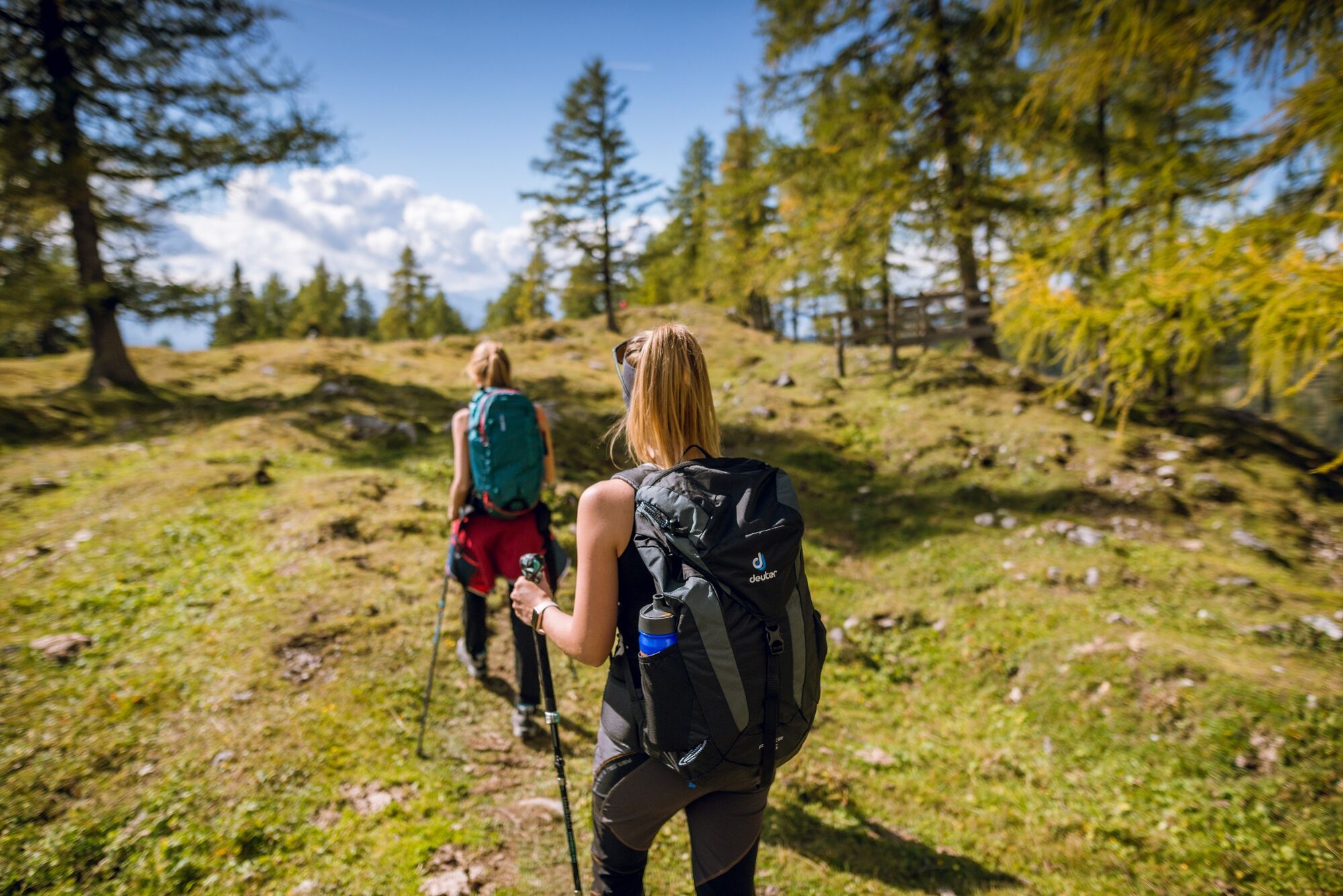
A steep but rewarding hike to the "Steinernen Jungfauen" - some bizarre psephitic rock formations.
- Difficulty
-
medium
- Rating
-
- Starting point
-
Hiking trail head Edelbrunn-Roseggersteig
- Route
-
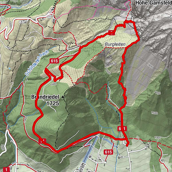
Jungfrauen1.3 kmAustriahütte4.1 kmBrandalm4.6 kmDachsteinhaus6.6 kmAlpengasthaus Edelbrunn7.4 km
- Best season
-
JanFebMarAprMayJunJulAugSepOctNovDec
- Description
-
The stone quarry for the material for building the Protestant Church in Ramsau was located near the "Stone Maidens" (Steinerne Jungfrauen). At the bench at the lower end of the Gamsfeldgassl you can enjoy a magnificent view over the Ramsau plateau and over to the Schladminger Tauern. The Jungfrauensteig is a steep, gravelly path, but sure-footedness is essential.
- Directions
-
From the Edelbrunn-Roseggersteig hiking trail head, you first hike up a wide forest path to the right of the Edelbrunn inn. At the crossroads in the forest you turn right and follow hiking trail #9. First the path takes you up the edge of the scree field of the “Kraml-Lahn” and then turns left into the forest. You will soon reach the rock formations of the “Stone Maidens”, where there are also some nice rest areas. To the left above the Brandriedel, the Dachstein towers in the background. We continue on the gravelly path up to the rock faces below the Gamsfeld to a viewing bench, where you really deserve a break and can enjoy the view.
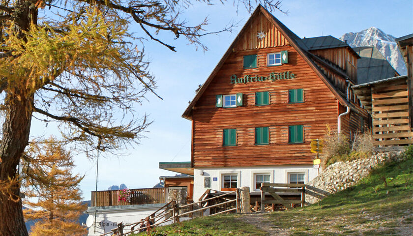
We continue over to the lower end of the Edelgrieß and from there down to the Austriahütte with the Dachstein Museum and over the Brandalm and path #615 past the Dachsteinhaus back to the starting point. Alternatively, you can also go back downhill a bit from the Bankerl and take the hiking trail that branches off to the right directly to the Brandriedel.
- Highest point
- 1,958 m
- Endpoint
-
Hiking trail head Edelbrunn-Roseggersteig
- Height profile
-

- Equipment
-
A well-packed backpack is helpful and especially when touring Alpine terrain a tuque, gloves, a windproof jacket and pants are standard equipment. Good, waterproof shoes, sun glasses, sun cream and sufficient beverages are essential too. Torch light, a map of the area, knie and a small first-aid kit should also be in the backpack.
- Safety instructions
-
A very steep path. Places with slipped earth.
Changes in weather patterns, quick falls in temperature, thunderstorms, wind, fog and snow are some of the dangers that can be encountered on a hiking tour. Hosts of alpine huts and mountain refuges have a lot of experience in the mountains and can give good advice about weather and the trails. Poor equipment, overestimation of one's own capabilities, carelessness, poor personal constitution and/or wrong judgement can lead to critical situations. In case of thunderstorms: avoid summits, ridges and steel ropes.
GPS data and orienteering
Available GPS data - just like hiking maps - is only a guidance for orientation and can never depict a trail exactly with all its details. Especially at dangerous spots it is essential to judge on site how to proceed.
In an emergency please call:
140 - for Alpine emergencies (all over Austria) 112 - European GSM emergency number - Tips
-
On the circular tour you can also take a detour from the Austriahütte to the viewing and photo point at Brandriedel.
- Directions
-
From the west: Tauern Autobahn (A 10) to Knoten Ennstal - turnoff direction Graz/Schladming - stay on the Ennstal-Bundesstraße (B320) for approx. 20 km until Schladming - take the turnoff for Ramsau.
From the north: Pyhrn Autobahn (A 9) direction Liezen - take the Ennstal-Bundesstraße (B320) to Schladming - turnoff Ramsau.
Drive up to Ramsau and through the village until you reach the turn-off "Edelbrunn" to your right-hand side. Drive up the road to the parking lot.
- Public transportation
- Parking


-

-
AuthorThe tour Jungfrauensteig is used by outdooractive.com provided.


General info
-
Schladming - Dachstein
3000
-
Ramsau am Dachstein
1690
-
Dachstein Gletscher
529


