- Brief description
-
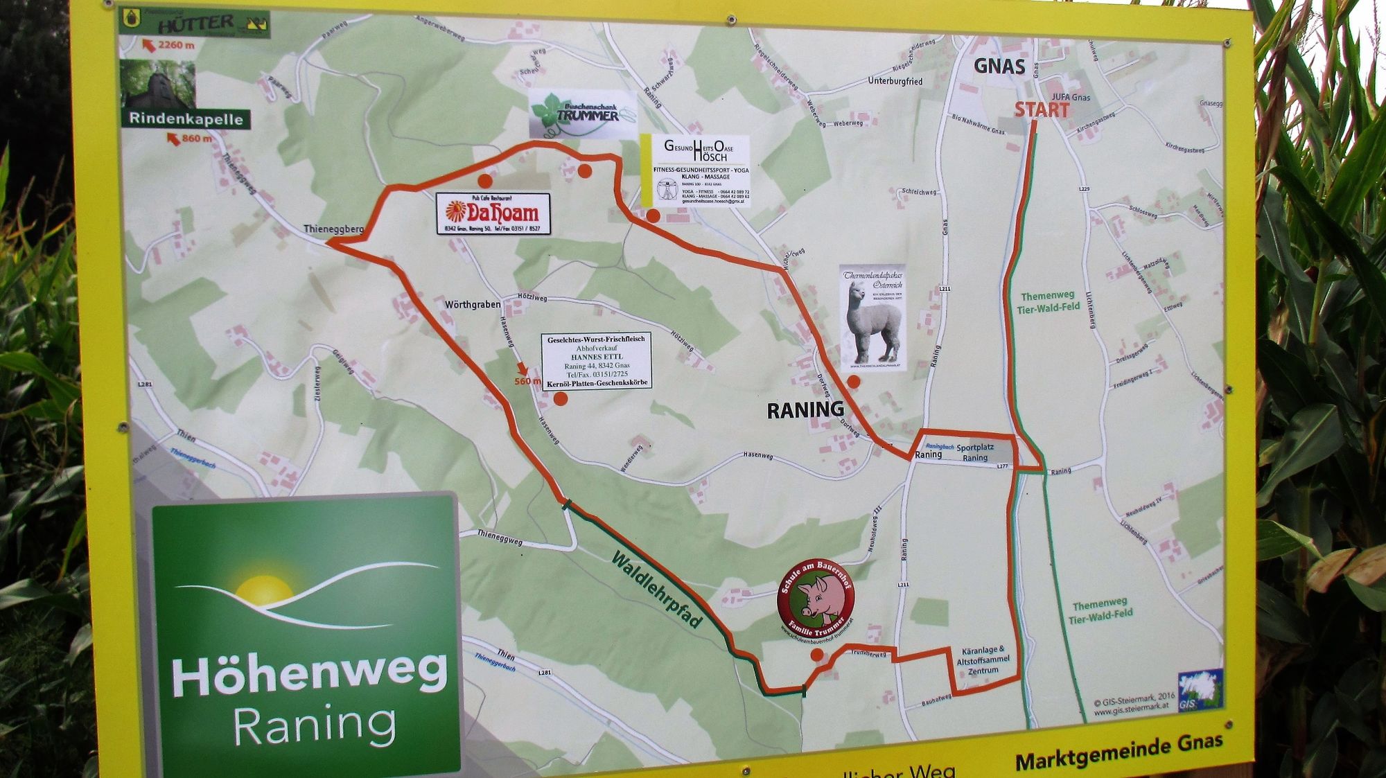
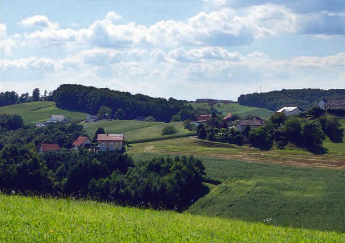
Cozy circular hiking trail with views from Gnas to Raning! Stop and visit the alpacas of Sven Roll!
- Difficulty
-
medium
- Rating
-
- Starting point
-
Gnas sports field (Sportplatz)
- Route
-
Thieneggberg4.2 kmBuschenschank Trummer4.8 kmGrabenberg5.8 kmDorfkapelle Raning6.6 kmRaning6.7 km
- Best season
-
JanFebMarAprMayJunJulAugSepOctNovDec
- Description
-
Hiking trail to the heights of Raning to enjoy the view. Our hike leads us to the Gnasbaches, where we feel the shade of the trees and the ripple of the stream. Our hike continues to Grabersdorf and through the forest to the viewpoint in Raning.
Attention: Back we hike a piece on asphalt until we get to the Gnasbach and via the agricultural theme trail back to our starting point.
- Directions
-
The Höhenwerg of the market community Gnas leads us in the local community Raning mainly through forest and meadow. We start our hike at the sports grounds in Gnas along the Gnasbach stream and on part of the agricultural theme trail. Past the waste collection center, the path leads us to the "School on the Farm", where a stop can be made. Afterwards we can explore most of the local trees at the forest nature trail. From the highest point in the village of Raning we have a wonderful view in all directions. Now we have the possibility to make a stop at the "Dahoam" or Buschenschank Trummer.
Worth seeing awaits us at the health oasis Hösch and all animal lovers are welcome at the Thermenlandalpakas of the family Roll.
- Highest point
- 382 m
- Endpoint
-
Gnas sports field (Sportplatz)
- Height profile
-

- Equipment
-
sturdy shoes
backpack with drink and snack if necessary
Hiking sticks - Safety instructions
-
stay on the path
sticks
good shoes - part of the route is on asphalt - Tips
-
Visit also the Thermenlandalpakas of Sven Roll!
- Additional information
- Directions
- Public transportation
-
Timetables and travel information can be found directly at: Austrian Federal Railways (ÖBB), Steiermärkische Landesbahnen (STLB), www.busbahnbim.at.
With the BusBahnBim app from Verbundlinie, timetable information has never been easier: all bus, train and streetcar connections in Austria can be queried by entering locations and/or addresses, stops or important points. The app is available as a free app for smartphones (Android, iOS) - on Google Play and in the App Store.
- Parking
-

-
AuthorThe tour Raning mountain path (Höhenweg Raning) is used by outdooractive.com provided.


General info
-
Oststeiermark
2126
-
Bad Gleichenberg
372
-
Gnas
141