
- Brief description
-
This is an advanced hike, which is nevertheless rewarded with fantastic mountain panorama.
- Difficulty
-
difficult
- Rating
-
- Starting point
-
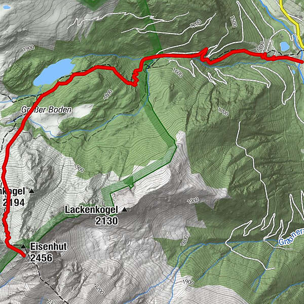
Parking lot Zwiefler lakes
- Route
-
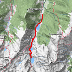
Eisenhut (2,456 m)4.7 km
- Best season
-
JanFebMarAprMayJunJulAugSepOctNovDec
- Description
-
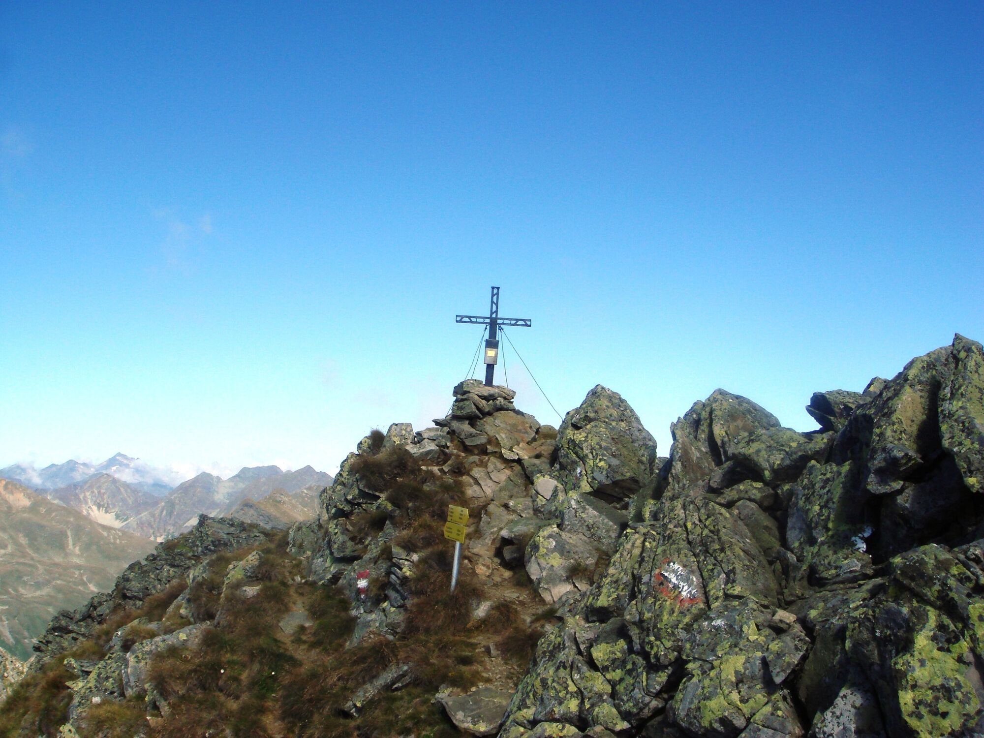
The tour leads along a beautiful Almway and in serpentines towards the Zwiefler lakes. The ascent to the summit of the Eisenhut is, however, a challenging hiking trail that should only be practiced by experienced hikers. Here the emphasis is on personal responsibility - surefootedness and a head of heights mus be present!
- Directions
-
From the parking lot across the road continues effortlessly over a beautiful alpine pasture until the ascent. Here follow a serpentine path with a challenging ascent. Through the forest the path leads to the lower Zwiefler lake. The hike continues over the "Große Boden" to the upper Zwiefler lake into the north-facing steep cirque and therein straight uphill to the Eisenhut summit!
The way back follows the ascent path!
- Highest point
- 2,408 m
- Endpoint
-
Eisenhut
- Height profile
-

- Equipment
-
Good footwear
Sun protection
Sufficient food - Tips
-
Possibly pack swimming gear to go for a swim in the Zwiefler lakes.
- Additional information
-
The ideal time for this tour is from May to October.
- Directions
-
Coming from Judenburg via Unzmarkt to Scheifling. Here turn right in the direction of Murau. In Katsch an der Mur keep right and drive to Schöder. Shortly before Schöder turn right again and dirve along the Sölkpass road to the Zwiefler lakes parking lot.
Coming from Tamsweg via Ranten (or Stadl an der Mur) to Schöder. After Schöder turn left and follow the Sölkpassstraße to the parking lot of the Zwiefler lakes.
- Public transportation
-
With the BusBahnBim app of the Verbundlinie, timetable information has never been easier: all bus, train and streetcar connections in Austria can be queried by enteriing locations and/or addresses, stops or important points. The app is available as a free app for smartphones (Android, iOS) - on Goolge Play and in the App Store.
- Parking
-
Parking is available directly at the Zwief lakes parking lot.
- Author
-
The tour Eisenhut is used by outdooractive.com provided.