


- Brief description
-
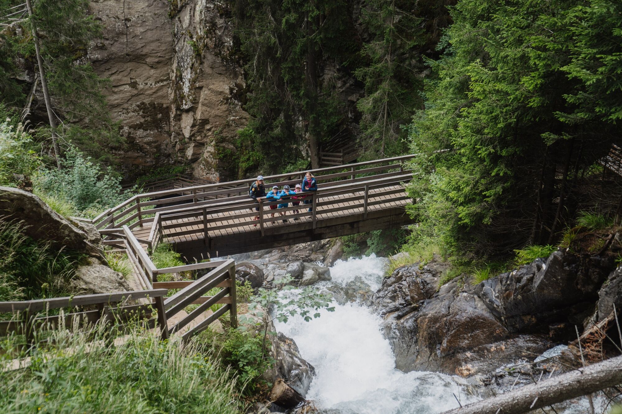
Worth seeing hike through beautiful nature with an impressive stopover at the highest waterfall in Styria: the Günster waterfall.
- Difficulty
-
medium
- Rating
-
- Starting point
-
Schöder
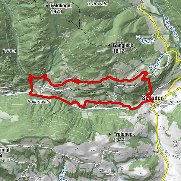
- Route
-
Schöder0.1 kmHirschenwirt0.1 kmGünster Wasserfall4.6 kmKalvarienbergkapelle9.9 kmPfarrkirche Mariä Geburt10.2 kmHirschenwirt10.3 kmSchöder10.3 km
- Best season
-
JanFebMarAprMayJunJulAugSepOctNovDec
- Description
-
With a drop of 65 meters, the Günster waterfall is the highest in Styria. 250 to 300 liters per second rush over the two water-worn cauldrons and down the three impressive cascades. In addition, the waterfall is the perfect photo opportunity on vacation!
- Directions
-
From the starting point S8, follow the signs for about 500m towards Krakaudorf, turn right at the “Stoff” carpentry shop. Continue following the signs (hiking trail no. 7) to the Schöderberg. At the forest intersection keep left. You hike slightly downhill through the forest to the “Ertl” family property. Walk along the community path and always follow the signs “Wasserfall-Schöderbergrunde”. Follow the asphalt road downhill. Continue past the curve towards "Kienberger Anton" and follow the signs over a footbridge to the inn at the waterfall "Wedam" - stage number 6. Follow the signs over the waterfall to the forest road. Walk along this forest road for a while until you turn right onto a municipal road that leads towards Schöderberg to the water features. Past the water features, follow the signs to the Bischof “Gangl” inn. From there you follow the Kirchsteig (hiking trail no. 8) down to the town and back to the starting point.
- Highest point
- 1,286 m
- Endpoint
-
Schöder
- Height profile
-

- Equipment
-
Good shoes
Sun protection
Sufficient food - Additional information
-
The ideal time for this tour is from April to October.
- Public transportation
-
With the BusBahmBim app from the composite line, timetable information is easier than ever before: all bus, train and tram connections in Austria can be queried by entering locations and/or addresses, stops or important points. The app is available as a free app for smartphones (Android, iOS) - on Google Play and in the App Store.
- Parking
-
Public parking spaces are available directly at the Schöder parish church.

- Author
-
The tour Waterfall - Schöderberg round is used by outdooractive.com provided.


General info
-
TourismusRegion Murau
1736
-
Naturpark Sölktäler
919
-
Ranten
157


