


- Brief description
-
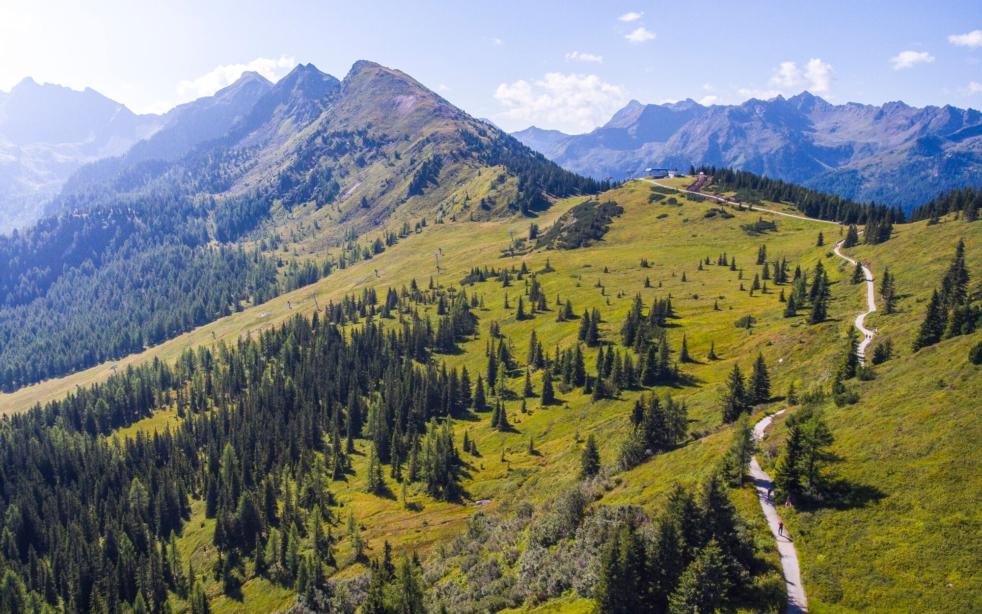
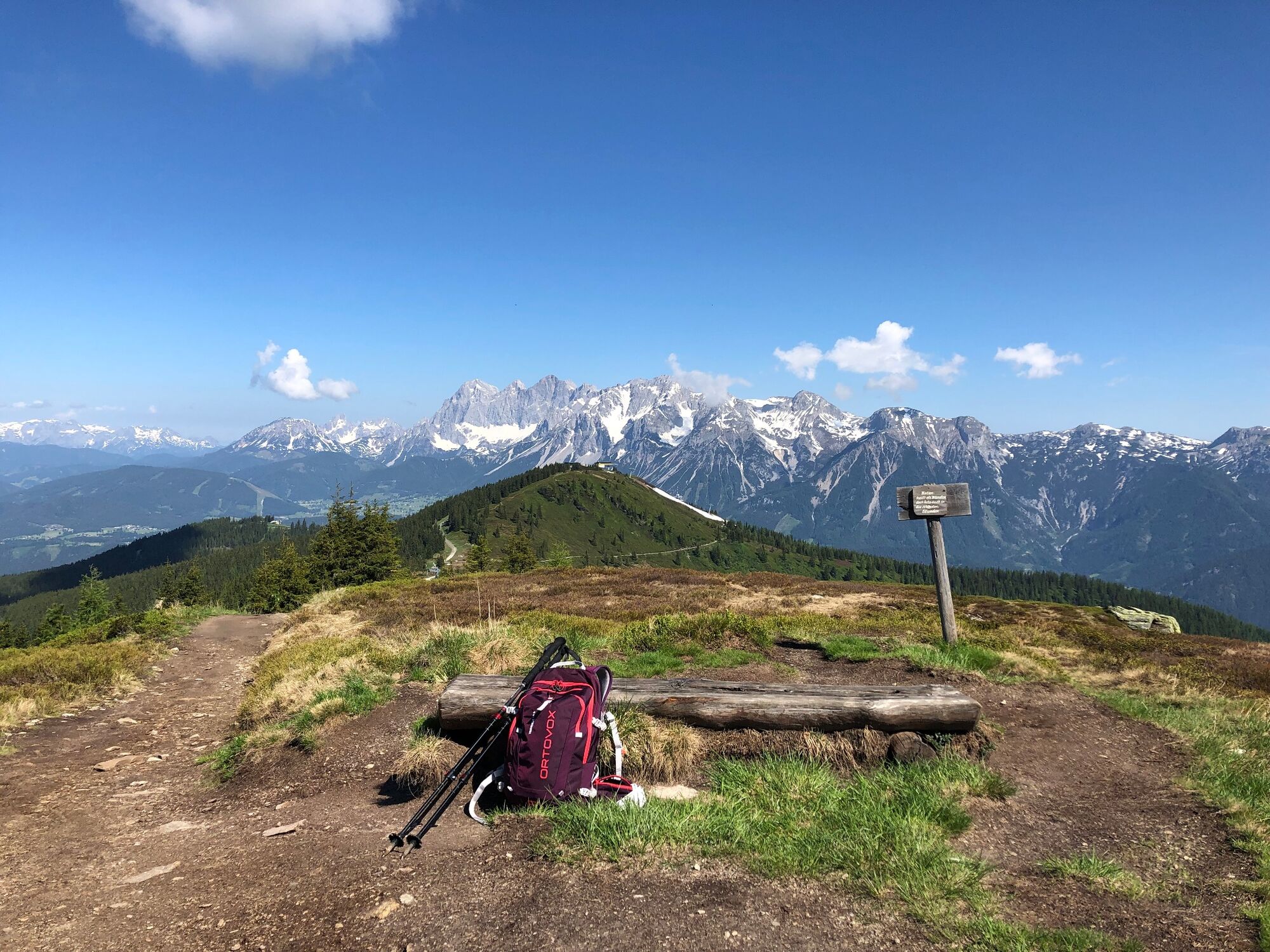
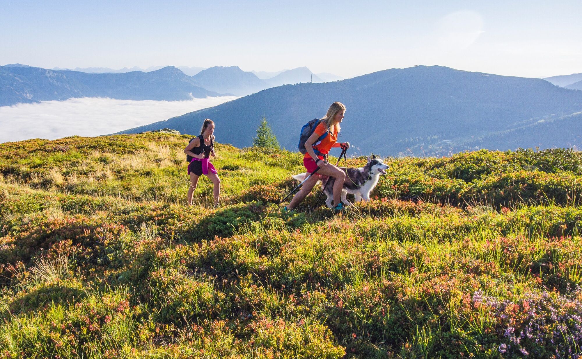
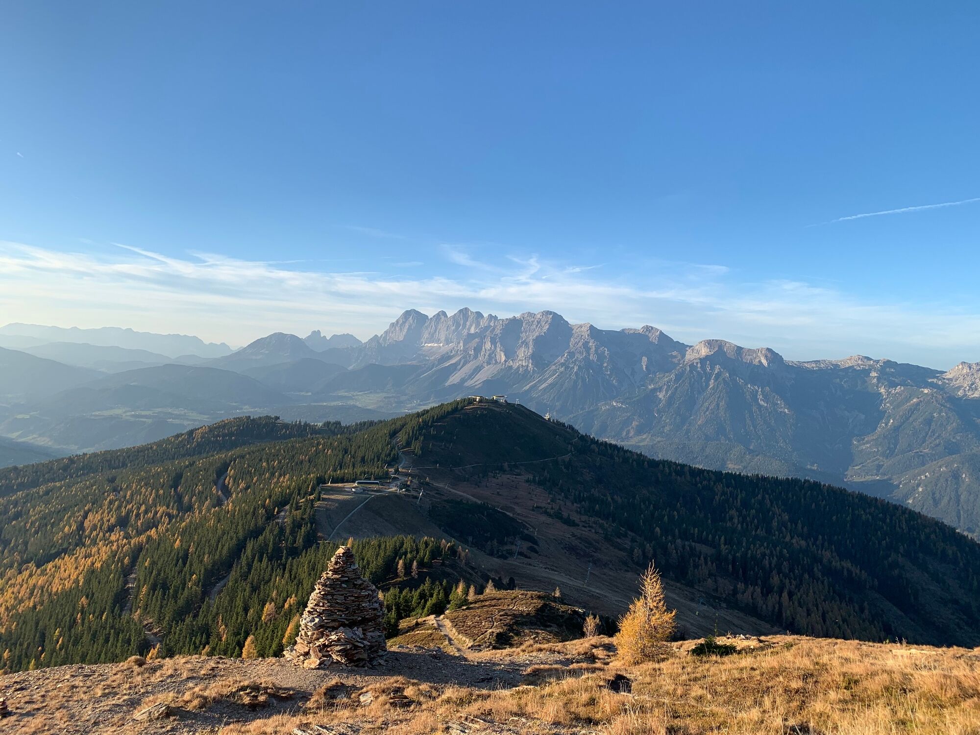
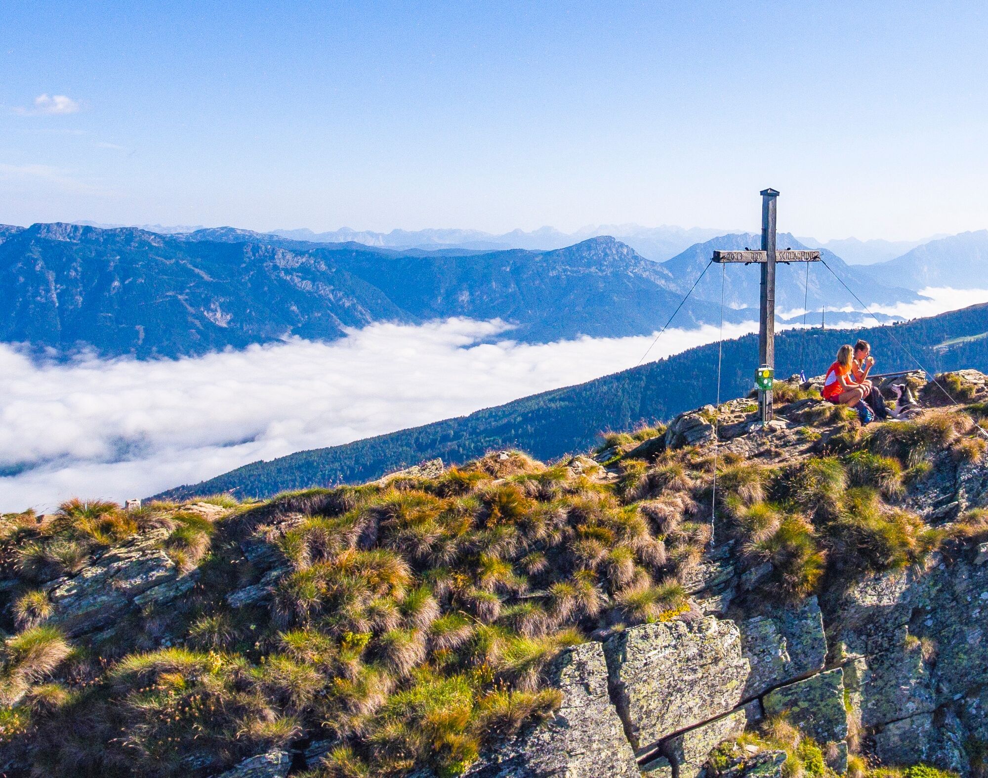
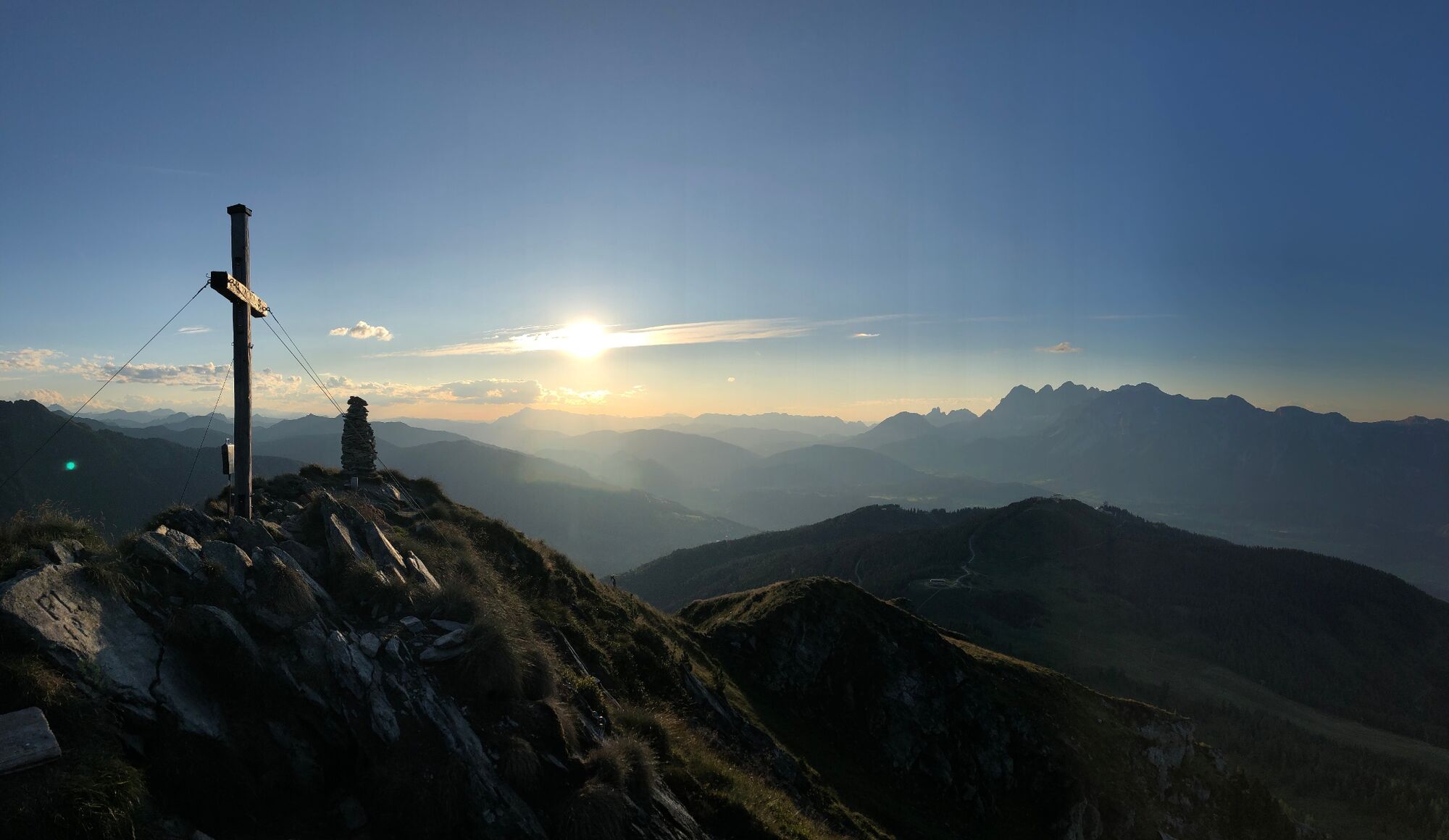
This summit hike lends itself well as a short morning or afternoon hike. On the summit, surefootedness and a head for heights are a must. The views from the Krahbergzinken are unforgettable.
- Difficulty
-
medium
- Rating
-
- Starting point
-
Hiking trail head Planai
- Route
-
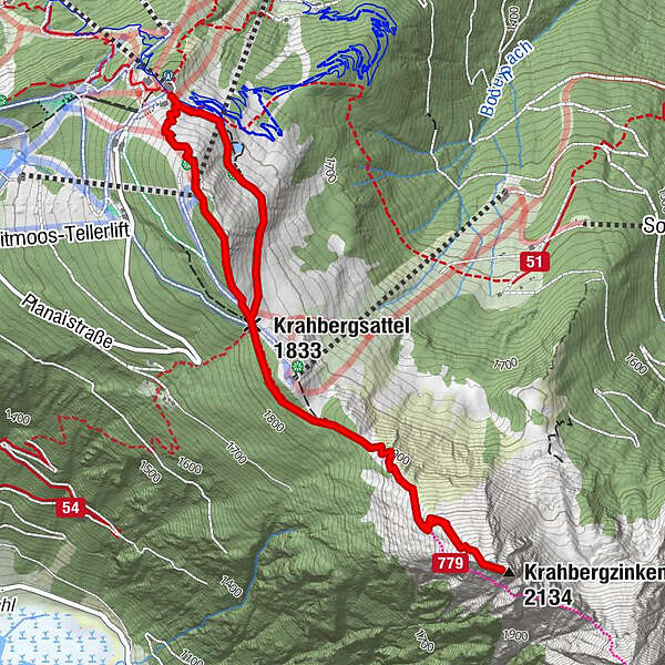
Uschi's Bründl0.5 kmKrahbergsattel (1,833 m)1.0 kmKrahbergzinken (2,134 m)2.7 kmKrahbergsattel (1,833 m)4.3 kmPlanai (1,906 m)4.9 km
- Best season
-
JanFebMarAprMayJunJulAugSepOctNovDec
- Description
-
This summer tour is an ideal half-day programme. Surefootedness and a head for heights are required around the summit. The view from Krahbergzinken is unforgettable. On the way back an alternative via the Planai summit is possible.
Conditions:
mountain trail through switchbacks to the summit, short stretch of forest path
Restaurants:
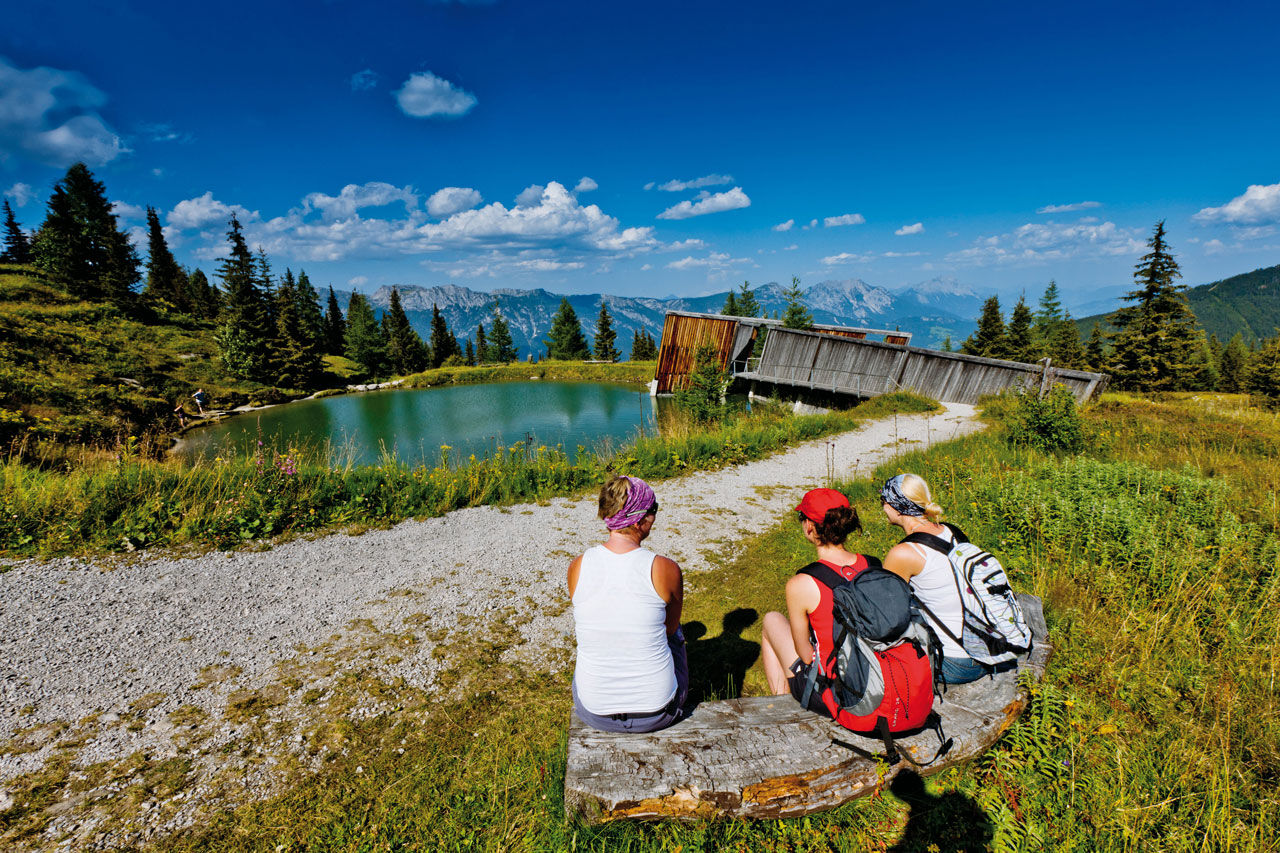
Schladminger Hütte, Schafalm, Planaihof
Highlights:
peak Krahbergzinken
- Directions
-
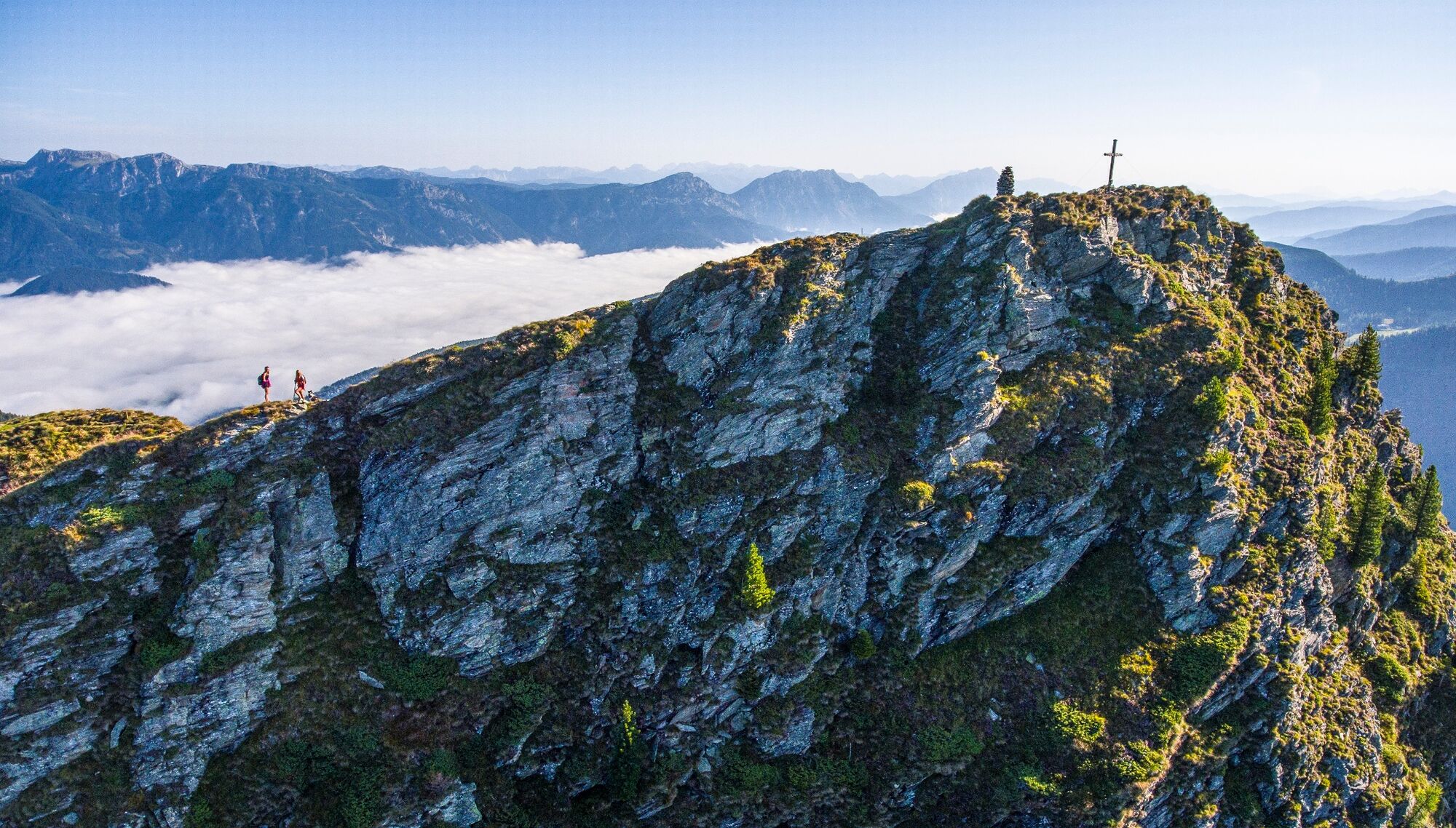
At the mountain lift terminal, head along the “Planai Panoramarundweg” to the trail crossing and follow path No. 779. From there, continue along the timber line to the Krahbergsattel. Now through steep switchbacks, you will hike to the Grosses Steinmandl. Here you will leave the Schladminger Höhenweg, which branches off to the right towards the Preintalerhütte – the hike up the Krahbergzinken leads us straight, as we follow the unmarked trail to the summit. Traversing from the lower peak to the summit cross requires caution – though it is well secured. The impressive panoramas and the open views of Untertal valley are breathtaking.
- Highest point
- 2,105 m
- Endpoint
-
Hiking trail head Planai
- Height profile
-

- Equipment
-
A well-packed backpack is helpful and especially when touring Alpine terrain a tuque, gloves, a windproof jacket and pants are standard equipment. Good, waterproof shoes, sun glasses, sun cream and sufficient beverages are essential too. Torch light, a map of the area, knie and a small first-aid kit should also be in the backpack.
- Safety instructions
-
Traversing from the lower peak to the summit cross requires caution – though it is well secured.
Changes in weather patterns, quick falls in temperature, thunderstorms, wind, fog and snow are some of the dangers that can be encountered on a hiking tour. Hosts of alpine huts and mountain refuges have a lot of experience in the mountains and can give good advice about weather and the trails. Poor equipment, overestimation of one's own capabilities, carelessness, poor personal constitution and/or wrong judgement can lead to critical situations. In case of thunderstorms: avoid summits, ridges and steel ropes.
GPS data and orienteering
Available GPS data - just like hiking maps - is only a guidance for orientation and can never depict a trail exactly with all its details. Especially at dangerous spots it is essential to judge on site how to proceed.
In an emergency please call:
140 - for Alpine emergencies (all over Austria) 112 - European GSM emergency number - Additional information
- Directions
-
Take Planai cable-car from Schladming to the top of Planai. It is also possible to reach the trail head by car via the Planaistraße toll road.
- Public transportation
-
In the town of Schladming you can take the Citybus. From Rohrmoos take the Planai buses to Planet Planai, from Ramsau take the buses of Ramsauer Verkehrsbetriebe.
From there continue with the Planai cable-car.
- Parking
-
Parking is available at the valley terminal of Planai cable-car.


-

-
AuthorThe tour Up the Krahbergzinken is used by outdooractive.com provided.


General info
-
Schladming - Dachstein
3001
-
Schladming - Rohrmoos
1478
-
Schladming
467


