- Brief description
-
A circular hike with forest and meadow character to the highest point of the mountain ridge in the north of Oberzeiring, to the transmitter, and via the Kalvarienberg church back to Oberzeiring.
- Difficulty
-
easy
- Rating
-
- Starting point
-
Center of Oberzeiring
- Route
-
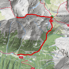
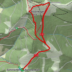
OberzeiringPfarrkirche St. NikolausGasthaus Zum Grüner Specht0.0 kmKalvarienbergkirche4.7 kmPfarrkirche St. Nikolaus6.0 kmOberzeiring6.0 kmGasthaus Zum Grüner Specht6.0 km
- Best season
-
JanFebMarAprMayJunJulAugSepOctNovDec
- Description
-
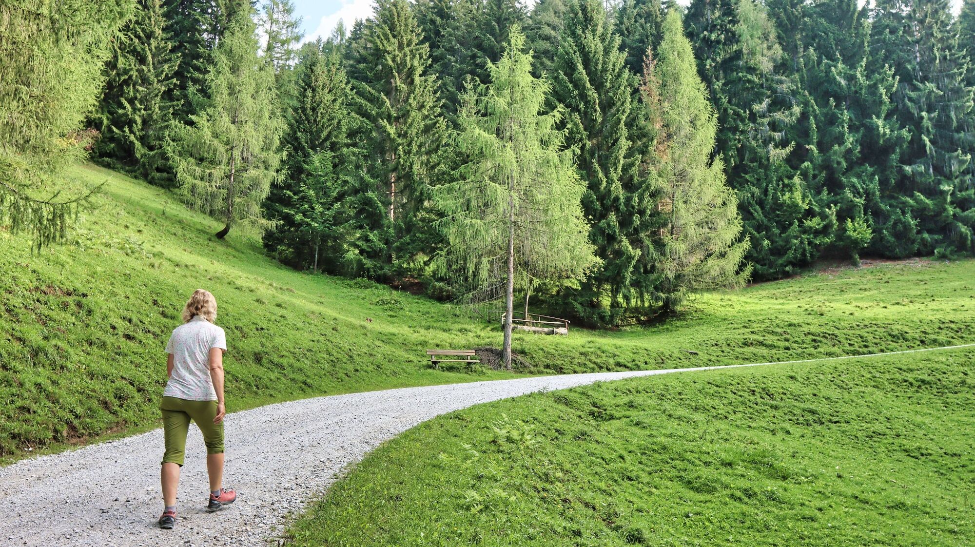
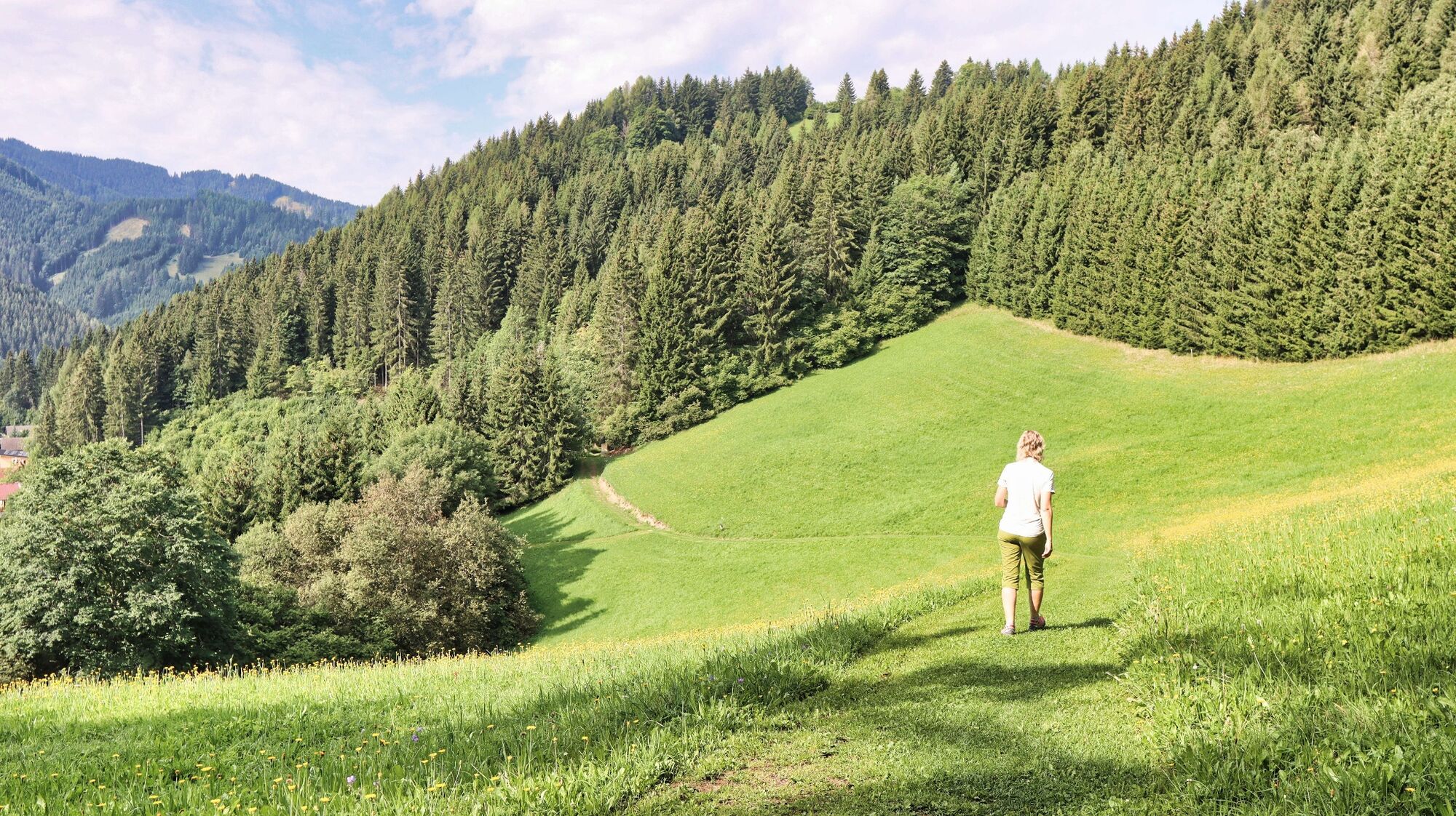
The market town of Pölstal consists of the villages of Bretstein, Oberzeiring, St. Oswald-Möderbrugg and St. Johann am Tauern. The village of Oberzeiring is known for its spa centre, which specialises in the treatment of respiratory diseases. The historic market has also made a name for itself with the show mine and the THEO studio stage. Starting from Oberzeiring, there are numerous local recreational trails that can be used for everything from simple walks to mountain hikes. With the Oberzeiring circular hike to the transmitter, you get to know the wooded mountain ridge in the north of the village. The hiking trail is on gravel roads, forest paths and trails, is well marked and leads along beautiful cultivated areas up to approx. 1300 m above sea level. On the ascent you have a beautiful view of the nearby Lachtal hiking and skiing area, which you can recognise from the wind turbines. A tip on the side: Above the farm vlg. Taurer, hiking trail 7 leads to the Klosterneuburger Hütte, with the option of continuing to the peaks of the Lachtal. On the descent of this circular hike we pass the Calvary Church built in 1860 and the Crucifixion Chapel. Conclusion: A round hike to feel good in the Pölstal region.
- Directions
-
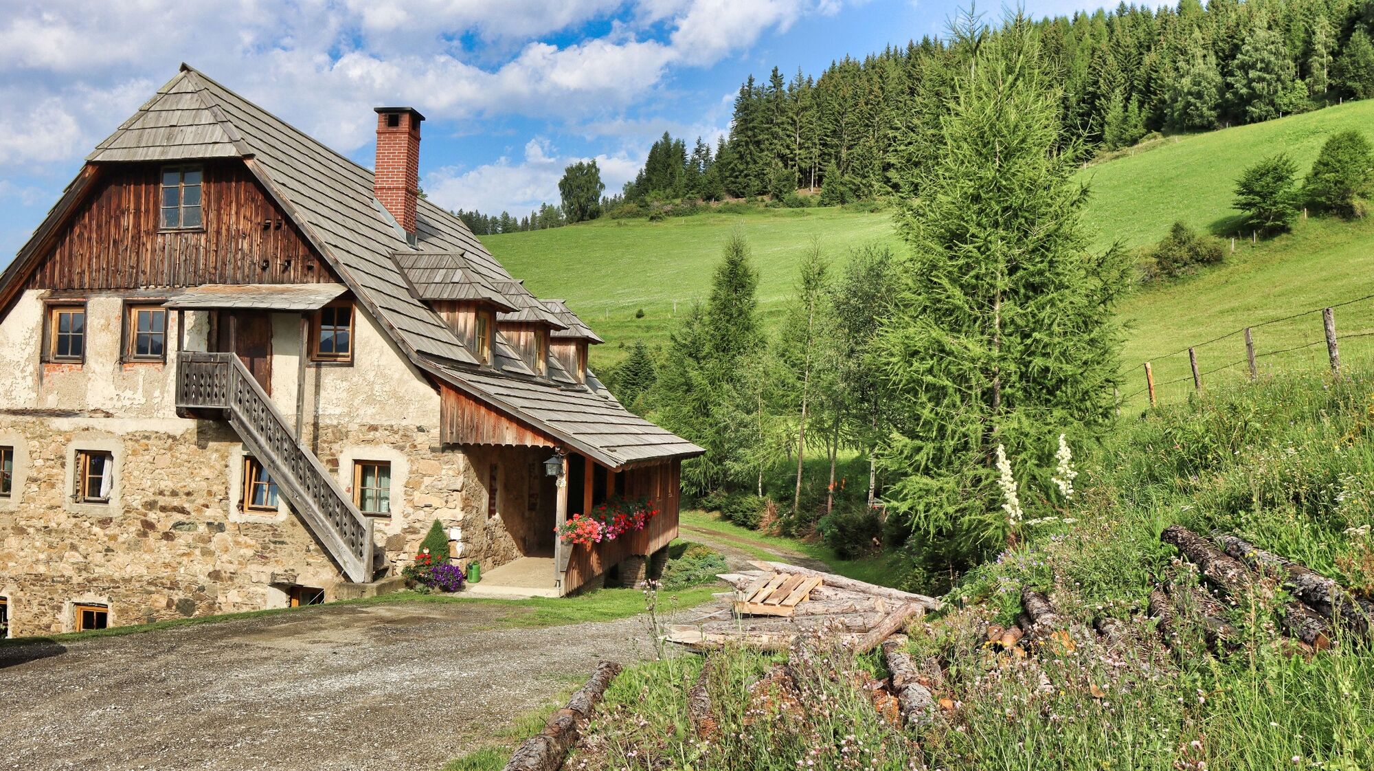
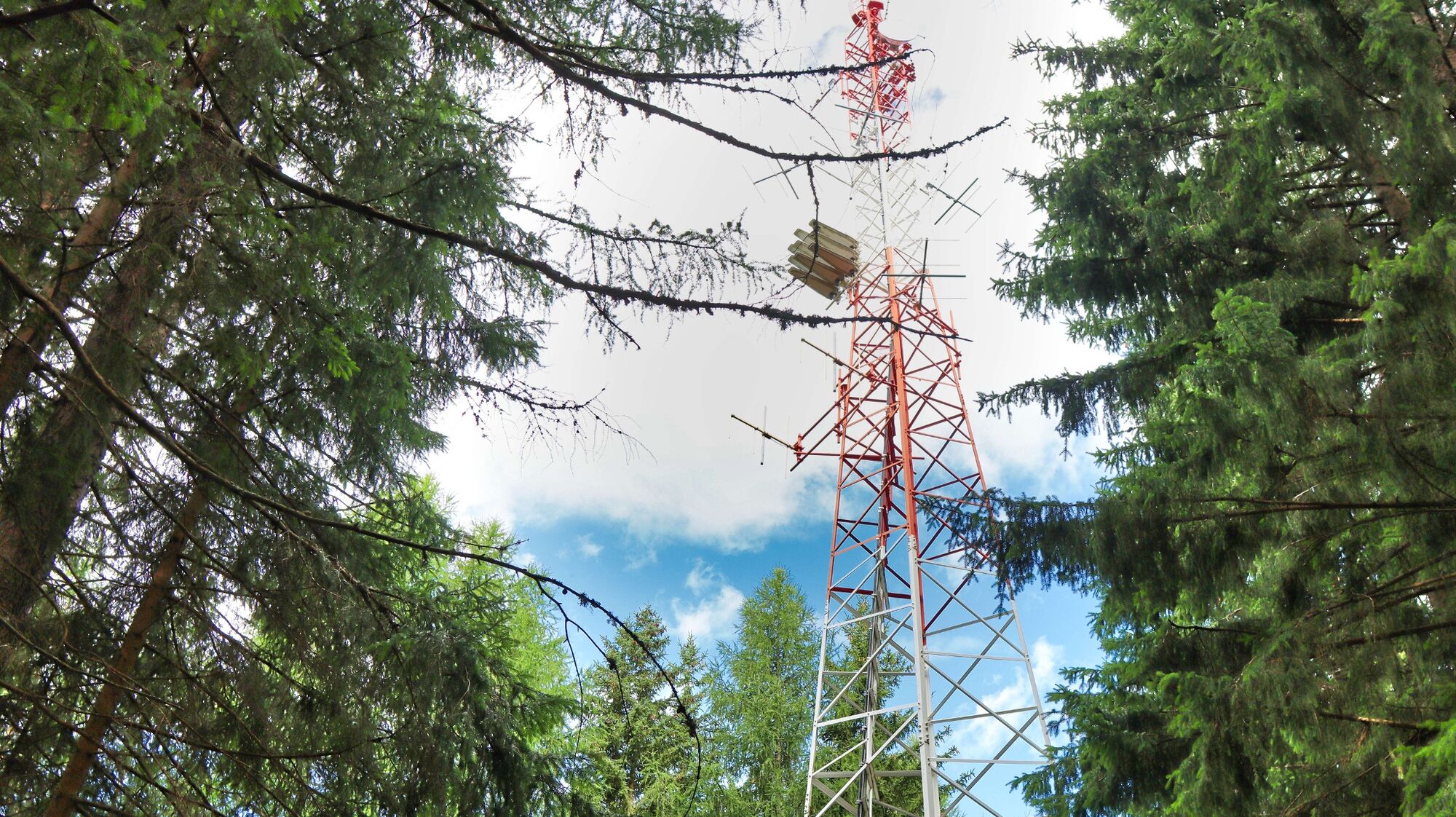
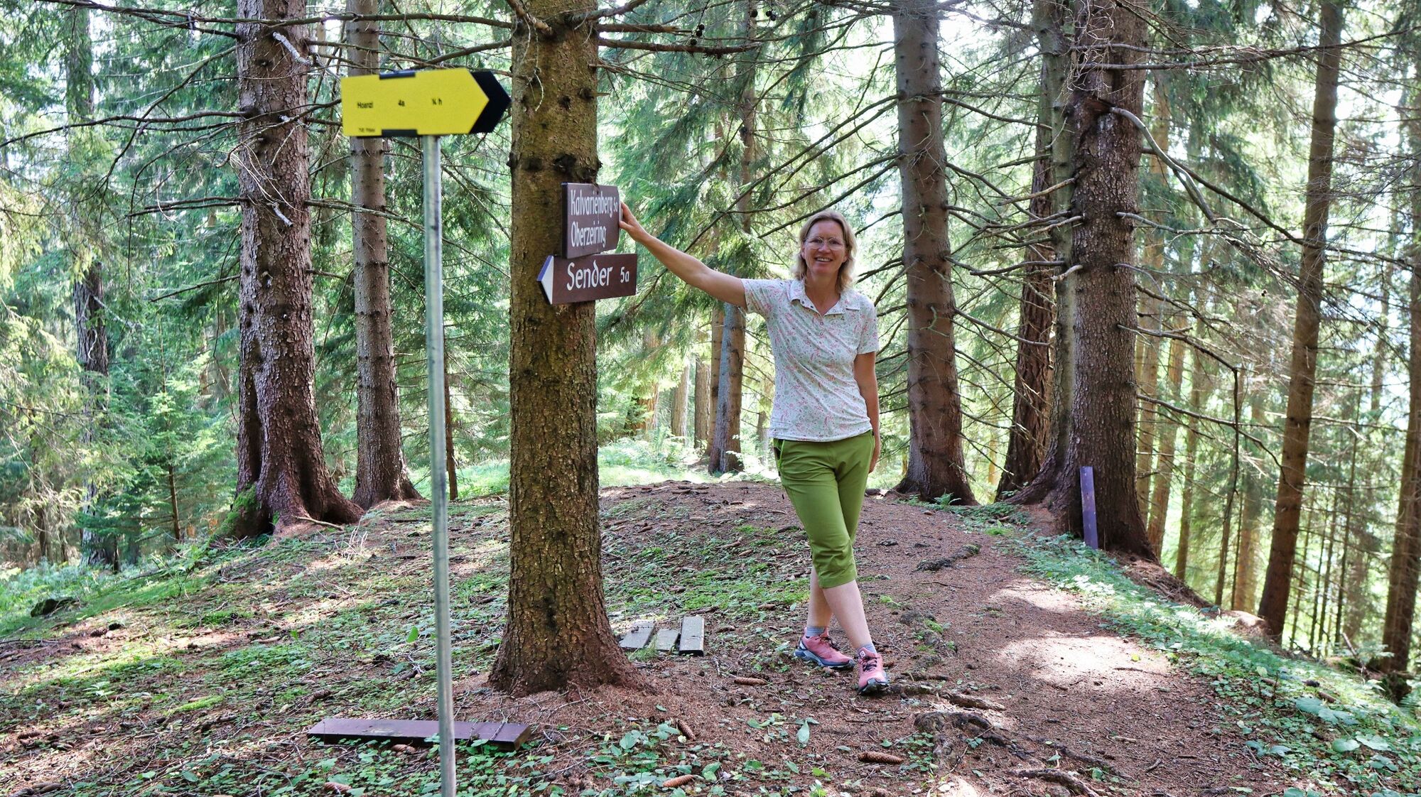
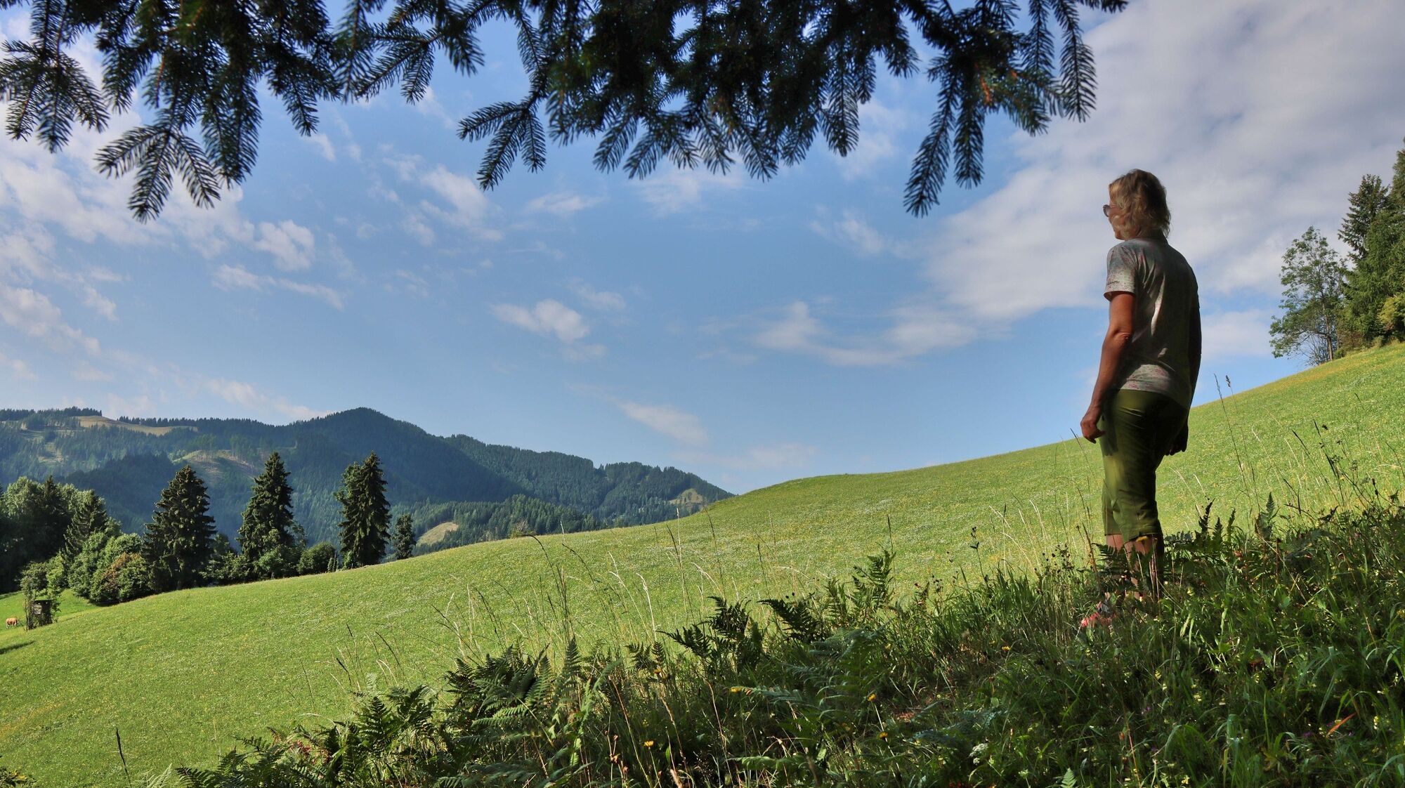
We start in Oberzeiring (1), 932 m, at the information office of the tourist association, walk in the direction of the spa hotel and shortly before turn right onto the Knappenweg. We pass the Oberzeiring health resort and reach the entrance to the historic Silberstollen, where we follow a path uphill to the left. The trail leads to a wide path. Turn right and hike slightly uphill with a view of Oberzeiring. When we reach a gravel road, we turn left and stay on the road (number 5) for the next 1.4 km until we reach the Hoanzl junction. At this junction we continue left, stay on the road and hike comfortably uphill to the farm vlg. Taurer (2), 1200 m. A few more metres uphill and we reach the Möderbrugg / Klosterneuburger Hütte / Sender crossroads. We leave the road and hike right along forest roads and forest paths uphill through the forest to the highest point of this ridge, where the transmitter (3), 1269 m, is also located. The trail is well marked and partly signposted with wooden boards (number 5a). We hike continuously downhill through the partly dense forest until we come to a meadow area and enjoy the view in the direction of Habring. A short distance along the edge of the meadow and further through the forest we come to a turnoff in the direction of the Jausenstation Hoanzl. Continue straight downhill and you will soon reach a large meadow with a view of Oberzeiring and the Kalvarienberg church (4), 1034m. The detour to the church and the Crucifixion Chapel is short and definitely recommended. Behind the church there is a rest area with table and benches. After a leisurely break, we hike downhill across the large meadow area and follow the wide path (number 4) with the Stations of the Cross until we reach the gravel road we already know. From here we follow our ascent path back to Oberzeiring.
- Highest point
- 1,260 m
- Endpoint
-
Center of Oberzeiring
- Height profile
-

- Equipment
-
Backpack with rain cover
Telescopic / hiking poles
Mountain / hiking boots
Headgear / sunglasses
Drinking bottle / thermos flask (on cooler days a warming drink is pleasant) - Safety instructions
-
For a conflict-free coexistence on alpine pastures and meadows it is important to observe a few rules, especially when traveling with dogs. (Source: www.sichere-almen.at - 06/2021)
Avoid contact with grazing animals, do not feed them, keep a safe distance!
Keep calm, do not frighten grazing animals!
Mother cows protect their calves. Avoid encounters between mother cows and dogs!
Always keep dogs under control and on a short leash. If an attack by a grazing animal is foreseeable: Immediately unleash!
Do not leave hiking trails on alpine pastures and meadows!
If grazing animals block the way, avoid them as far as possible!
When grazing animals approach: Stay calm, do not turn your back, avoid the animals!
Leave the grazing area quickly at the first sign of restlessness of the animals!Fences must be respected!
If there is a gate, use it, then close it well and cross the pasture quickly!
Treat the people working here, nature and the animals with respect!
A few tips for correct and fair behavior in the forest: (Source: www.bundesforste.at - 6/2021)
Hikers should avoid visits to the forest about 1.5 hours before sunrise and after sunset, as wildlife is especially active during this time.
Plastic bottles, handkerchiefs, cigarette butts & Co have no place in the forest! Please make sure that you do not leave any trash in the forest.
Camping and making fire - is strictly forbidden in the forest!
In principle, each person is allowed to collect 2 kg of mushrooms and berries per day for personal use in the forest. It is only forbidden if the forest owner expressly forbids it.
Alpine emergency call:
Mountain rescue emergency number: 140
EU emergency number: 112
Weather service: www.zamg.ac.at
Direct link mountain weather Styria: https://www.zamg.ac.at/cms/de/wetter/produkte-und-services/bergwetter/steiermark
- Tips
-
For a short round in Oberzeiring, we recommend the mining theme trail (duration approx. 1 - 1.5 hours).
- Additional information
-
Refreshment and overnight accommodation options:
Gasthof Zum Grünen Specht, Tel.: +43 3571 2238, 8762 Pölstal, Marktplatz 2, www.gruener-specht.at
Further accommodation and inns: www.murtal.at
- Directions
-
From Judenburg via the B 114 in the direction of Hohentauern (19 km, approx. 20 minutes).
From Trieben an der Pyhrn motorway A 9 via the B114 towards Judenburg (33 km, approx. 35 minutes).
- Public transportation
-
Oberzeiring is connected to the public transport network and can be reached by bus.(From Judenburg or Hohentauern approx. 30 minutes).
The exact timetable and general information about public transport in the region: www.verbundlinie.at
- Parking


- Author
-
The tour Oberzeiring - circular hike to the transmitter is used by outdooractive.com provided.