
- Brief description
-
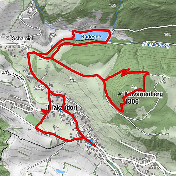
This panoramic exploration tour takes you first to the Calvary, around the bathing lake and then through the beautiful village.
- Difficulty
-
easy
- Rating
-
- Starting point
-
Infopoint Krakaudorf
- Route
-
Scharnigl0.3 kmKalvarienberg (1,306 m)1.3 kmKalvarienbergkapelle1.4 kmBuffet am Badeteich Krakaudorf3.5 kmPfarrkirche hl. Oswald4.4 kmErlebnispension Guniwirt5.4 kmKrakaudorf5.5 km
- Best season
-
JanFebMarAprMayJunJulAugSepOctNovDec
- Description
-
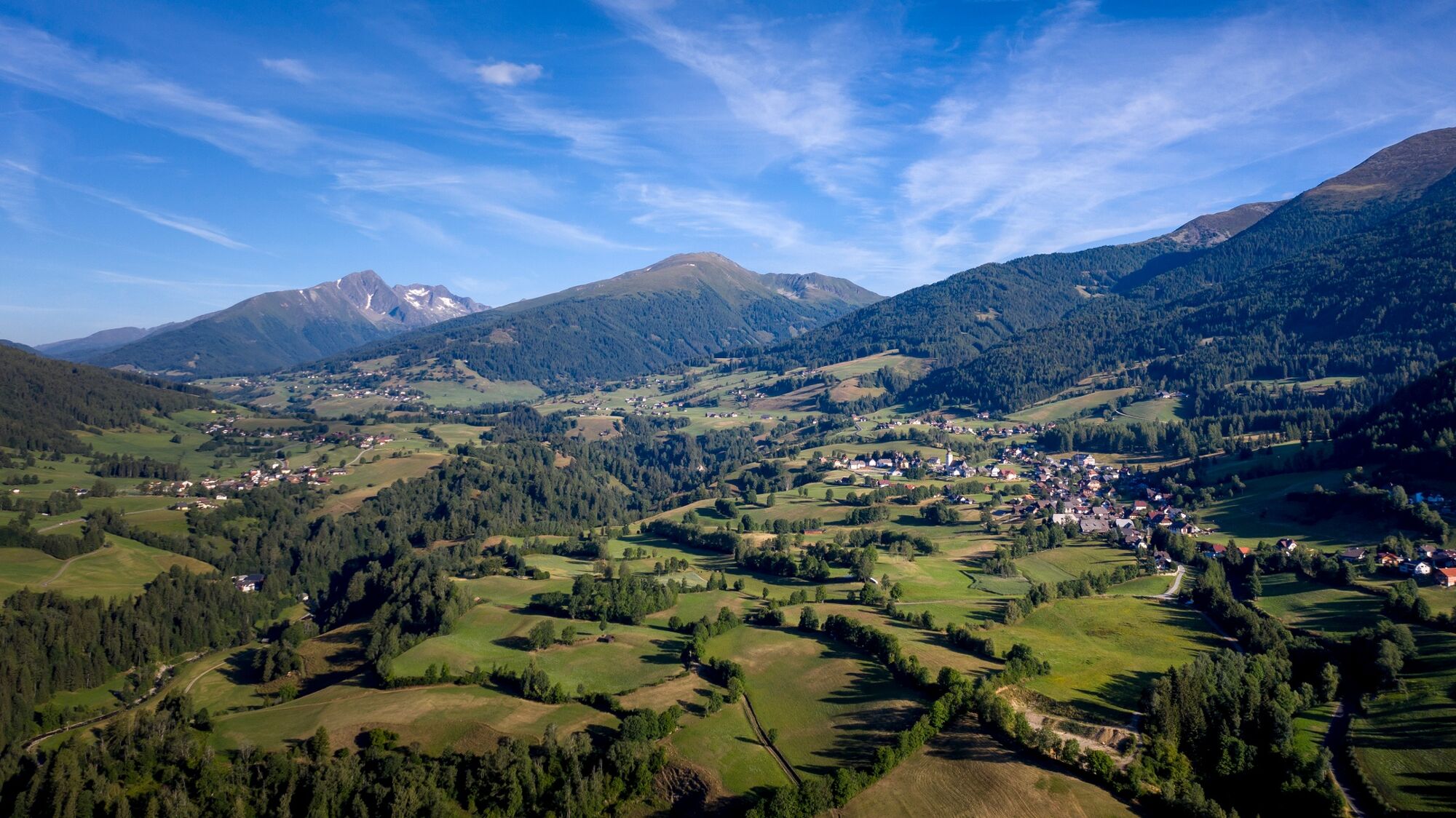
Get to know Krakowdorf on a leisurely hike and discover one or two hidden secret places. Krakaudorf particularly scores points with its wonderful panoramic landscape, worthwhile excursion destinations and friendly businesses and locals.
- Directions
-
Start at the info point, from there to the municipal office here heading north to the turnoff to the bathing lake or to the Kalvarienberg. Pass the first station of the Way of the Cross, along the forest road, then turn left onto the footpath towards Kalvarienberg. From the chapel with a wonderful view back to the fork - keep left here until you reach a forest clearing with a bench. Now the path turns to the west and leads to a forest path to the forest road near the first station of the Way of the Cross.
Along the forest road to the junction (bench) towards the swimming lake. Continue on the forest road to the swimming lake. Enjoy the tour around the beautiful swimming lake. Now back along the forest road and from here take the same route back towards the municipal office. (A shortcut possible before the saw through the larch forest). At the municipal office, take the street on the right to the church. Through the cemetery gate (main gate), then keep left and through a small gate past the football field and turn left onto the path. Follow the residential area to the state road, turn right here, a few meters further on you will find the village museum on the right (open on Wednesdays from around mid-May to October, also on Sundays in the summer months). Then along the state road back through the town to the starting point. The gemstone garden and the mineral museum are located in the center of the town near GH Guniwirt.
- Highest point
- 1,296 m
- Endpoint
-
Infopoint Krakaudorf
- Height profile
-

- Equipment
-
Good shoes
Sun protection
Sufficient food - Tips
-
Especially worth seeing is the beautiful view of the entire Krakow from Calvary .
Other places of interest during this village hike are:
the parish church Krakaudorft he village museum the gemstone garden and the mineral museum - Additional information
-
The tour can be hiked all year round.
- Directions
-
East: From Vienna on the A 2 and S 6 to Leoben and St. Michael i. d. E., continue on the S 36 to Judenburg and on the B 96 to Murau. From Murau via Ranten to Krakau. From Graz on the A 9 to St. Michael i. d. O.. Further see above.
West, North: From Bregenz/Innsbruck via the A 12, A 93 and A 8 to Salzburg. From Salzburg on the A 10 to St. Michael im Lungau. From here on the B 96 to Tamsweg and further towards Murau via Sauerfeld to Krakau.
South: From Klagenfurt on the B 83 to Scheifling. Then take the B 96 to Murau and on to Krakau.
- Public transportation
-
With the BusBahmBim app from the composite line, timetable information is easier than ever before: all bus, train and tram connections in Austria can be queried by entering locations and/or addresses, stops or important points. The app is available as a free app for smartphones (Android, iOS) - on Google Play and in the App Store.
- Parking
-
Parking spaces are available directly at the info point.


- Author
-
The tour Krakauer village loop road is used by outdooractive.com provided.