- Brief description
-
The alpine single trail on narrow climbs and paths is peppered with 5 gifpeln and technical trails.
- Difficulty
-
difficult
- Rating
-
- Starting point
-
Mountain rescue hut Planneralm
- Route
-
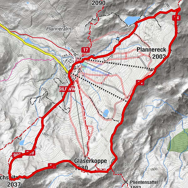
Bergrettungshütte0.1 kmPlannereck (2,003 m)2.5 kmKleiner Rotbühel (1,912 m)3.7 kmGroßer Rotbühel (2,019 m)4.5 kmGläserkoppe (1,980 m)5.1 kmJochspitze (2,037 m)5.9 kmGoldbachscharte (1,960 m)6.2 km
- Best season
-
JanFebMarAprMayJunJulAugSepOctNovDec
- Description
-
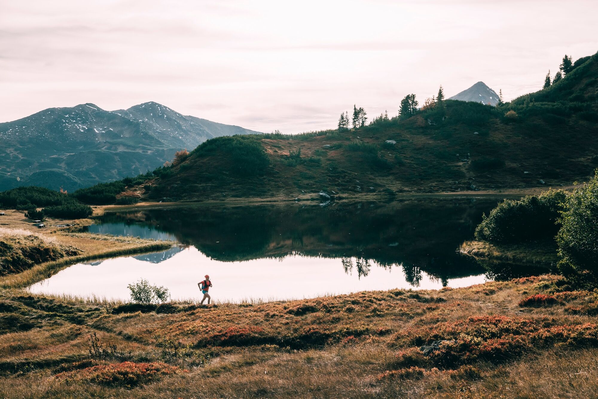
The starting point in the highest mountain village in Styria is at 1,600 meters. The first highlight is the Plannersee lake. From here it's over single trails up to the Plannerknot and then always along the ridge. Several summits are on the program and give each time the opportunity to enjoy the panoramic view from new perspectives. Several descents allow trail running in the modular principle.
- Directions
-
Trail number: 9
- Highest point
- 2,023 m
- Endpoint
-
Mountain rescue hut Planneralm
- Height profile
-

- Equipment
-
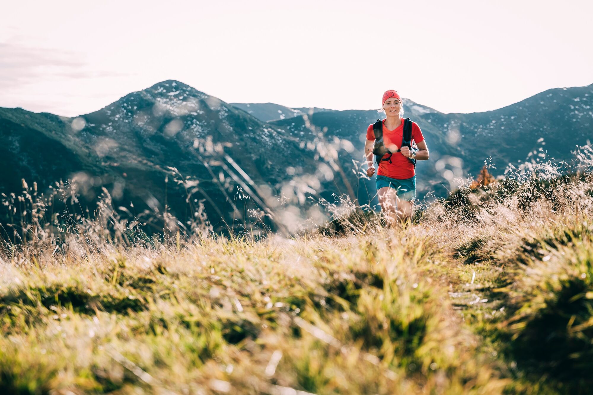
Trail running shoes - no asphalt running shoes
Running backpack or vest depending on the length of the tour hydration bladder or softflasks
thin windbreaker
first aid kit, including emergency blanket
cell phone
energy bar
money
change of shirt
Headband
Sunglasses - Safety instructions
-
Plan your trail in advanceInform yourself about the course of the trail and its demands
Pay attention to weather forecasts and weather changes
Let others know where you are going
Adapt your equipment to the weather and the trail
Be aware of livestock when crossing pastures - Tips
-
At the Kothüttensee to finish the soul dangle or wnn still time and energy is left, the Karlspitze offers as an extension +2.3km +130hm
- Additional information
-
Tourism information: www.schladming-dachstein.at
Tourism blog: www.derbergdastal.at
www.schladming-dachstein.at/de/Sommer/Wandern-und-Bergsport/Laufen-und-Trailrunning
Tourist Office Schladming-Dachstein
Ramsauerstrasse 756
8970 Schladming
T: +43 3687 23310
Garbage on meadows and paths can not smell mountain and valley. Please take it with you. Agriculture and forestry are important partners for Berg und Tal. They allow you to walk and drive on many of their paths. Be aware that only good cooperation will guarantee your recreational enjoyment in the future.
- Directions
-
Coming from the B320, at the Trautenfels intersection in the direction of Irdning. Then in the direction of Donnersbach. In the village turn left in the direction of Planneralm and follow the 12 km long and toll-free mountain road.
- Parking
-
Free at the Planneralm.


-

-
AuthorThe tour Summit Trail Planneralm is used by outdooractive.com provided.