
- Brief description
-
Welcome to the VIA NATURA - a long-distance hiking trail with a length of around 130 km.
- Difficulty
-
medium
- Rating
-
- Starting point
-
Gasthaus Fischerwirt, Zeutschach
- Route
-
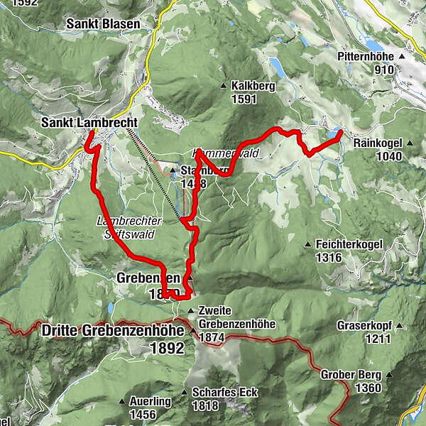
Fischerwirt0.0 kmZeutschach1.7 kmGasthaus Schönanger4.9 kmGrebenzenhaus7.1 kmGrebenzen (1,870 m)8.9 kmDreiwiesenhütte9.4 kmMarktkreuz15.4 kmStifterl15.7 kmMarktcafé15.7 kmSankt Lambrecht15.8 kmTorwirt15.8 km
- Best season
-
JanFebMarAprMayJunJulAugSepOctNovDec
- Description
-
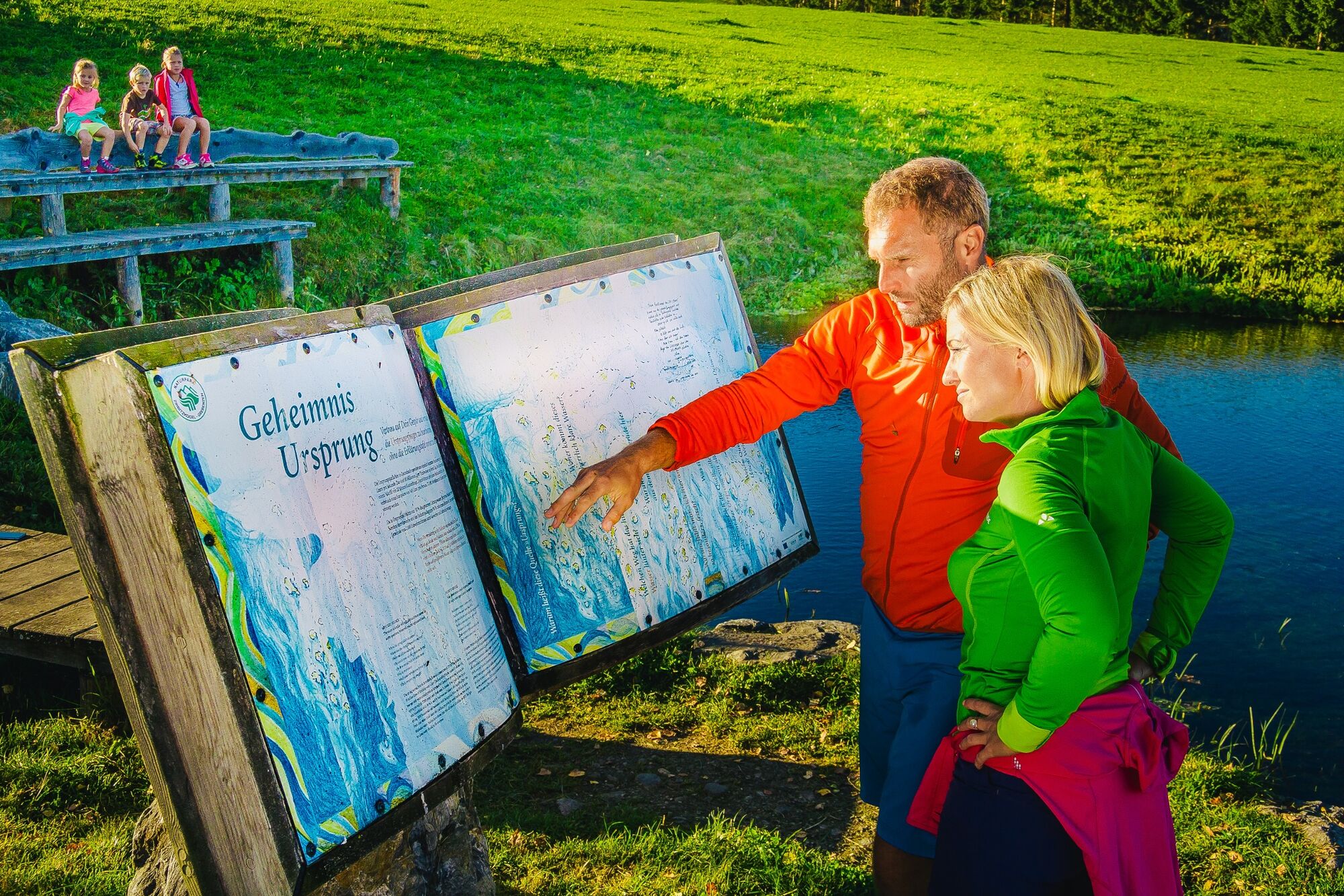
Learn the great secrets of life-giving water at the Grasluppteichen and realize that the principle of the water cycle and the water movements that you can observe in the outside world also occur within you.
For thousands of years, wise people have taught us that nature is a great book from which we can learn infinitely much. But instead of reading the book of nature, we listened to everything else and spurned the infinite intelligence of Mother Earth. Via Natura wants to bring people closer to nature and nature to people again.
- Directions
-
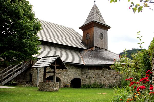
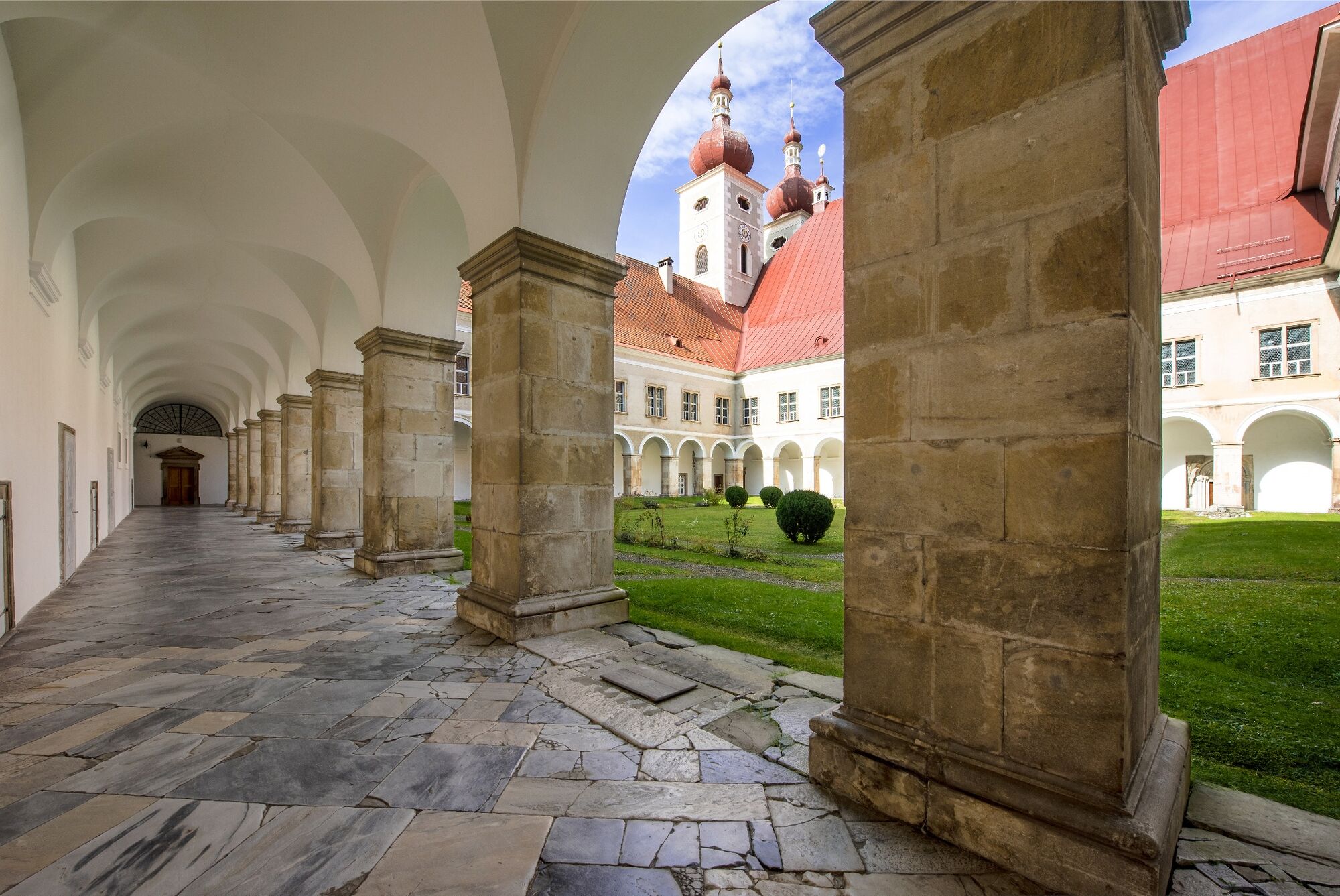
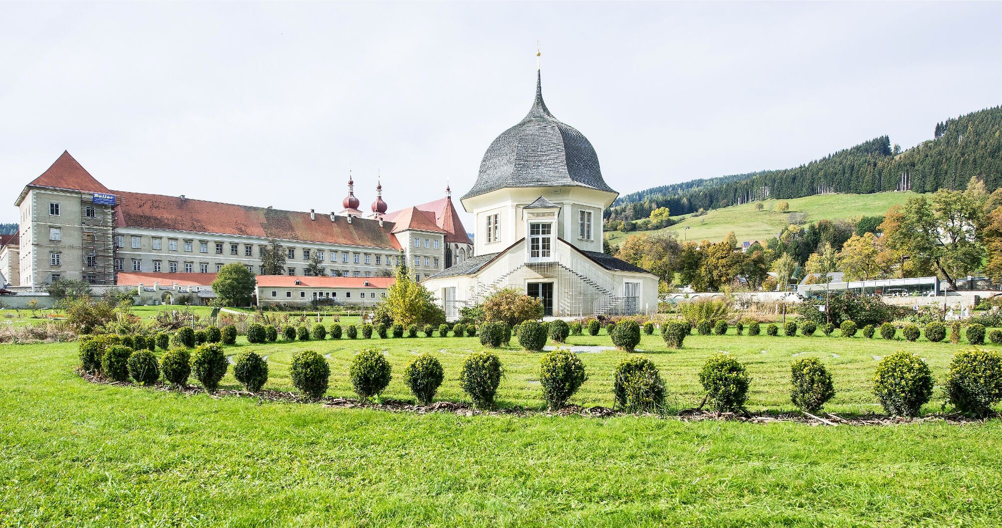
Wiesen und Wäldern mit schönen Ausblicken auf den Zirbitzkogel zur Wallfahrtskirche Maria Schönanger. Weiter geht man leicht bergauf in Richtung Grebenzenschutzhaus und weiter zur 1. Grebenzenhöhe (1.870 m), die einen einzigartigen Einblick in den Naturpark und einen unendlich weiten Ausblick nach Süden und Nord-Westen bietet. Man geht weiter zur Dreiwiesenhütte. Wenn man noch Engerie haben, kann man durch einen Lärchenwald zur 2. Grebenzenhöhe (1.874m) wandern, die sich als flach geformte Kuppe präsentiert und einen Rundumblick auf die faszinierende Bergwelt freigibt. Durch den Stiftswald und über den bergab führenden Pfaffentritt, der vor Jahrhunderten bereits von den "Pfaffen" der Region genutzt wurde, geht man Richtung St. Lambrecht, dessen schönes Ortszentrum mit dem imposanten Benediktinerstift St. Lambrecht schon am Weg dahin zu bewundern ist. Die Etappe endet in St. Lambrecht beim Stift.
clear
977 / 5.000
Übersetzungsergebnisse
Übersetzung
Via the small town center in Zeutschach, the path leads along meadows and forests with beautiful views of the Zirbitzkogel to the Maria Schönanger pilgrimage church. You continue slightly uphill towards the Grebenzenschutzhaus and on to the 1st Grebenzenhöhe (1,870 m), which offers a unique insight into the nature park and an infinitely wide view to the south and north-west. You continue to the Dreiwiesenhütte. If you still have energy, you can hike through a larch forest to the 2nd Grebenzenhöhe (1,874m), which presents itself as a flat hilltop and offers a panoramic view of the fascinating mountain world. Through the Stiftswald and over the downhill Pfaffentritt, which was used by the region's "priests" centuries ago, you go towards St. Lambrecht, whose beautiful town center with the impressive Benedictine monastery of St. Lambrecht can be admired on the way there. The stage ends in St. Lambrecht near the monastery.
- Highest point
- 1,855 m
- Endpoint
-
Abbey St. Lambrecht
- Height profile
-

- Equipment
-
Good shoes
Sun protection
Possibly food - Additional information
-
The ideal time for this tour is from April to October.
- Arrival
-
By car from Germany
From Munich via the A8 towards Salzburg. From Salzburg on the A10 Tauernautobahn to St. Michael im Lungau. On the B 96 to Tamsweg, then on the B 95 to Predlitz. The B 97 leads via Stadl/Mur to Murau. There at the roundabout towards St. Lambrecht to Murauer train station and further towards St. Lambrecht. Via Laßnitz near Murau you reach St. Lambrecht, which is already in the nature park. From there continue towards Mariahof and Neumarkt. In Neumarkt towards the train station, past it towards Zeutschach. The hiking starting point is in Zeutschach near the Grasluppteichen.Arrival from Eastern Austria/Hungary
At the motorway junction in St. Michael near Leoben, take the S 36 towards Klagenfurt. Past Knittelfeld and Judenburg to Scheifling. In Scheifling continue towards Klagenfurt to Neumarkt, via Unzmarkt and Perchau am Sattel you reach Neumarkt. In Neumarkt towards the train station, past it towards Zeutschach. The hiking starting point is in Zeutschach near the Grasluppteichen.Arrival from southern Austria/Italy
Via Klagenfurt on the B 83 past St. Veit/Glan, Treibach and Friesach. In Friesach continue towards Vienna, via Dürnstein and Wildbad to Neumarkt. In Neumarkt towards the train station, past it towards Zeutschach. The hiking starting point is in Zeutschach near the Grasluppteichen. - Public transportation
-
With the BusBahnBim app from the interconnected line, timetable information is easier than ever before: all bus, train and tram connections in Austria can be queried by entering locations and/or addresses, stops or important points. The app is available as a free app for smartphones (Android, iOS) - on Google Play and in the App Store.
- Parking
-
Public parking spaces are available at the Gasthaus Fischerwirt.


- Author
-
The tour Via Natura Stage 3: The nature of water is used by outdooractive.com provided.