Bruderkogel, the often stormy brother at the origin of the Pölstal valley


- Brief description
-
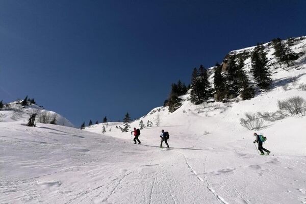
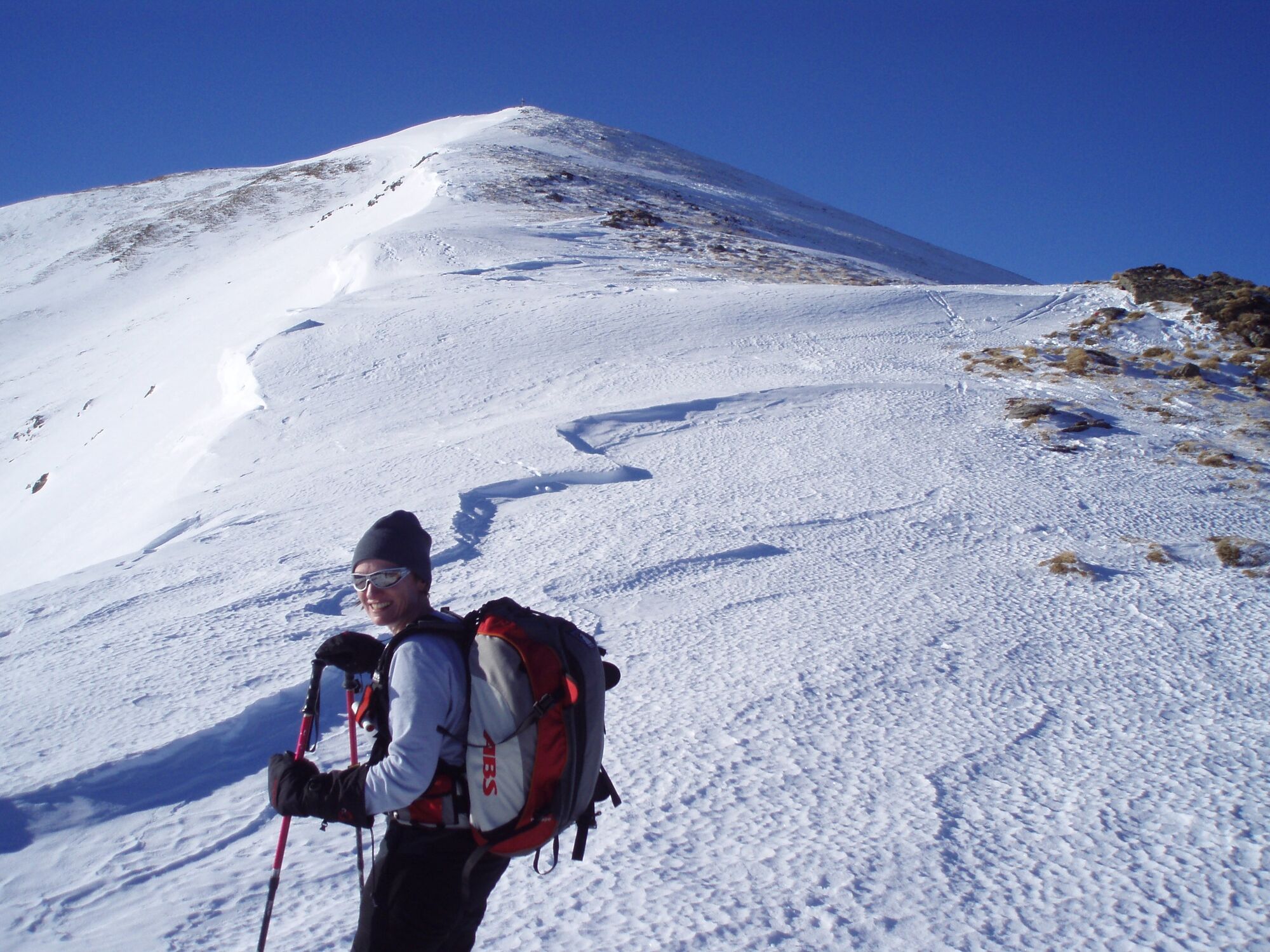
The trail leads through the forest until a beautiful cirque opens up above the tree line. The hilly terrain leads to the western ridge, which leads to the summit of the Bruderkogel.
- Difficulty
-
medium
- Rating
-
- Starting point
-
Parking lot entrance Pölsen
- Route
-
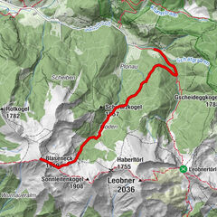
Lackneralm5.5 kmBruderkogel (2,299 m)7.1 km
- Best season
-
AugSepOctNovDecJanFebMarAprMayJunJul
- Description
-
From the parking lot, take the forest road into the Pölsen. The lower part of the tour leads through the forest belt, at the beginning the summer ascent to the Bruderkogel is used. The route leads through sparse forest to the Lackneralm. You then follow another narrow cart track that leads into a wide cirque. The route is rather flat along the cirque floor until you find a good passage to the left across the slopes for the ascent to the western ridge of the Bruderkogel. There are several options over hilly terrain. Once on the ridge, the tour leads along the ridge to the summit.
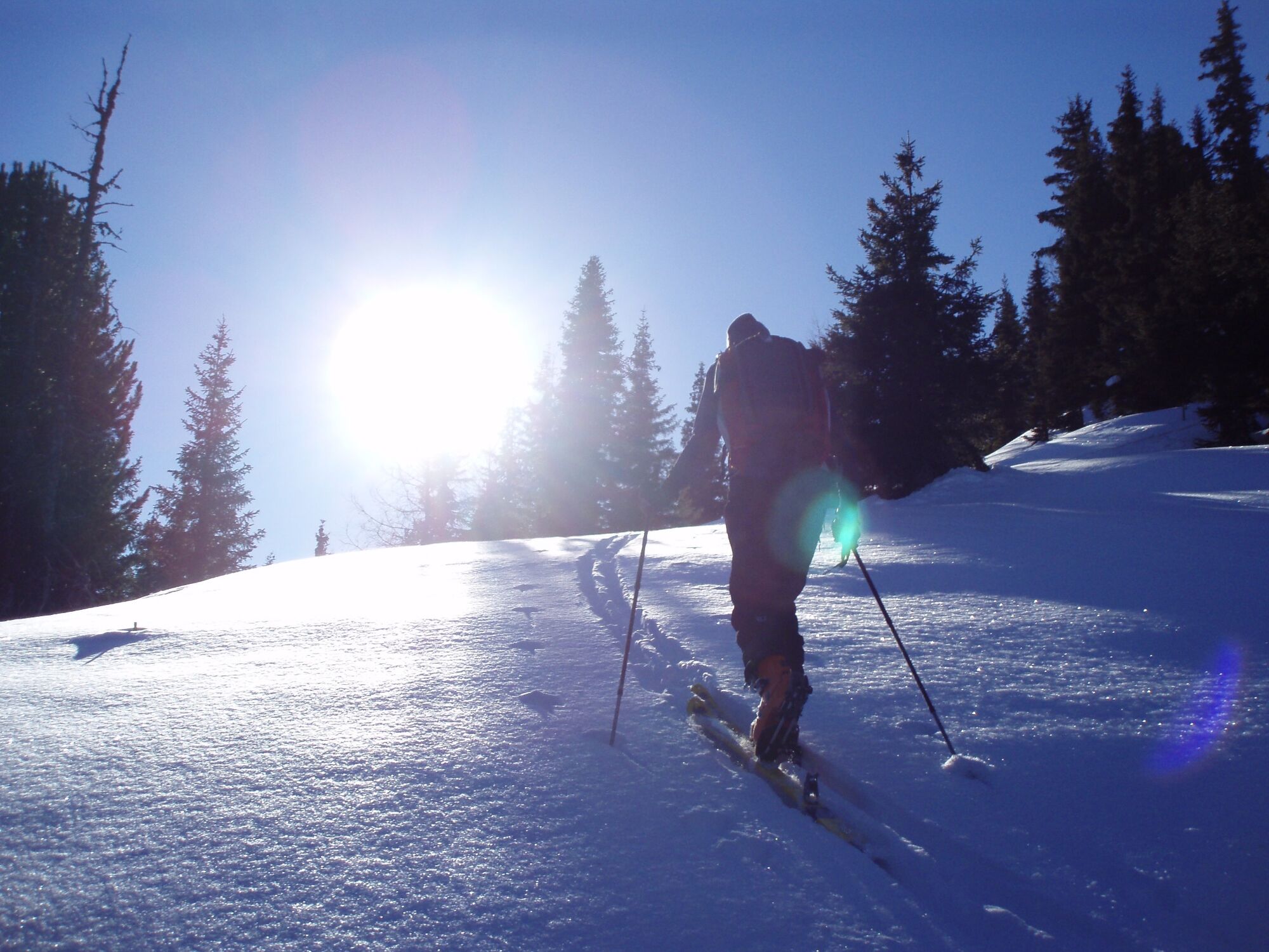
The ski tour to the Bruderkogel is very rewarding in good conditions. You cross the forest belt on paths and roads. Once in the cirque, follow the trail on flat terrain. Look for a good track on the slope from the cirque floor to the ridge crest. Sometimes the slope is blown off. Then the track is particularly important to avoid the hollows with drifting snow.
- Directions
-
The car is parked in the parking lot, which is already visible from the B114 main road. Driving is prohibited from here. Now follow the forest road, which initially leads slightly downhill. Sometimes it is better to carry your skis here. Passing a few houses on the left-hand side, take the left-hand road at the fork, which leads over the bridge. It is advisable to put your skis on now if the forest road is not open. After about 600 m on the forest road, follow the summer path, which points SW (left). After crossing the small stream, follow it further along the left bank in the direction of the ascent until you reach a forest road again at about 1440m. Follow this in the direction of Lackneralm (hut). Leave the hut on the right and follow the forest path that begins south of the hut and after about 150 m, with a distinctive right-hand bend, leads fairly flat in a westerly direction south of the Lackneralm stream. At around 1600 m, you climb a few meters in altitude over a clearing, not very steeply in a southerly direction and soon afterwards ascend again in a westerly direction and thus to the wide cirque (also known as Lackneralm). In this area, the gullies and hollows that you have to cross up to the cirque are very difficult to negotiate.Be aware of the risk of avalanches. Once you reach the Lackneralm cirque, head into the cirque on flat terrain up to around 1900 m and then find a good ascent track on the slopes to the left (heading SW). There are many small ridges and hollows here, which you should make good use of on the ascent. Due to the frequent strong winds, there are often drift snow deposits on these slopes of the Bruderkogel. Ascent and descent routes should be chosen carefully. Once you reach the western ridge of the Bruderkogel, the route leads eastwards to the summit of the 2299 m high Bruderkogel. Descent as ascent.
- Highest point
- 2,291 m
- Endpoint
-
Bruderkogel
- Exposition
- Height profile
-

- Equipment
-
Emergency equipment: Burial tool, shovel, probe. First aid kit, 2 man bivy sack, tape, headlamp Signal cartridges, storm fuse, candle Tools (Leatherman) Wax for skis and/or skins
crampons Thermos bottle or normal drinking bottle Clothes, suitable for the weather Gloves, spare gloves Hood sunscreen, sunglasses, goggles topographic map of the area GPS drink, food - Safety instructions
-
Gib jemanden dein Tourenziel mit der geplanten Rückkehr bekannt.
You are in alpine terrain on every ski tour, therefore alpine dangers must be taken into account.
Consistent tour planning is required for every tour:
Weather report: www.zamg.at , www.alpenverein.at , www.yr.no
Avalanche situation report: www.lawine.at
The avalanche situation always depends on the current conditions. Ascent and descent tracks must be carefully planned and selected.
Avalanche seminars, ski technique courses for ski tourers and guided tours:
Pay attention to possible information boards on site, observe wildlife rest zones!
Let someone know your tour destination and the planned return.
- Tips
-
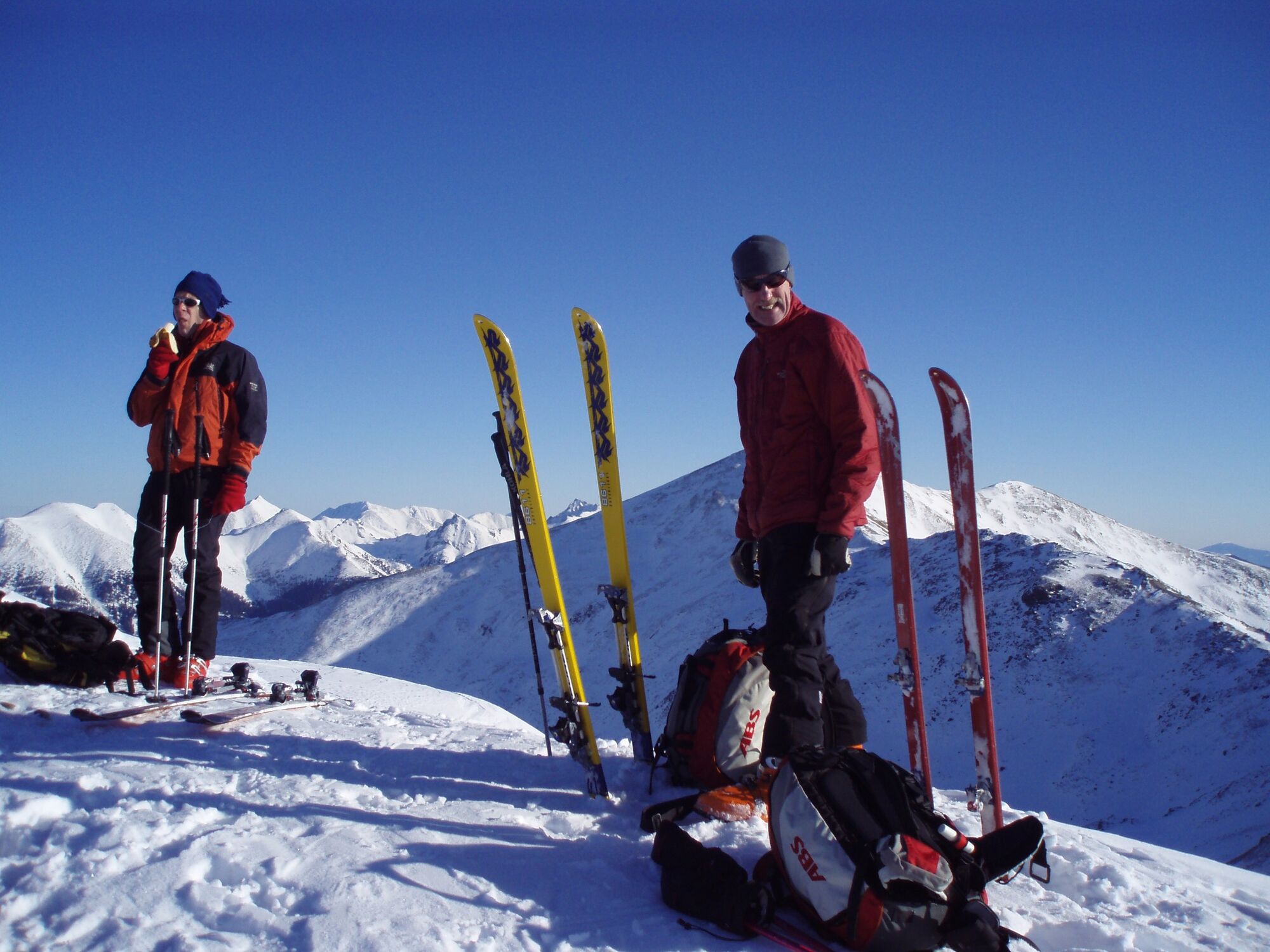
A rest in the magnificent cirque is recommended.
If the slopes of the Bruderkogel are blown off, you can choose the Schüttnerkogel as your tour destination.
- Additional information
- Directions
-
From the north
On the A9, the Pyhrnautobahn, take the Trieben exit. From there take the B 114 in the direction of Judenburg to Hohentauern.
3.5 km after the end of Hohentauern in the direction of St. Johann, the road to the right (direction W) leads into the Pölsen. The parking lot is located right after the junction at the beginning of the forest road.
From the south
Via the S36, the Murtalschnellstraße to Judenburg, continue on the B 317 to the junction with the B114 towards Liezen. Follow the road towards Hohentauern for about 35 km. 3.5 km before the village of Hohentauern, turn right (direction W) into Pölsen. The parking lot is located immediately after the junction at the beginning of the forest road.
- Public transportation
- Parking
-
Parking lot entrance Pölsen


- Author
-
The tour Bruderkogel, the often stormy brother at the origin of the Pölstal valley is used by outdooractive.com provided.


-
Gesäuse
193
-
Grimming - Donnersbachtal
116
-
Hohentauern
38