
- Brief description
-
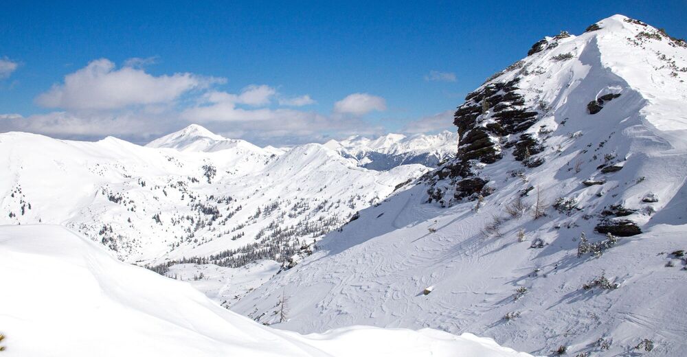
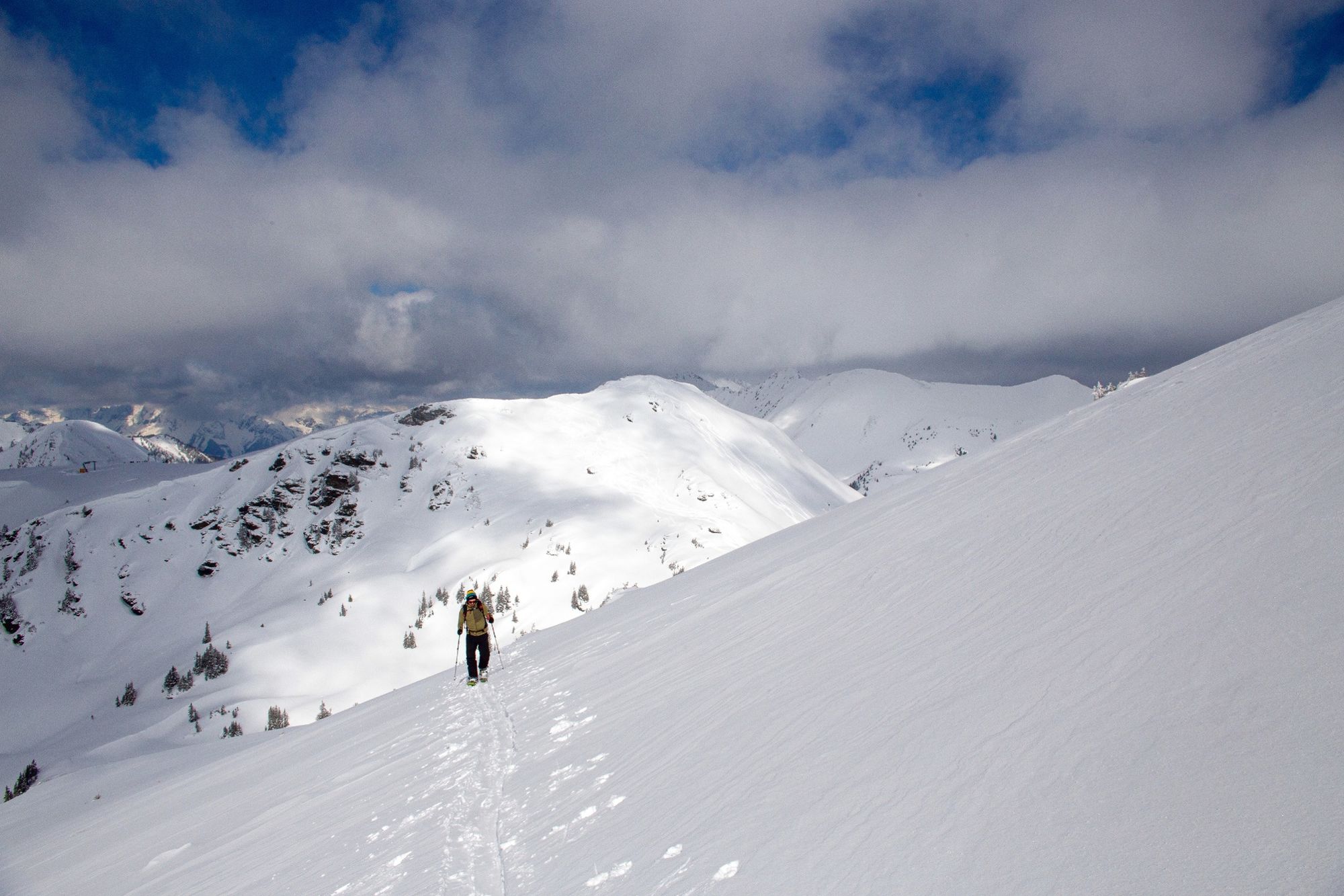
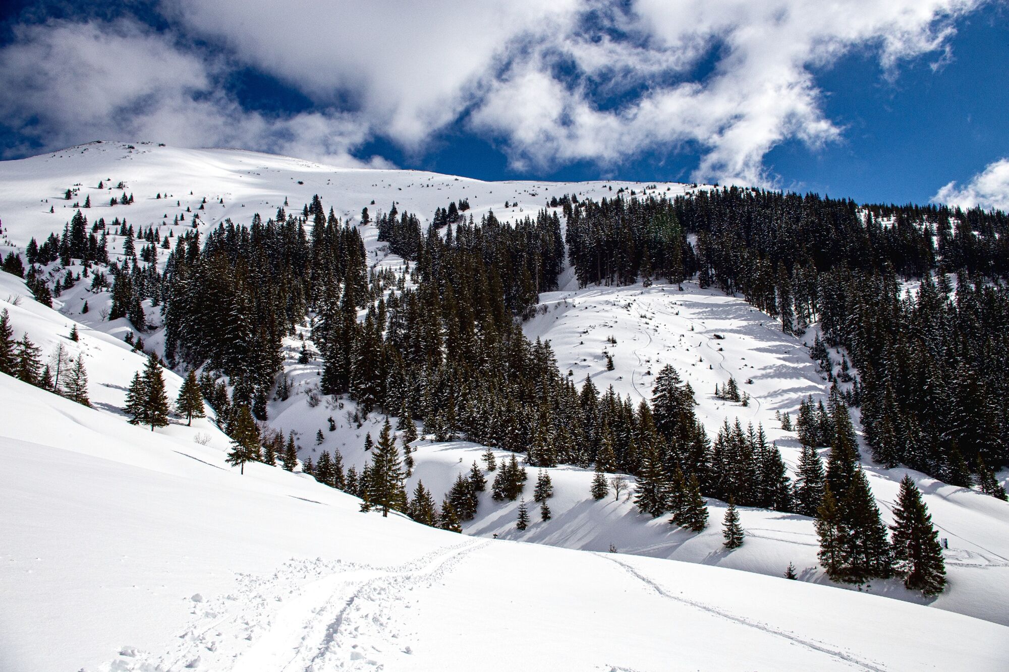
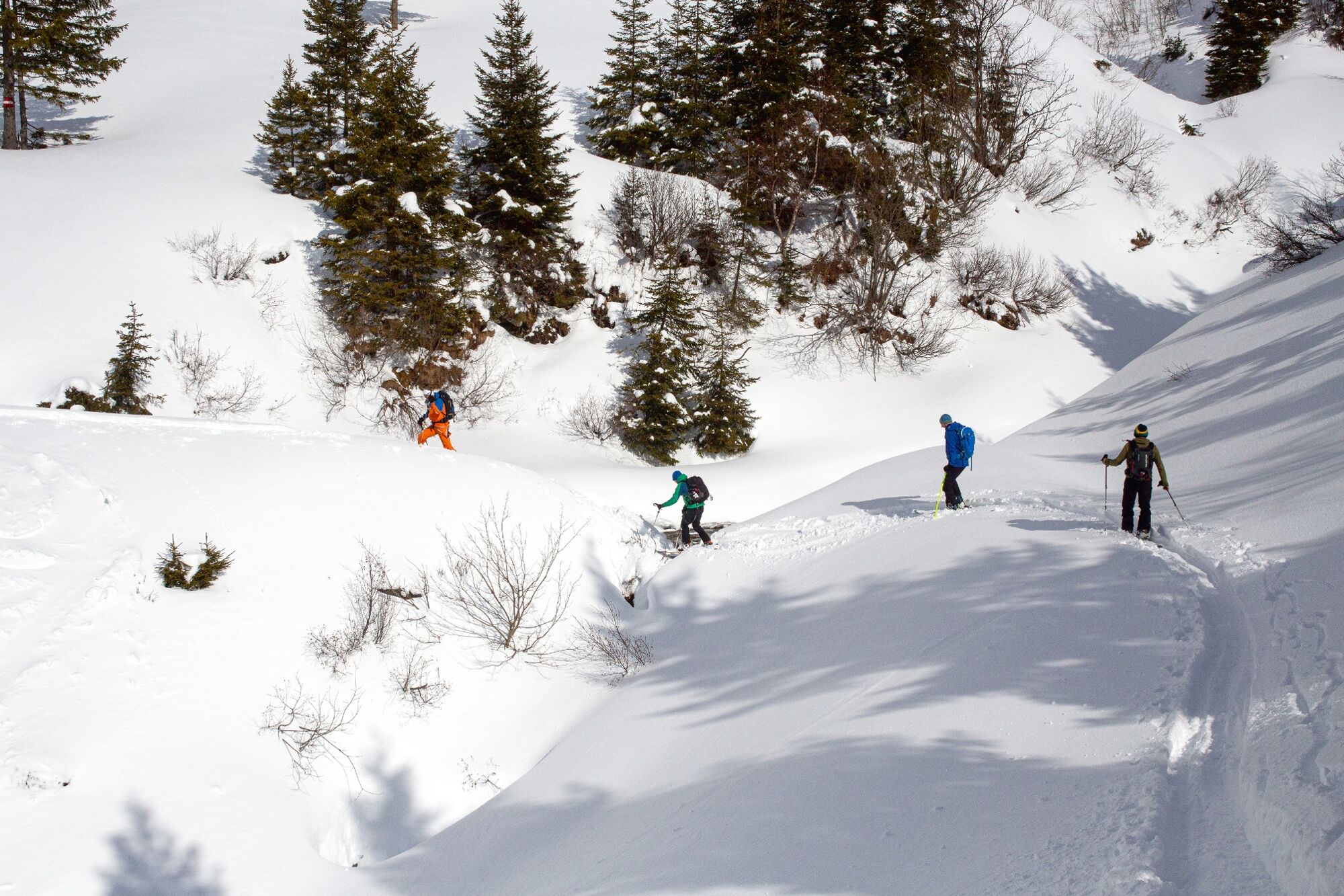
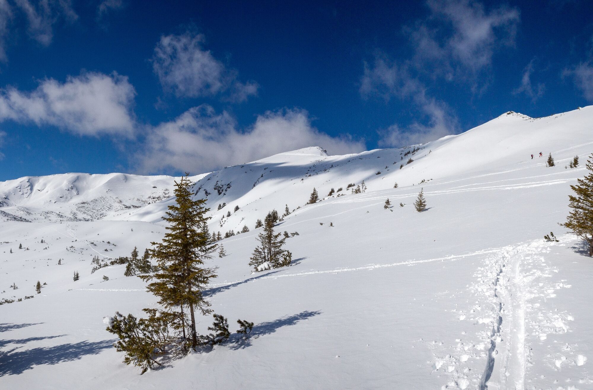
Skinning up, skiing down, skinning up, skiing down. And in between enjoy the fascinating mountain panorama and the wonderful deep snow.
- Difficulty
-
medium
- Rating
-
- Starting point
-
Planneralm Center
- Route
-
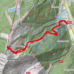
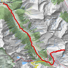
Großer Rotbühel (2,019 m)0.3 kmPlientensattel (1,902 m)0.6 kmHintergullingspitz (2,054 m)1.1 kmStallaalm2.4 kmGoldbachalm2.9 kmGoldbachscharte (1,960 m)4.5 km
- Best season
-
AugSepOctNovDecJanFebMarAprMayJunJul
- Description
-
Please skins up several times! A scenic and ski technically extremely rewarding round, which can be shortened by the ascent with the Gläserbodenlift neatly. Although it is several times to skins up, but the descents, especially those to Stallaalm, are clear highlights. Arrived at the Goldbachscharte, you can decide - continue to the Jochspitze or go straight down towards the Planneralm.
- Directions
-
Either you take the Gläserboden lift to the mountain ridge of the same name or you walk up next to the ski slope. From the mountain station eastwards to a small saddle, from where you descend steeply to the Plientensattel. You can skin up here and ascend over the ridge to the summit or head southeast into a hollow and from there ascend over the slope to the south and just before the ridge head west to the Hintergullingspitz. The descent is over wonderful slopes directly west to the Stallaalm. There you climb up again and cross the Goldbach a bit north of the Stallaalm and climb up following the summer path to the Goldbachalm. Taking advantage of the open terrain, you cross to the northwest up to about 1760 meters. The Goldbachscharte is easily recognizable. Below the Goldbachscharte you ascend keeping to the right in several hairpin bends to the Scharte.
Would you like more? The Jochspitze as another summit destination is not far away, before you head back towards the Planneralm.
- Highest point
- 2,044 m
- Endpoint
-
At the starting point
- Exposition
- Height profile
-

- Equipment
-
In addition to food and warm drinks, pack spare clothing and a first aid kit in your backpack.
Choose your clothing according to the onion layer system.
An avalanche transceiver, probe and shovel are a prerequisite in alpine terrain.
You should also pack maps and/or tour descriptions. GPX tracks on your cell phone or GPS device will also help.
Ski touring and safety equipment can be rented at Sport Scherz and Sport Schöttl. - Safety instructions
-
Mountain sports and the assessment of the situation on site are - even more so in winter - primarily subject to personal responsibility. Tourism associations or avalanche warning services do not assume any liability based on the information provided.
Check the weather and avalanche situation at www.lawine-steiermark.at before each ski tour. The use of the tour description is at your own risk and responsibility. Do not go on a ski tour alone. It's more fun together anyway! Always behave risk-conscious and react to danger signs! Respect existing regulations, such as hunting and game protection areas, reforestation or young growth areas. You should always have your cell phone well charged. Do you have the emergency numbers saved? Mountain rescue: 140. If you have no reception, take out the sim card and dial 112. - Tips
-
The descent from Hintergullingspitz to Stallaalm is one of the most beautiful in this area.
- Additional information
-
Tourism information: www.schladming-dachstein.at
Tourism blog: www.derbergdastal.at
Tourist Office Schladming-Dachstein
Ramsauerstrasse 756
8970 Schladming
T: +43 3687 23310
Garbage on meadows and paths can not smell mountain and valley. Please take it with you. Agriculture and forestry are important partners for Berg und Tal. They allow you to walk and drive on many of their paths. Be aware that only good cooperation will guarantee your recreational enjoyment in the future.
Sport Scherz
At Riesneralm, Planneralm and in Wörschach
+43 (0)3682 22383
sport-scherz.atSport Schöttl
At Planneralm and in Irdning
+43 (0)3682 22952 0
sport.schoettl.atAvalanche workshops are offered by the local ski school:
Ski & Freeride School Planneralm
+43 (0)660 7445538
www.freeski.school - Directions
-
Turn off the Ennstalbundesstraße (B320) at the crossing Trautenfels in direction Irdning, Donnersbach, Donnersbachwald. In Donnersbach after the center of the village turn left towards Planneralm. 12 km long driveway over the toll-free mountain road up to the Planneralm.
- Public transportation
- Parking
-
Free parking at the large parking lot on the Planneralm. Please park in the lower area of the parking lot on busy days as tourers.


-

-
AuthorThe tour Hintergullingspitz is used by outdooractive.com provided.