- Brief description
-
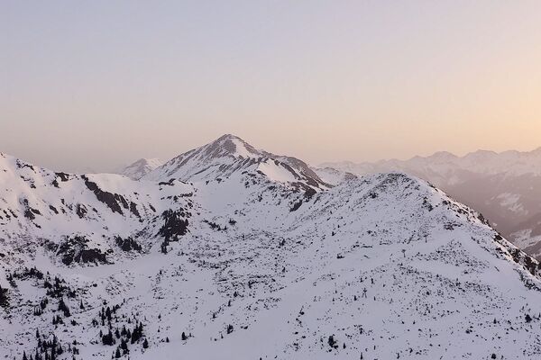
On this hike, the Jochspitze gives you a fantastic mountain panorama and thousands of wonderful views.
- Difficulty
-
medium
- Rating
-
- Starting point
-
Parking Planneralm
- Route
-
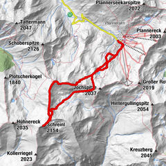
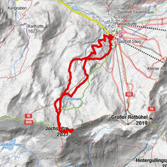
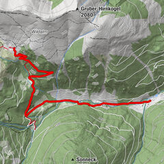
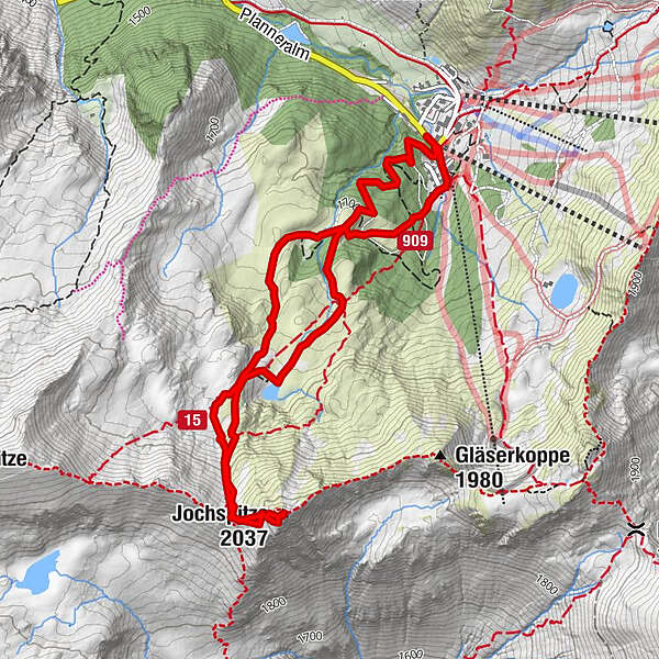
Goldbachscharte (1,960 m)2.5 kmJochspitze (2,037 m)2.7 km
- Best season
-
AugSepOctNovDecJanFebMarAprMayJunJul
- Description
-
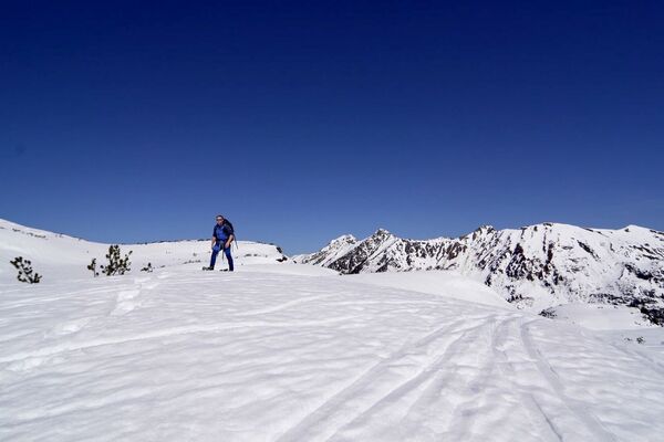
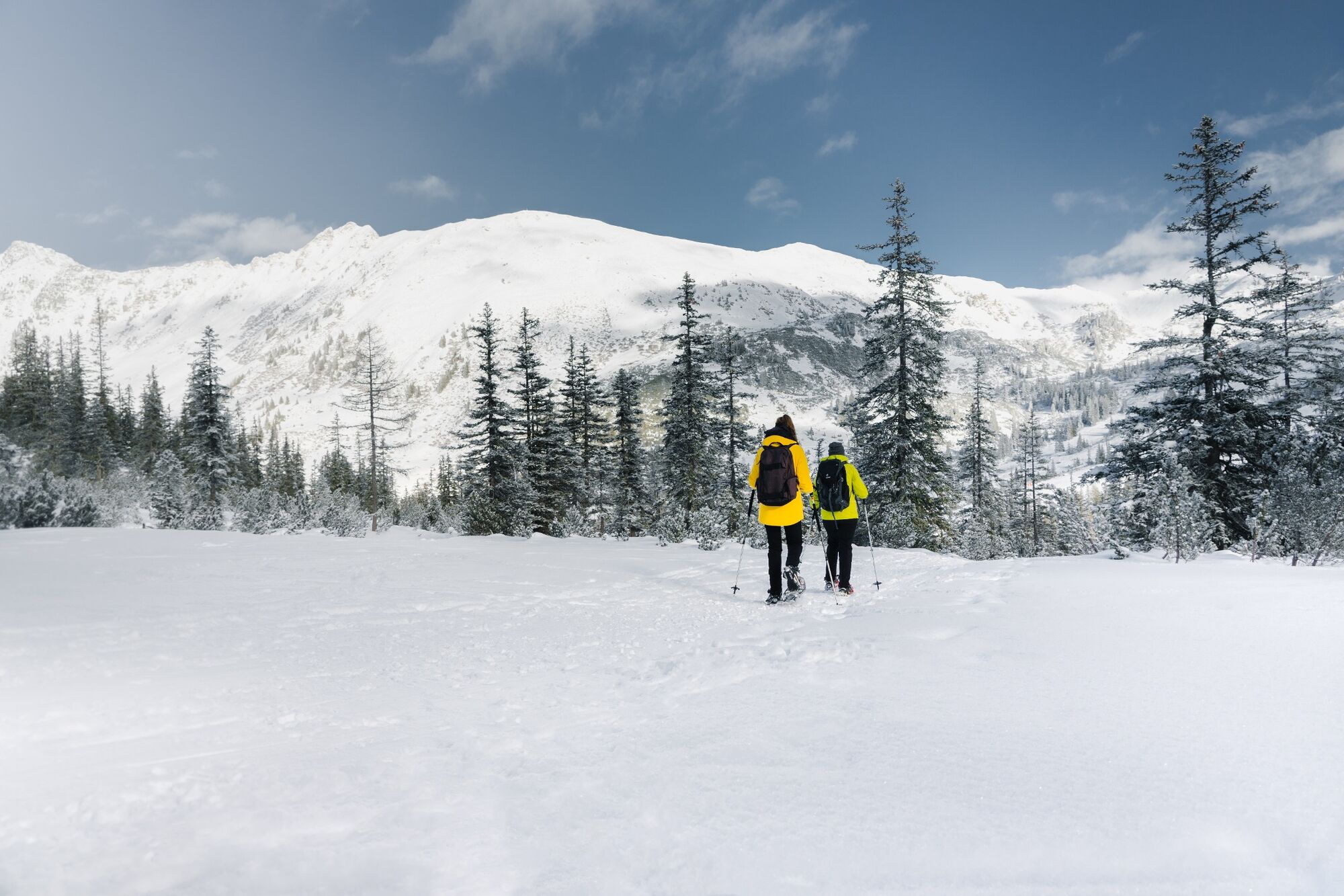
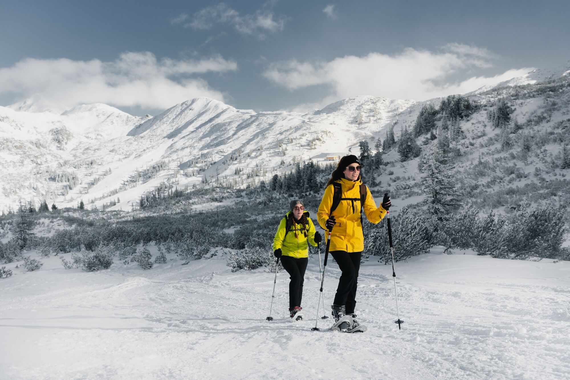
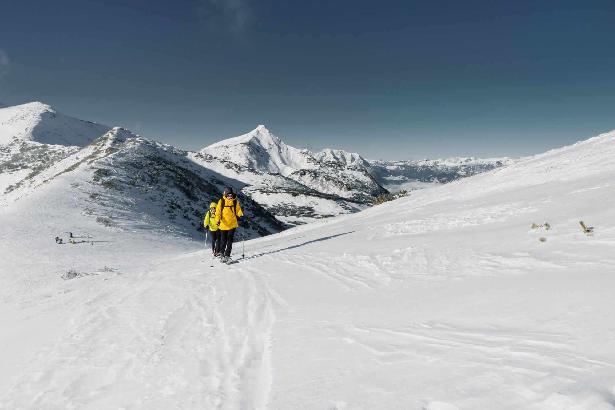
The Planneralm is a popular skiing area in the northern part of the Wölzer Tauern. But up here you will also find a wonderful area for snowshoe hiking. In the mostly very snowy Plannerkessel, the tour to the 2037 m high Jochspitze can be made easier or more demanding depending on your skills and abilities.
- Directions
-
From the parking lot you start in the direction of Hildes Plannerstub'n and follow the toboggan run or the marked high altitude trail uphill. You will soon reach a mountain pasture, the Höhenplateau, and continue over snow-covered mountain pines in the direction of Kothüttensee. Before you turn left and climb up a steep step to the Goldbachscharte and then to the summit of the Jochspitze, take a short break and look at the surrounding Plannerberge. The descent takes place to the Kothüttensee, which is the same as the ascent route, and then there are no limits to your creativity when it comes to your own track layout.
- Highest point
- 2,022 m
- Endpoint
-
At the starting point
- Height profile
-

- Equipment
-
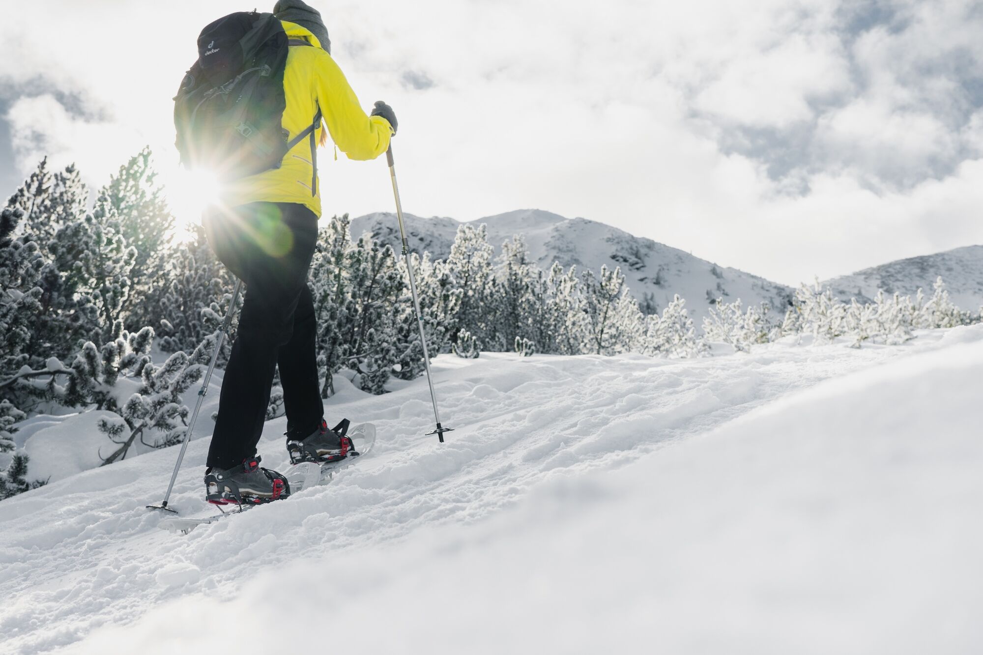
Always important: snowshoes, winter mountain boots or sturdy mountain boots as well as telescopic poles with snow plates
In addition to food and warm drinks, pack spare clothing and a first aid kit in your backpack
Choose your clothing according to the onion layer system
An avalanche transceiver, probe and shovel are, as in ski touring, required in alpine terrain
Use a backpack to which you can attach your snowshoes
You should also pack maps and/or tour descriptions. GPX tracks on your cell phone or GPS device will also help you
Rental of snowshoes, poles and safety equipment at Sport Scherz and Sport Schöttl - Safety instructions
-
Before every snowshoe hike you should always check the current avalanche report - available at www.lawine-steiermark.at. Mountain sports and the assessment of the situation on site are - in winter all the more so - above all subject to personal responsibility. Tourism associations or avalanche warning services do not assume any liability based on information provided. Do not go on snowshoe hikes alone. Together it is more fun anyway. Always be aware of risks and react to danger signs. Observe existing regulations such as hunting and game reserves, reforestation or young growth areas You should always have your cell phone well charged. Have you also saved the emergency number 140 of the mountain rescue service? If you have no reception, take out the SIM card and dial 112.
- Tips
-
In Hilde's Plannerstub'n you can also go bowling after the hike.
- Additional information
-
Tourism information: www.schladming-dachstein.at
Tourism blog: www.derbergdastal.at
Tourist Office Schladming-Dachstein
Ramsauerstrasse 756
8970 Schladming
T: +43 3687 23310
Garbage on meadows and paths can not smell mountain and valley. Please take it with you. Agriculture and forestry are important partners for Berg und Tal. They allow you to walk and drive on many of their paths. Be aware that only good cooperation will guarantee your recreational enjoyment in the future.
Sport Scherz
At Riesneralm, Planneralm and in Wörschach
+43 (0)3682 22383
sport-scherz.at
Sport Schöttl
At Planneralm and in Irdning
+43 (0)3682 22952 0
sport.schoettl.at
Avalanche workshops are offered by the local ski school:
Ski & Freeride School Planneralm
+43 (0)660 7445538
freeski.school - Directions
-
Turn off the Ennstalbundesstraße (B320) at the crossing Trautenfels in direction Irdning, Donnersbach, Donnersbachwald. In Donnersbach after the center of the village turn left towards Planneralm. 12 km long driveway over the toll-free mountain road up to the Planneralm.
- Public transportation
- Parking
-
Free parking at the large car park on the Planneralm
- Author
-
The tour Snowshoe hiking tour Jochspitze is used by outdooractive.com provided.