
- Brief description
-
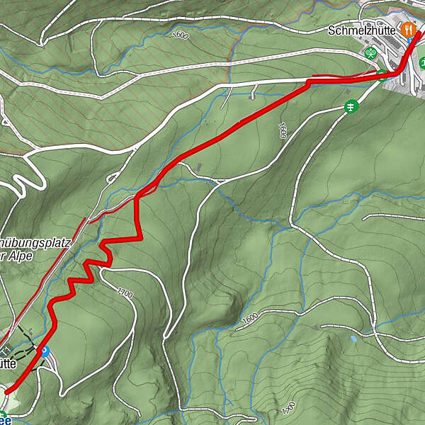
A beautiful toboggan run through the pine forest with 2.4km, easy difficulty, height difference 222m with toboggan rental at the Winterleitenhütte in the Murtal region.
- Difficulty
-
easy
- Rating
-
- Starting point
-
Ossach 45, 8750 Judenburg
- Route
-
Schmelzhütte2.0 km
- Best season
-
AugSepOctNovDecJanFebMarAprMayJunJul
- Description
-
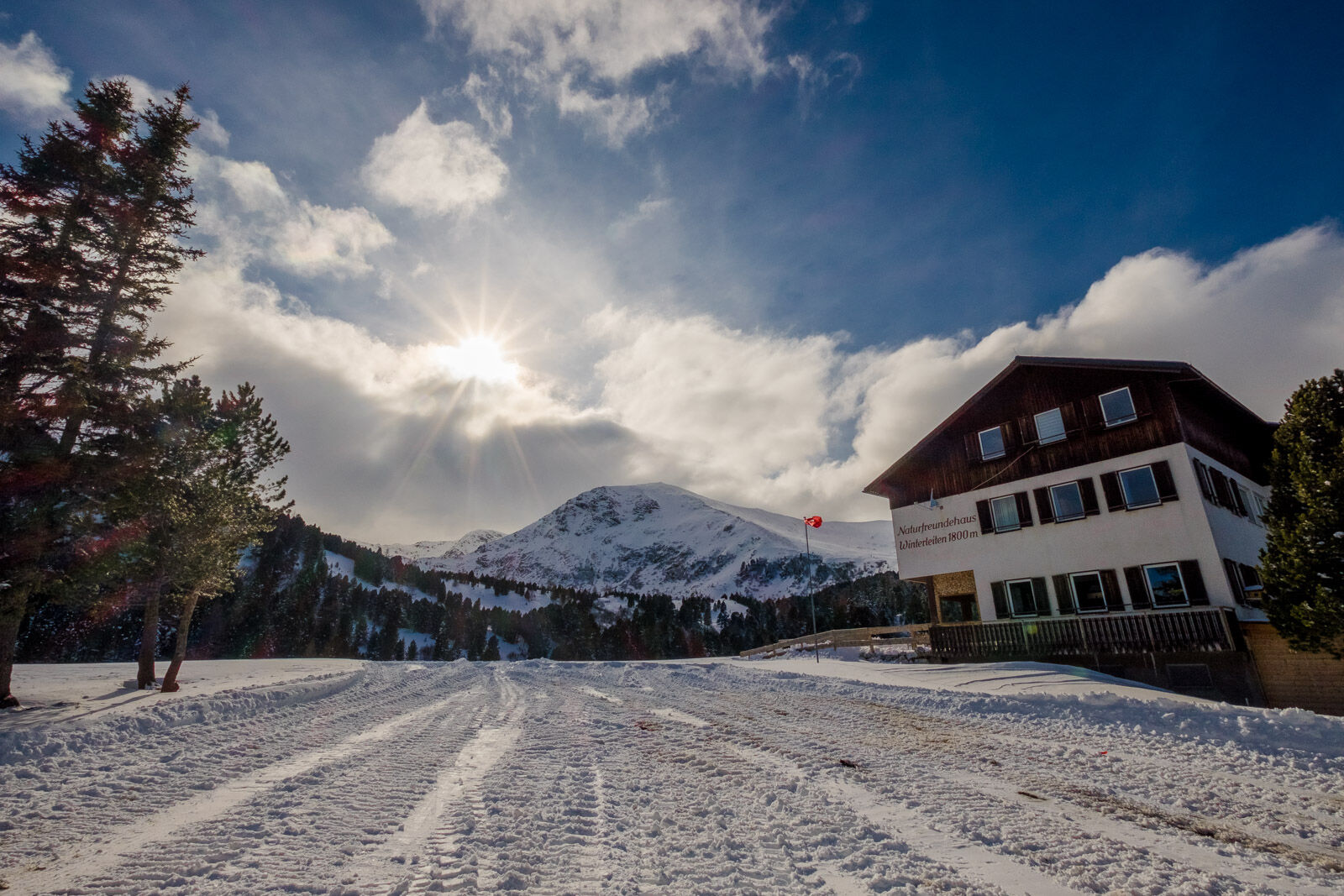
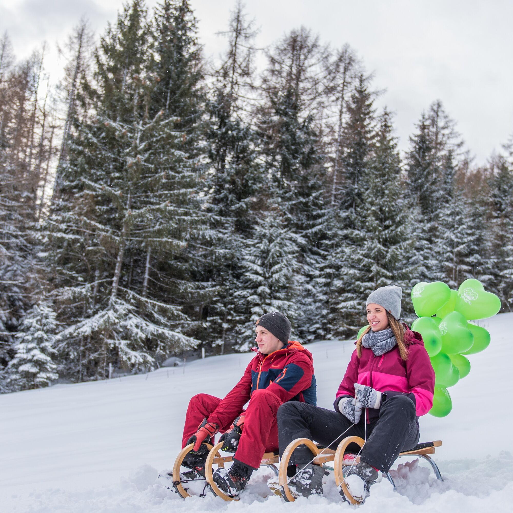
Whizzing down the toboggan run together is an experience for the whole family. The 2.4 km long toboggan run starting at the Winterleitenhütte (1,800 m) is an excursion destination for the whole family in the Murtal adventure region. The easy and medium natural toboggan run, on which the World Cup elite has already raced, leads to the Schmelzhütte (1,560 m). Due to the floodlight system, the track can be used free of charge until 9 pm.
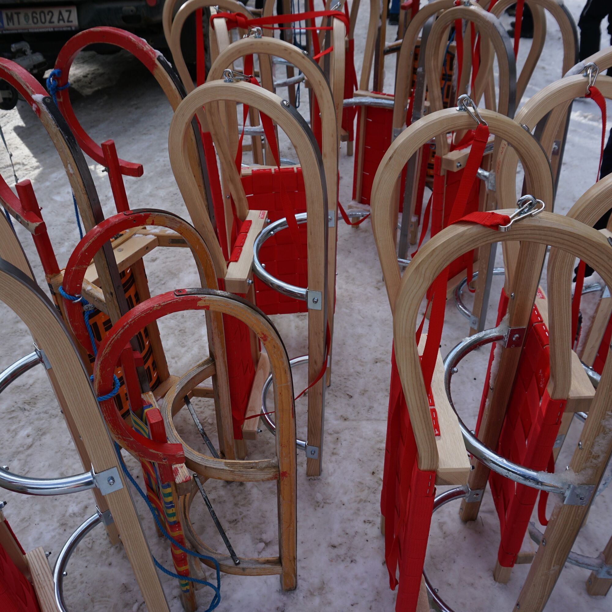
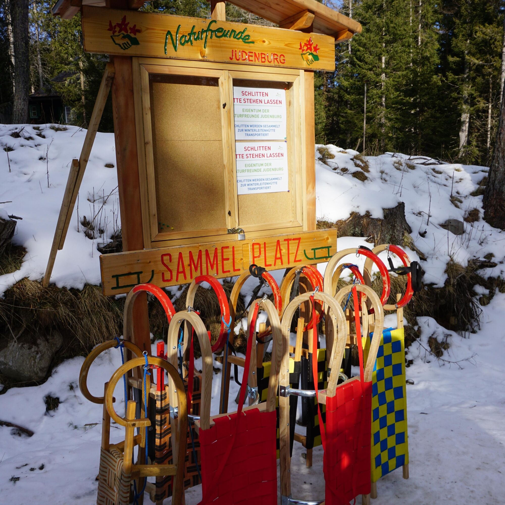
The Naturfreunde Judenburg organize the sled rental on the Winterleiten. Sled rental: SA., SO., and holiday 13:00-19:00 and during the opening hours of the Winterleitenhütte www.winterleiten.com
- Directions
-
The 2.4 km long natural toboggan run starts at the Winterleitenhütte at an altitude of 1,800 m and leads to the Schmelzhütte at 1,560 m. Thanks to the floodlights, the run can even be used free of charge until 9 pm.
If you would also like to take a winter hike to the start of the toboggan run, you can park at the Schmelzhütte and hike to the Winterleitenhütte in approx. 1 hour.
- Highest point
- 1,774 m
- Endpoint
-
Ossach 37, 8750 Judenburg
- Height profile
-

- Equipment
-
Toboggans or sleds can be rented at the Winterleitenhütte for a fee.
General equipment for tobogganing: ski helmet, day hiking backpack (approx. 20 liters) with rain cover, comfortable and waterproof winter shoes or sturdy hiking boots, if necessary danglers and gaiters, cap /headband, scarf, waterproof gloves, sun and rain protection, provisions and drinking water, thermos bottle with hot drink, first aid kit, pocket knife, cell phone, if necessary headlamp and reflectors, map material, if necessary bivouac bag and rescue blanket.
- Safety instructions
-
The right equipment - especially for such tours - can save lives! Therefore, always be safe on the road!
Alpine emergency call:
Mountain rescue emergency number: 140
EU emergency number: 112
Weather service: www.zamg.ac.at
Direct link mountain weather Styria: https://www.zamg.ac.at/cms/de/wetter/produkte-und-services/bergwetter/steiermark
- Tips
-
It pays to stop at the Winterleitenhütte! The sun terrace offers a magnificent view of the Winterleiten lake.
- Additional information
- Directions
-
From Judenburg via Oberweg and Ossach the Seetalstraße leads directly to the area of the military training area Seetaler Alpe . Parking possibilities
From Wolfsberg via the B78 to Obdach and then via St. Wolfgang keep left at the church and follow the signs to the starting point (50 km, approx. 50 minutes).
Good winter tires are an absolute MUST!
Ice scraper, snow broom, de-icer for the door locks and a small shovel belong to the basic equipment.
Put snow chains and a tow rope in the car, even if you are not good with them yourself. Helping and knowledgeable hikers are always available on the mountain!
Clear the car completely of snow and ice, especially sweep off the roof of the car completely.
When parking, make sure you leave room for other motorists.
Always park so that the rest of the roadway remains clear for cars, logging trucks, and snow removal vehicles.
Find out about the snow situation on the access road or parking facilities before setting off. (hut host, webcams)
- Public transportation
- Parking
-
Parking lot Schmelzhütte or Soldatenkirche and then about 300 hm walk through the pine forest to Winterleitenhütte.

-

-
AuthorThe tour Winterleiten-Seetaleralpen toboggan run is used by outdooractive.com provided.