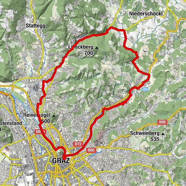
Tour data
24.74km
348
- 531m
215hm
207hm
01:24h
- Brief description
-
Für die ganze Familie
- Difficulty
-
easy
- Rating
-
- Route
-
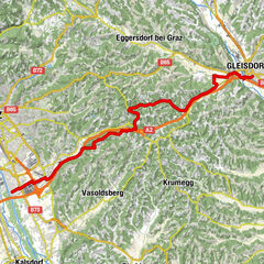
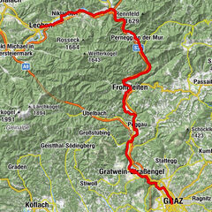
Graz (353 m)Innere Stadt0.0 kmLeechkirche0.7 kmUniviertel0.9 kmKroisbach3.5 kmMariatrost4.9 kmWasnerkapelle8.1 kmFölling9.0 kmSternwirt10.4 kmAnnengraben15.7 kmWildlife Enclosure (deer)16.5 kmSchöcklbach16.7 kmNeustift17.5 kmJohanneshof18.6 kmPeneffgründe19.3 kmAndritz20.0 kmUnterandritz20.8 kmJohannes Nepomuk-Kapelle24.1 kmSankt-Antonius-Kirche24.5 kmInnere Stadt24.6 kmGraz (353 m)24.6 km
- Best season
-
JanFebMarAprMayJunJulAugSepOctNovDec
- Highest point
- 531 m

GPS Downloads


Other tours in the regions
-
Erlebnisregion Graz
261
-
Graz und Region Graz
129
-
Graz - Stadt
36