- Brief description
-
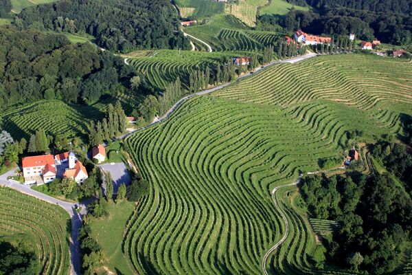
The Gravelbike, the new trend in cycling.
- Difficulty
-
difficult
- Rating
-
- Starting point
-
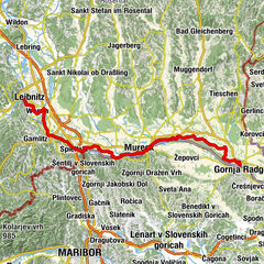
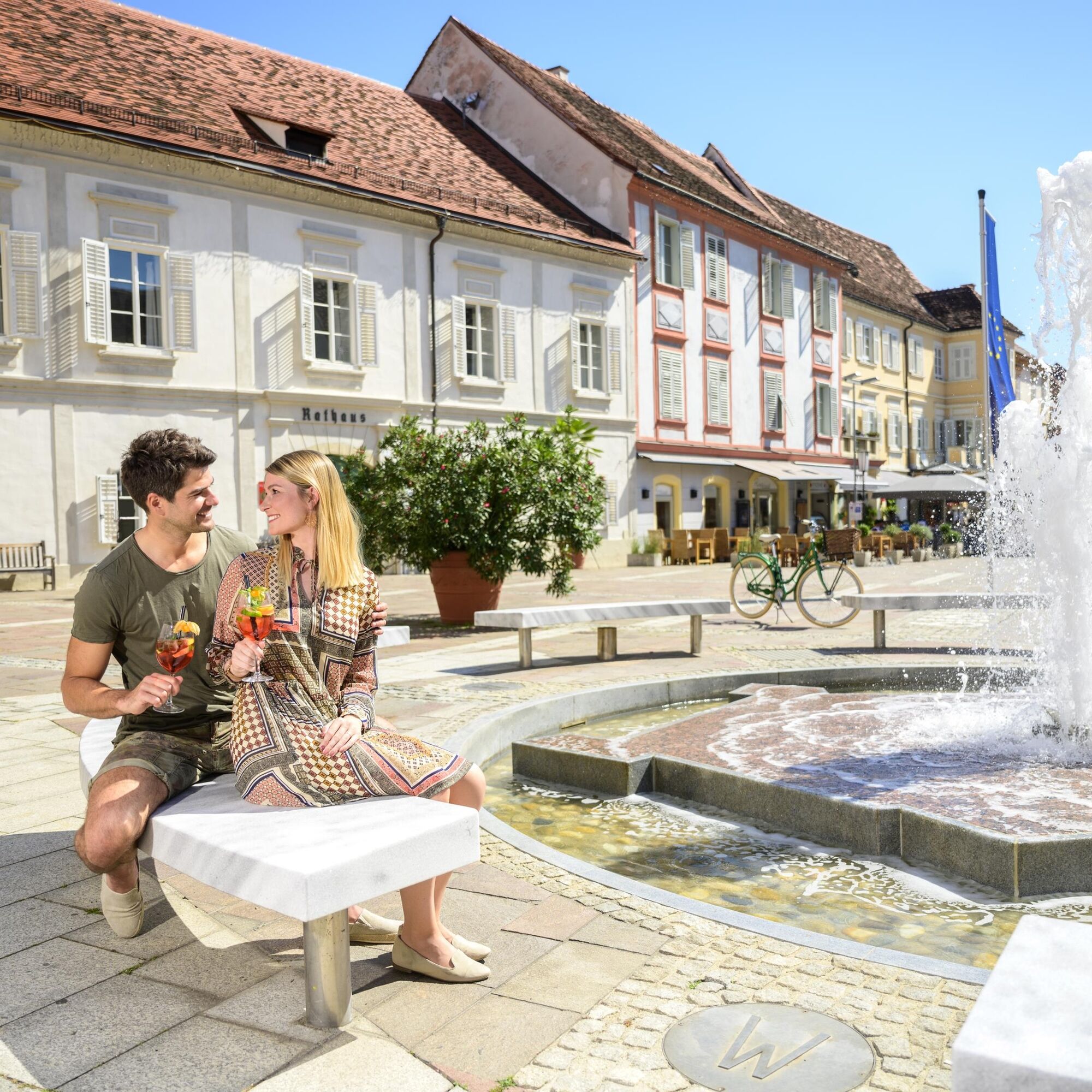
Main square Bad Radkersburg
- Route
-
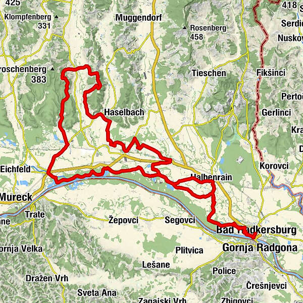
Bad RadkersburgPrentlkreuz1.5 kmPrentl1.8 kmAltneudörfl2.6 kmKapelle Dietzen5.7 kmDietzendörfl5.8 kmDietzen6.8 kmBettina's Stüberl7.0 kmUnterau8.9 kmKapelle Donnersdorf/Au9.6 kmDonnersdorf12.6 kmElfi's Hütt'n14.8 kmFluttendorf14.9 kmDiepersdorf16.6 kmMurturm18.6 kmGasthof zur Post20.9 kmGosdorf21.1 kmRatschendorf23.3 kmMostschenke Pechmanns alte Ölmühle24.2 kmSchildhof24.6 kmTax Berg25.1 kmDeng25.9 kmSchröttenberg27.9 kmHofstättenberg28.6 kmHofstätten bei Deutsch Goritz30.3 kmNägelsdorf31.2 kmHart-Oberberg33.2 kmOberkrobathenberg34.5 kmKrobathen34.9 kmUnterspitz36.9 kmOberspitz37.6 kmFriesenberg38.3 kmSalsach40.3 kmWeixelbaum42.0 kmAm Berg42.3 kmUnterpurkla46.4 kmBachbrucken47.0 kmKapelle Donnersdorf/Au50.3 kmHalbenrain53.4 kmDietzen54.2 kmKapelle Dietzen54.8 kmDietzendörfl54.9 kmAltneudörfl58.3 kmPrentl59.0 kmPrentlkreuz59.4 kmBad Radkersburg60.7 km
- Best season
-
JanFebMarAprMayJunJulAugSepOctNovDec
- Description
-
The gravel bike tour in the Bad Radkersburg region, in the south of Thermen- & Vulkanland Styria, starts at the main square in Bad Radkersburg and ends there again.
- Directions
-
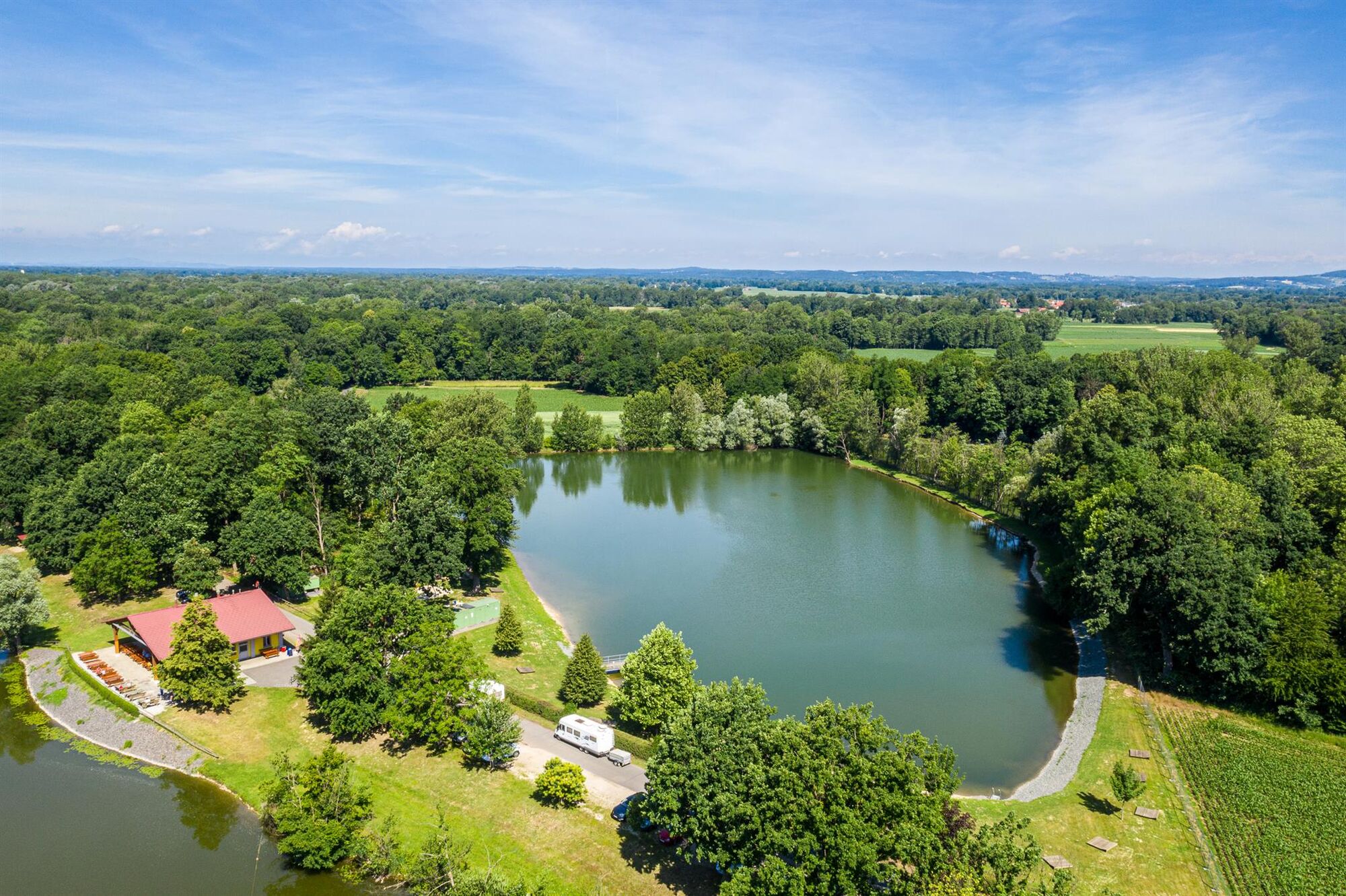
Short bike check at the main square, then you can start. Starting from Bad Radkersburg, the route follows the Murradweg R2 in the direction of Liebmannsee. From afar you can already see the Liebmannsee, a very romantic place where you can spot fishermen, hikers or guests on the beautiful terrace.
Continue on the R2 through the small village of Dietzen in the direction of Gosdorf. The R2 cycle path is the primary rock of the region, therefore known far and wide. In Fluttendorf you turn left from the asphalt road into a wide gravel road, which winds for about 15 km next to the Mura River to Gosdorf.
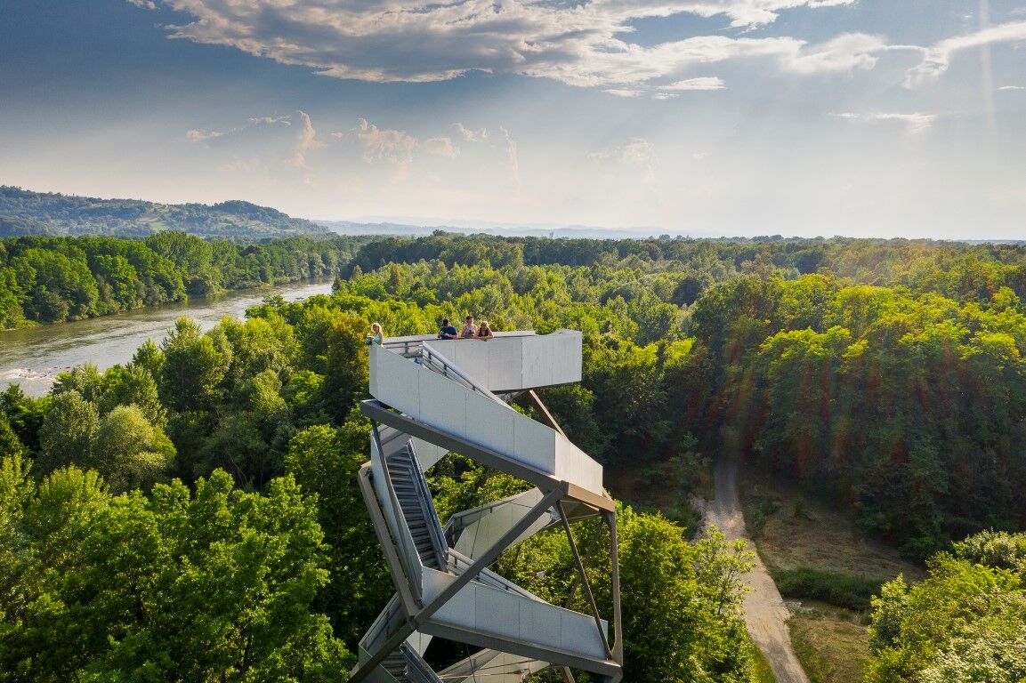
On the route is a highlight, the Murtrurm, often very well visited. Many want to "look into the country" there, of course, and enjoy the view over the UNESCO biosphere park all the way to Slovenia. Ascent an absolute must, afterwards everyone also finds a place to rest, drink, enjoy in the midst of beautiful nature.
After Röcksee you leave the R2 and turn right towards Gosdorf. There a piece of the path is again on the asphalt in the direction of Deutsch Goritz. In Ratschendorf we turn to "Pechmann's alte Ölmühle" and meet the Gnas cycle path R27. From the Ölmühle we continue north, first on asphalt, but soon on a natural road. Uphill and downhill through dense forest to Hofstätten. Primarily on asphalt you ride along the mountain ridge until it goes downhill towards Nägelsdorf. After the Gnasbach comes a small challenge. With a gradient of about 15% you climb the next 2 km to Rasserberg. Now you can prove where the Bartel gets the cider from. You will be rewarded with a fantastic view, and a bench invites you to take a short rest or refreshment.
Rapidly downhill we arrive in Krobathen and then continue to follow the R27.
From Spitz to Salsach we drive on asphalt and also the R27 there we turn off in the direction of Weixelbaum. A gravel road that runs along the edge of the forest provides shade. In the center of Unterpurkla we turn back to the R2 at the train station. Via Donnersdorf Au we drive to Halbenrain, Dietzen, Altneudörfl back to Radkersburg to the main square.
- Highest point
- 352 m
- Endpoint
-
Main square Bad Radkersburg
- Height profile
-

- Equipment
-
Bicycle helmet
Cycling clothing
Sturdy shoes
Well-maintained bicycle, intact bicycle lights, bicycle lock, bicycle pump, bicycle repair kit and spare tube (possibly assembly stand), multi-tool, chain oil, screwdriver
Water bottle
Sunglasses
Rain cover
Bike backpack
Camera - Safety instructions
-
Partial traffic on the roads and oncoming hikers. Use at your own risk.
Emergency call fire department: 122
Emergency call police: 133
Emergency call rescue: 144
Euro emergency call: 112
ÖAMTC breakdown emergency call: 120
ARBÖ breakdown emergency call: 123 - Tips
-
The Mur Tower on the Mur Cycle Path R2.
- Directions
- Public transportation
-
Detailed information about arriving by ÖBB (Austrian Federal Railways) can be found at www.oebb.at or on the Verbundlinie Steiermark website www.busbahnbim.at
With Verbundlinie’s BusBahnBim route planner app, planning your journey has never been easier: simply enter towns and/or addresses, stop names or points of interest to check all bus, train and tram connections in Austria. The app is available free of charge for smartphones – on Google Play and in the App Store
- Parking
-
- in the Old Town "Blue Zone" free of charge, for max. 90 min., please be sure to set your parking meter Mon-Fri 8:00-18:00, Sat 8:00-12:00, Sundays and holidays no restriction
- Parking lot-Hasenhaide and parking lot-Stadtgraben "Grüne Zone "free of charge, for max. 180 min., please be sure to set your parking meter Mon-Fri 9:00-12:00 & 14:00-18:00, Sat 9:00-12:00, Sundays and holidays no restriction
- Park+Ride "P-Nord" (in Dr. Kamniker-Straße) max. 7 days, NO E-charging stations
- Park+Ride "P-East" (at soccer stadium Mitterling) max. 7 days, NO e-charging points
- Author
-
The tour Gravelbike tour is used by outdooractive.com provided.


General info
-
Südsteiermark
236
-
Region Bad Radkersburg
123
-
Deutsch Goritz
53