


- Brief description
-
The Way of St. James in Western Styria was opened on 25 July 2010 and is divided into eight stages. These were chosen so that they are manageable for average hikers. Overnight accommodation is available at the end of each stage. Particularly athletic pilgrims will probably manage a larger daily workload; in the event of bad weather or sightseeing, the mileage will be less. For the most part, the trail leads along existing hiking and pilgrimage routes and partly along asphalted municipal and provincial roads.
- Difficulty
-
difficult
- Rating
-
- Starting point
-
Maria Osterwitz
- Route
-
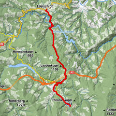
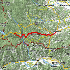
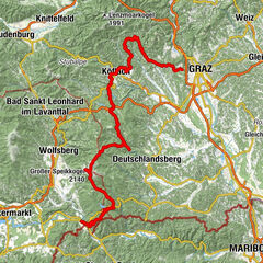
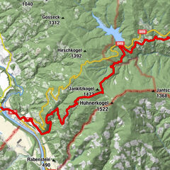
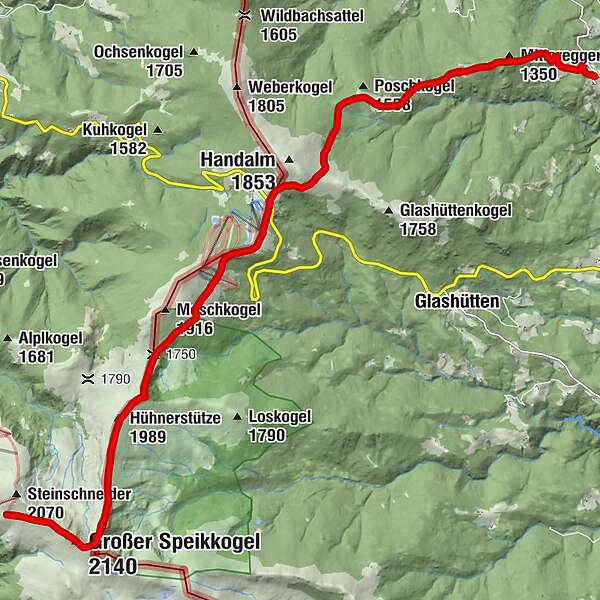
Pfarrkirche Maria OsterwitzOsterwitz0.0 kmMittereggerkogel (1,350 m)1.8 kmPoschalm4.7 kmPauluskapelle7.6 kmWeinofenblick7.7 kmWeinofen (1,726 m)8.2 kmHühnerstütze (1,989 m)12.7 kmSeespitz (2,066 m)14.5 kmGroßer Speikkogel (2,140 m)15.4 kmKoralpenhaus16.6 km
- Best season
-
JanFebMarAprMayJunJulAugSepOctNovDec
- Description
-
The regions along the West Styrian Way of St. James are an irresistible encounter of tradition and modernity, rural lifestyle and diverse folk culture. Unmistakable and richly varied, we can enjoy the unique interplay of scenic features. Along gentle hilly landscapes, in the middle of green alpine meadows or high up on the Koralpe, we can harmonise our senses without everyday stress and noise. Honest cordiality and tangible hospitality are the special features of this unique journey of discovery of a somewhat different kind. Please note the opening hours of the establishments/huts. Always take enough food with you.
- Directions
-
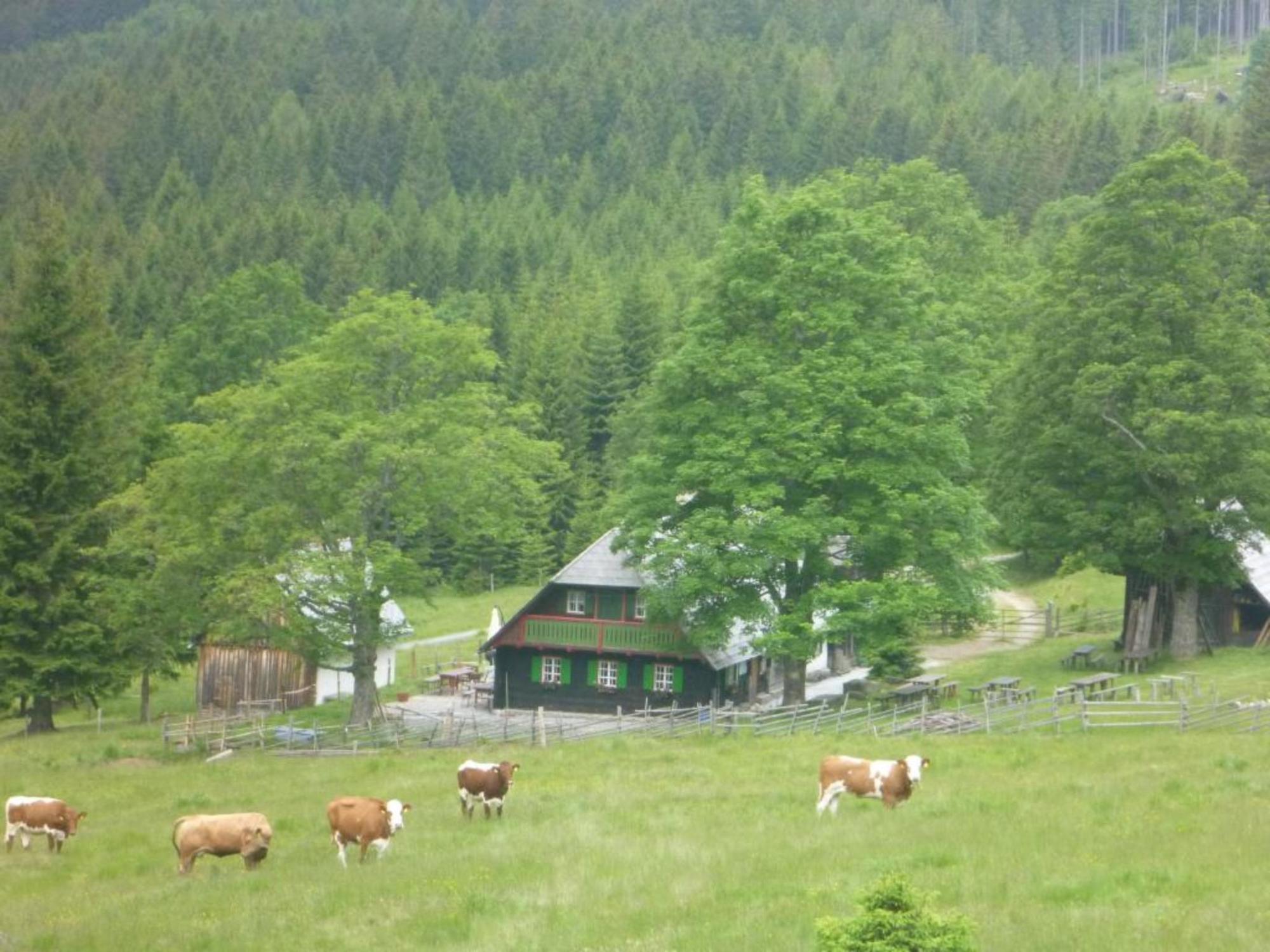
We leave this idyllic place of pilgrimage and head in the direction of the church on trail 553 and pass the primary schools and the municipal office. 150m after the church, we take a path to the left through the forest and meet the road again just before the football field. 100m after that, we see the road junction to the Trahüttner Hut on the left at the gate. We stay on the more scenic hiking trail 553 - after 300m at the farm we pass between the garage and the farm and follow the markings through forest and meadows to the Trahüttner Hut at 1,317m above sea level. The walking time from Osterwitz to the hut is about 1 hour.
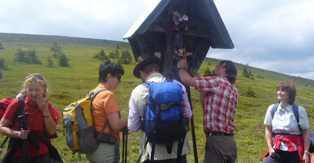
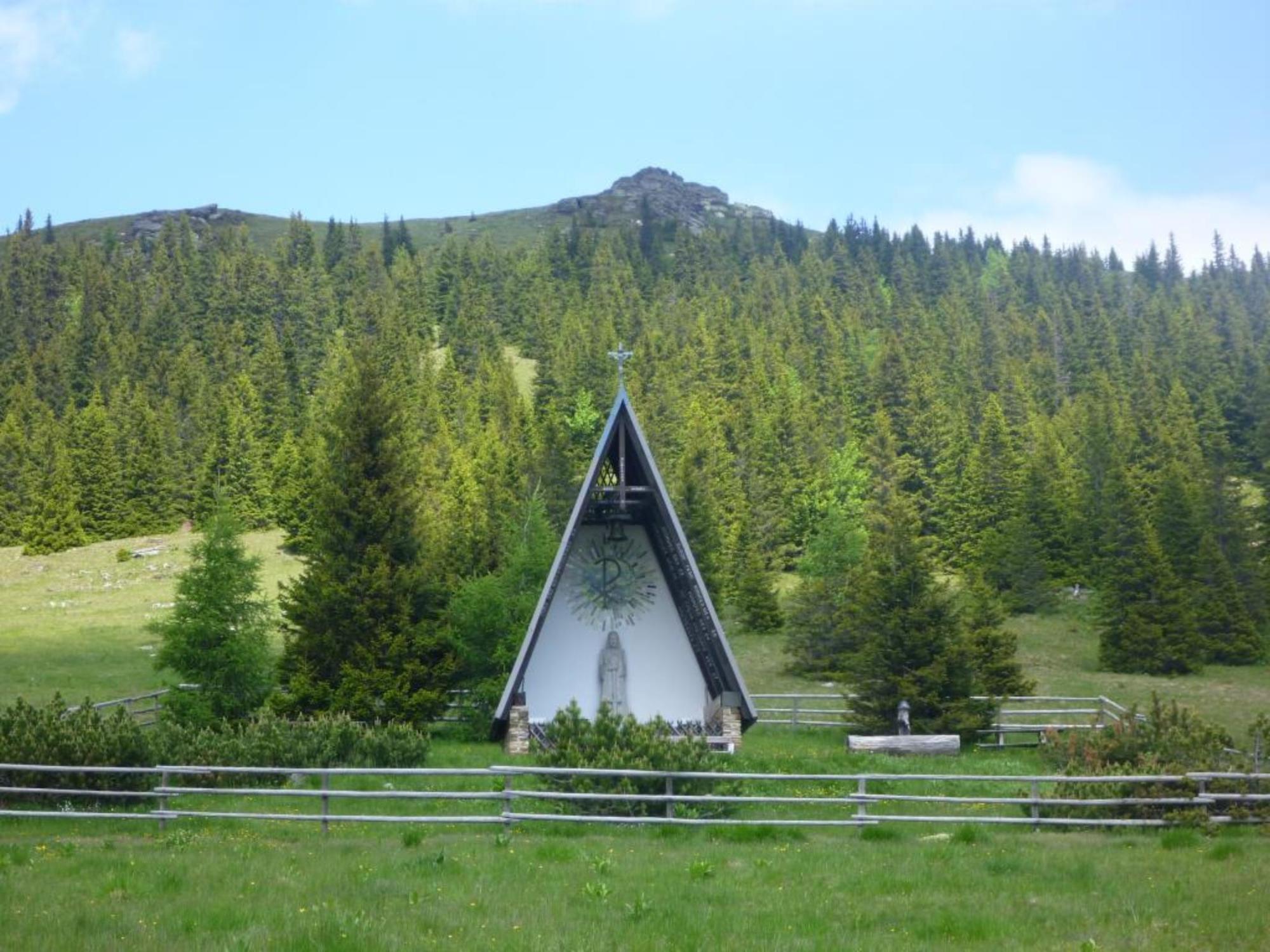
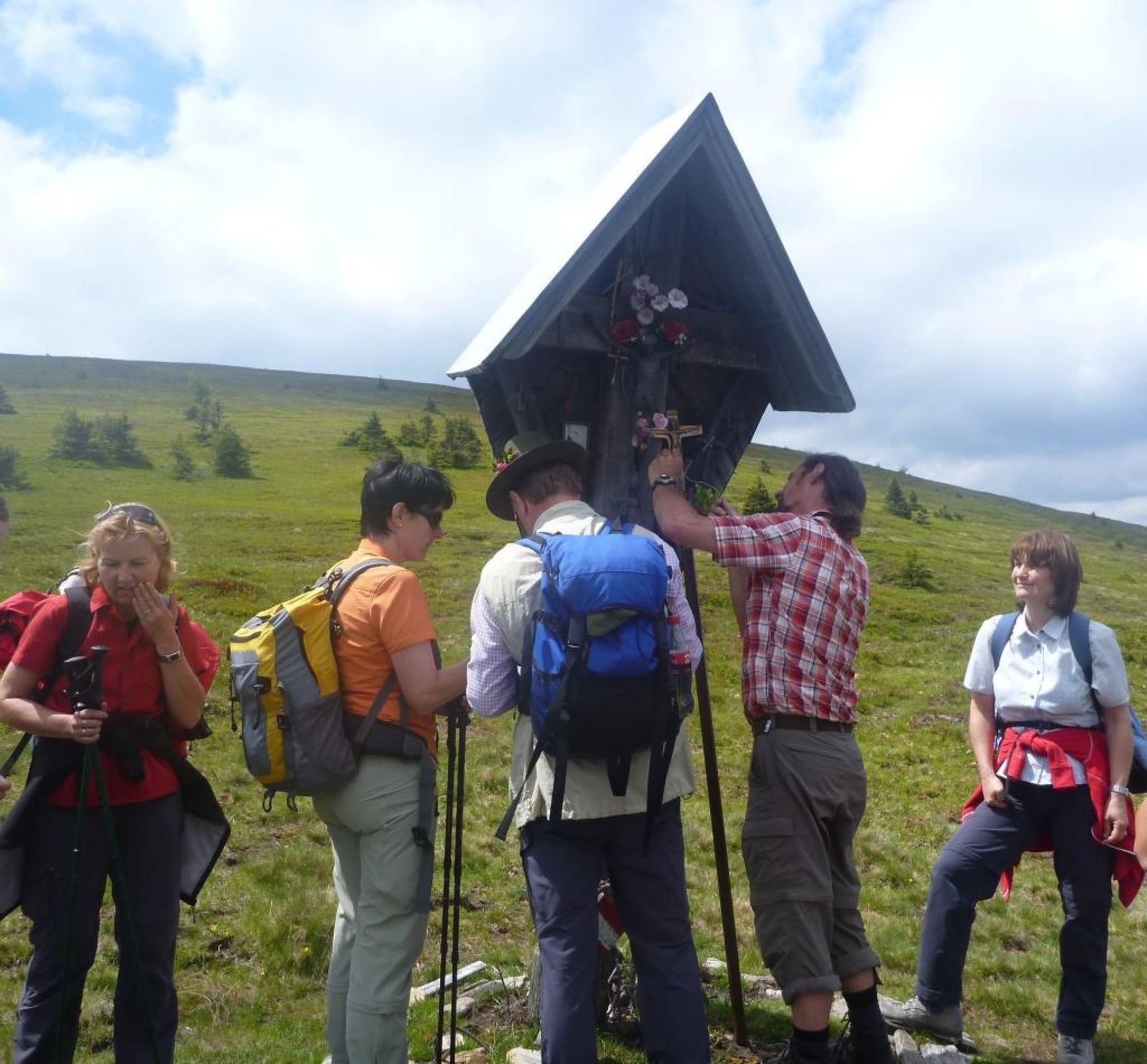
After a short rest, we continue along trail 553 in the direction of Poschalm. Past the hunting lodge with the black Lord, we turn left immediately after the barn and follow the trail to the Wildbachsattel-Glashütten junction. Follow the signposts for the Jakobsweg trail and trail 578b and walk steeply uphill through the forest towards the Handhöhkreuz Weinebene cross. At the Handhöhkreuz cross we follow the markings again until we arrive at the Pauluskapelle chapel created by Carl Hermanns at the Weinebene pass summit. After this strenuous climb, it is important to take a break and gather our strength for the ascent to the Koralpenspeik.
It is highly recommended to check the weather conditions beforehand so that we arrive safely and in one piece at our stage destination, the Koralpenschutzhaus.
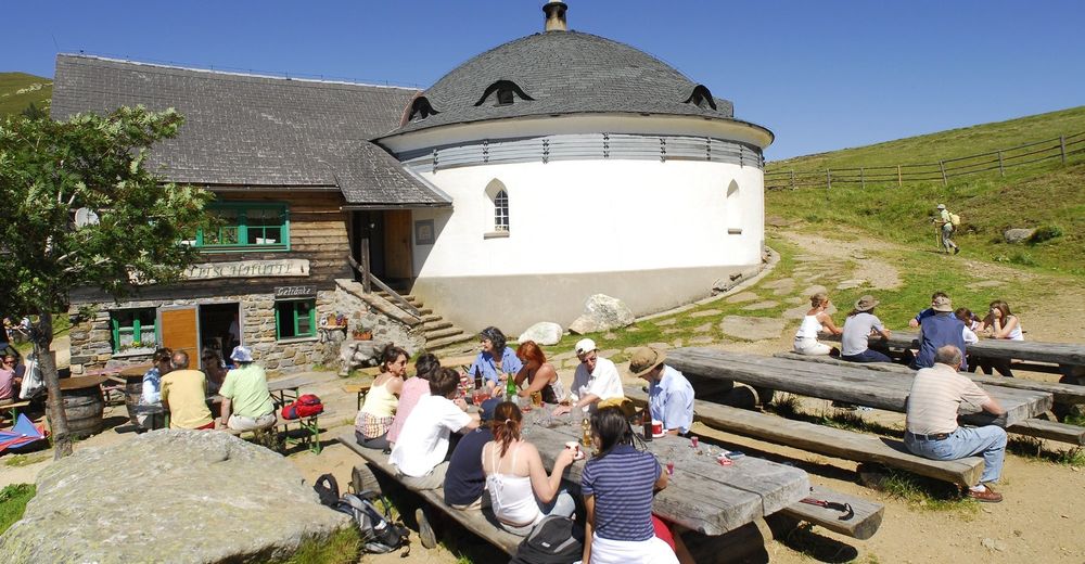
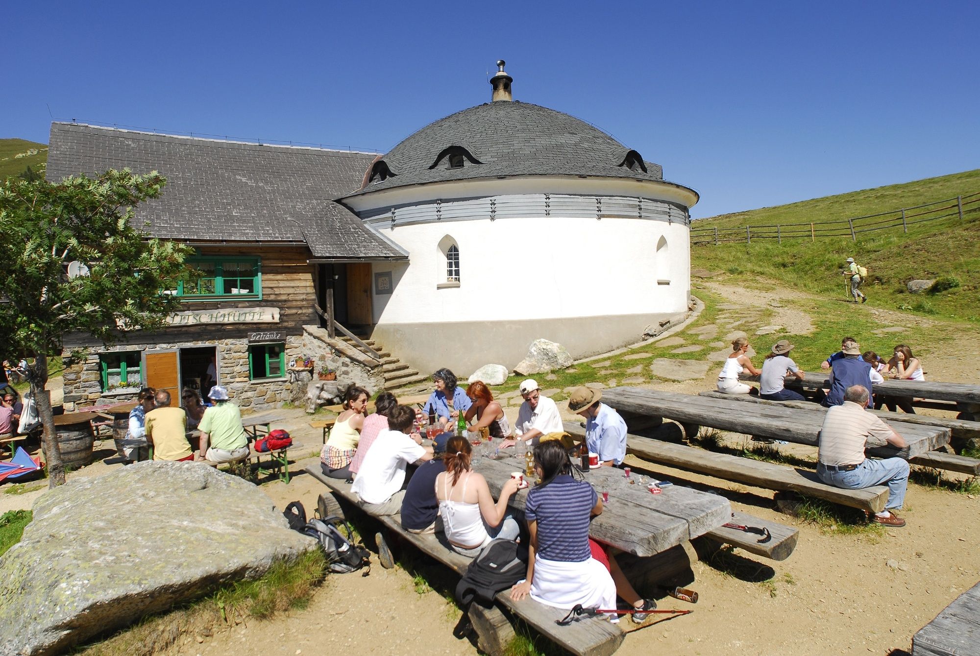
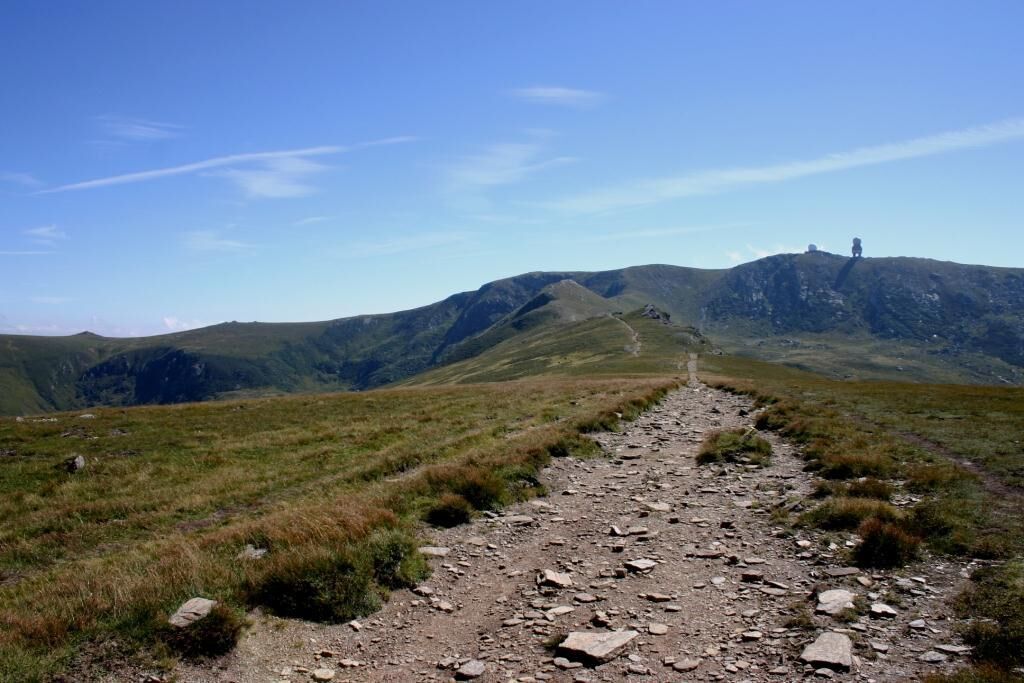
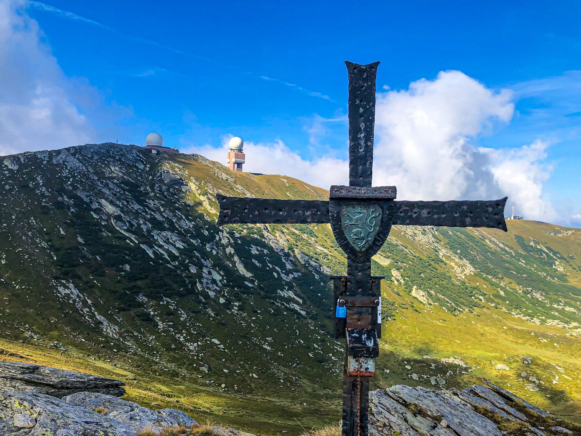
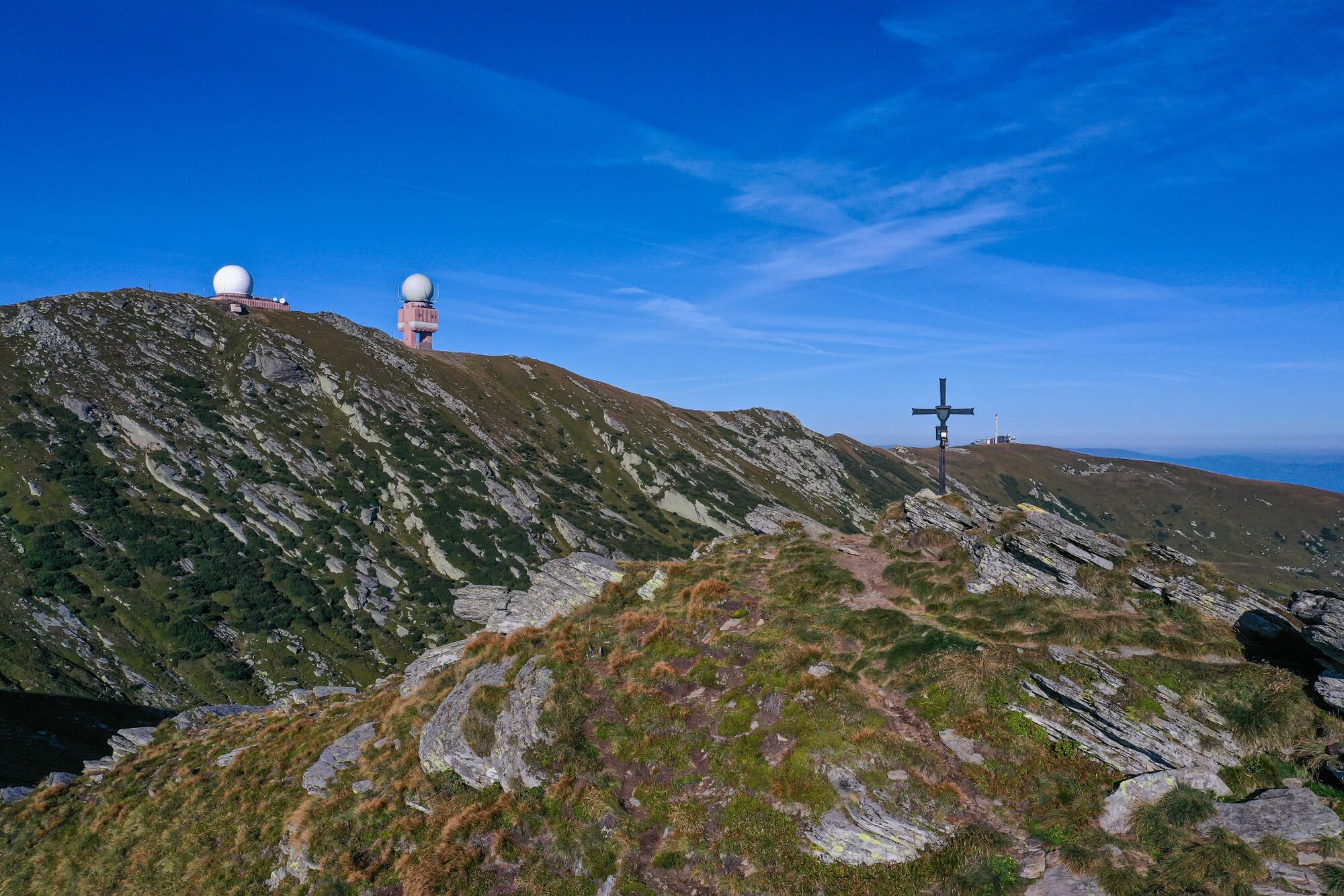
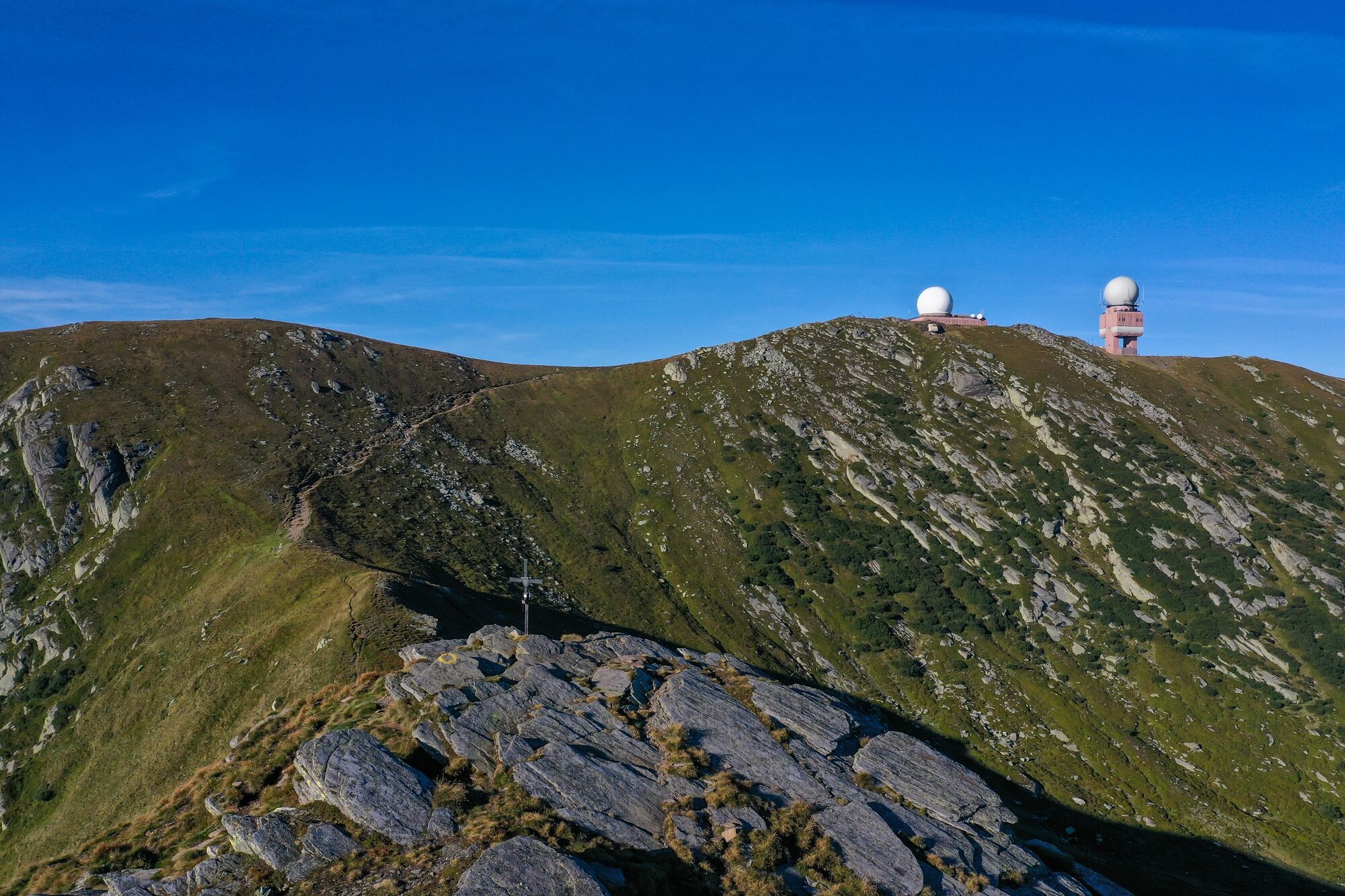
From the Weinebene we follow the long-distance hiking trail 505, we turn left at the Pichler Alm inn in the direction of the Hühnerstütze and Grillitsch hut and enjoy the picturesque panorama of the Styrian/Carinthian mountains. Slightly ascending, we make our pilgrimage on the gravel road along the Brandhöhe and the Moschkogel down to the "Grillitschhütte" turn-off. We keep to the left and walk steeply uphill over the "Hühnerstütze" (1,979m). Hiking along the grade, we see the Great cirque below on the right and in front of us we first see the summit cross of the Koralpenspeik at 2,140m above sea level with the Goldhauben. (The "Goldhaube" is a radar station of the Austrian Armed Forces and serves to monitor the airspace). Passing to the side, along the Seespitz steadily uphill, we reach the highest point of the Jakobsweg at 2,140m above sea level, the summit cross of the Koralpenspeik. In clear weather we enjoy the magnificent view of the Styrian and Carinthian mountains. Afterwards, there is only a short descent on trail 505 to the situated Koralpen-Schutzhaus (1,966m). We have reached the destination of the 6th stage.
To the 6th stage of the Styrian Way of St. James
To the complete overview of the Styrian Way of St. James
- Highest point
- 2,133 m
- Endpoint
-
Koralpe / Koralpenschutzhaus
- Height profile
-

- Equipment
-
Proper backpack packing makes many things easier: Pack heavy things first. The water bottle should always be within easy reach in a side pocket. All things that are often needed, such as sunglasses, camera or hiking map, belong on top. An emergency kit including blister plasters belongs in every rucksack and it is always advisable to dress according to the "onion system"!
- Safety instructions
-
Sturdy and comfortable footwear required (e.g. gym or hiking shoes). In winter only accessible in good weather. Walk at your own risk!
Rescue: 144
Tip for reporting an emergency - give answers to the six W-questions: What happened? How many injured? Where did the accident happen (possibly GPS coordinates)? Who reported the accident (call-back number)? When did the accident happen? Weather at the accident site?
The Way of St. James in Western Styria is marked with signs (arrow with shell). It is possible to orientate yourself by the red-white-red markings of the Friends of Nature and the Alpine Club. In addition, there are ground markings on asphalt roads. Nevertheless, it is highly recommended to carry a hiking map.
This stage over the Koralpe should only be undertaken in good weather!
- Tips
-
At each stage destination and at each St. James church along the West Styrian Way of St. James, there is a pilgrim's stone that indicates the kilometres still to be walked until the end of the pilgrimage in Santiago de Compostela. At the "Pilgerkastln" along the Way of St. James, we have the opportunity to write down our thoughts and experiences in a book.
Pilgrim stamp sites:
Koralpe / KoralpenschutzhausIt is highly recommended that pilgrims carry an Austrian pilgrim's booklet with their pilgrim's passport. Discounts are offered at some establishments. This booklet can be obtained in advance from parish offices or pilgrim businesses.
- Additional information

-

-
AuthorThe tour Stage 6: Way of St. James Western Styria is used by outdooractive.com provided.


General info
-
Erlebnisregion Graz
2783
-
Lavanttal
611
-
Koralpe
172