- Brief description
-
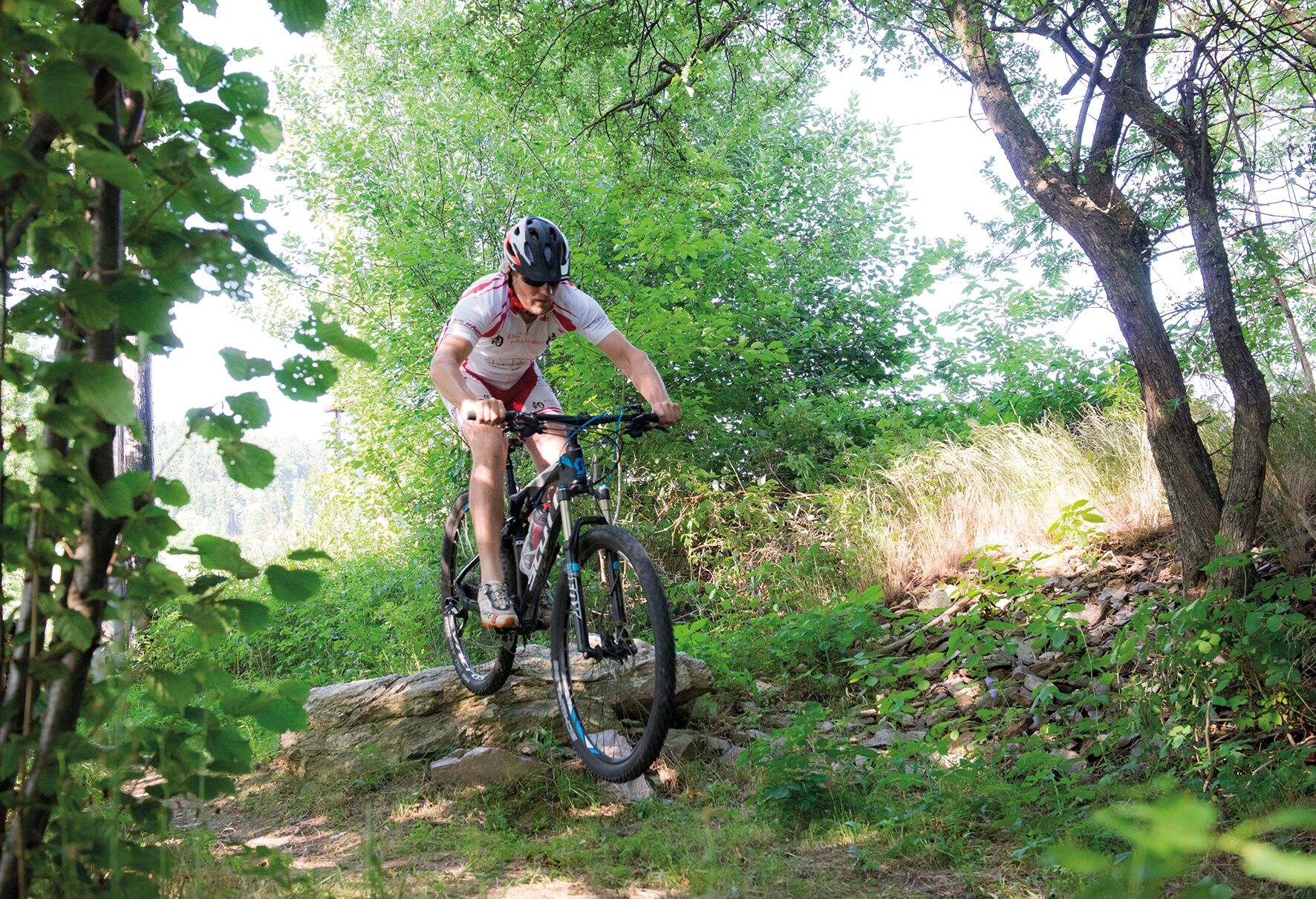
This varied and challenging circuit has a cross-country character with some downhill elements
- Difficulty
-
difficult
- Rating
-
- Starting point
-
P&R at the Pöllau bypass
- Route
-
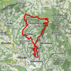
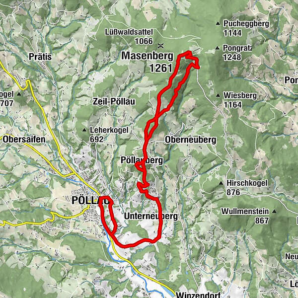
Pöllau0.0 kmGalgenkreuz1.2 kmKirchenackersiedlung1.4 kmHambuchen1.6 kmPikeroi3.4 kmUnterneuberg3.8 kmHolzhöf4.5 kmObersalberg5.1 kmBuschenschank Haubenwaller5.3 kmWallfahrtskirche Maria Pöllauberg7.2 kmPöllauberg7.2 kmFilialkirche St. Anna7.2 kmBerggasthof König7.4 kmBergstubm7.8 kmSchweighof9.4 kmGlückskapelle13.0 kmSchutzhaus Masenberg13.1 kmMasenberg (1,261 m)13.1 kmSchweighof15.2 kmBergstubm16.8 kmBerggasthof König17.3 kmPöllauberg17.3 kmFilialkirche St. Anna17.4 kmWallfahrtskirche Maria Pöllauberg17.4 kmGasthof Goger "Zum Jagawirt"17.4 kmBuschenschank Haubenwaller18.9 kmObersalberg19.1 kmHolzhöf19.7 kmUnterneuberg20.4 kmPikeroi20.7 kmHambuchen22.3 kmKirchenackersiedlung22.8 kmGalgenkreuz22.9 kmPöllau25.0 km
- Best season
-
JanFebMarAprMayJunJulAugSepOctNovDec
- Description
-
Starting from Pöllau, this mountain bike tour takes us via the flower and garden village of Pöllauberg (place of pilgrimage) to the Masenberg and then back. There are numerous catering establishments and cultural highlights along the route.
- Directions
-
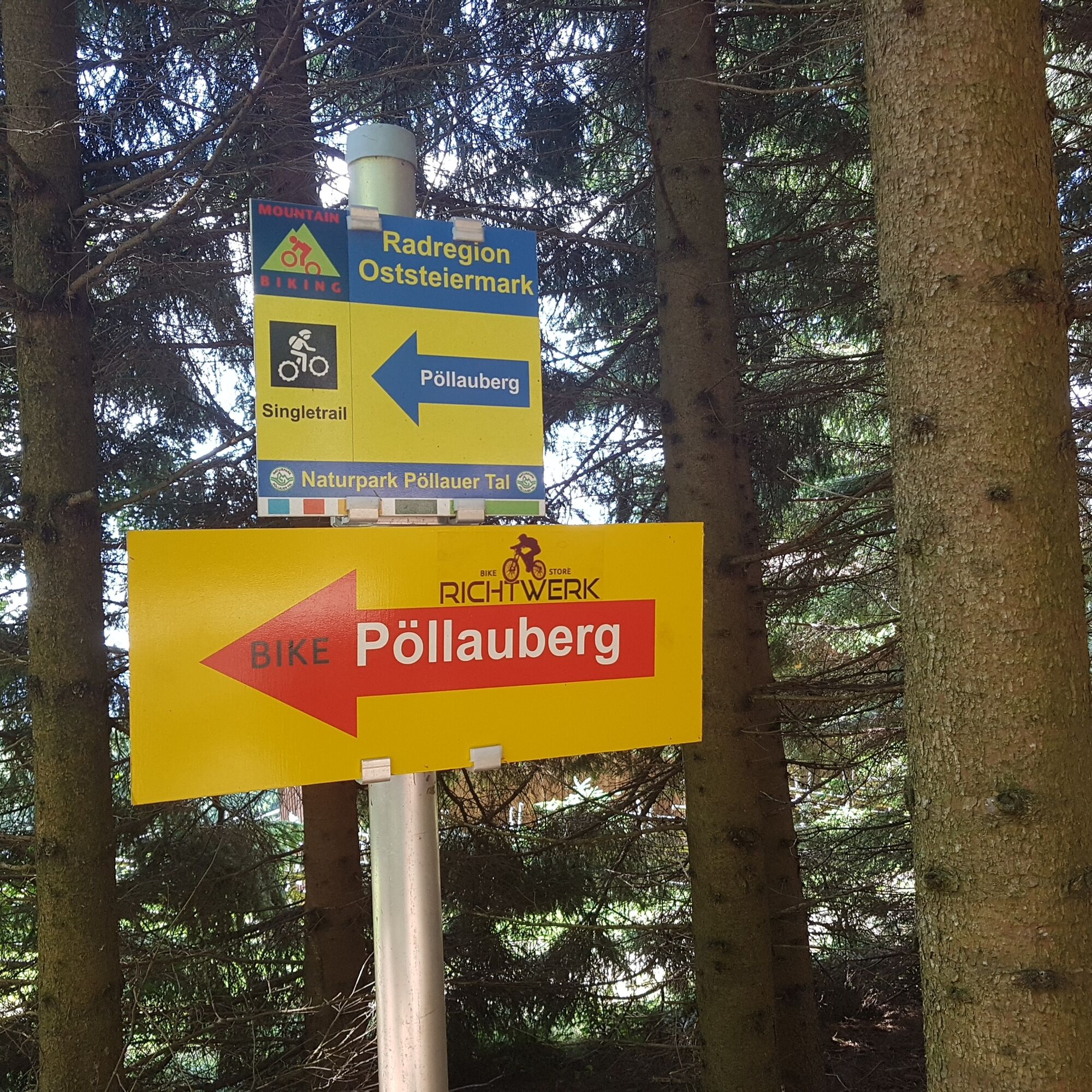
The ascent from Pöllau towards Pöllauberg (approx. 6 km and 350 metres in altitude) is mostly on local roads. From Hotel Retter, the route leads along the orchards along partly forest tracks towards Pöllauberg.
At the Ölkreuz waypoint on the left, the easier option or the more challenging section on the right leads to the pilgrimage church.
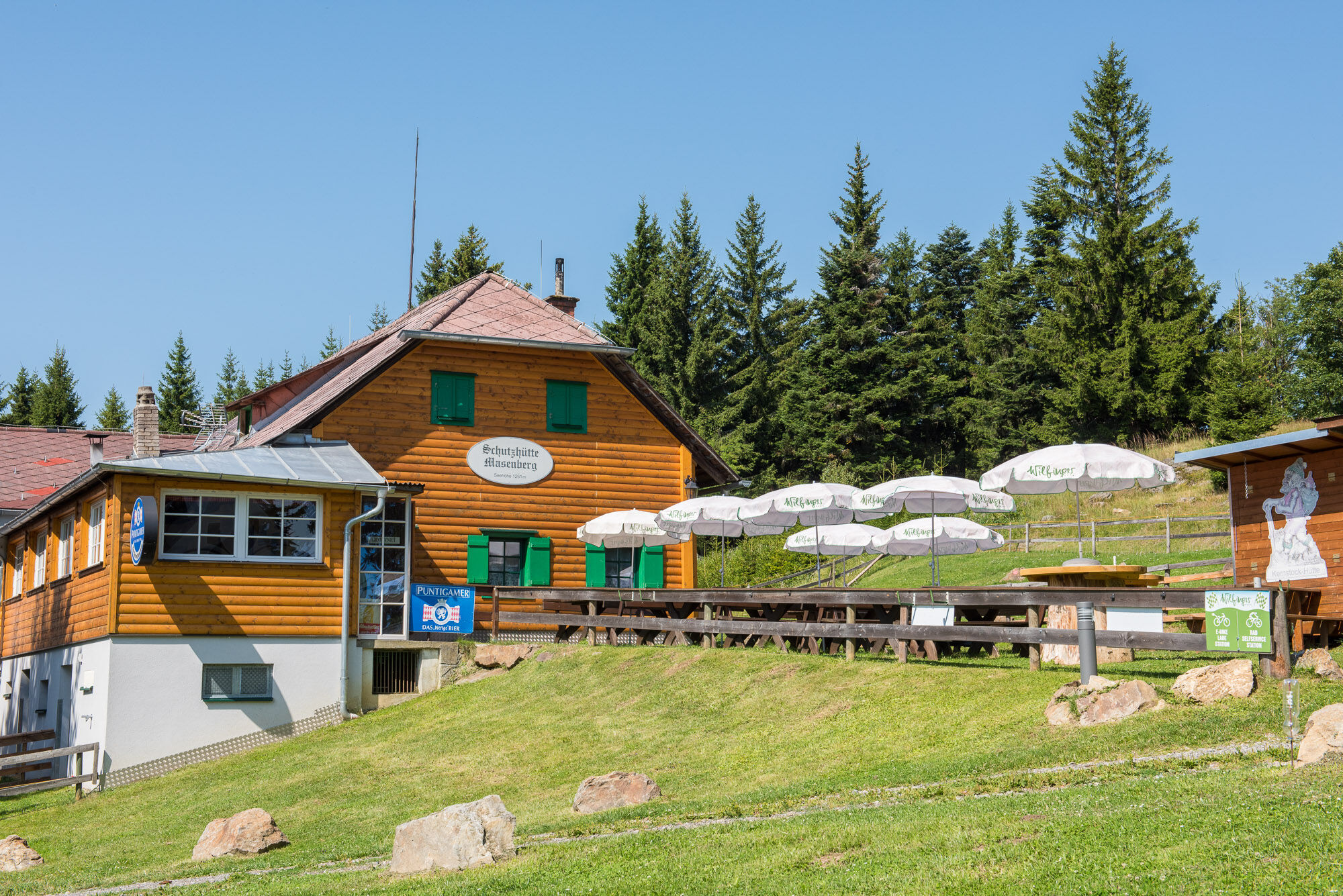
The next stage up the Masenberg (approx. 6 km and 500 metres in altitude) runs along the Masenbergstraße and here we reach the highest point of this tour on the Masenberg at 1261 m.
The descent is possible via the road again or via the 5 km long, very challenging downhill route built into the natural landscape (only for very experienced mountain bikers with the appropriate equipment!!!).
After a gastronomic stopover on the Pöllauberg, you return to the starting point in Pöllau as described above.
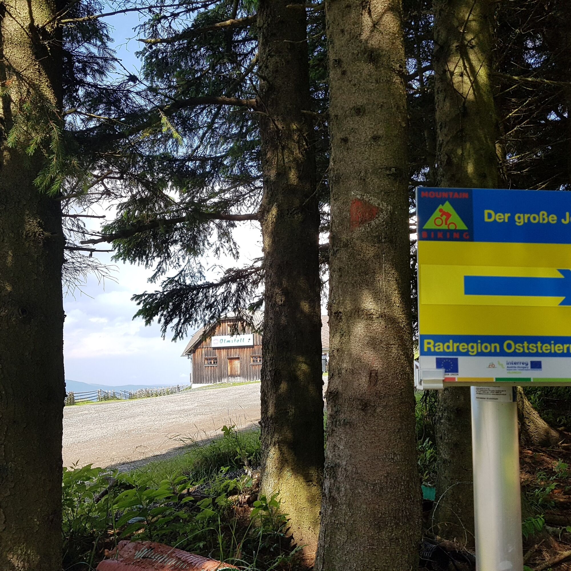
Attention: Parts of the route are on hiking trails.
- Highest point
- 1,253 m
- Endpoint
-
P&R at the Pöllau bypass
- Height profile
-

- Equipment
-
HelmetSunglasses
Water bottle
Provisions for the journey
Protective clothing if necessary (knee pads etc.)
Sporty clothing
Sturdy shoes
Gloves
Rain jacket/windbreaker
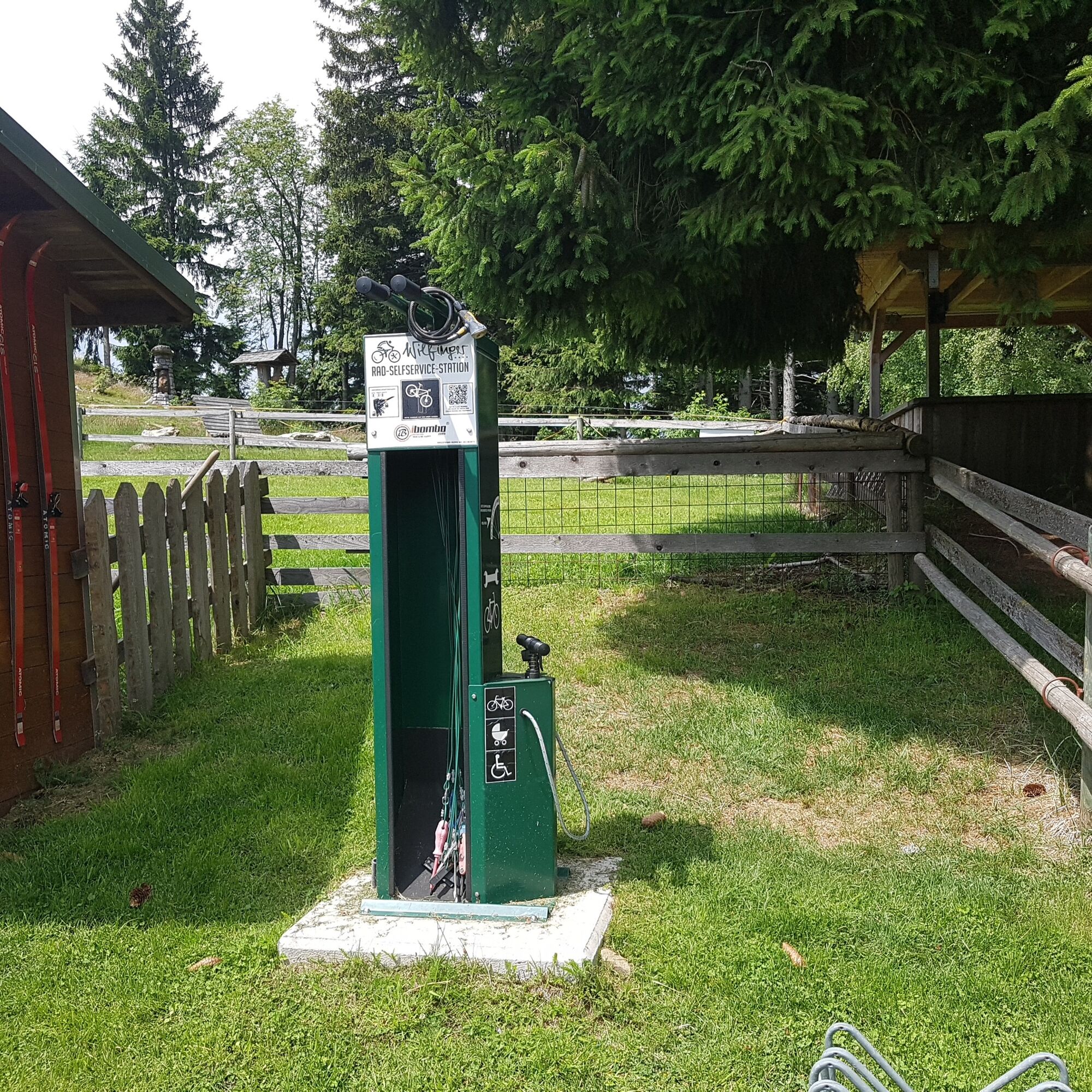
Repair kit (air pump, puncture repair kit, spare inner tube, multitool, etc.)
Light
First aid kit
Maps - Safety instructions
-
Important telephone numbers: European emergency call: 112 Emergency call mountain rescue: 140 (if possible, please provide GPS data) Rescue: 144 Fire brigade: 122 Police: 133
Fair play rules for cyclists
Plan your tour carefully! Check your bike before you set off! Always ride with the right protective equipment! Always ride with a helmet! Don't forget all your equipment (repair kit, first aid kit, etc.)! Only ride on signposted paths! Observe the road traffic regulations! Observe driving bans and keep to opening times! Control your speed! Leave no tracks! Respect other nature users! Show consideration for animals (only ride in daylight & close pasture fences)! Avoid noise and rubbish! Use the cycle paths at your own risk! Beware of working machines, wood or potholes on the road, grazing livestock and motorised traffic (forest roads are working areas and workplaces)!A few tips on correct and fair behaviour:
Cycling and mountain biking in the forest(oesterreich.gv.at)
Cyclists should avoid visiting the forest approx. 1.5 hours before sunrise and after sunset, as wild animals are particularly active at this time.
Plastic bottles, handkerchiefs, cigarette butts etc. have no place in the forest! Please make sure that you do not leave any rubbish in the forest.
Camping and making fires is strictly forbidden in the forest!
- Tips
-
Important information about the "bike":
Nature Park Pöllauer Valley
- Additional information
-
Information about the region, places to stop for refreshments and overnight accommodation, excursion destinations etc. can be found here:
Eastern Styria Tourist Board
Nature Park Pöllauer Valley office
Castle 1
8225 Pöllau, Austria
- Directions
- Public transportation
- Parking


- Author
-
The tour MTB round tour: Pöllau - Pöllauberg - Masenberg and back is used by outdooractive.com provided.


Surfaces
General info
-
Oststeiermark
158
-
Naturpark Pöllauer Tal
130
-
Pöllauberg
39