


- Brief description
-
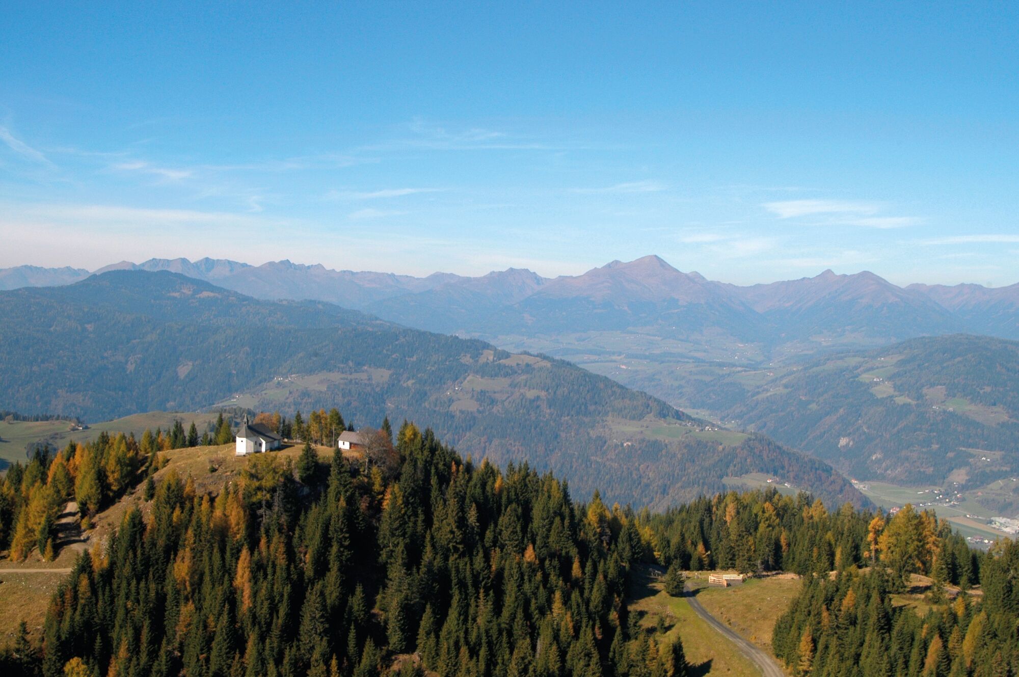
Up to Mühlsteinboden (1,544m) and enjoying a beautiful view of the Grebenzen - is the motto of this route.
- Difficulty
-
medium
- Rating
-
- Starting point
-
Abbey Gate St. Lambrecht
- Route
-
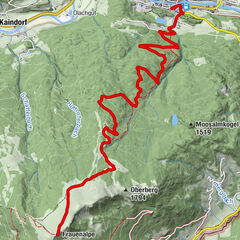
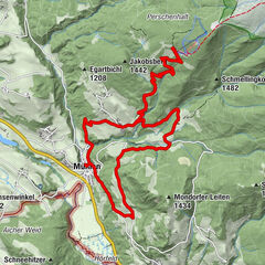
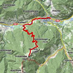
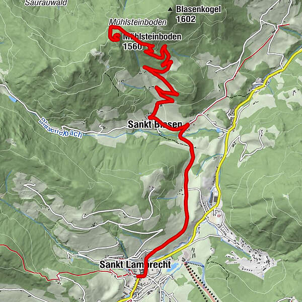
Sankt LambrechtStifterl0.0 kmMarktcafé0.0 kmTorwirt0.0 kmHeiligenstadt1.7 kmStraussenhof Wallner2.6 kmVorderbach3.4 kmSankt Blasen3.7 kmMühlsteinboden (1,560 m)9.6 kmWallfahrtskirche Mühlsteinboden9.7 kmSankt Blasen15.5 kmVorderbach15.7 kmStraussenhof Wallner16.6 kmHeiligenstadt17.4 kmSankt Lambrecht19.2 kmTorwirt19.3 kmMarktcafé19.3 kmStifterl19.3 km
- Best season
-
JanFebMarAprMayJunJulAugSepOctNovDec
- Description
-
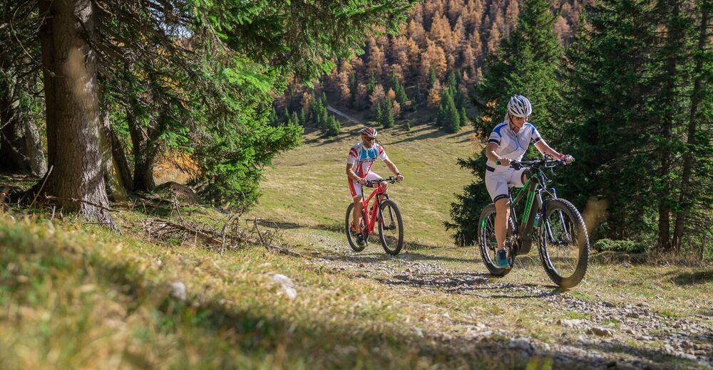
The promising tour leads from St. Lambrecht Abbey over gravel paths and forest roads to Mühlsteinboden, where there is a small pilgrimage church.You can either go downhill again on the same path or via the “SINGELTRAIL MÜHLSTEINBODEN”.
- Directions
-
With the aim of a wonderful view, the route leads via Heiligenstadt to St. Blase (asphalt and gravel). Shortly afterwards, the steep climb begins over the serpentines to the highest point on the route - the Mühlsteinboden (1,544m). Once at the top, you can take a pleasant rest next to the small pilgrimage chapel before taking the same path back to the starting point, St. Lambrecht Abbey (1,028m).
Tip: For those who are hungry for altitude, the tour can easily be combined with our circular routes to the Murtal-Blick or around the Kalkberg with a cool jump into the Podolerteich!
- Highest point
- 1,539 m
- Endpoint
-
Abbey Gate St. Lambrecht
- Height profile
-

- Equipment
-
Helmet
Suitable footwear
Sportswear
Drinking bottle etc. - Tips
-
On the descent, take a leisurely stop at the Gasthof Kirchmoar in St. Blase or an inn in St. Lambrecht.
- Additional information
-
The ideal time for this tour is from April to September.
- Directions
-
- Arrival from Germany
From Munich via the A8 towards Salzburg. From Salzburg on the A10 Tauernautobahn to St. Michael im Lungau. On the B 96 to Tamsweg, then on the B 95 to Predlitz. The B 97 leads via Stadl/Mur to Murau. There at the roundabout towards St. Lambrecht to Murauer train station and further towards St. Lambrecht. You reach St. Lambrecht via Laßnitz near Murau. The monastery is located in the town center.
- Arrival from Eastern Austria/Hungary
At the motorway junction in St. Michael near Leoben, take the S 36 towards Klagenfurt. Past Knittelfeld and Judenburg to Scheifling. In Scheifling continue towards Klagenfurt to Neumarkt, via Unzmarkt and Perchau am Sattel you reach Neumarkt. Turn right there towards Mariahof and St. Lambrecht. In Mariahof, after the railway crossing, turn left towards St. Lambrecht. The monastery is located in the center of St. Lambrecht.
- Arrival from southern Austria/Italy
Via Klagenfurt on the S37 past St. Veit/Glan, Treibach and Friesach. In Friesach continue towards Vienna, via Dürnstein and Wildbad to Neumarkt. After the town center of Neumarkt turn left towards Murau, in Mariahof turn left after the railway crossing towards St. Lambrecht. The monastery is located in the center of St. Lambrecht.
- Public transportation
-
With the BusBahmBim app from the composite line, timetable information is easier than ever before: all bus, train and tram connections in Austria can be queried by entering locations and/or addresses, stops or important points. The app is available as a free app for smartphones (Android, iOS) - on Google Play and in the App Store.
- Parking
-
Parking spaces are available at St. Lambrecht Monastery or along the monastery wall or at the Grebenzen mountain railways.

- Author
-
The tour Mühlsteinboden-Tour is used by outdooractive.com provided.