- Brief description
-
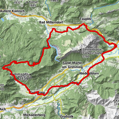
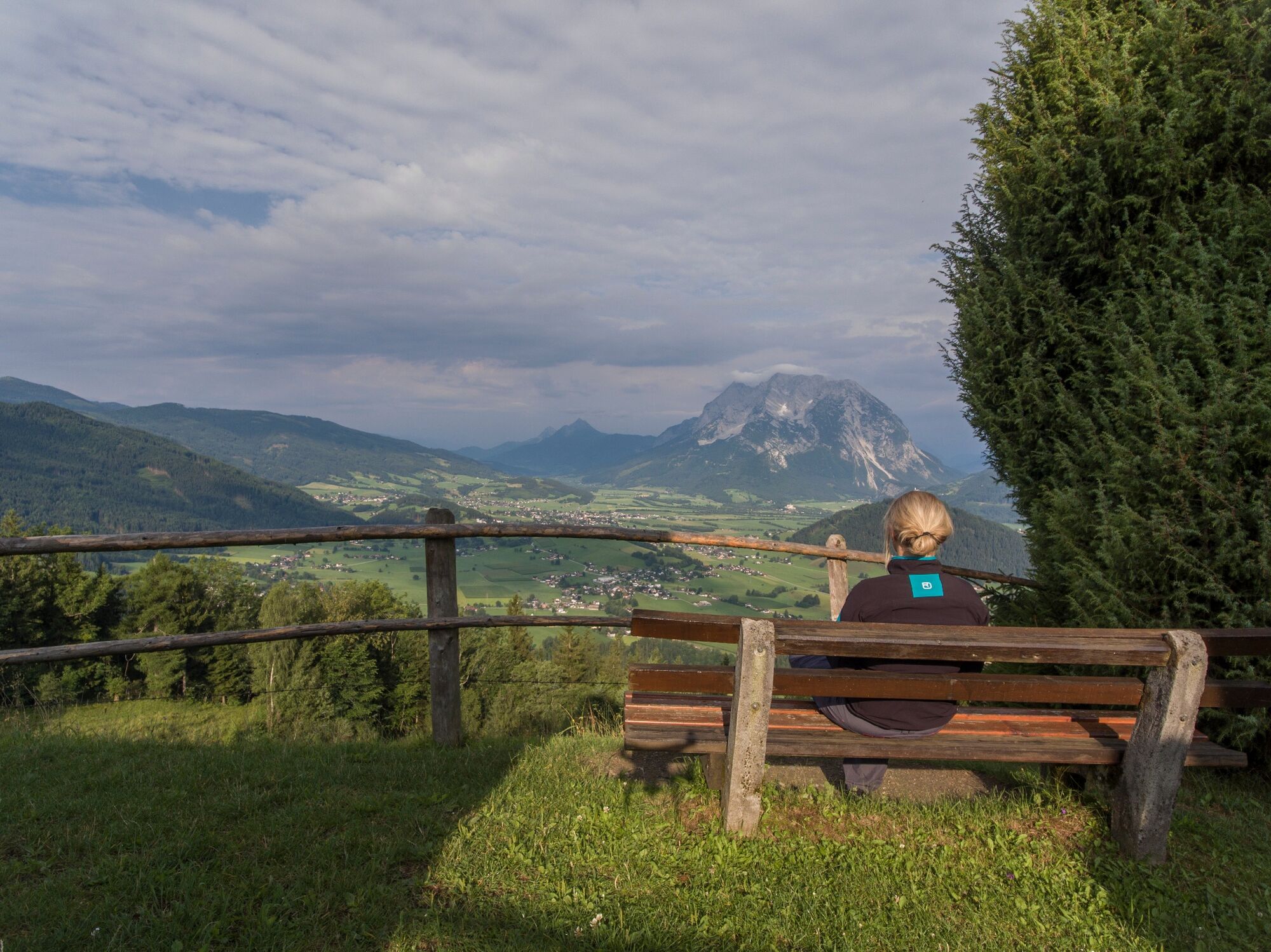
We explore Aigen on roads with little traffic and parts of the Ennstal cycle path. Over the Vorberg it goes to the Stalingradkapelle, a breathtaking view of the upper Ennstal awaits you there.
- Difficulty
-
easy
- Rating
-
- Starting point
-
Bus station Irdning
- Route
-
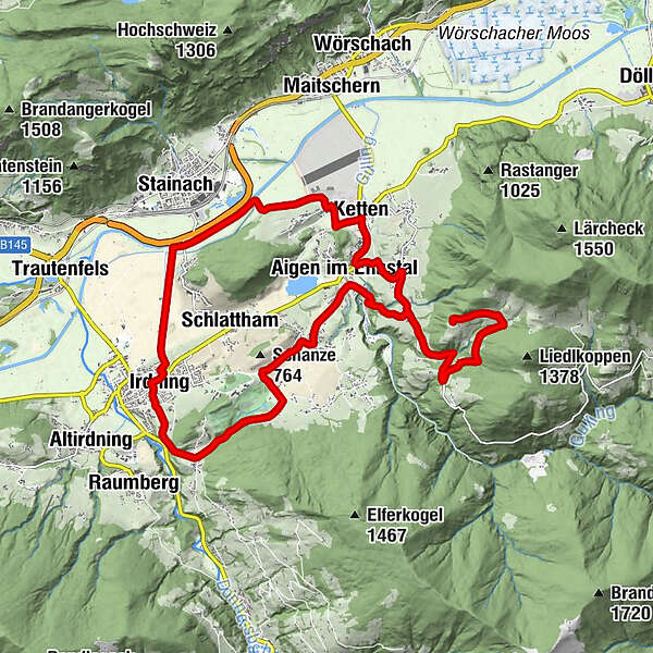
Irdning0.1 kmGasthaus Wöhrer5.0 kmLantschern5.1 kmAigen im Ennstal5.9 kmRitzmannsdorf7.4 kmStalingradkreuz Kapelle11.7 kmRitzmannsdorf16.0 kmAigen im Ennstal17.6 kmKetten18.6 kmGasthaus Zechmann18.7 kmHohenberg20.1 kmPfarrkirche Irdning24.6 kmGabriel24.6 kmIrdning24.7 km
- Best season
-
JanFebMarAprMayJunJulAugSepOctNovDec
- Description
-
Mountain bike route over asphalt and forest roads. The tour offers an excellent view of the Grimming, the highest free-standing mountain in Europe, at several points and passes gorgeous meadows, forests and lakes.
- Directions
-
The following localities and waypoints serve as a guide:
Starting point Busstation Irdning – Falkenburg – Moar zWinklem – Jagerlenzweg – Schloss Pichlarn – Lantschern – Puttererseehof – Ritzmannsdorf – Brückenwirt – Hohenberg – Ennsweg – Irdninger Moos – Irdning Schwarzer Weg - Irdning – back to the starting point
- Highest point
- 1,111 m
- Endpoint
-
Bus station Irdning
- Height profile
-

- Equipment
-
Fahrradhelm, Radbekleidung, festes Schuhwerk, kleines Erste-Hilfe-Set, Kartenmaterial und ein vollständig aufgeladenes Mobiltelefon.
Das richtige Fahrrad: Mountainbike oder Gravelbike mit Stollenreifen, Rennräder sind nicht zu empfehlen.
Eine Grundausrüstung an Werkzeug und Zubehör:Ersatzschlauch und/oder Flickzeug, Universalschraubenschlüssel, Luftpumpe, Brems- und Schaltseil, sowie ein Schraubenzieher. - Safety instructions
-
Stay on it on the signposted bike routes.
SOME ROUTES MAY ONLY BE USED AT CERTAIN TIMES. PLEASE KEEP TO THESE.
At all other times, the forest, meadows and their inhabitants may rest. Please be considerate of them.
Mountain and valley want to be in tip-top shape for you. Therefore, always expect work on the trails.
Pedestrians and animals can also cross your path from time to time. Therefore, drive with foresight and give them priority.
Please also remember to close pasture fences.
Use the brakes in a controlled manner to protect forest and meadow soils.
Rain is good for nature. If possible, refrain from riding on the trails afterwards.
Garbage on meadows and trails can not smell mountain and valley. Please take it with you.
Agriculture, forestry and hunting are important partners for Berg und Tal. They allow you to ride on many of their trails. Be aware, only a good cooperation will guarantee your biking pleasure in the future.
In case of emergency, please dial the following emergency numbers: No. 140 - Mountain rescue No. 112 - Euro emergency call - Tips
-
At the Stalingrad Chapel it is worth to take a rest. Wonderful view :-)
- Additional information
-
Tourist Office Schladming-Dachstein
T: +43 3687 23310
Garbage on meadows and paths can not smell mountain and valley. Please take it with you. Agriculture and forestry are important partners for Berg und Tal. They allow you to walk and drive on many of their paths. Be aware that only good cooperation will guarantee your recreational enjoyment in the future.
- Arrival
-
At Trautenfels or Wörschach turn off the B320, direction Irdning, village center.
- Public transportation
- Parking
-
A free parking lot is located just across from the starting point at the tourist office.


-

-
AuthorThe tour Aigen Tour | 24 is used by outdooractive.com provided.