Cardiovascular system with running ABC (Herz-Kreislauf mit Lauf ABC)


- Brief description
-
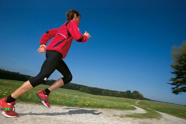
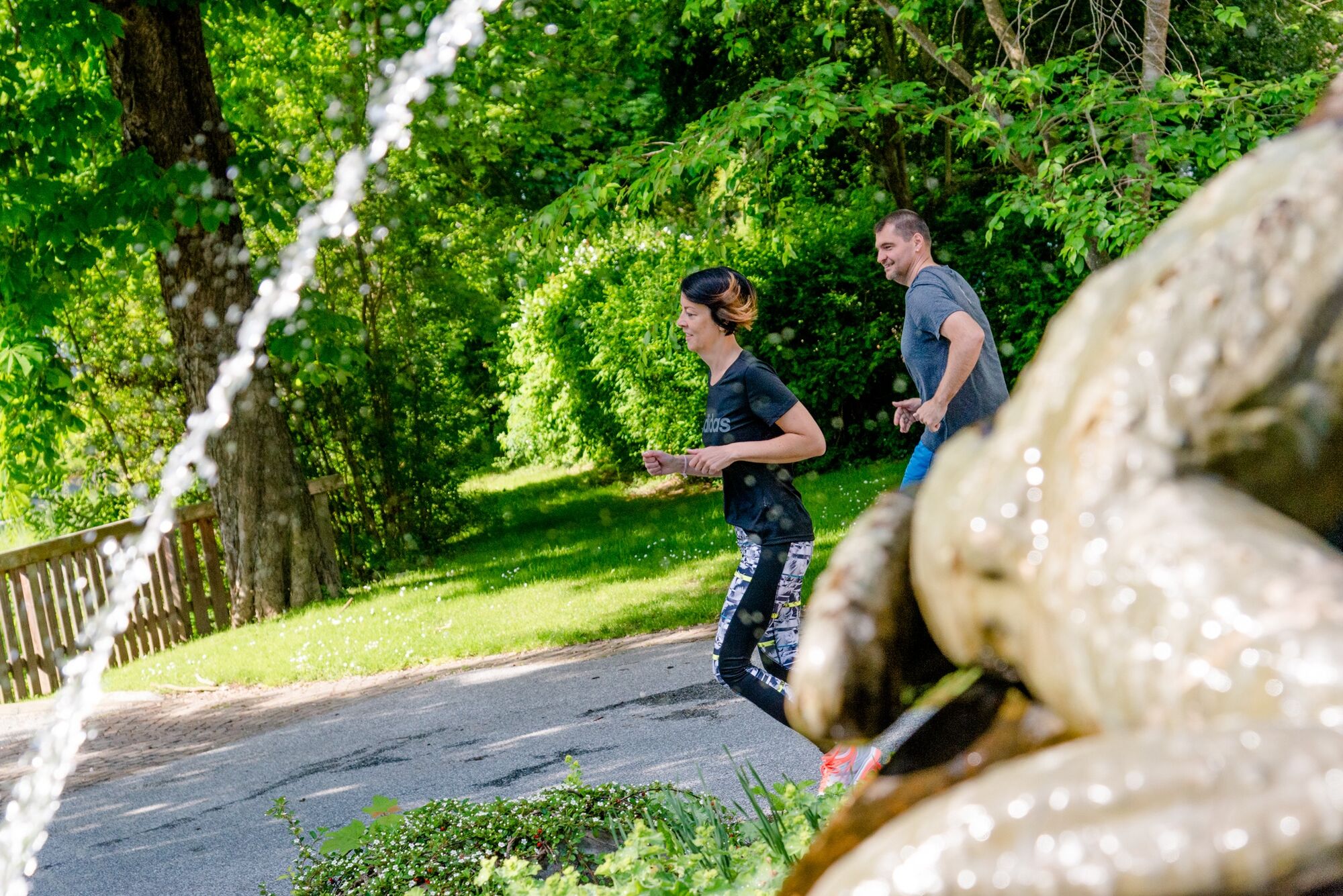
Proper regular running strengthens the cardiovascular system, the immune system, burns fat, prevents postural deformity and improves general health.
- Difficulty
-
medium
- Rating
-
- Starting point
-
Spa Bad Waltersdorf
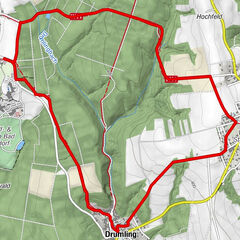
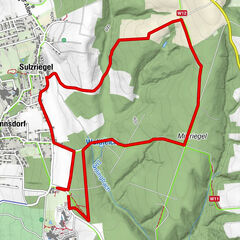
- Route
-
Buschenschank der Pieber0.1 kmBuschenschank Thaler0.3 kmBad Waltersdorf1.8 km
- Best season
-
JanFebMarAprMayJunJulAugSepOctNovDec
- Description
-
Along this route we offer you a running ABC with a variety of exercises. With these exercises you will improve your running style and learn to run faster and smoother.
- Directions
-
The starting point of this running route is the Heiltherme Bad Waltersdorf. You start slightly uphill and already after 100 m turn right. Then go straight towards the campsite, continue to the railroad crossing. Cross the railway and turn right immediately along Siegesbrunn Street. At the end of the road turn left and go up the slightly ascending road. At 2,900 m turn right, past the landlords, downhill back to the Heiltherme Bad Waltersdorf.
Perform the running ABC exercises for max. 30 sec., then continue running loosely.
1.slightly uphill, after 100 m turn right
2.straight on in the direction of the camping site
3.to the railroad crossing
4.cross, immediately right, along Siegesbrunn street
5.at the end of the road left
6.slightly uphill along road
7.at 2.900 m downhill back to the thermal spa - Highest point
- 323 m
- Endpoint
-
Spa Bad Waltersdorf
- Height profile
-

- Equipment
-
-Sportswear
-running shoes
-blister plaster
-Sunglasses
-running map - Safety instructions
-
Emergency call mountain rescue: 140
ambulance: 144
European emergency call: 112
firefighters: 122
police: 133Tips when reporting an emergency – Answer these six WH questions: What happened? How many people are injured? Where did the accident happen (are there GPS coordinates)? Who is reporting the incident (callback number)? When did the accident happen? What is the weather like at the site of the incident?
- Tips
-
GenussCard - One card. Three regions. Endless enjoyment!
- Additional information
-
The Styria Tours App, which is available for free on Google Play and in the App Store (Android, iOS), offers detailed first-hand information: short facts (length, duration, difficulty, ascent and descent in altitude meters, ratings), map, route descriptions, altimeter, compass, summit finder, navigation along the tour. In addition, you can create your personal favorites list of favorite tours and points, save tours and destinations offline, play social media - channels and more...
Tourist Office Thermen- & Vulkanland
Gästeinfo Bad Waltersdorf
Hauptplatz 90
8271 Bad Waltersdorf
Tel: +43 3382 55 100-71
badwaltersdorf@thermen-vulkanland.at
www.thermen-vulkanland.at - Directions
-
Arrival by car from the direction of Vienna:
Freeway A2 direction Graz - you take the exit Sebersdorf/ Bad Waltersdorf
Arrival by car from the direction of Graz:
Freeway A2 direction Vienna - you take the exit "Sebersdorf/ Bad Waltersdorf
Arrival by train:
Austrian Federal Railways: TelNr. 0043 (0) 51717 or www.oebb.at
- Public transportation
-
Detailed information about arriving by ÖBB (Austrian Federal Railways) can be found at www.oebb.at or on the Verbundlinie Steiermark website www.busbahnbim.at
With Verbundlinie’s BusBahnBim route planner app, planning your journey has never been easier: simply enter towns and/or addresses, stop names or points of interest to check all bus, train and tram connections in Austria. The app is available free of charge for smartphones – on Google Play and in the App Store
- Parking
-
There are numerous parking spaces available in Bad Walterdorf and around the tour route.

-

-
AuthorThe tour Cardiovascular system with running ABC (Herz-Kreislauf mit Lauf ABC) is used by outdooractive.com provided.