


- Brief description
-
Running in Stainz
Sporty running on 25 kilometres around Stainz. The route invites you to discover the advantages of the region.
- Difficulty
-
difficult
- Rating
-
- Starting point
-
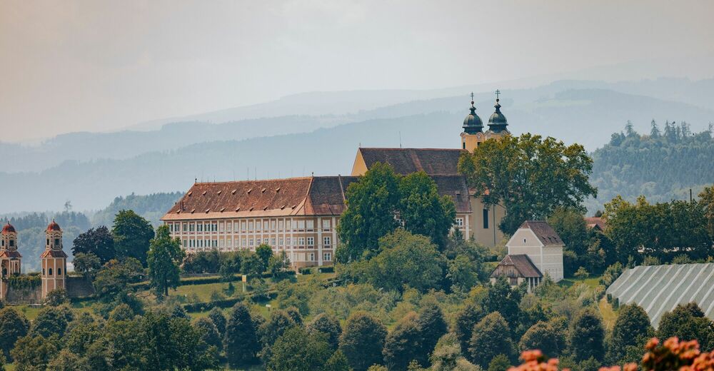
Stainz Castle
- Route
-
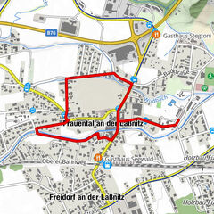
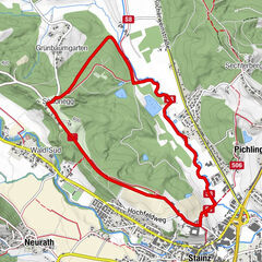
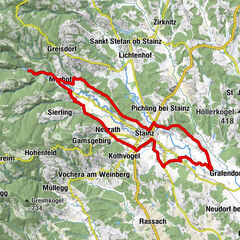
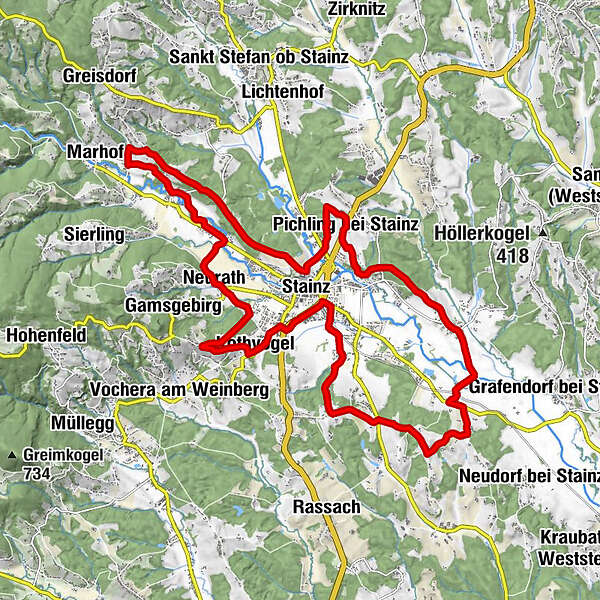
StainzSchönegg1.7 kmPreißberg2.7 kmTeufenbach4.2 kmWald in der Weststeiermark5.2 kmRauch-Hof6.2 kmWald-Süd6.5 kmNeurath7.6 kmPletterikapelle9.8 kmKothvogel10.9 kmStainz12.4 kmEvangelische Kirche A.B. "Friedenskirche"12.5 kmSchwaig14.8 kmEttendorf bei Stainz20.1 kmGeorgsbergkapelle20.9 kmStallhof22.2 kmKalvarienbergkapelle22.5 kmPichling bei Stainz23.3 kmSchlosstoni23.3 kmMarienkapelle24.0 kmStainz25.1 kmPfarrkirche Heilige Katharina25.3 km
- Best season
-
JanFebMarAprMayJunJulAugSepOctNovDec
- Description
-
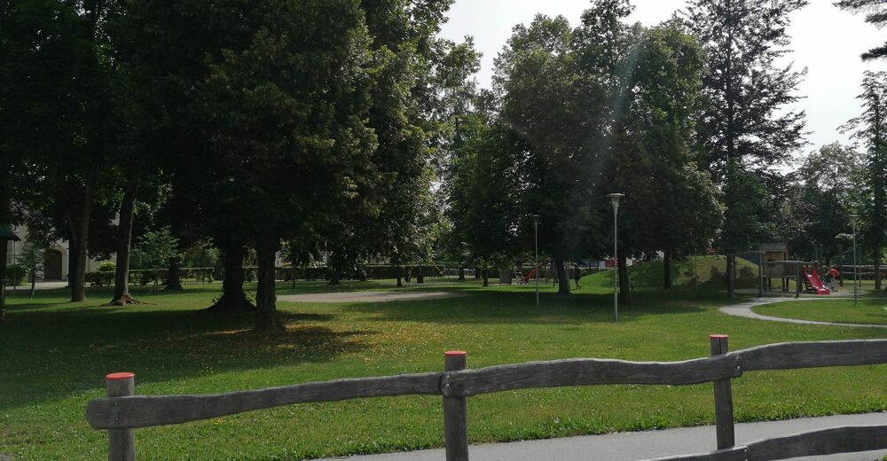
Stainz can be discovered in a sporty and above all healthy way. Not even locals know how many beautiful chapels and wayside crosses there are around Stainz. The tour starts at Stainz Castle, in keeping with the theme. Many "Matterl", small chapels and wayside crosses can be seen on this route. Most of the route (about 12 km) is on asphalt and the remaining kilometres are on gravel paths, trails and forest paths. Variety is definitely a given here.
- Directions
-
Take advantage of the beautiful ambience at Stainz Castle and warm up for your upcoming run directly at the car park. Well prepared for the upcoming 4-hour run, set off in the direction of Bründlwald. A beautiful gravel path leads you through the forest to Schönegg. Now run along the road to Preisberg. At the crossroads, take the road on your left and run downhill for a while. After 400 metres, a path branches off to the left (Mitterweg). Follow this path for the time being. After passing through a small forest, you will shortly arrive in "Wald in der Weststeiermark". The path now leads you further through fields and forests in the direction of Rauch-Hof. Here you can discover fish ponds, asparagus fields and a bathing pond. After the beautiful run through the Rauch-Hof, you now come to the road. Walk in the direction of Stainz and turn right into Neurathstraße after the company "Steinbrüche Rath". Follow this road to the end and turn left. In the meantime you have already walked past many Matterln. At the end of Neurath there are still the Schlossblick-Alpakas to discover. Here you now walk straight across Engelweingartenstraße. This path takes you into Ziegelstadelstraße. Directly after the Freydl bakery, turn right and walk through the forest to Eichegg. Once you arrive here, there is also a small chapel to visit. Now head down the Sonnenhügel hill to Kothvogel. Continue at a brisk pace in the direction of Stainz. When you reach the Billa, turn right over the zebra crossing and then straight over the roundabout. The Gewerbeparkstraße leads you to the Bahnhofpark. Walk through the park and follow Langwiesenbachgasse in the direction of Graschuh. A beautiful field and forest path takes you to Schwaig. Now the trail descends a little through Graschuh. Here you can see western Styrian houses and many large farms. Walk straight across the Lasselsdorfer Landesstraße in the direction of Herbersdorf. Now walk around the Frauenkogel, slightly sloping, in the direction of the Öhlmühle Herbersdorf. This oil mill is one of the smallest and oldest oil mills in Styria and definitely worth a visit. You then pass through the district of Ettendorf. Again there is a lot of nature to see. The next destination on the running route is the Georgskapelle (St. George's Chapel). You take the path over the Georgiberg through the Hofwald forest. Then you go to Pichling and for a short stretch onto the B76 motorway. Shortly after the Schlosstoni inn, turn left at a run into the cul-de-sac. At the end, a field path leads to the Marienkapelle chapel. A forest path leads you further to Pichling. You cross the main road and can already see Stainz Castle. A small bridge takes you safely across the small Lemsitzbach stream and now it is only a short way uphill to the starting point. You've done it! Stretch a little before you finish the sports unit for today.
- Highest point
- 475 m
- Endpoint
-
Stainz Castle
- Height profile
-

- Equipment
-
Running shoes and seasonal running clothes.
- Safety instructions
-
Suitable running clothes are an advantage.
Rescue: 144
Emergency reporting tip - give answers to the six W questions: What happened? How many injured? Where did the accident happen (possibly GPS coordinates)? Who reported the accident (call-back number)? When did the accident happen? Weather at the accident site?
- Tips
-
Many excursion destinations can be discovered on this running route. After your run, visit the hunting museum in Stainz Castle together with friends or family.
- Directions
-
Plan your journey via Google Maps to the starting point of the tour: www.google.at/maps
From the north: Motorway Munich - Salzburg - Eben - Schladming - Liezen onto the A9 towards Graz. Exit at Lieboch and follow the B76 towards Deutschlandsberg. In Stainz leave the B76 and follow the direction of Schloss Stainz.
A9 is subject to toll - Gleinalmtunnel. Alternative: at St. Michael take the S6 towards Bruck and in Bruck take the S35 towards Graz.
From the west: In Villach take the A2 towards Klagenfurt. Take the Steinberg exit and follow the signs for Stainz - Schloss Stainz.
From the east: A2: Vienna - Aspang - Hartberg - Fürstenfeld - Graz. From Graz continue on the A2 in the direction of Klagenfurt and take the Lieboch exit in the direction of Stainz/Deutschlandsberg/Eibiswald. Follow the B76 to Stainz - direction Schloss Stainz.
From the south: A1 from Marburg to Leibnitz. Exit in Leibnitz (Gralla) and continue on the B74 in the direction of Deutschlandsberg (Heimschuh - Gleinstätten - St.Martin - Deutschlandsberg). Pass the LKH Deutschlandsberg, at each of the four roundabouts take the second exit in the direction of Stainz-Graz. Follow the B 76 in the direction of Stainz. Directly in Stainz, take the third exit at the JET roundabout and drive in the direction of Schloss Stainz.
- Public transportation
-
You can find timetables and travel information directly at
With the BusBahnBim app of the Verbundlinie, timetable information is easier than ever: all connections by bus, train and tram in Austria can be retrieved by entering places and/or addresses, stops or important points. The app is available as a free app for smartphones (Android, iOS) - on Google Play and in the App Store.
- Parking


-

-
AuthorThe tour Chapels run is used by outdooractive.com provided.