- Brief description
-
A beautiful 3-day-hike that is a real treatment for yourself, including 2 overnights in a mountain chalet in the Schladminger Tauern range. One overnight at Duisitzkarsee Lake, the other at the Giglachseen Lakes. Each day you hike for approximately 3 hours.
- Difficulty
-
medium
- Rating
-
- Starting point
-
Hiking trail head Eschachalm, Obertal
- Route
-
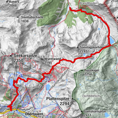
Eschachhüttn (1,213 m)0.0 kmFahrlechhütte (1,648 m)6.7 kmDuisitzkarseehütte (1,660 m)6.8 kmGiglachsee Hütte (1,955 m)12.7 kmIgnaz-Mattis-Hütte (1,986 m)13.9 km
- Best season
-
JanFebMarAprMayJunJulAugSepOctNovDec
- Description
-
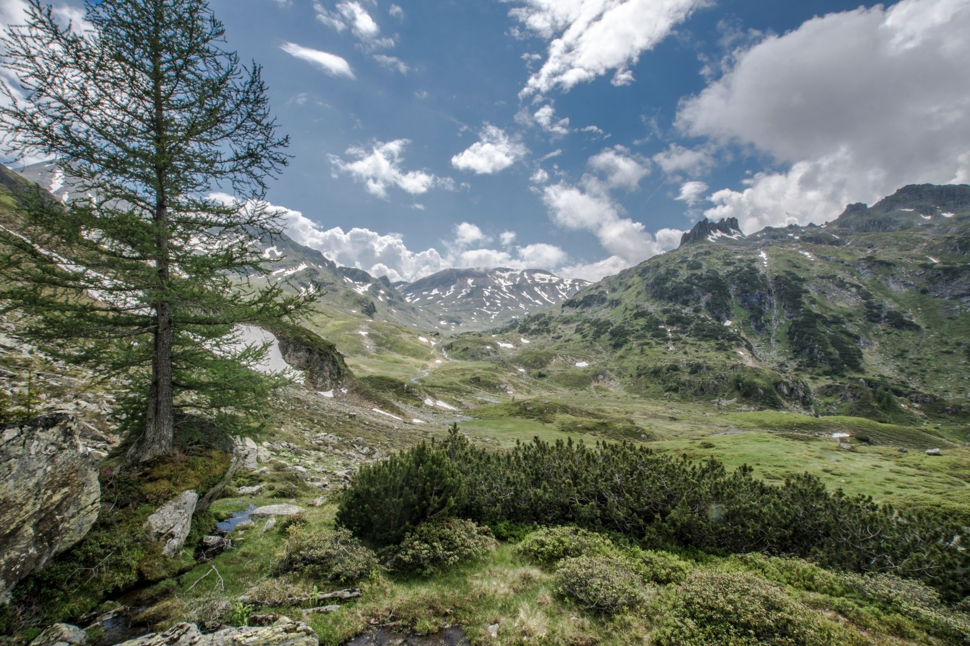
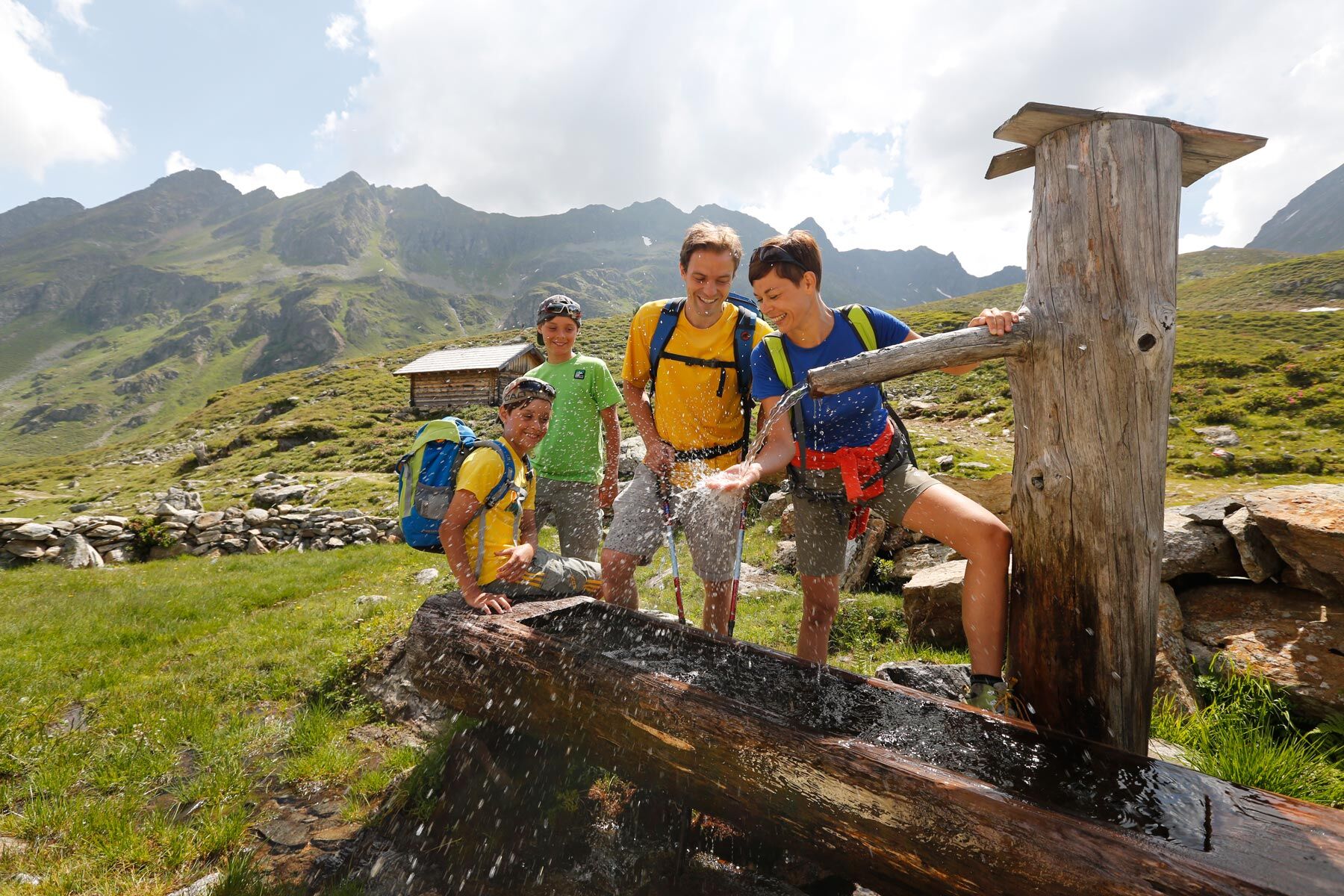
The 3-day-hike along the "Alp Tour Obertal" is a wonderful hike to the mountain lakes in the Duisitzkar and Giglachkar cirques. The tour is layed out for 2 overnight stays and caters especially to families with kids and hikers who enjoy the trail as part of the experience. Along the route and at each days stage point you enjoy the great scenery of the Schladminger Tauern range in the Obertal valley. Along the route and the Duisitzkarsee and Giglachseen Lakes there is a lot to discover. Kids will enjoy the element of water - playing along the creeks or swimming in the lakes. Along the trails further beautiful spots wait to be discovered. Magical places in the forest, view points inmidst of fields of dwarf pines, trails seamed by berry bushes, and centuries-old chalets wait along the Alp Tour Obertal.
- Directions
-
Day 1 - Picturesque Obertal valley
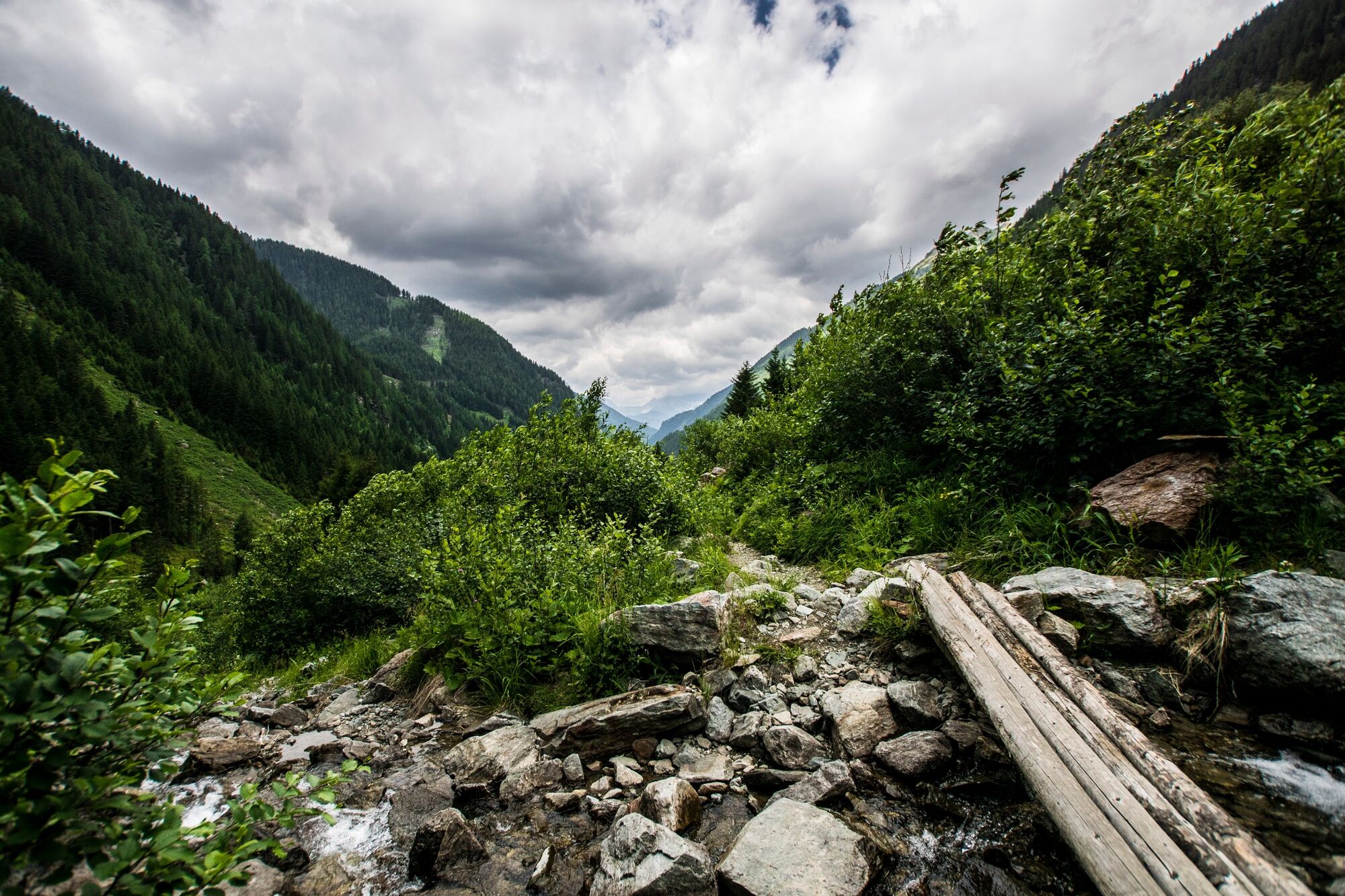
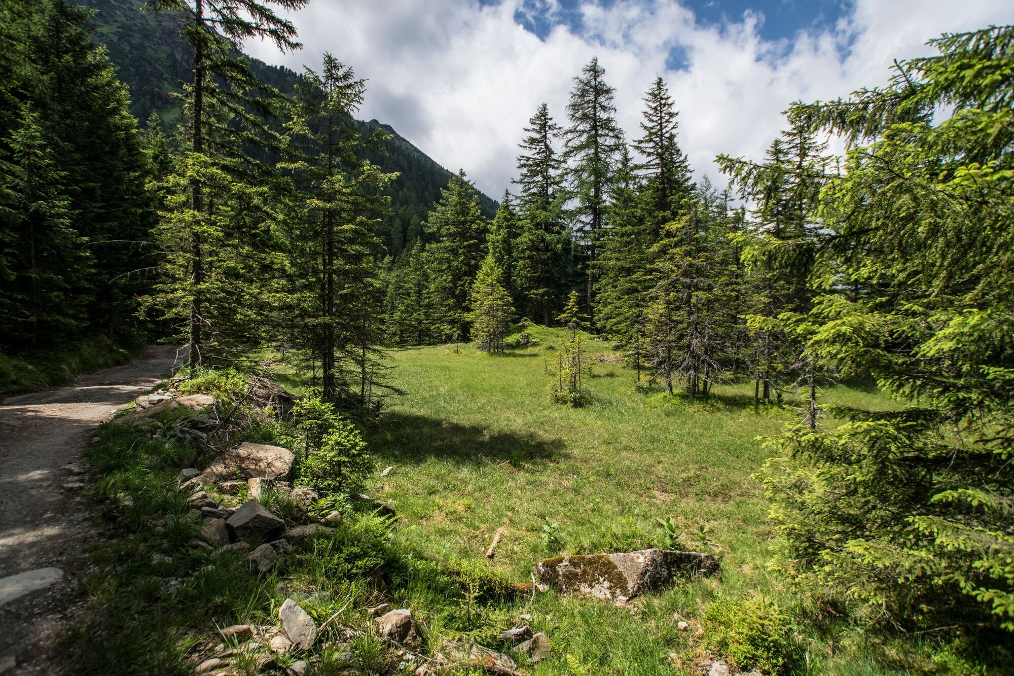
The first stage of this 3-day-tour along the Alp Tour Obertal shows the different faces of Obertal valley. Starting point for the tour is at the hiking trail head Eschachalm at the valley head of Obertal, which can be reached comfortably by Planai bus. From the beautiful valley floor you follow trail n° 774 towards Neualm/Keinprechthütte. The trail ascends moderately through fairy-tale like forests and the roaring sound of the Obertalbach creek is your constant companion. Until Neualm the trail is interrupted by some short sections along a forestry road.
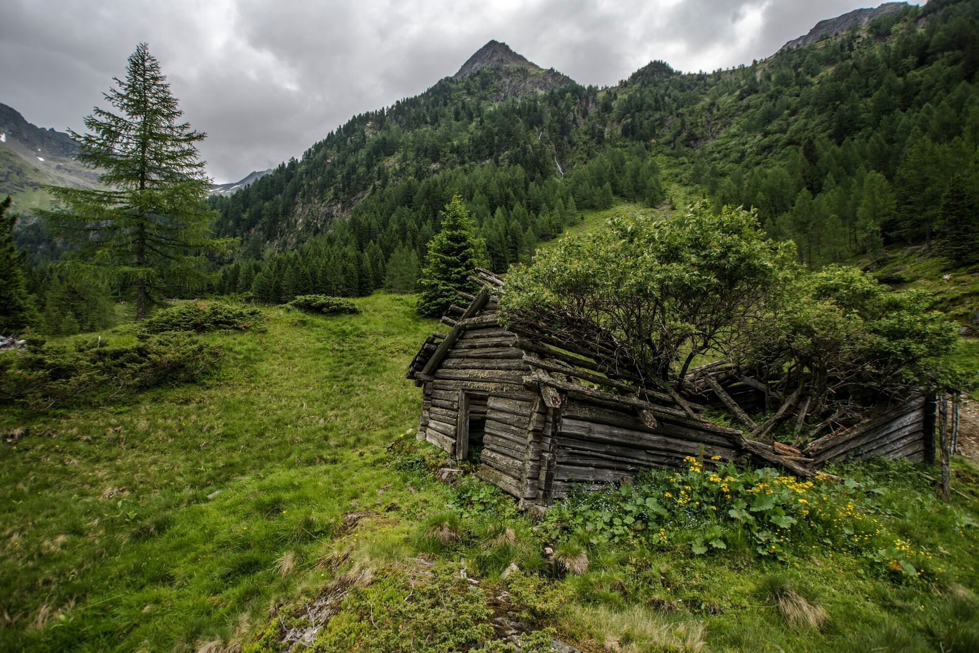
Neualm chalet (private only - no refreshment stop) lies on a lush green alpine meadow at an altitude of ca. 1,650 m. After about 1.5 hours of walking time this is a perfect place for a break on the chalets terrace. The view to the surrounding mountains is impressive. Kids may use the break to play at the creek next to the chalets. If you want, you can also hike from here to the Keinprechthütte in about 2 hours (there and back).
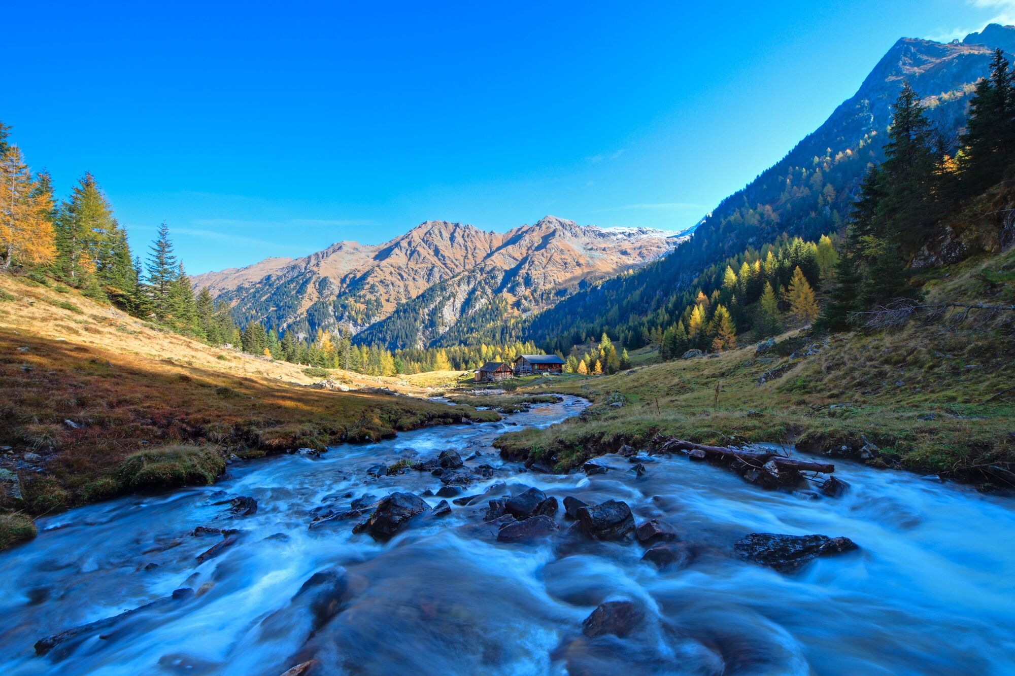
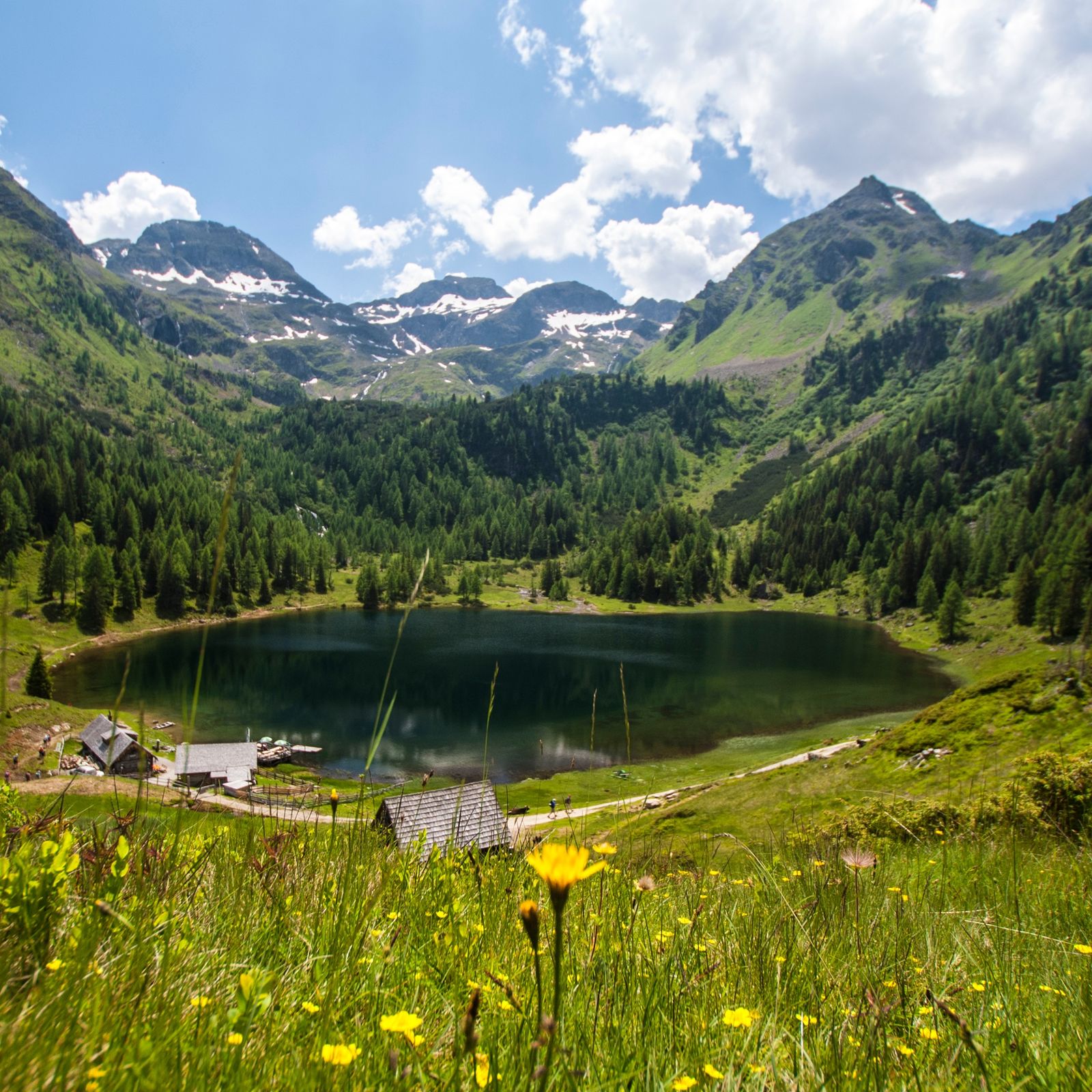
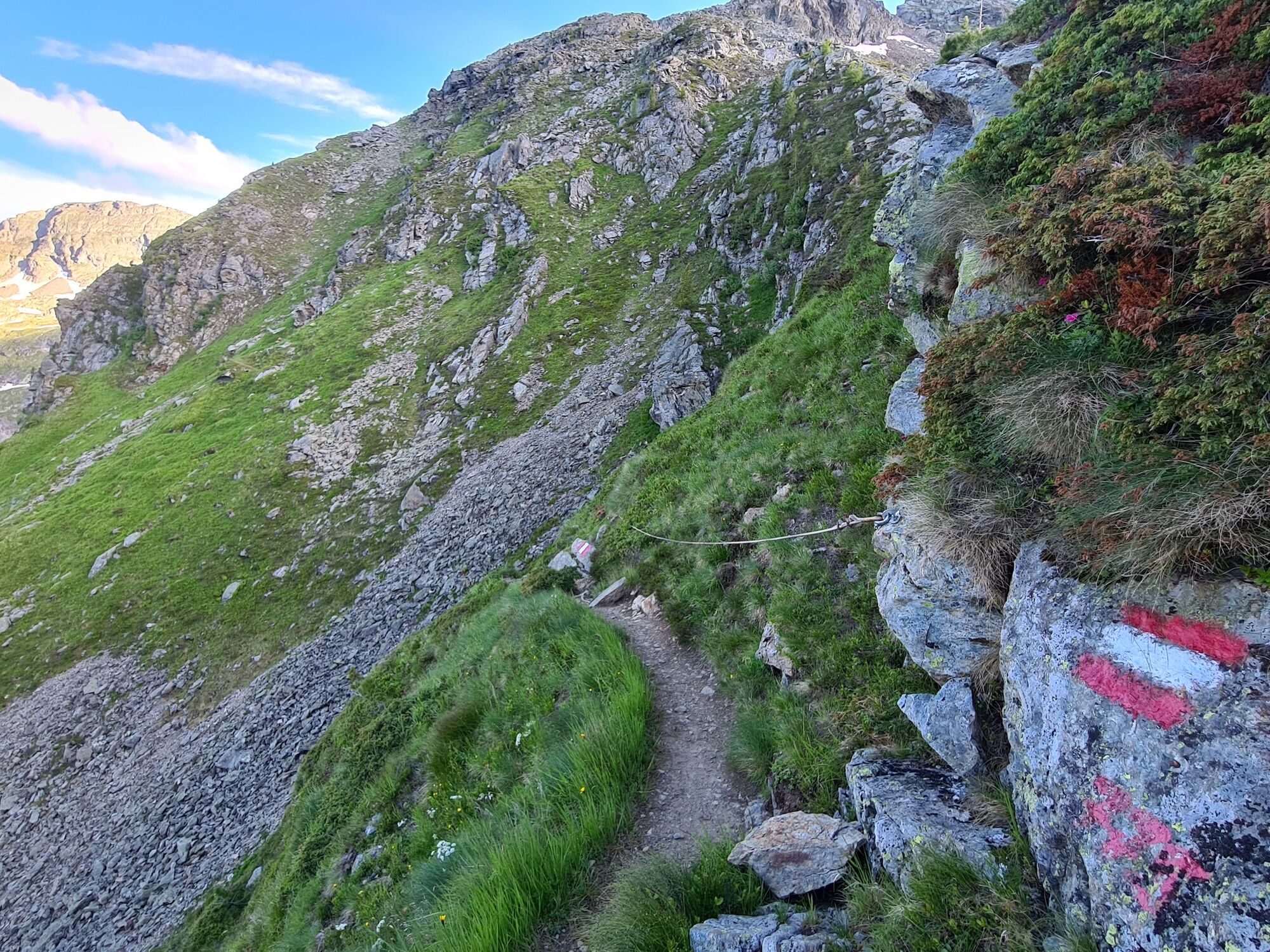
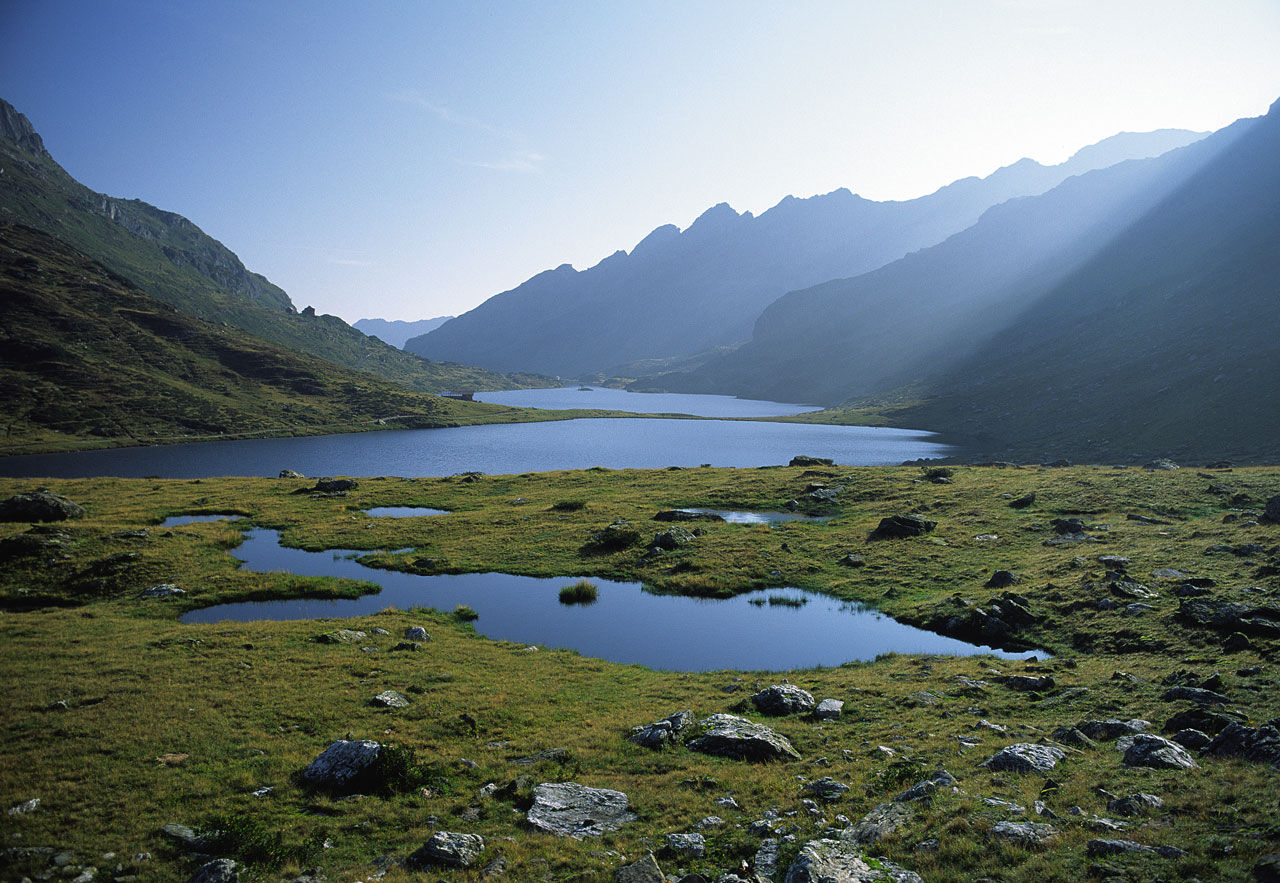
After the break you cross the creek and then turn-off right on the trail towards Duisitzkarsee lake. The trail is a classic hiking trails with lots of tree roots along the way and takes you through clear forest and extensive fields of dwarf pines. The trail nestles to the slopes of the Duisitzer Hahnkamp mountain and leads towards Duisitzkar cirque via a constant, but moderate up and down. This section of the hike awaits you with breathtaking viewpoints, centuries-old trees, and some small surprises along the way. After about 1.5 hours from Neualm chalets you finally reach picturesque Duisitzkarsee Lake, and you will instantly know, why this lake is one of Austria's most popular photo points.
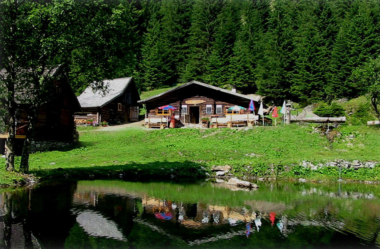
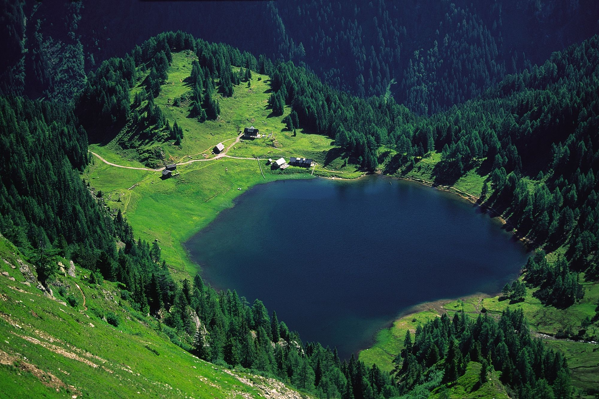
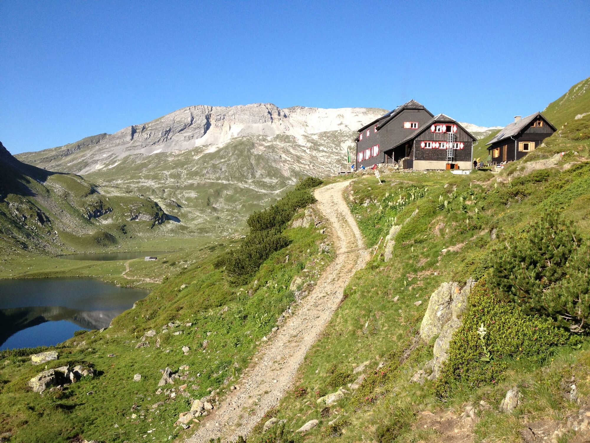
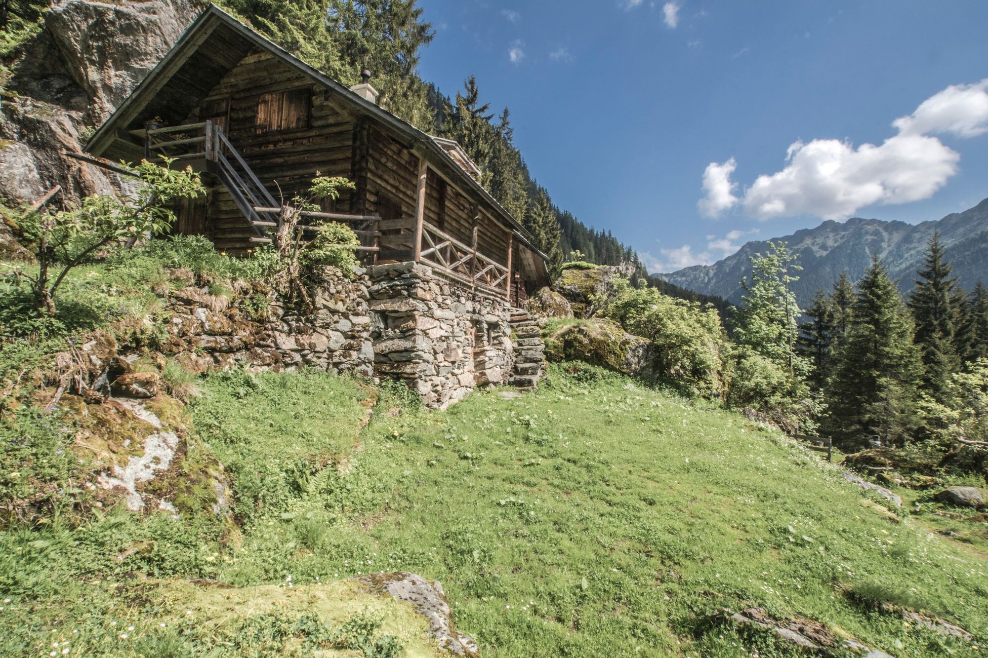
Especially during the hot summer months the lake - coloured in a dark green - is perfect for refreshing yourself and locals as well as guests occassionally go for a swim. On the South shore of the lake there are lot of possibilities for kids to play in nature, and a stroll around the like in the evening is also a must. Fahrlechhütte chalet is located directly at the lake and just a few meters further Duisitzkarseehütte chalet invites guests for a stay. Each of the two huts offers approximately 15 places for an overnight stay.
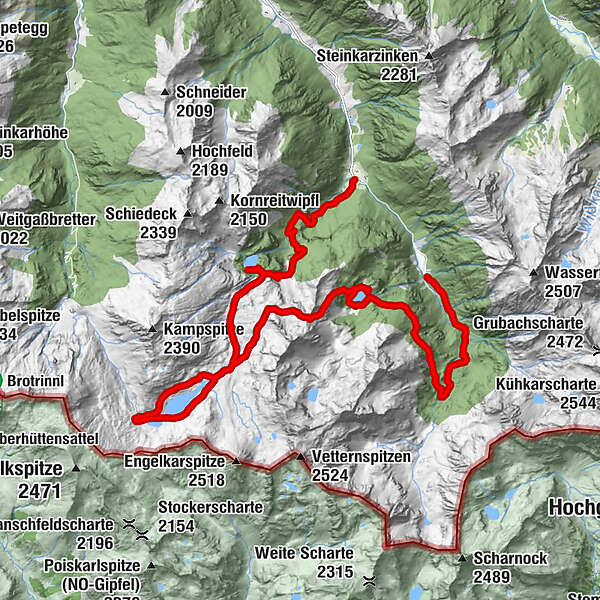
Day 2 - To Giglachseen Lakes
After a rich breakfast at the chalet you start into your second day of Alp Tour Obertal. This stage takes you from Duisitzkarsee Lake to Giglachseen Lakes via Ferchtlhöhe ridge and Murspitzsattel mountain saddle.
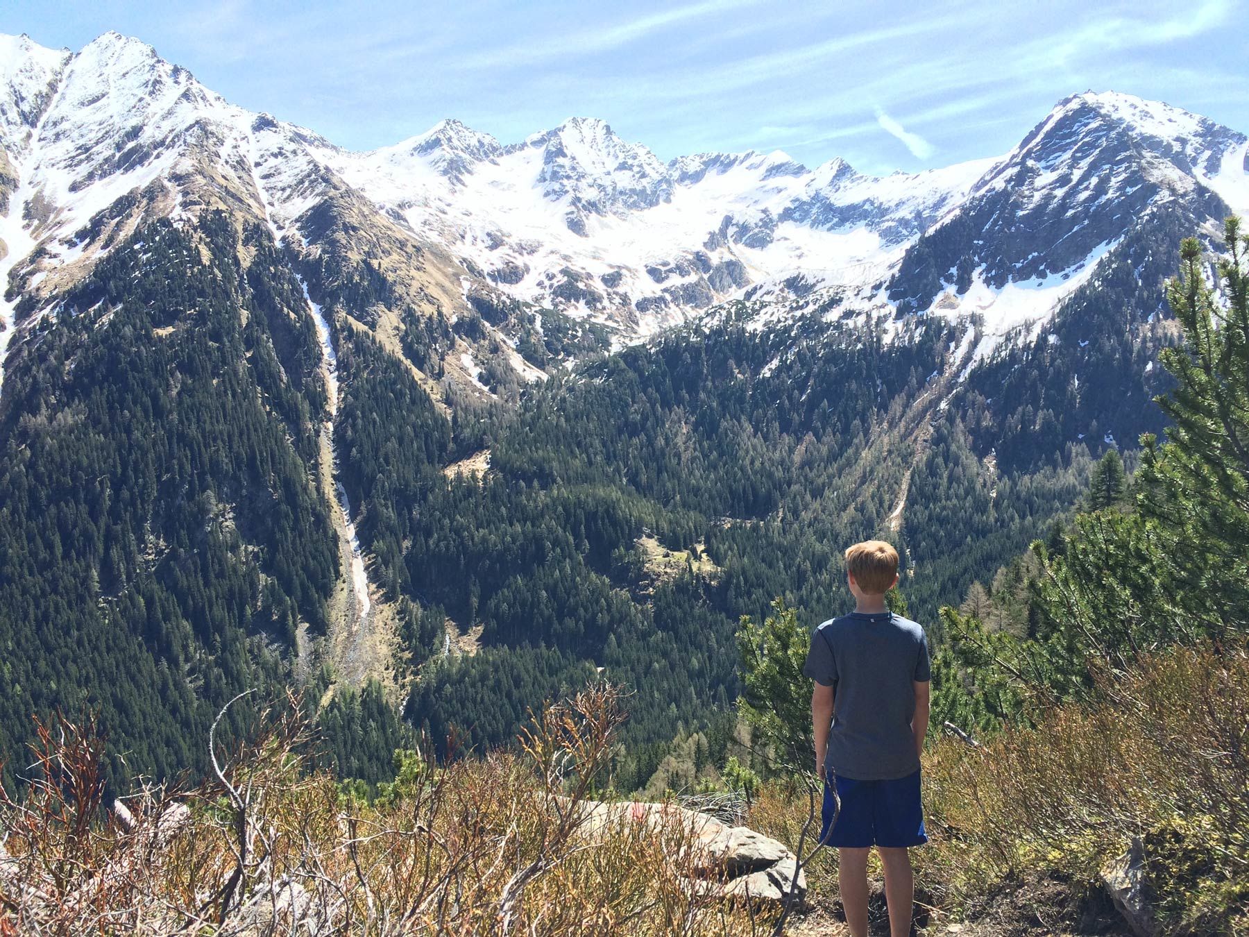
At the trail junction just above the lake you take trail n° 775 towards Giglachseen Lakes. The trail ascends quite steeply via the shoulder of Ferchtlhöhe ridge. At first you hike through a clear larch forest, followed by a section through dwarf pines and berry bushes after leaving the timberline behind you. After about 1 hour you reach Ferchtlhöhe ridge, which is a great spot for a break. The breathtaking view to the picturesque Duisitzkar cirque with its lake is a reward for the steep ascent.
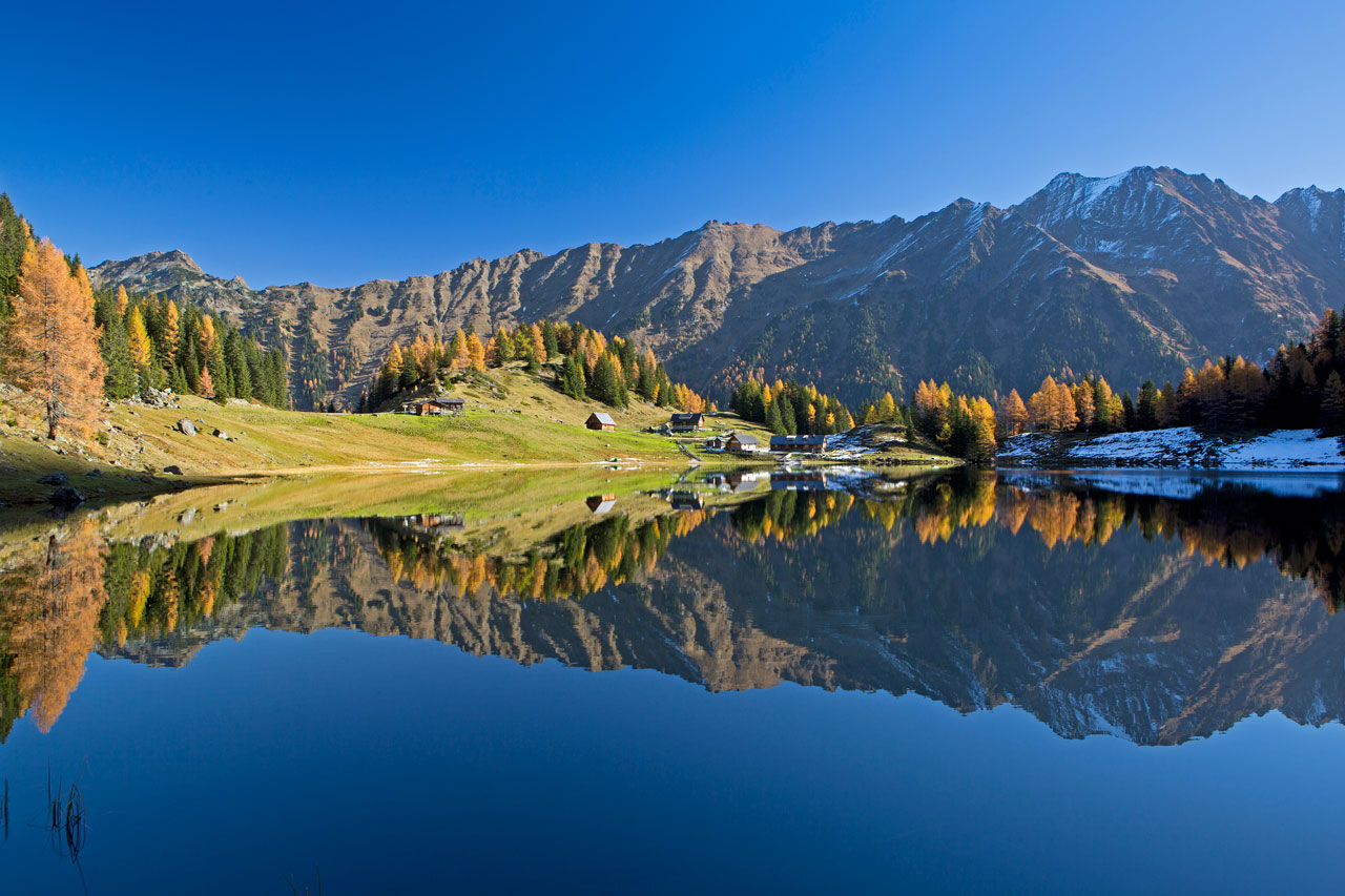
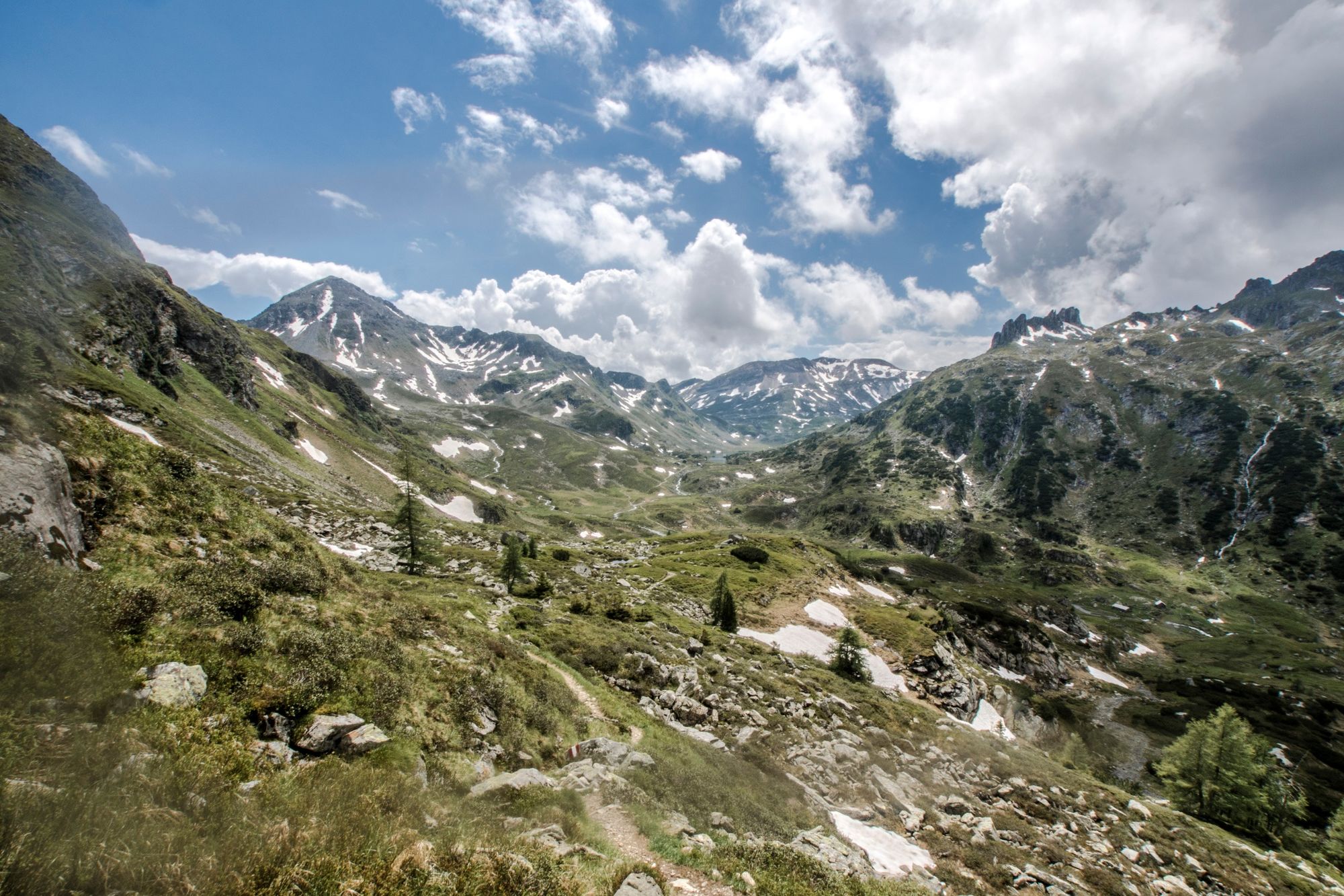
From Ferchtlhöhe you continue your hike via a constant, moderate up & down - passing by Murspitzsattel (2,013 m) mountain saddle. On your way you enjoy fantastic views to the Landauersee Lake lying below you and the Giglachkar cirque ahead.
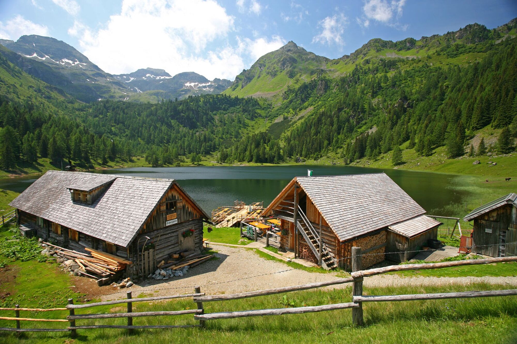
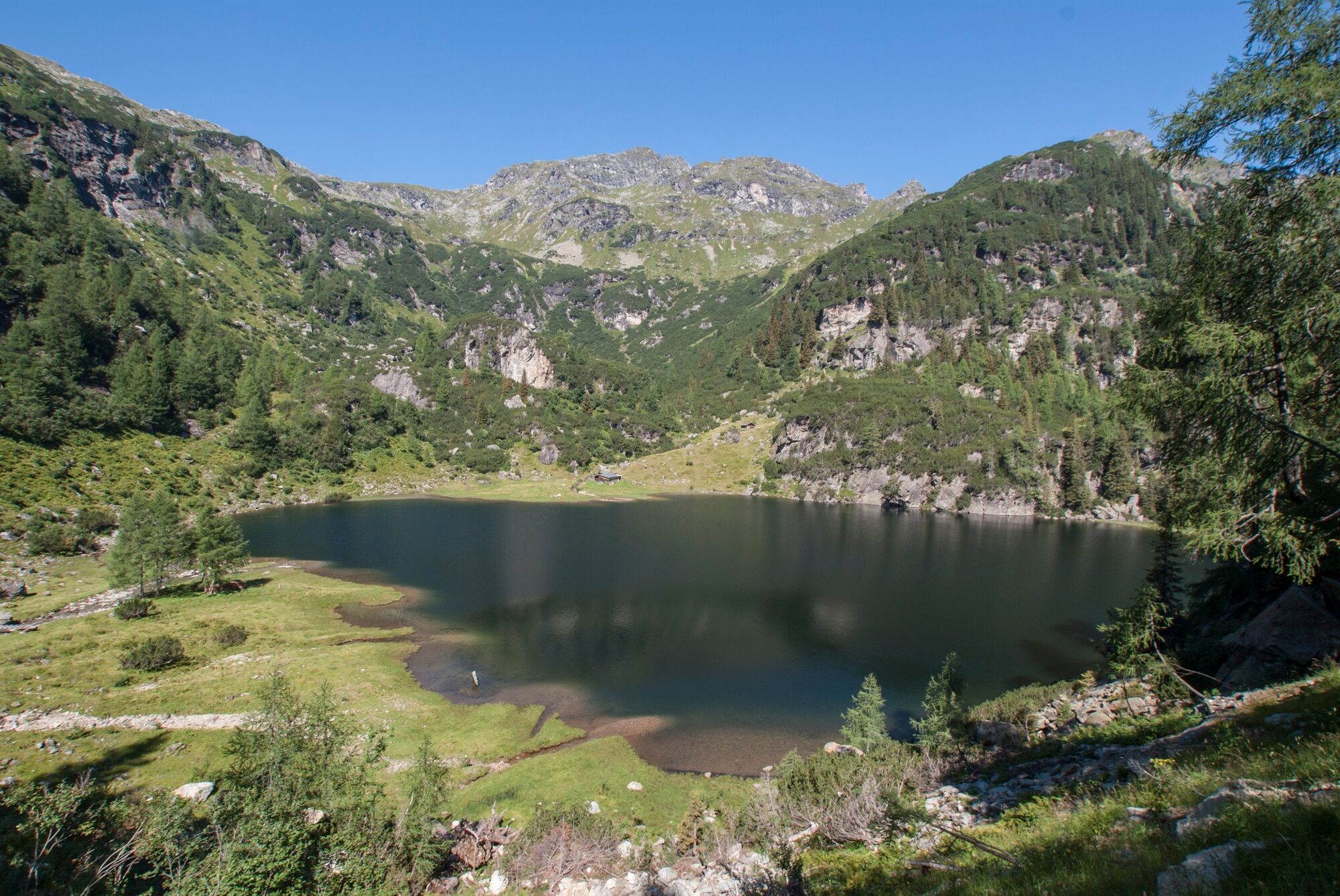
After approximately 1.5 hours from Ferchtlhöhe you reach the trail junction with trail n° 776. Soon afterwards you reach the Eastern shore of the lower Giglachsee Lake. The two lakes ares surrounded by an impressive mountain scenery. Steirische and Lungauer Kalkspitze summits in the West of the cirque are a special feature in geological terms: the Schladminger Tauern range is made up of so-called "primitive rock" (slate), while these 2 summites are made up of limestone.
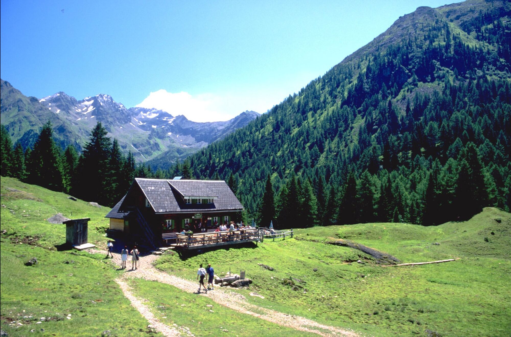
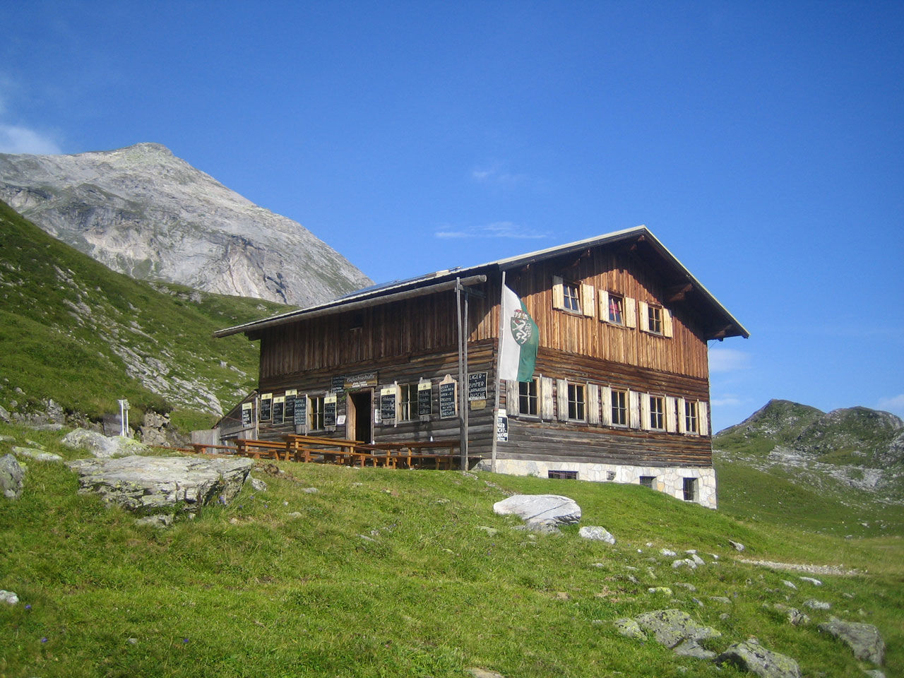
Above the lower Giglachsee Lake Ignaz-Mattis-Hütte chalet (1,986 m) is one of two chalets for an overnight stay. The second possibility is Giglachseehütte chalet (1,956 m), situated above the upper Giglachsee Lake. Kids will enjoy themselves around the lakes and the creeks.
Day 3 - The historic miners' trail
After a recreative night in the chalet and a rich breakfast you start into your final day of Alp Tour Obertal. You start from the chalet, and for the beginning you make a loop around both lakes. On this day the Alp Tour Obertal takes you from the Giglachseen Lakes to Hopfriesen in Obertal.
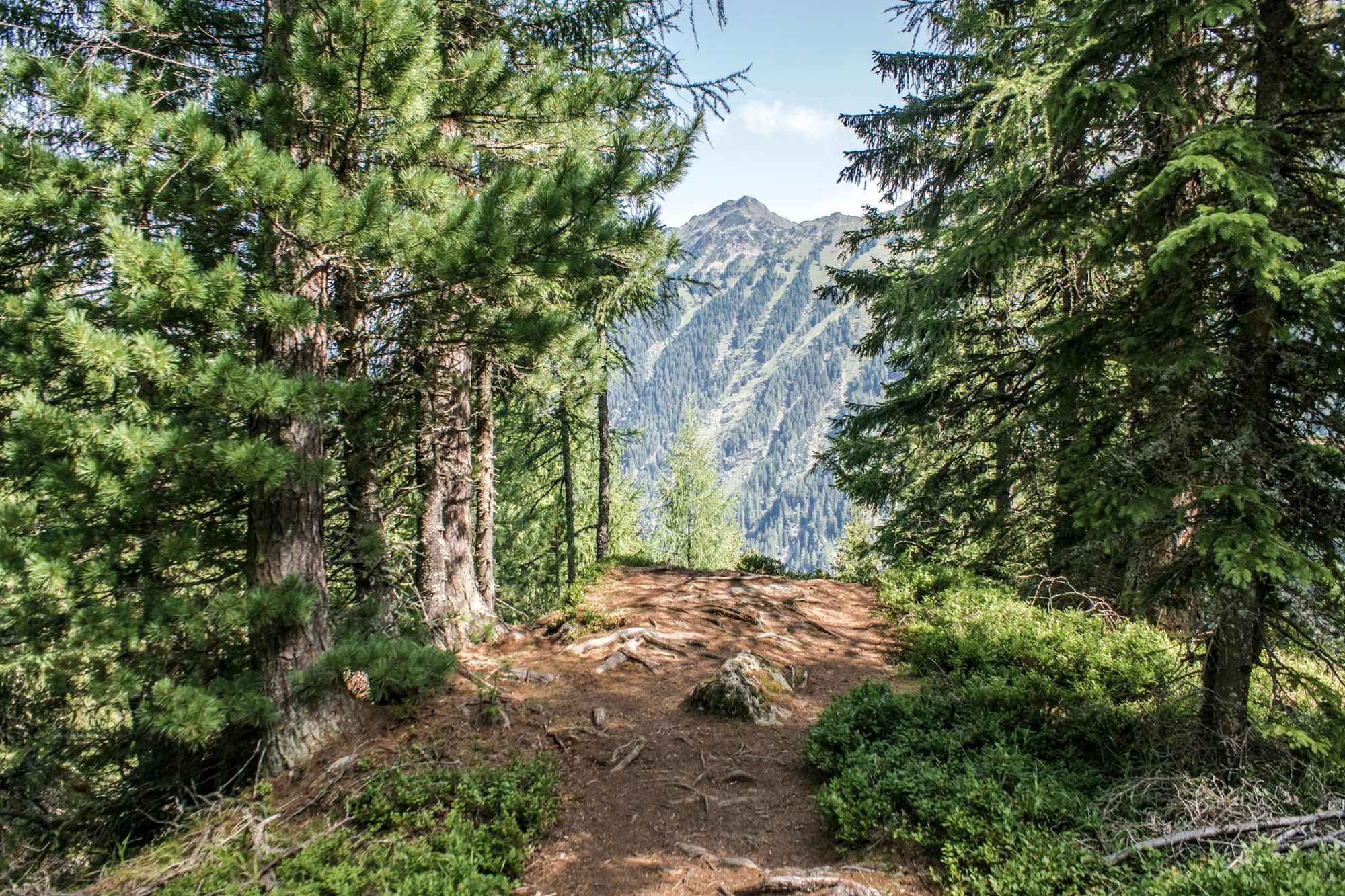
From the Eastern shore of the lower Giglachsee Lake you hike back to the trail junction 775/776 which you know from the day before. Now, you branch off across the bridge and follow trail n° 776 towards Hopfriesen. Through the fascinating alpine scenery you moderately descend to the "Giglachalmen" chalets. Soon after you reach the end of a forestry road.
Here the trail starts to drop a little more and you now hike along the forestry trail to the "Knappenkreuz" waypoint, which reminds us about the active mining history in the Schladminger Tauern range up to the 19th century. Before reaching this waypoint we recommend to make a short detour to Landauersee Lake, which is nestling between dwarf pines and rocks.
From Landauersee Lake and the Knappenkreuz you now in turns descend on a hiking trail and a forestry road to Lackneralm chalet (private only - no refreshment stop). After crossing over the Giglachbach creek the trail now leads through forest towards Hopfriesen. Below steep rock faces the trail takes you to the valley floor through clear forest.
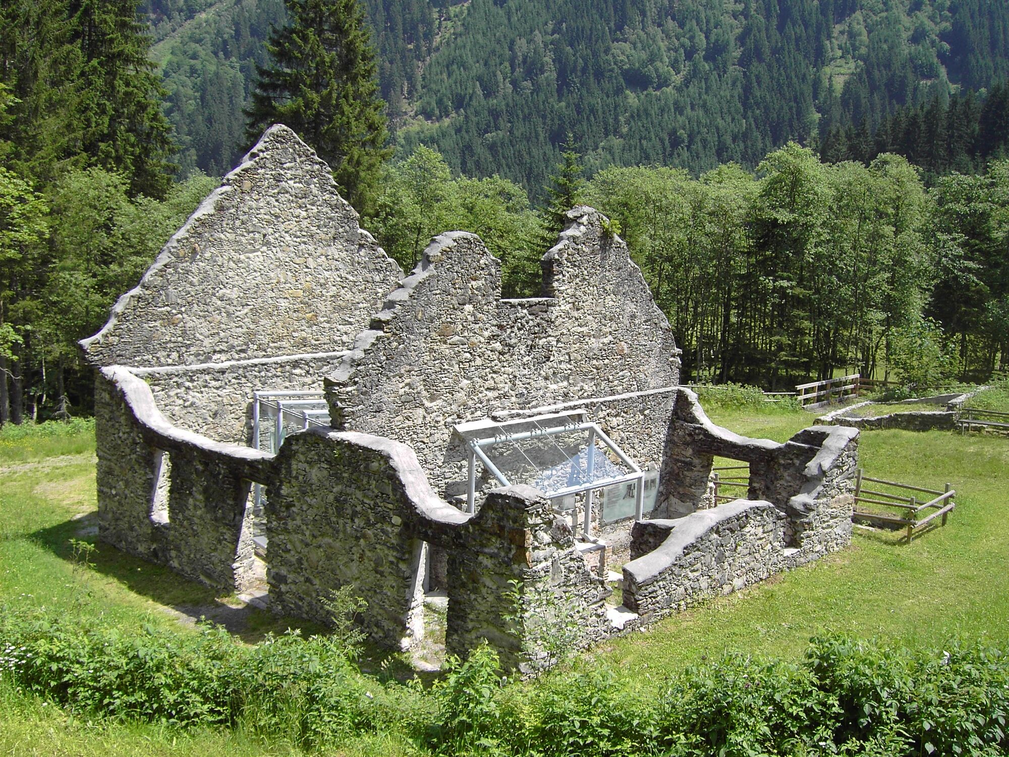
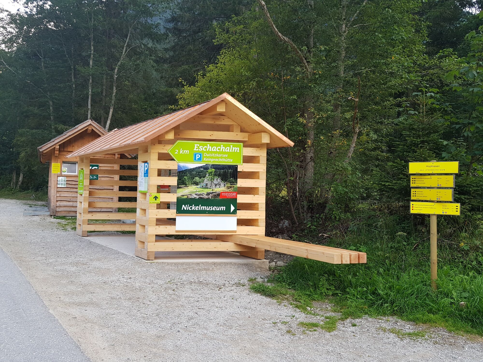
Shorty before arriving at the hiking trail head in Hopfriesen make another 5-minute detour to the historic nickel smelting furnace, which is a museum nowadays (its open Wednesday and Friday mornings). From the hiking trail head Hopfriesen you can catch the Planai bus back to Rohrmoos and Schladming.
- Highest point
- 2,047 m
- Endpoint
-
Hiking trail head Hopfriesen, Obertal
- Height profile
-

- Equipment
-
Anckle high hiking boots recommended.
A well-packed backpack is helpful and especially when touring Alpine terrain a tuque, gloves, a windproof jacket and pants are standard equipment. Good, waterproof shoes, sun glasses, sun cream and sufficient beverages are essential too. Torch light, a map of the area, knie and a small first-aid kit should also be in the backpack.
- Safety instructions
-
Changes in weather patterns, quick falls in temperature, thunderstorms, wind, fog and snow are some of the dangers that can be encountered on a hiking tour. Hosts of alpine huts and mountain refuges have a lot of experience in the mountains and can give good advice about weather and the trails. Poor equipment, overestimation of one's own capabilities, carelessness, poor personal constitution and/or wrong judgement can lead to critical situations. In case of thunderstorms: avoid summits, ridges and steel ropes.
GPS data and orienteering
Available GPS data - just like hiking maps - is only a guidance for orientation and can never depict a trail exactly with all its details. Especially at dangerous spots it is essential to judge on site how to proceed.
In an emergency please call:
140 - for Alpine emergencies (all over Austria) 112 - European GSM emergency number - Tips
-
Tip for day 1:
From Neualm you can include Keinprechthütte chalet into your tour - additional walking time: approximately 3 hours.
Tip for day 2:
From Giglachseen lake you can reach the remains of historic miners' housing at Vetternkar cirque - additional walking time: approximately 2 hours.
Tip for day 3:
The last remaining nickel smelting furnace of the Eastern Alps is located in Hopfriesen. The furnace is open as nickel museum on Wednesday and Friday mornings.
- Additional information
-
From the valley head at Eschachalm further into Obertal the landowners do not allow to bring along dogs.
If you are one of the toughest ones and go swimming in the lake, be considerate of the fish in the lake and avoid, for example, stirring up dust. In addition, please do not go into the water with sunscreen, as this can upset the sensitive ecology of the lake.
Tourist information: www.schladming.com
- Directions
-
From Schladming take provincial highway L722 (Rohrmoosstraße road) to Rohrmoos and at the roundabout continue on provincial highway L723 (Tälerstraße road) towards Untertal. In the village of Untertal turn right onto Obertalstraße road and continue to Eschachalm.
- Public transportation
- Parking
-
Parking is available at the trail heads Eschachalm and Hopfriesen. For the multiple-day tour we recommend to park in the parking garage at WM-Park Planai and take the bus to Obertal from there.


-

-
AuthorThe tour 3-days-hiking treat - Alp Tour Obertal is used by outdooractive.com provided.


General info
-
Schladming - Dachstein
3000
-
Schladming - Rohrmoos
1478
-
Rohrmoos
521