Südwandhütte - Guttenberghaus | Sun Trail Dachstein: Stage 02


- Brief description
-
Immerse yourself in another world in the "Am Stein" area. 2nd stage of the 3-day Sun Trail Dachstein, 3rd stage of the 8-day Dachstein circular hiking trail,
- Difficulty
-
medium
- Rating
-
- Starting point
-
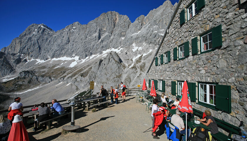
Dachstein Südwandhütte
- Route
-
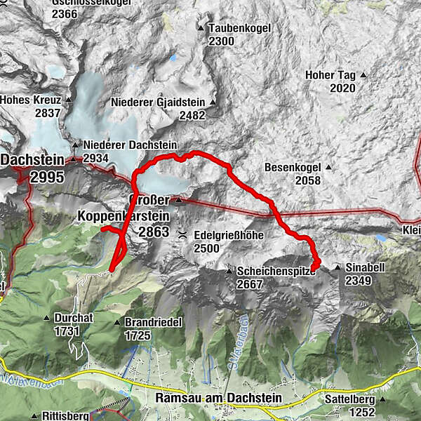
Steinfeld2.2 kmSkywalk3.6 kmDachstein glacier restaurant3.7 kmHunerkogel (2,687 m)3.7 kmFeisterscharte11.1 kmGuttenberghaus11.6 km
- Best season
-
JanFebMarAprMayJunJulAugSepOctNovDec
- Description
-
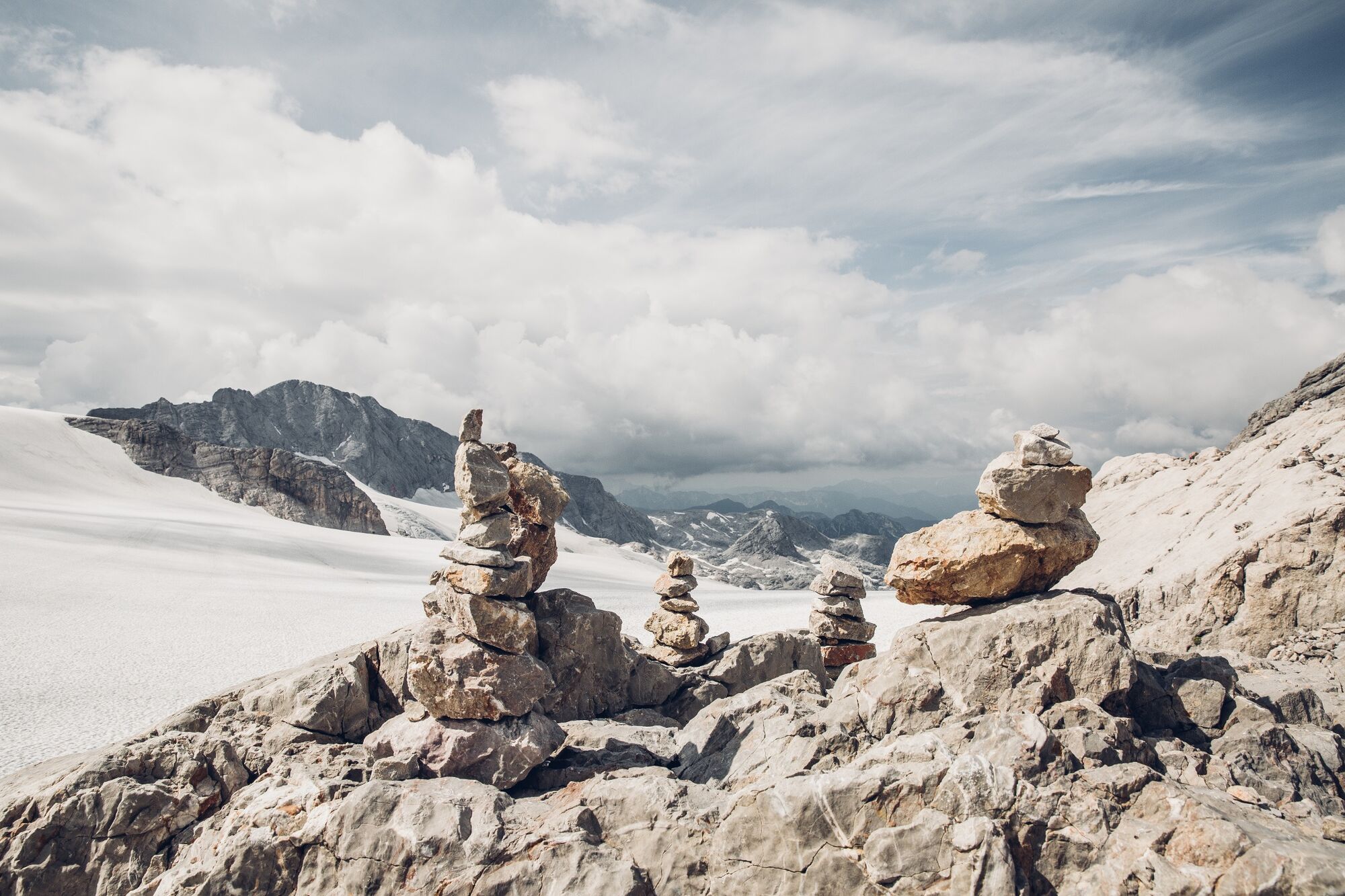
Glacier hike over the Schladming Glacier and the "am Stein" plateau to the Guttenberghaus with a walking time of around 4 to 5 hours. Most of the meters uphill are overcome with the help of the Dachstein Gletscherbahn. In contrast to the green Ramsau alpine pasture area at the foot of the Dachstein south walls, the karst plateau "Am Stein" looks almost like a lunar landscape. Experience this special landscape, which is also a UNESCO World Heritage Site.
- Directions
-
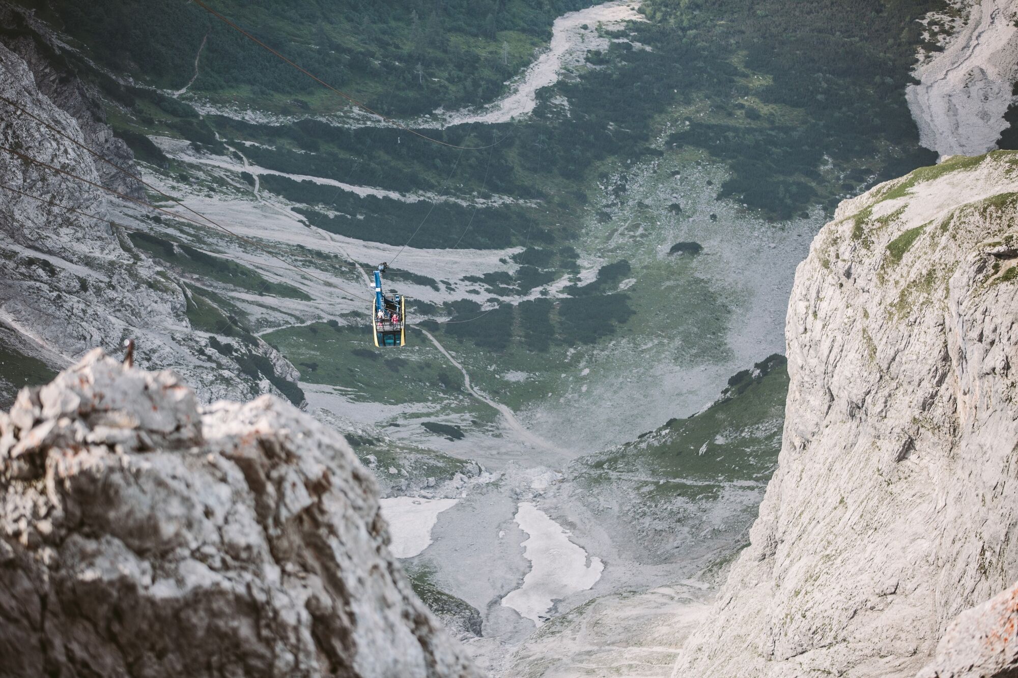
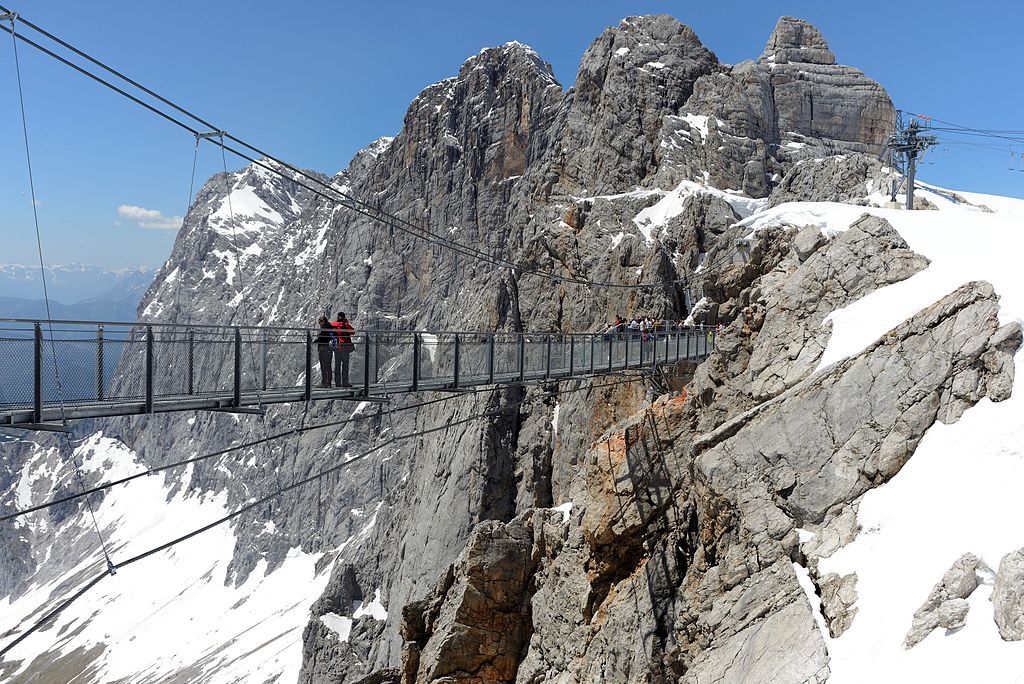
The descent from the Südwandhütte is best done early in the morning and takes about 35 minutes to the valley station of the Dachstein Gletscherbahn. The cable car overcomes 1000 meters in altitude in just 7 minutes to the Hunerkogel mountain station. The "Sky Walk" viewing platform, the Dachstein Ice Palace and the suspension bridge with the stairway to nothingness are located right next to the mountain station. Definitely worth a visit.
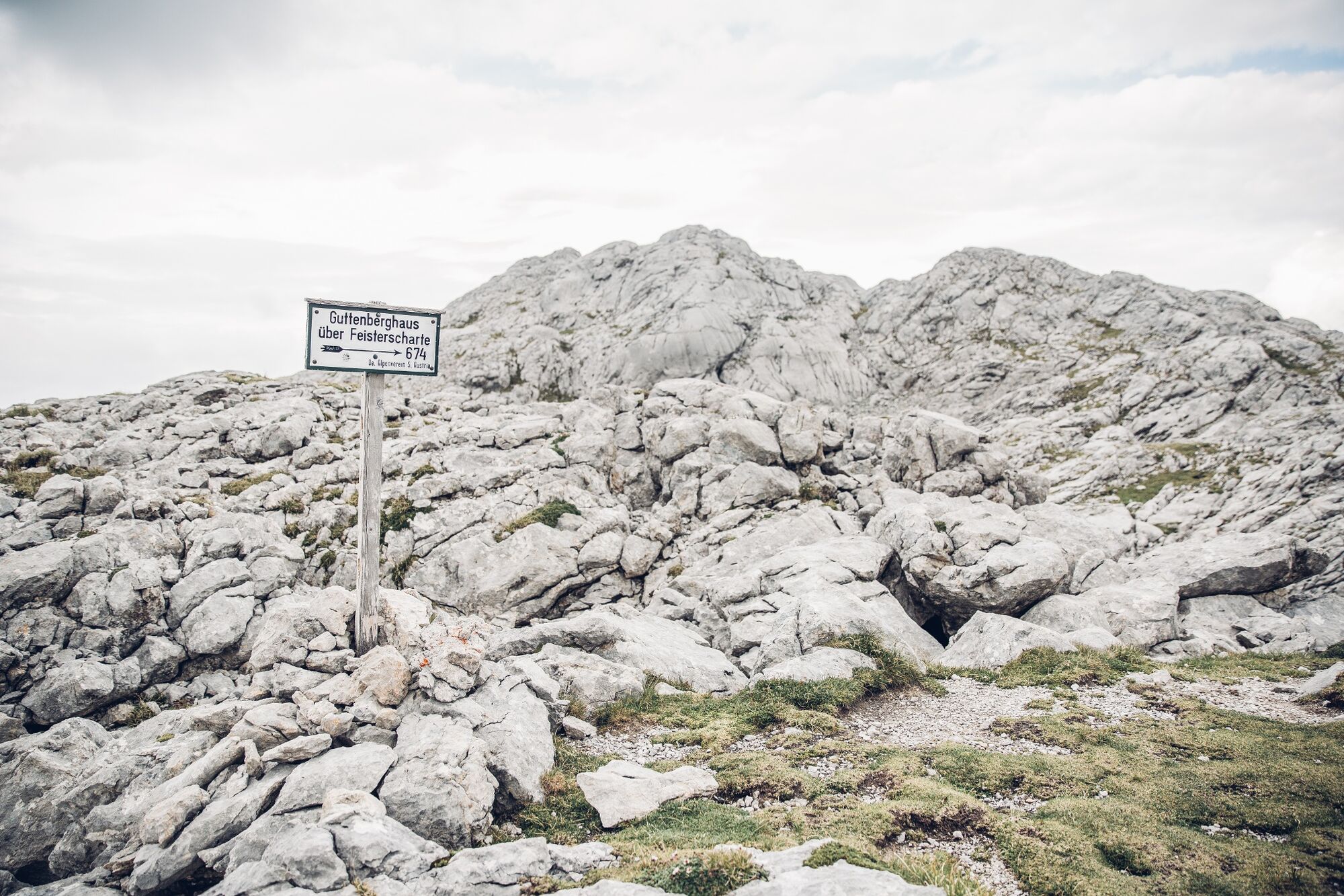
We continue on the path to the Guttenberghaus. This leads you first over the Schladming Glacier in the direction of Gjaidstein, on whose eastern flank you hike downhill to the east. The marker number is 674. It is a high alpine tour that starts at almost 2,700 meters above sea level and offers no shelter in between if the weather changes. Colored markings on the rock and snow poles serve as orientation.
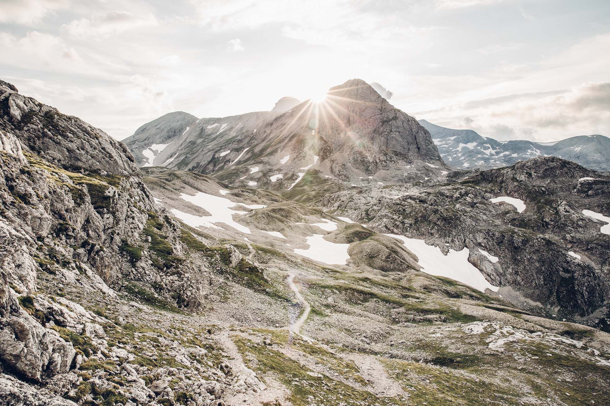
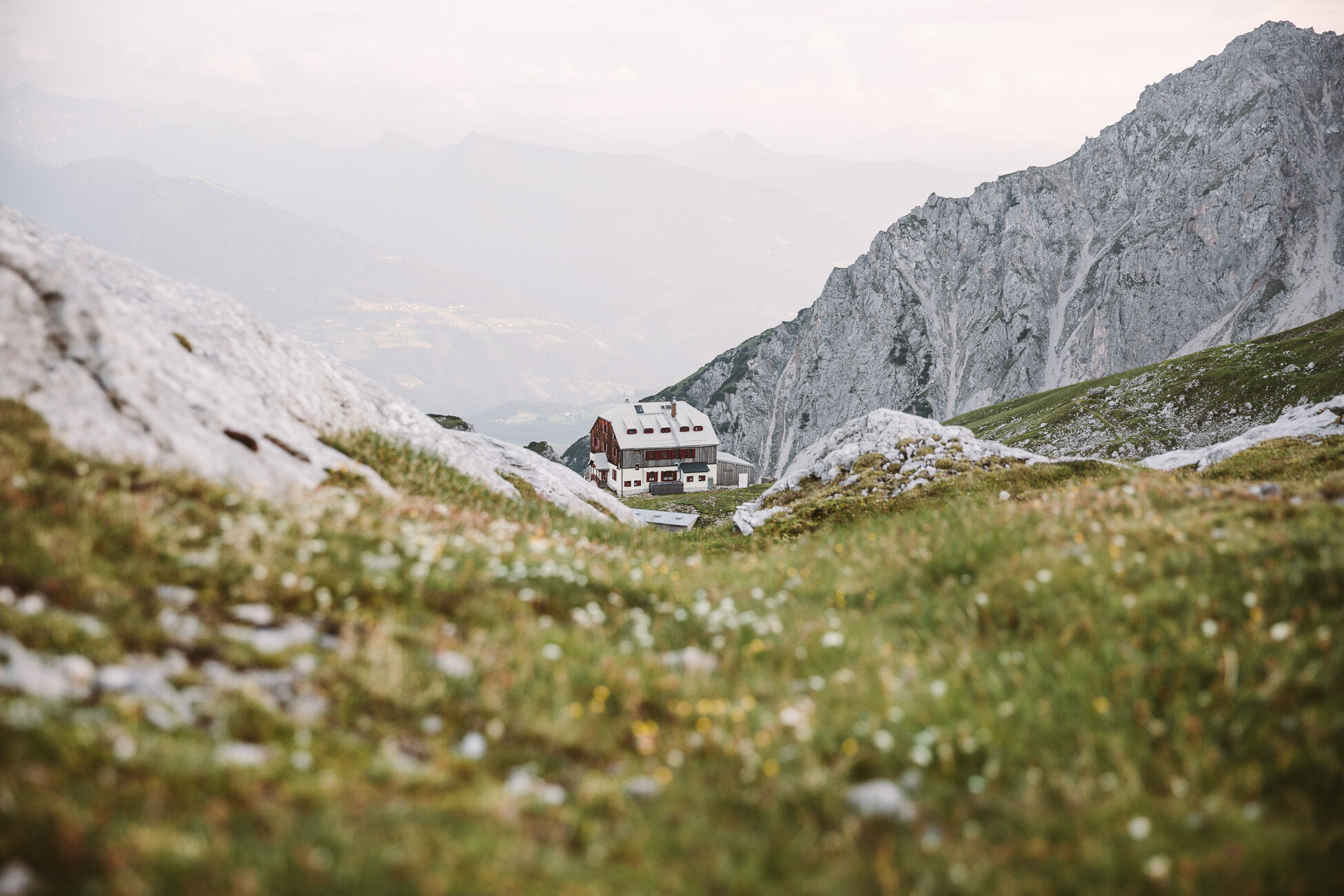
The landscape is typical of the "am Stein" plateau, snow hollows, easy climbs, rocky ridges and a wide view of the Totes Gebirge Mountains form the scenery. After about 4 hours of walking, 2 climbs meet on the Feistererscharte. Path #616 is the descent to the already visible Guttenberghaus at 2,146m above sea level. The highest mountain shelter in Styria is the 2nd stage destination on the Dachstein circular hiking trail.
- Highest point
- 2,684 m
- Endpoint
-
Guttenberghaus
- Height profile
-

- Equipment
-
A well-packed backpack is helpful and especially when touring Alpine terrain a tuque, gloves, a windproof jacket and pants are standard equipment. Good, waterproof shoes, sun glasses, sun cream and sufficient beverages are essential too. Torch light, a map of the area, knie and a small first-aid kit should also be in the backpack.
- Safety instructions
-
Changes in weather patterns, quick falls in temperature, thunderstorms, wind, fog and snow are some of the dangers that can be encountered on a hiking tour. Hosts of alpine huts and mountain refuges have a lot of experience in the mountains and can give good advice about weather and the trails. Poor equipment, overestimation of one's own capabilities, carelessness, poor personal constitution and/or wrong judgement can lead to critical situations. In case of thunderstorms: avoid summits, ridges and steel ropes.
GPS data and orienteering
Available GPS data - just like hiking maps - is only a guidance for orientation and can never depict a trail exactly with all its details. Especially at dangerous spots it is essential to judge on site how to proceed.
In an emergency please call:
140 - for Alpine emergencies (all over Austria) 112 - European GSM emergency number - Directions
-
From west:
Tauernautobahn A 10 to the Ennstal junction - exit in the direction of Graz/Schladming - about 20 km on the Ennstal federal road to Schladming. Turn off in Schladming Mitte and follow the state road in the direction of Ramsau am Dachstein. In Ramsau Schildlehen turn off onto the Dachstein toll road and go to the valley station of the Gletscherbahn.
From the north:
Pyhrnautobahn in the direction of Liezen Ennstalbundesstraße to Schladming. Turn off in Schladming Mitte and follow the state road in the direction of Ramsau am Dachstein. In Ramsau Schildlehen turn off onto the Dachstein toll road and go to the valley station of the Gletscherbahn.
- Public transportation
- Parking
-
Car park at the valley terminal of Dachstein cable-car (reachable via toll road).
-

-
AuthorThe tour Südwandhütte - Guttenberghaus | Sun Trail Dachstein: Stage 02 is used by outdooractive.com provided.


General info
-
Schladming - Dachstein
3011
-
Ramsau am Dachstein
1702
-
Dachstein Gletscher
540


