Southern Alpine Trail 03 / Border Panorama Trail


- Brief description
-
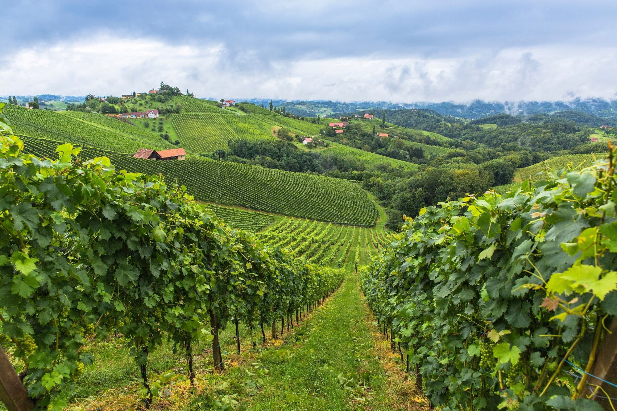
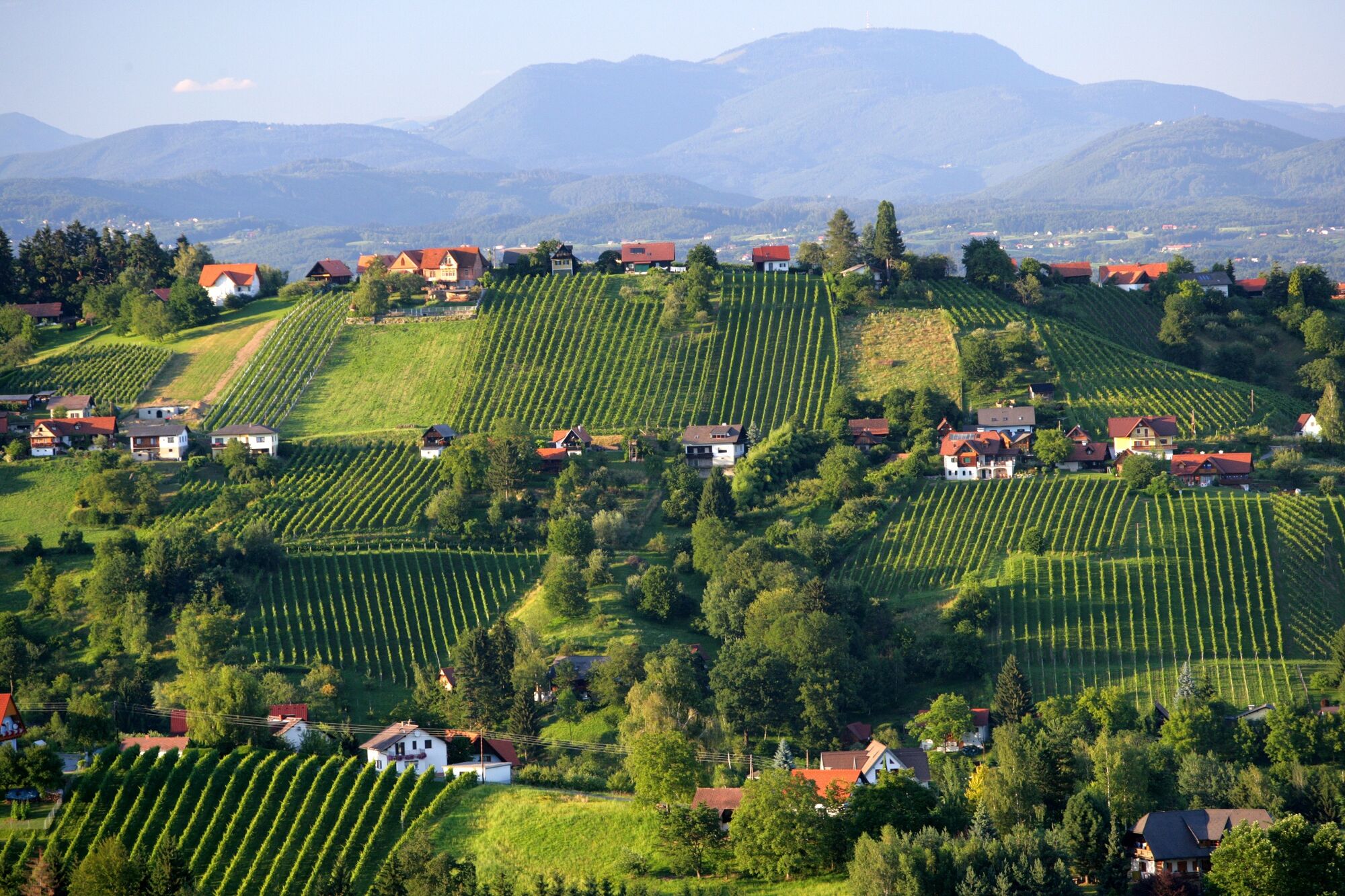
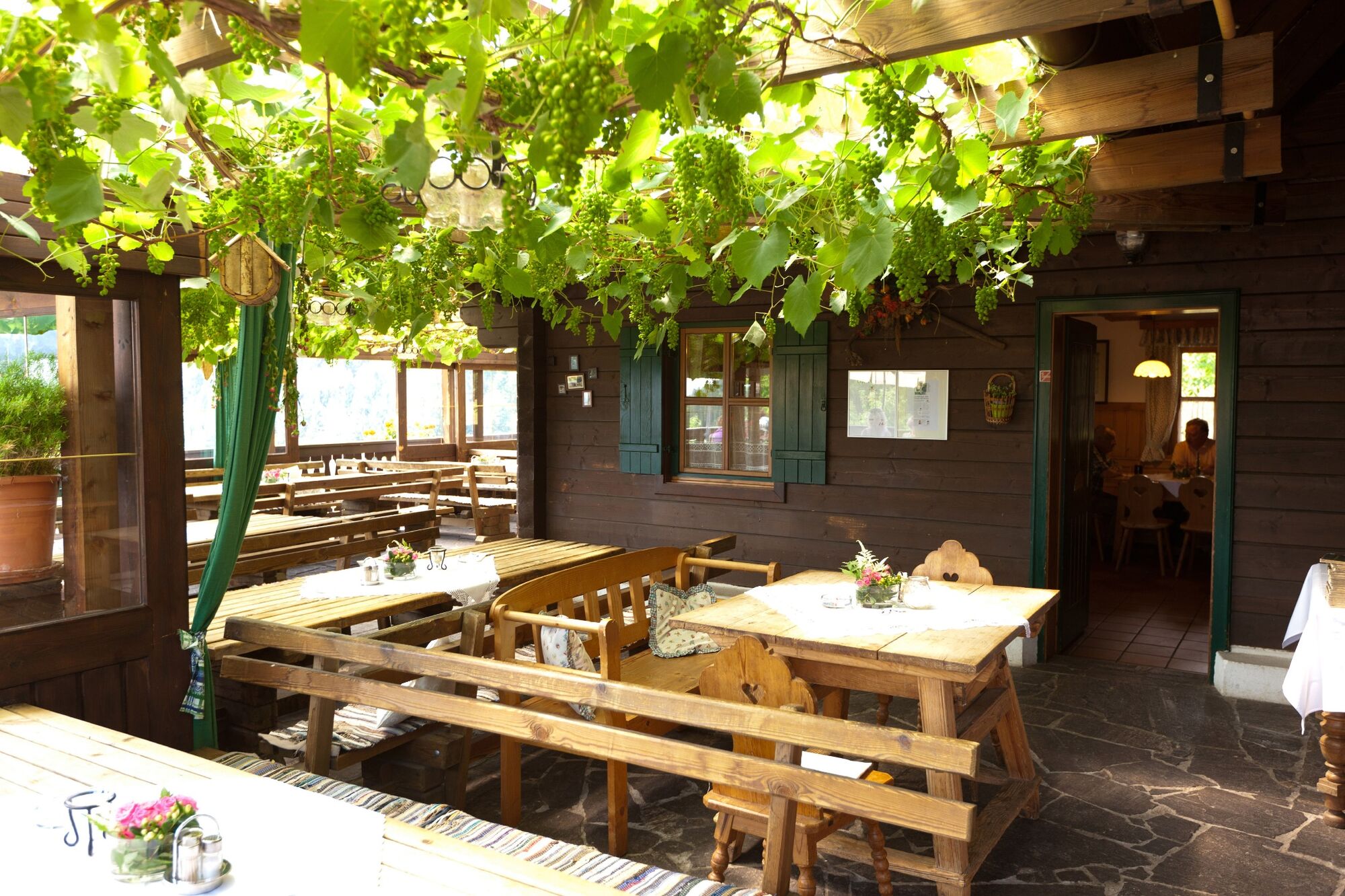
What a liberating feeling it was when the Iron Curtain fell! When that rigid border, that separated our homeland from that of our neighbours, gave way to friendship and shared experiences. This feeling will inevitably come back to us when we hike the Border Panorama Trail. This landscape leads us from the hiking village of Soboth at an altitude of 1,065 Metres above sea level across soft alpine pastures and meadows to the romantic vineyards of Southern Styria and the adjoining alluvial landscapes around Bad Radkersburg. The curtain is history, the feeling of freedom on the mountain ridges with views of the countryside to the left and right - that has remained and represents an unforgettable hiking, enjoyment and cultural experience. Let's look forward to the pilgrimage church of Sveti Duh, cosy wine taverns, countless, sheer endless views and, at the end of the tour, the Parktherme in Bad Radkersburg.
- Difficulty
-
medium
- Rating
-
- Starting point
-
Soboth
- Route
-
Soboth0.0 kmJantschkifels (1,368 m)12.0 kmGasthaus Strutz15.4 kmLaaken15.9 kmZweibach (491 m)18.4 kmSankt Bartlmä23.8 kmSankt Lorenzen25.8 kmMlinarjev vrh (777 m)28.0 kmRadelj (784 m)31.3 kmKapunerhütte (1,003 m)33.6 kmKlementkogel (1,052 m)33.8 kmSt. Pongratzen (900 m)38.8 kmKogel (781 m)40.8 kmJausenstation Isak45.4 kmTolsti vrh (756 m)46.2 kmRemschnigg Almhütte48.4 kmAlpengasthof Pronintsch49.9 kmMontikogel (633 m)52.4 kmSchloßberg54.9 kmHubertuskapelle55.7 kmMostschank Krampl60.7 kmHeiligen Geist am Osterberg60.8 kmSchagerkogel (860 m)62.2 kmKrebskogel (516 m)69.5 kmLangegg73.1 kmRaum 173.5 kmGrenztisch Glanz - Kungota76.5 kmSulztal78.4 kmPečovje (473 m)80.8 kmSvečinski vrh (Kamenik) (517 m)82.7 kmPruh83.7 kmBuschenschank Gallunder84.0 kmGraßnitzberg85.1 kmNeubauer87.3 kmCatholic Church of Saint Michael88.4 kmSpielfeld-Straß88.6 kmSpielfeld89.1 kmOberschwarza91.4 kmUnterschwarza92.2 kmWeitersfeld97.0 kmMurhütt'n97.1 kmSladki vrh98.1 kmKindergartenbergerl102.1 kmMureck102.4 kmVratji vrh (337 m)103.3 kmMisselsdorf104.1 kmMurturm106.5 kmDiepersdorf108.5 kmFluttendorf110.1 kmElfi's Hütt'n110.1 kmDonnersdorf112.5 kmKapelle Donnersdorf/Au115.4 kmUnterau116.1 kmDietzen118.0 kmBettina's Stüberl118.1 kmBad Radkersburg122.8 km
- Best season
-
JanFebMarAprMayJunJulAugSepOctNovDec
- Description
-
Our tour takes us along the Austrian-Slovenian border and, with the following 6 suggested daily stages, is part of the International Long Distance Trail 03, which leads from Bad Radkersburg in the border triangle of Austria-Slovenia-Hungary to Silian in Italy. However, we walk in the opposite direction in this case - from the hiking village Soboth to Bad Radkersburg. On short sections, such as at Leutschach, we leave the 03 trail for a few kilometres to visit particularly beautiful hiking trail sections, such as the one through the Heiligengeist ravine. In addition, Leutschach offers numerous accommodations for a soothing night's sleep. We also stay on the Austrian side in the section from Glanz an der Weinstraße via Ratsch and Beerghausen to Spielfeld, where numerous places to stop for refreshments and overnight stays await us.
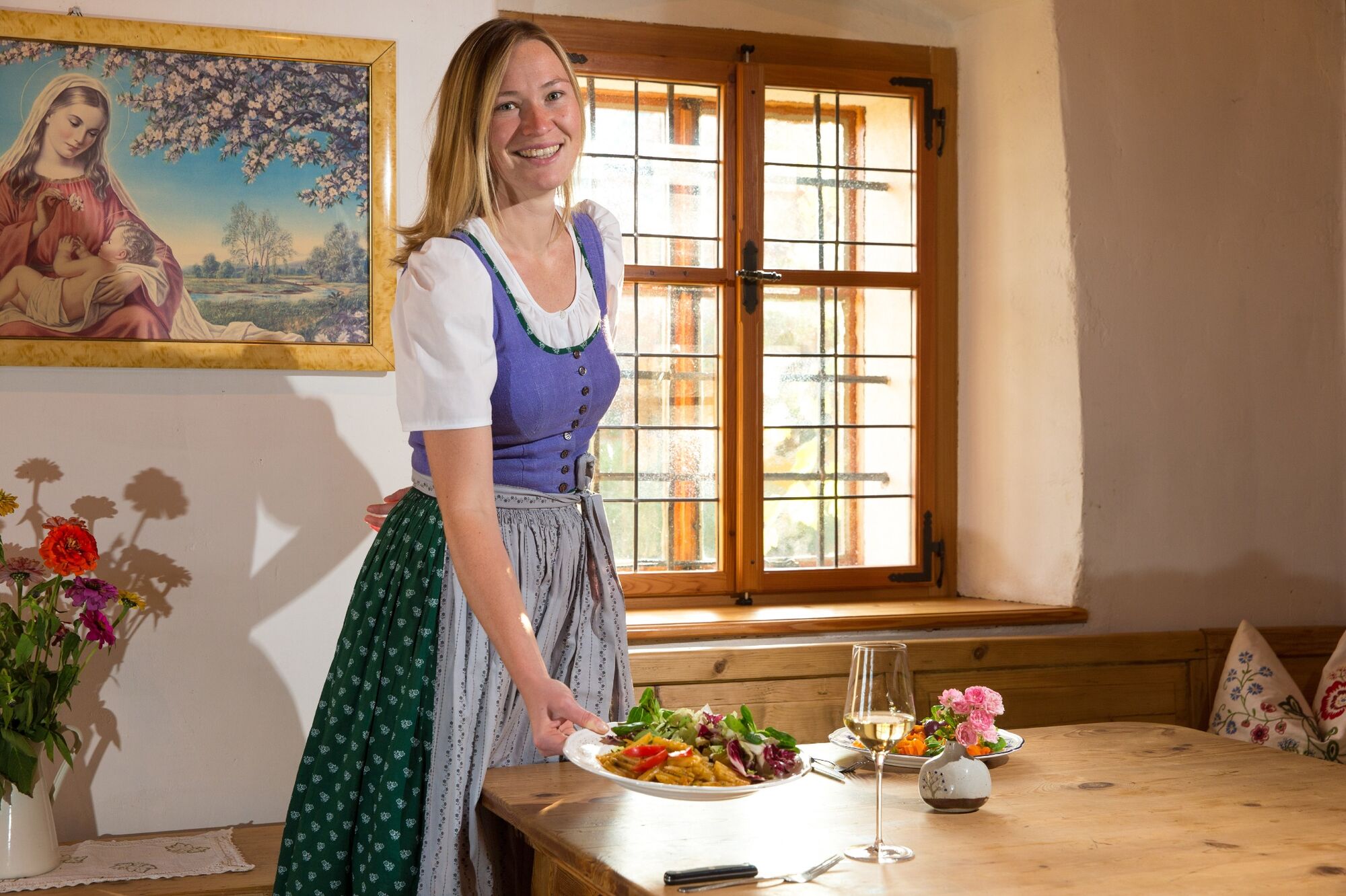
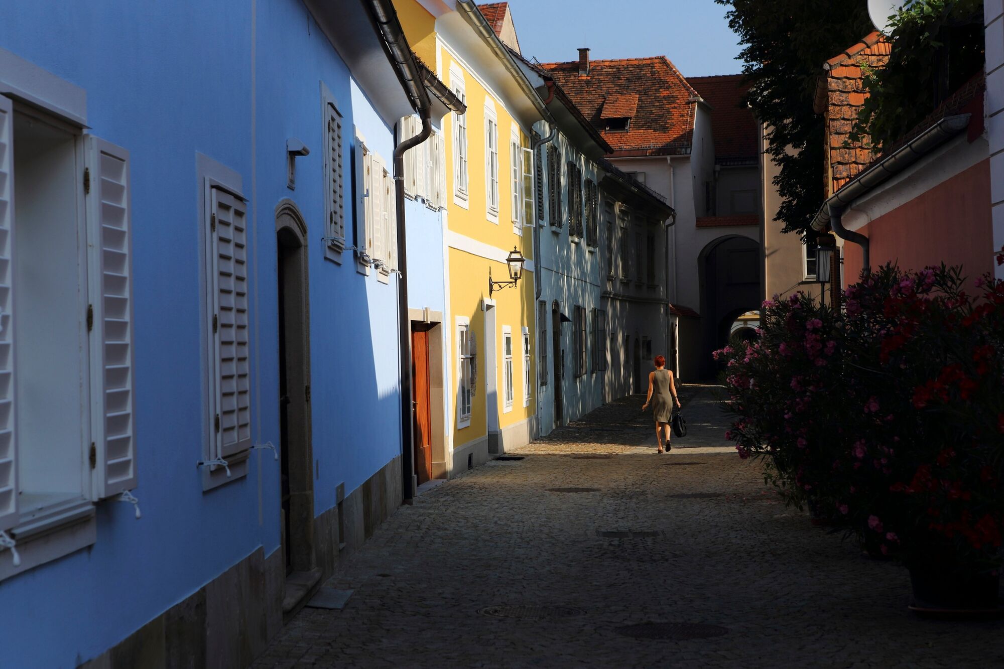
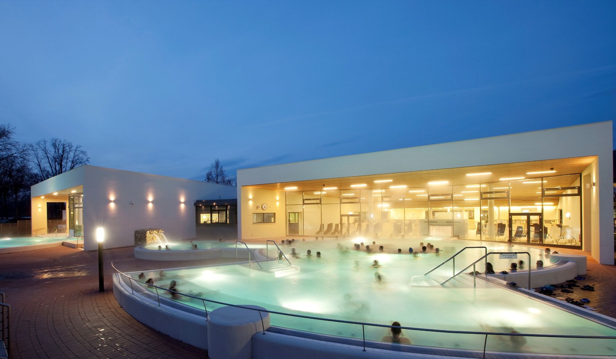
We get into the hiking village of Soboth and first let ourselves be led over wide, soft alpine pastures down into the vineyards of Southern Styria. We hike through magnificent alluvial landscapes. We can see and visit the famous pilgrimage church Sveti Duh on the Slovenian side. Its eventful history goes back to the 17th century - today it is very nicely renovated. We also have the option of deviating from the "right path" and including individual daily stages such as the one to Eibiswald in our tour. Also worth seeing is the old Mureck ship mill, which is still operating. And finally, at the end of our tour, the charming 700-year-old border town of Bad Radkersburg awaits us with its small alleys, cafés and, of course, its park thermal baths.
- Directions
-
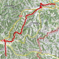
We start in the hiking village of Soboth, where the Koralm Crystal Trail ends, and enjoy the view of the Steiner Alps, the Karawanken to the Julian and Carnic Alps. Over the Hühnerkogel we go to Gasthof Strutz in Laaken and then to St. Pongratzen and Gasthof Legat vulgo Wutschnig.
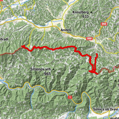
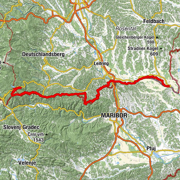
The rest of the route takes us to Leutschach, somewhat off the Südalpenweg 03. From the wine-growing village of Leutschach, the route leads through the beautiful idyllic Heiligengeist ravine, which is an experience in itself. Returning along the Grenzpanoramaweg, the route takes us via the Kos customs office to Sulztal an der Weinstraße. Leaving the beautiful Sulztal, Mureck awaits us. First, however, we cycle through vineyards in the direction of Spielfeld. The rest of the way takes us along the Mur through the UNESCO Biosphere Park Unteres Murtal, past the Röcksee lake to Bad Radkersburg. The thermal spa town and Radstadt welcomes us at the end of the tour with its beautifully preserved old town centre. Once we arrive in Bad Radkersburg, we are greeted not only by the thermal spa with its numerous hotels and guesthouses, but also by vinotheques that offer us the wonderful variety of Styrian and Slovenian wines and introduce us to the culinary delights of this region.
- Highest point
- 1,483 m
- Endpoint
-
Bad Radkersburg
- Height profile
-

- Equipment
-
Proper backpack packing makes many things easier: Pack heavy things first. The water bottle should always be within reach in a side pocket. All the things that are often needed, such as sunglasses, camera or hiking map, belong on top. An emergency kit, including blister plasters, belongs in every rucksack and it is always advisable to dress in layers.
- Safety instructions
-
Emergency call mountain rescue: 140
Tips when reporting an emergency – Answer these six WH questions: What happened? How many people are injured? Where did the accident happen (are there GPS coordinates)? Who is reporting the incident (callback number)? When did the accident happen? What is the weather like at the site of the incident?
- Additional information
-
Steiermark Tourismus
Tel. +43 316 4003
If you would like to hire a tour operator, simply book with Steiermark Touristik, the official travel agency of Steiermark Tourismus:
Tel. +43 316 4003 450,
The Steiermark Touren app, available free of charge on Google Play and the App Store (Android, iOS), offers detailed first-hand information: brief facts (length, duration, difficulty, ascent and descent/elevation gain, ratings), map, route descriptions, altimeter, compass, peak finder, navigation along the tour. You can also create your own personal lists of favourite tours and sites, store tours and destinations offline, use social media channels, and much more.
- Public transportation
-
Accessible by train and bus.
Detailed information about arriving by ÖBB (Austrian Federal Railways) can be found at www.oebb.at or on the Verbundlinie Steiermark website www.busbahnbim.at
With Verbundlinie’s BusBahnBim route planner app, planning your journey has never been easier: simply enter towns and/or addresses, stop names or points of interest to check all bus, train and tram connections in Austria. The app is available free of charge for smartphones – on Google Play and in the App Store


-

-
AuthorThe tour Southern Alpine Trail 03 / Border Panorama Trail is used by outdooractive.com provided.


General info
-
Südsteiermark
1132
-
Maribor-Pohorje
261
-
Leutschach an der Weinstraße
259