Zubringer 2 BergZeitReise Mariazell - Seewiesen (Etappe 3)


- Brief description
-
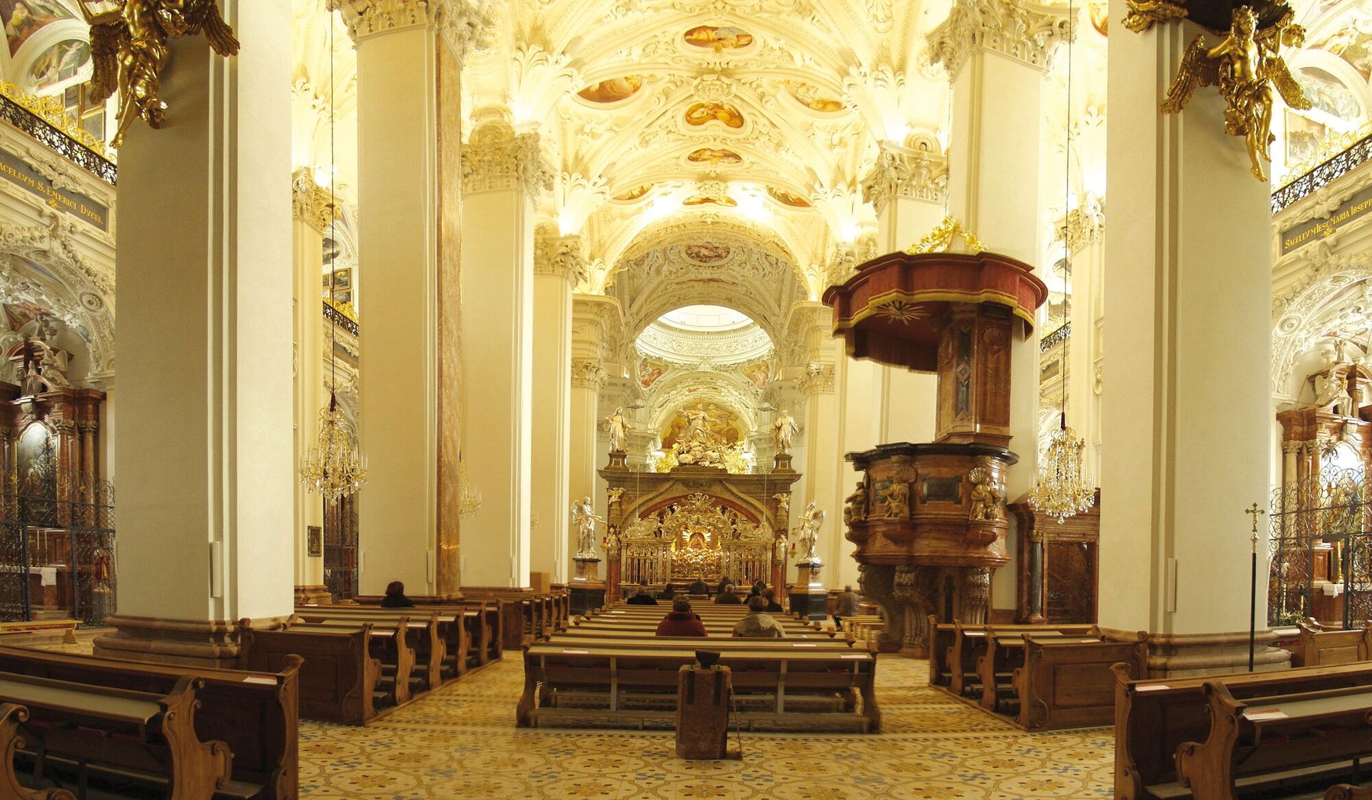
The famous place of pilgrimage Mariazell, the Magna Mater Austriae, is one of the most important excursion and vacation destinations in Hochsteiermark. The basilica, the Bürgeralpe and the numerous hiking opportunities in and around Mariazell should lead to a longer stay in this beautiful place anyway.
And of course, the High Styrian BergZeitReise can also be ideally reached from the small town in the north of Styria.
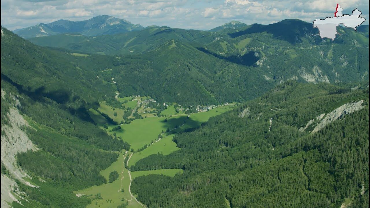
To do this, we hike along the Mariazell Founders' Trail via Gusswerk to Seewiesen.
- Difficulty
-
difficult
- Rating
-
- Route
-
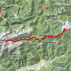
MariazellMichaelskapelle0.1 kmSt. Josef0.1 kmRasing2.0 kmHl. Sigmund3.0 kmBohrwerk4.0 kmGußwerk4.8 kmSalzahammer5.8 kmBrunngrabenquellen8.5 kmPretal11.7 kmGollrad19.1 kmGasthaus Egger19.5 kmSeebergalm24.8 km
- Best season
-
JanFebMarAprMayJunJulAugSepOctNovDec
- Description
-
If we follow the classic pilgrimage route from Mariazell in feeder option 1, we hike along the historic Gründerweg, which monk Magnus is said to have taken in 1157 on his tour from St. Lamprecht to Mariazell (more information: www.mariazeller-gruenderweg.at).
To do this, we first walk over the Sigmundsberg (chapel) to Gußwerk. Here we follow the road through the Salzatal valley until we reach the Brunngraben, which branches off to the left.
This represents our further route (in case of a possibly blocked game gate, take the bypass route) and thus, after a longer march, we reach the federal road over the Seeberg a bit south of Wegscheid.
We continue along this road in a southerly direction until we reach Gollrad and continue past the Brandhof (former estate of Archduke Johann) until we reach the Seebergalm.
Here we meet the main trail of the BergZeitReise.
- Directions
-
From Mariazell we first hike via the small, picturesque Sigmundsberg Chapel to Gusswerk. There we turn in the direction of Salzatal, which we hike along briefly.
Soon our path branches off to the left and we follow a forest path over the so-called Pretal to Wegscheid.
From here our path runs on or parallel to the main road to Gollrad. Passing the Brandhof, we reach the idyllic Seebergalm (stop for refreshments and overnight stay) and thus stage 3 of the BergZeitReise.
- Highest point
- 1,216 m
- Endpoint
-
Seewiesen
- Height profile
-

- Equipment
-
Normal hiking gear, sturdy shoes, sun protection, jacket, hood and gloves. Do not forget a water bottle and a snack box! And just in case, pack a small pharmacy with blister plasters.
- Safety instructions
-
Long but technically easy hike.
- Tips
-
The pilgrimage site of Mariazell with its famous basilica is worth a visit on its own. But also along the way, for example, with the Brandhof, which was once built as a musergut by Archduke Johann, a cultural-historical gem awaits us.
- Additional information
-
www.steiermark.com/wandern
Start: Mariazell, tourist information, overnight accommodations: Tel.: +43 3882 2366, www.mariazell-info.at and, especially for this section of the trail, www.mariazeller-gruenderweg.at (Stage 6)
Cab services: Taxi Scheucher Tel.: +43 664 4837688, Taxi Auer Gußwerk Tel.: +43 676 840855842, Taxi Orttenburger Tel.: +43 664 5129651 GPS grid N 47° 46' 21,5" O 15° 19' 6,1"
Destination / overnight stop: Seewiesen, the "Styrian Heiligenblut", tourist information, overnight accommodations: Tel.: +43 664 3548485, www.turnau.gv.at/tourismus
Cab services: Taxi Steiner Tel.: +43 3862 51333 and Taxi Hochschwab Reisen Tel.: +43 3861 2400
GPS grid N 47° 37' 14,3" E 15° 16' 15,3"
- Public transportation
-
With the BusBahnBim app of Verbundlinie, timetable information has never been easier:All bus, train and streetcar connections in Austria can be queried by entering locations and/or addresses, stops or important points.The app is available as a free app for smartphones (Android, iOS) - on Google Play and in the App Store.
- Parking
-
Parking facilities in Mariazell (note parking fee!).

- Author
-
The tour Zubringer 2 BergZeitReise Mariazell - Seewiesen (Etappe 3) is used by outdooractive.com provided.


General info
-
Mostviertel
2451
-
Mariazellerland
1503
-
Gußwerk
363